Kirkby Stephen, Cumbria, CA17
- Land size
- 13.42 acres
Key Features
- Extending to approximately 13.42 acres (5.43 hectares) or thereabouts of pasture land.
- Mains water.
- For Sale as a Whole.
- Guide Price - Offers Over £75,000.
Description
Introduction
This sale of land at Crosby Garrett near Kirkby Stephen offers an opportunity to purchase a useful block of grazing land, which extends to approximately 13.43 acres (5.43 hectares) and is located within the Yorkshire Dales National Park.
The land will be of interest to farmers looking to expand their existing land holdings, together with those with amenity, conservation or alternative land use interests.
The land is accessed over a private track and benefits from a mains water supply. DirectionsFrom the North take the B6260 heading south from Appleby. Approximately 1/2 mile after leaving the town, take the turning to the left signposted Ormside, Great Asby & Soulby. After 1 1/4 miles take the right hand turn signposted for Great Asby. Continue along this road to the first crossroads and then turn left. Proceed down the hill and over the river and follow the road up the hill towards Little Asby, Soulby & Kirkby Stephen. After approximately 2 miles you will reach the hamlet of Whygill Head. At the crossroads, proceed straight across continuing towards Soulby. From here continue for approximately 3/4 mile until reaching New Close Lane on your right hand side. From here the land is located approximately 775m down Newclose Lane as shown by the blue dots on the sale plan within these sale particulars. From the South exit the M6 at Junction 38 and head east along the A685 towards Kirkby Stephen until reaching the village of Newbiggin on Lune. Take the left hand turn off the A685 signposted Kelleth & Great Asby. From here proceed up the hill out of Newbiggin on Lune over Ravenstonedale Moor. After approximately 2 3/4 miles, turn right at the T junction, continue along this road until reaching the hamlet of Whygill Head. At the crossroads in Whygill Head, turn right and proceed for approximately 3/4 mile until reaching Newclose Lane. From this point, follow the directions above.
The location of the land is shown on the plan within these sale particulars and will be identified by way of a PFK sale board on Newclose Lane.
What3Words:
Field Location: ///ships.inflating.pickle
Access off the Highway: ///cycle.gazes.dogs
The Land
This parcel of land extends to approximately 13.42 acres (5.43 hectares) or thereabouts of sound grazing land. The land is gently undulating and westerly facing and is located within the Yorkshire Dales National Park.
Access to the land is taken over the adjoining land parcel off Newclose Lane along the route shown by blue dots on the sale plan and the land benefits from a mains water supply.
The land lies between 240 and 270m above mean sea level, falls within the Severely Disadvantaged Area and is classified as Grade 4 under the former MAFF Classification System.
General Remarks, Reservations & Stipulations
Method of Sale
The land at Crosby Garrett is offered for sale by Private Treaty as a whole.
The Vendors and Sole Selling Agent reserve the right to alter or divide the property or to withdraw or exclude any of the property at any time.
The Vendor reserves the right to vary any of the terms and conditions of the sale or to change the method of sale without notice. For this reason, we recommend likely Purchasers should register their interest with the selling Agents as soon as possible in order that they are kept abreast of any changes to the marketing of the land.
Money Laundering Obligations
As a requirement of the Money Laundering Regulations (Money Laundering Terrorist Financing and transfer funds (information on the payer) regulations 2017) relating to property transactions, the selling agents are obliged to carry out Customer Due Diligence checks on all prospective Purchasers prior to any transaction being completed. Please contact the selling agents for the information required to register.
Tenure
The land is offered for sale freehold with vacant possession upon the date of completion.
Water
The land benefits from a mains water supply.
Access
The land is accessed via Newclose Lane and a neighbouring field parcel, as shown by the blue dots on the sale and location plan included within these sale particulars.
For full details of this right of access please contact the Vendors solicitors.
Wayleaves, Easements, Covenants & Rights of Way
The property is sold subject to all rights including rights of way, whether public or private, light, support, drainage, water and electricity supplies and other rights and obligations and easements, quasi easements and restrictive covenants and all existing and proposed wayleaves for masts, pylons, stays, cables, drains, and water, gas and other pipes, whether or not referred to in these particulars.
In particular, it should be noted that there are overhead cables running across the land.
As previously noted, the land benefits from a right of access across third party land.
Any Purchaser will have satisfied themselves as to the nature of such restrictions and are advised to contact the Vendor’s Solicitors for details:
Minihan McAlister Solicitors, Unit 1B South Mill, Warwick Bridge, Brampton, Cumbria CA4 8RR. Email: . Sam McAlister acting.
Sporting & Mineral Rights
The Sporting and Mineral Rights are included within the sale in so far as they belong to the Vendors.
Basic Payment Scheme (BPS)
The land is sold without any entitlement to any BPS monies nor any de-linked payment.
Quotas & Environmental Schemes
For the avoidance of doubt there are no livestock quotas nor milk quotas included in this sale and there are no schemes currently in place on the land.
Land Status
The land is classified as Grade 4 under the former MAFF Land Classification System.
Boundaries
As far as the Vendors are aware, the responsibility of the boundaries are shown on the sale plans by inward facing ‘T’ marks. When no mark is shown, there is no further information available.
Plans & Schedule of Areas
The plans attached to these particulars are based on Ordnance Survey Plans and are for reference only. Any prospective Purchaser will have deemed to have satisfied themselves of the land and schedule.
Fixtures & Fittings
Any fixtures and fittings referred to in these particulars will be included in the sale unless stated otherwise.
Measurements
The measurements are approximate and must not be relied upon.
Health & Safety
Given the potential hazards of agricultural land, we request that you take as much care as possible when making your inspection for your own personal safety, particularly around livestock.
Viewing & Further Information
Viewing of the land at Crosby Garrett is permitted during any daylight hour provided a copy of these particulars is to hand.
Please do not obstruct any gateways or the public highway or any property belonging to third parties whilst viewing the land.
Please do not disturb any livestock grazing any land and all viewings are to be undertaken on foot and NO vehicular access is to be taken to the land.
For all enquiries please contact Jo Edwards for further information by telephone on or by email:
Authorities
Westmorland & Furness Council, Town Hall, Penrith, Cumbria, CA11 7QF
Yorkshire Dales National Park Authority, Yoredale, Bainbridge, Leyburn, North Yorkshire, DL8 3EL
United Utilities, Dawson House, Great Sankey, Warrington, WA5 3LW
General Reservations
The right is reserved to the Vendor(s) to amend, alter and incorporate fresh provisions as appropriate in respect of the above matters.
First Edition: April 2026
Particulars Prepared: April 2026
Photographs Taken: April 2026
Map Location
Property details
- Tenure
- Freehold
- Council Tax Band
- Ask Agent
- Date Posted
- 2026-04-29
Market Value Analysis
Compared with 13 Bare & Undeveloped Land listings in North West England (10+ acres).
Utilities & Restrictions
Utilities
- Electricity
- Ask Agent
- Water
- Ask Agent
- Heating
- Ask Agent
- Broadband
- Ask Agent
- Sewerage
- Ask Agent
Rights & Restrictions
- Public Rights of Way
- Ask Agent
- Private Rights of Way
- Ask Agent
- Listed Property
- Ask Agent
- Restrictions
- Ask Agent
Listed status, conservation areas and planning constraints for this location are in the full report.
Property Features
- Accessibility
- Ask Agent
- Parking
- Ask Agent
- Garden
- Ask Agent
Beyond the particulars: planning activity, flood history, heritage and ground risks, checked for this exact spot.
Connectivity
Broadband
Fastest speed available at this postcode
1.8 Gbps
Gigabit full fibre · available to 80% of premises
Suitable for
- 4K streaming on every screen
- Full-time home working
- Online gaming & big downloads
Mobile signal
Outdoor predictions; indoor signal depends on building materials.
Ofcom Connected Nations postcode-level predictions. Speeds and signal are modelled, not measured, and vary between addresses and providers.
Signal is the easy part. Planning activity, flood history and protected designations here are in the full report.
Nearest Schools
Primary
- Asby Endowed School2.8 milesNo Ofsted rating
- Ages
- 4 to 11
- Pupils
- 20
- Type
- Voluntary controlled school
- Warcop CofE Primary School3.7 milesNo Ofsted rating
- Ages
- 3 to 11
- Pupils
- 85
- Type
- Voluntary aided school
- Faith
- Church of England
- Kirkby Stephen Primary School3.9 milesNo Ofsted rating
- Ages
- 3 to 11
- Pupils
- 189
- Type
- Community school
- Brough Community Primary School5.4 milesOfsted: Good
- Ages
- 4 to 11
- Pupils
- 73
- Type
- Community school
- Orton CofE School5.9 milesNo Ofsted rating
- Ages
- 3 to 11
- Pupils
- 47
- Type
- Voluntary aided school
- Faith
- Church of England
Secondary
- Kirkby Stephen Grammar School3.7 milesOfsted: Good
- Ages
- 11 to 18
- Pupils
- 377
- Type
- Academy converter
- Appleby Grammar School7 milesOfsted report card · May 2026
- Ages
- 11 to 18
- Pupils
- 357
- Type
- Academy converter
- Settlebeck School12 milesOfsted: Good *
- Ages
- 11 to 16
- Pupils
- 203
- Type
- Academy converter
- The Queen Katherine School16 milesOfsted report card · May 2026
- Ages
- 11 to 19
- Pupils
- 910
- Type
- Academy converter
- Kirkbie Kendal School17 milesNo Ofsted rating
- Ages
- 11 to 18
- Pupils
- 1,029
- Type
- Academy converter
* Latest graded judgement covers quality of education only; no overall grade was issued under the 2024-25 inspection framework.
Distances are straight-line from the advertised location. Source: the national school registers (DfE, Welsh Government, Scottish Government) and Ofsted.
Schools are just the start: sold prices nearby, planning activity and any flood history are in the full report.
Amenities
Supermarket
GP surgery
Pharmacy
Hospital
Straight-line distances from the advertised location. Sources: NHS records, Geolytix supermarket locations, OS Open Greenspace and the national trails registers.
The area stacks up? Now check the location itself: planning nearby, protected designations and past flooding.
Getting Around
Nearest station
Nearest bus stop
Typical drive times
Straight-line distances from the advertised location; drive times are typical free-flow times over OpenStreetMap road data, so allow more at peak. Public transport locations from DfT NaPTAN.
Easy to reach matters. So do planning activity, flood history and ground risks: all in the full report.
Flood Risk
From Environment Agency flood map open data, checked around the advertised map pin and allowing for the listed acreage where known. This summary comes from LandSale, the advertising platform, not from the listing agent, and is not part of the agent's particulars. Risk can vary across a single holding, so verify anything critical through your own searches before committing.
Rivers and the sea
Surface water
Mapped within the area searched, not at the advertised map pin itself.
These bandings are the summary. Where this location sits on the flood maps, plus planning activity, heritage and ground risks, is in the full report.
Important notice: Information, maps and tags on this page are drawn from the advertising agent's marketing materials or generated automatically. LandSale has not verified them. Relying on these details is at your own risk, always carry out independent checks before committing to a purchase.
LandSale full disclaimer
Marketing information only - not formal particulars. The details on this website are provided for general guidance and do not constitute an offer or contract. Neither LandSale nor the advertising estate/land agent accepts responsibility for any inaccuracy.
1. Source of information
- Listing content: Core description, asking price, tenure, measurements, photographs and planning history originate from the marketing materials of the advertising estate or land agent. LandSale does not author this content and cannot guarantee its accuracy.
- Automated tags & categorisation: Property type, land-use class, acreage bands and similar labels may be applied by machine-learning models. They are intended as a helpful guide only and may not reflect the property's legal status or permitted use.
- Third-party & enriched data layers: Maps, boundary outlines, planning designations, soil reports, broadband coverage and other environmental or location-based insights are licensed from external suppliers. Such data are supplied “as is", may be incomplete or out of date and are subject to change without notice.
2. Verification required
Prospective purchasers must verify critical matters, including but not limited to planning permission, title boundaries, public rights of way, environmental constraints, acreage, services, access and VAT status, through their own inspections, specialist surveys, legal advisers and the selling agent before relying on the information or entering into any contract.
3. No warranty or liability
LandSale gives no warranty, express or implied, as to the accuracy, completeness or fitness for any particular purpose of the information displayed. LandSale shall not be liable for any loss, damage, cost or expense arising directly or indirectly from any use of or reliance on such information, save where liability may not be excluded by law.
4. Updates & feedback
If you believe any detail on this listing is inaccurate, please let us know. We will investigate and, where appropriate, update the listing or notify the agent.
© LandSale | Version 1.3 - August 2026
Listing agent
PFK, Penrith
Devonshire Chambers, Devonshire Street, Penrith, CA11 7SS
View agent profileSimilar properties for sale
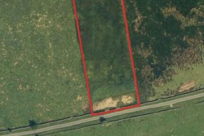
- Price
- Guide Price£35,000
- Size
- 1.89 acres
Added on 29/01/2026Grazing Land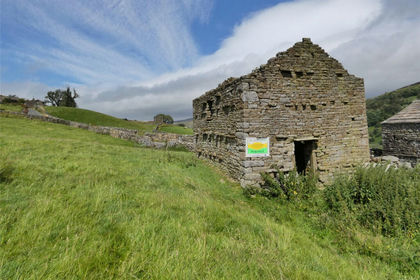
- Price
- Guide Price£70,000
- Size
- 4.9 acres
Angram Lane Barn & Land, Angram, Muker, North Yorkshire DL11 England
Added on 29/01/2026Conversion Land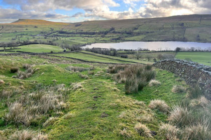
- Price
- Guide Price£20,000
- Size
- 2.3 acres
2.3 Acres of Permanent Pasture at Countersett, Hawes, Bainbridge, North Yorkshire DL8 England
Added on 17/02/2026Cheap Land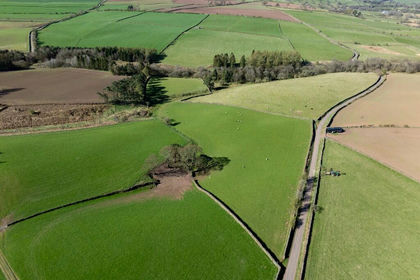
- Price
- Offers Over£70,000
- Size
- 5.56 acres
Lot 1 - Land at Glassonby, Penrith CA10, Glassonby, Westmorland and Furness CA10 England
Added on 29/01/2026Farmland
- Price
- Offers in Excess of£52,500
- Size
- 2.86 acres
Land Off Well Lane, High Casterton, LA6, Casterton, Westmorland and Furness LA6 England
Added on 09/09/2026Grazing Land
- Price
- Offers Over£60,000
- Size
- 3.01 acres
Added on 13/07/2026Vacant Land
- Price
- Fixed Price£35,000
- Size
- 0.64 acres
Rakes Head Lane, Slyne, Morecambe, LA4, Morecambe, Lancashire LA4 England
Added on 25/08/2026Small Plot of Land
- Price
- Guide Price£40,000
- Size
- 1.79 acres
Rakes Head Lane, Slyne, Morecambe, LA4, Morecambe, Lancashire LA4 England
Added on 25/08/2026Agricultural Land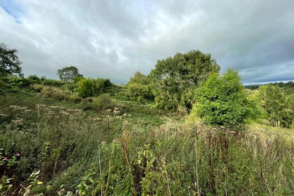
- Price
- Offers Over£25,000
- Size
- 1.71 acres
Added on 02/04/2026Grazing Land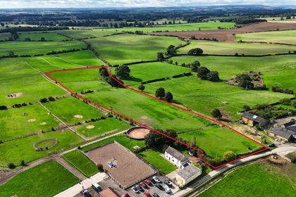
- Price
- Guide Price£75,000
- Size
- 5.73 acres
Added on 18/09/2026Grazing Land