Stodmarsh Road
- Land size
- 1.6 acres
- Bedrooms
- 4
- Bathrooms
- 1
Key Features
- Impressive detached bungalow located on sought after Stodmarsh Road on a plot of approx 1.6 acres
- Just over 1600 sq. ft. of spacious & versatile accommodation
- Dual aspect 19 ft. x 16 ft. living room & separate dining room with log burner & double doors onto the garden
- Country style kitchen/breakfast room with plenty of storage & space for free standing appliances
- 4 bedrooms, 2 doubles with fitted wardrobes & 2 good size singles. Family bathroom & separate shower room
- Chain free
- Large, established rear garden with mature trees, flower beds & several vegetable plots, plus a large patio
- Good size front garden & driveway parking for 4 cars
- 0.7 miles from Canterbury Golf Club, 2 miles from Canterbury City Centre & 3 miles from Littlebourne
- 2.3 miles from Canterbury East station & 3.9 miles from Canterbury West station with fast link to St Pancras
Description
Property Description: Guide Price £600,000 - £650,000. This impressive detached bungalow, situated on the sought after Stodmarsh Road, is set in approximately 1.6 acres of land. With just over 1600 square foot of accommodation, the property has spacious and versatile living with a layout which is thoughtfully designed to maximise comfort and functionality, appealing to families.
The heart of the home features a generous dual-aspect living room, measuring 19 foot by 16 foot, which provides ample space for relaxation and entertaining. Adjacent to this, a separate dining room includes a charming log burner, creating a cosy atmosphere, and double doors that open directly onto the garden, seamlessly connecting indoor and outdoor living. The country-style kitchen/breakfast room is well appointed with plenty of storage solutions and space for freestanding appliances, catering to all culinary needs.
The bungalow comprises four well-proportioned bedrooms. Two of these are comfortable double bedrooms, each fitted with wardrobes, providing practical storage. The remaining two bedrooms are good sized singles, suitable for children, guests, or as dedicated home office spaces. There is a family bathroom and a separate shower room, enhancing convenience for residents and guests.
This property is offered chain-free, providing a smooth transition for its new owners.
Outside: The property truly excels with a large, established rear garden. This outdoor space features mature trees, vibrant flower beds, and several productive vegetable plots, appealing to keen gardeners. A spacious patio area provides an ideal setting for al fresco dining and entertaining during warmer months. The good-sized front garden complements the property's kerb appeal, while the driveway has ample parking for up to four cars, a significant advantage in this desirable location.
Location: Stodmarsh Road, although just two miles from Canterbury city centre, is tucked away in a peaceful and tranquil setting. Fordwich is just 1 mile away and has the incredible Michelin star restaurant, The Fordwich Arms by the river. There are facilities nearby with Polo Farm Sports club, tennis courts and Canterbury Golf Club, all within walking distance. Canterbury has a wealth of cultural and leisure amenities, excellent schools, a wide range of shops, bars and restaurants and good road and rail links. These include The King's Mile, Whitefriars Shopping Centre, University of Kent, Canterbury Christ Church University and The Marlowe Theatre. There are good road links with the A2 providing access to the channel port of Dover, Canterbury and the M2. The two mainline railway stations offer fast and frequent services with the high speed link from Canterbury West to London St Pancras (approximately 56 mins). 'The Riverside' which is situated on the other side of the Great Stour River boasts Curzon's 5 screen cinema as well as restaurants and bars that wrap around the new public square that overlook the river. The Spitfire Ground is home to Kent County Cricket in the South Canterbury area (just over 2 miles away) with regular cricket games. Summer concerts are hosted here with big names which have included Sir Elton John and Michael Bublé. Canterbury is also the home to Kent & Canterbury Hospital and The BMI Chaucer Hospital.
Directions: SatNav = CT3 4AH / What3Words = cared.expand.owner
Council Tax: Band F (correct at time of marketing). To check council tax for this property, please refer to the local authority website.
Local Authority: Canterbury City Council . Kent County Council .
Services: Gas central heating, mains water, drainage and electricity. For broadband and mobile coverage, we advise you check your providers website or refer to an online checker.
Tenure: This property is freehold and is sold with vacant possession upon completion.
Disclaimer: Sandersons and their clients state that these details are for general guidance only and accuracy cannot be guaranteed. They do not form any part of any contract. All measurements are approximate, and floor plans are for general indication only and are not measured accurate drawings. No guarantees are given with any mentioned planning permission or fitness for purpose. No appliances, equipment, fixture or fitting has been tested by us and items shown in photographs are not necessarily included. Buyers must satisfy themselves on all matters by inspection or through the conveyancing process.
Identity verification: Please note, Sandersons UK are obligated by law to undertake Anti Money Laundering (AML) Regulations checks on any purchaser who has an offer accepted on a property. We are required to use a specialist third party service to verify your identity. The cost of these checks is £60 inc.VAT per property and accepted offer. This is payable at the point an offer is accepted and our purchaser information form is completed, prior to issuing Memorandum of Sales to both parties respective conveyancing solicitors. This is a legal requirement and the charge is non-refundable.
Disclaimer: Please note the image with the boundary line is for indicative purposes only and will be need to be confirmed via Land Registry during the conveyancing process.
Additional Property Notes: The property is of traditional construction and has had no adaptions for accessibility. There is driveway parking for 4 cars next to the property.
Register for new listings before the portal launch
Map Location
Property details
- Tenure
- Freehold
- Council Tax Band
- F
- Date Posted
- 2026-04-20
Price history
| Date | Change | Price |
|---|---|---|
| 28 Jul 2026 | Reduced 7.7% (−£50,000) | £600,000 |
| Until 28 Jul 2026 | Asking price | £650,000 |
Market Value Analysis
Compared with 1,937 Homes with Land listings in South East England (1+ acres).
Energy Performance Certificate
Energy Efficiency Rating
Based on UK Energy Performance Certificate standards (EU Directive 2002/91/EC)
Running costs are one side. Planning activity, flood history and ground risks for this location are in the full report.
Utilities & Restrictions
Utilities
- Electricity
- Mains
- Water
- Mains
- Heating
- Gas Central Heating
- Broadband
- Ask Agent
- Sewerage
- Mains
Rights & Restrictions
- Public Rights of Way
- Ask Agent
- Private Rights of Way
- Ask Agent
- Listed Property
- Ask Agent
- Restrictions
- Ask Agent
Listed status, conservation areas and planning constraints for this location are in the full report.
Property Features
- Accessibility
- Ask Agent
- Parking
- Parking Available
- Garden
- Rear Garden
Beyond the particulars: planning activity, flood history, heritage and ground risks, checked for this exact spot.
Connectivity
Broadband
Fastest speed available at this postcode
35 Mbps
Superfast · available to 33% of premises
Suitable for
- HD streaming
- Video calls
- Web & social
Fixed wireless access may also be an option here.
Mobile signal
Outdoor predictions; indoor signal depends on building materials.
Ofcom Connected Nations postcode-level predictions. Speeds and signal are modelled, not measured, and vary between addresses and providers.
Signal is the easy part. Planning activity, flood history and protected designations here are in the full report.
Nearest Schools
Primary
- Parkside Community Foundation Primary School0.8 milesOfsted: Good
- Ages
- 4 to 11
- Pupils
- 161
- Type
- Foundation school
- Pilgrims' Way Primary School1.3 milesOfsted: Good
- Ages
- 3 to 11
- Pupils
- 404
- Type
- Academy sponsor led
- St Thomas' Catholic Primary School, Canterbury1.6 milesOfsted: Good
- Ages
- 5 to 11
- Pupils
- 210
- Type
- Voluntary aided school
- Faith
- Roman Catholic
- Sturry Church of England Primary School1.7 milesOfsted: Outstanding *
- Ages
- 4 to 11
- Pupils
- 414
- Type
- Academy converter
- Faith
- Church of England
- St Johns Church of England Primary School1.7 milesOfsted: Good
- Ages
- 2 to 11
- Pupils
- 427
- Type
- Voluntary controlled school
- Faith
- Church of England
Secondary
- Barton Manor School1.2 milesOfsted: Good *
- Ages
- 11 to 19
- Pupils
- 596
- Type
- Free schools
- Barton Court Grammar School1.4 milesOfsted: Good
- Ages
- 11 to 18
- Pupils
- 995
- Type
- Academy converter
- Simon Langton Girls' Grammar School1.7 milesNo Ofsted rating
- Ages
- 11 to 18
- Pupils
- 1,258
- Type
- Voluntary controlled school
- Gender
- Girls
- St Anselm's Catholic School, Canterbury1.7 milesOfsted: Good
- Ages
- 11 to 18
- Pupils
- 1,116
- Type
- Academy converter
- Faith
- Roman Catholic
- Simon Langton Grammar School for Boys2.2 milesOfsted: Outstanding *
- Ages
- 11 to 18
- Pupils
- 1,226
- Type
- Foundation school
- Gender
- Boys
* Latest graded judgement covers quality of education only; no overall grade was issued under the 2024-25 inspection framework.
Distances are straight-line from the advertised location. Source: the national school registers (DfE, Welsh Government, Scottish Government) and Ofsted.
Schools are just the start: sold prices nearby, planning activity and any flood history are in the full report.
Amenities
Supermarket
GP surgery
Pharmacy
Hospital
Green space
Walking trail
Straight-line distances from the advertised location. Sources: NHS records, Geolytix supermarket locations, OS Open Greenspace and the national trails registers.
The area stacks up? Now check the location itself: planning nearby, protected designations and past flooding.
Getting Around
Nearest station
Nearest bus stop
Typical drive times
Straight-line distances from the advertised location; drive times are typical free-flow times over OpenStreetMap road data, so allow more at peak. Public transport locations from DfT NaPTAN.
Easy to reach matters. So do planning activity, flood history and ground risks: all in the full report.
Flood Risk
From Environment Agency flood map open data, checked around the advertised map pin and allowing for the listed acreage where known. This summary comes from LandSale, the advertising platform, not from the listing agent, and is not part of the agent's particulars. Risk can vary across a single holding, so verify anything critical through your own searches before committing.
Rivers and the sea
Surface water
These bandings are the summary. Where this location sits on the flood maps, plus planning activity, heritage and ground risks, is in the full report.
Important notice: Information, maps and tags on this page are drawn from the advertising agent's marketing materials or generated automatically. LandSale has not verified them. Relying on these details is at your own risk, always carry out independent checks before committing to a purchase.
LandSale full disclaimer
Marketing information only - not formal particulars. The details on this website are provided for general guidance and do not constitute an offer or contract. Neither LandSale nor the advertising estate/land agent accepts responsibility for any inaccuracy.
1. Source of information
- Listing content: Core description, asking price, tenure, measurements, photographs and planning history originate from the marketing materials of the advertising estate or land agent. LandSale does not author this content and cannot guarantee its accuracy.
- Automated tags & categorisation: Property type, land-use class, acreage bands and similar labels may be applied by machine-learning models. They are intended as a helpful guide only and may not reflect the property's legal status or permitted use.
- Third-party & enriched data layers: Maps, boundary outlines, planning designations, soil reports, broadband coverage and other environmental or location-based insights are licensed from external suppliers. Such data are supplied “as is", may be incomplete or out of date and are subject to change without notice.
2. Verification required
Prospective purchasers must verify critical matters, including but not limited to planning permission, title boundaries, public rights of way, environmental constraints, acreage, services, access and VAT status, through their own inspections, specialist surveys, legal advisers and the selling agent before relying on the information or entering into any contract.
3. No warranty or liability
LandSale gives no warranty, express or implied, as to the accuracy, completeness or fitness for any particular purpose of the information displayed. LandSale shall not be liable for any loss, damage, cost or expense arising directly or indirectly from any use of or reliance on such information, save where liability may not be excluded by law.
4. Updates & feedback
If you believe any detail on this listing is inaccurate, please let us know. We will investigate and, where appropriate, update the listing or notify the agent.
© LandSale | Version 1.3 - August 2026
Listing agent
Sandersons, Canterbury
Head Office, 26a Castle Street, Canterbury, CT1 2PU
Similar properties for sale
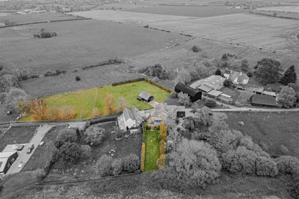
- Price
- Guide Price£625,000
- Size
- 1.12 acres
Deerson Lane, Preston, Canterbury, Preston, Kent CT3 England
Added on 29/01/2026Cottage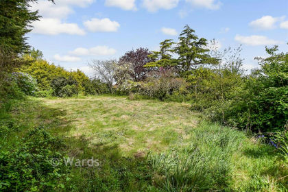
- Price
- Guide Price£550,000
- Size
- 1.3 acres
Stour Valley Close, Upstreet, Canterbury, Kent, Chislet, Kent CT3 England
Added on 29/04/2026House with Land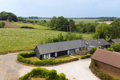 Added on 12/06/2026Barn Conversion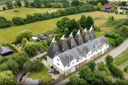
- Price
- Guide Price£725,000
- Size
- 4 acres
Added on 14/08/2026Equestrian property
- Price
- Guide Price£600,000
- Size
- 1.1 acres
Added on 22/06/2026House with Land
- Price
- Guide Price£600,000
- Size
- 1 acres
Added on 21/07/2026House with Land
- Price
- Guide Price£700,000
Added on 29/01/2026Development Land
- Price
- Guide Price£750,000
- Size
- 7.5 acres
Barnsole, Staple, Canterbury, Kent, Staple, Kent CT3 England
Added on 06/06/2026Self Build Plot
- Price
- £525,000
Down Barton Road, St Nicholas at Wade, Birchington, CT7, St. Nicholas at Wade, Kent CT7 England
Added on 14/05/2026Barn Conversion
- Price
- £725,000
- Size
- 2.5 acres
Stelling Minnis, Canterbury, Kent, CT4, Elham, Kent CT4 England
Added on 29/01/2026House with Land