Nr Wimborne, Dorset - 3.6 Acres
- Land size
- 3.56 acres
- Bedrooms
- 3
- Bathrooms
- 1
Key Features
- Three Bedroom Equestrian Property
- Building Regulations Approved for 4th Bedroom
- Barn with Four Stables
- 40m x 20m Arena
- Hay Barn, Wash Bay/ Tie Up
- Home Office
- Double Garage, Workshop & Stores
- Excellent Outriding
- About 3.6 Acres
- No Onward Chain
Description
Perfectly situated residential equestrian small holding in Woodlands situated onto a bridleway. The property offers generously proportioned three bedroom single storey dwelling, double garage (building regulations approval to convert into a master bedroom with ensuite & office), workshop, stores and fully connected home office, double garage and gardens. The equestrian facilities are excellent with 40m x 20m Arena, Barn housing four internal stables plus stores, hay barn, lorry parking and paddocks. Superb outriding.
In total 3.6 Acres
*The property is of Woolaway PRC construction, limiting financing options*
No Onward Chain
SITUATION
Ringwood 8 miles, New Forest 8 miles, Bournemouth 16 miles, Beaulieu 25 miles. Approx. 1hr 45 mins drive from London
International airports: Bournemouth International Airport 16 miles, Southampton Airport 28 miles
Mainline Train Services: Poole to Waterloo 2hrs
Brookfield is perfectly situated for safe outriding yet with an easy drive to access the road network. The property is quietly situated on a bridleway providing a truly tranquil and beautiful setting with paddocks to the front and rear and woodlands beyond.. Crofton Manor Equestrian & Sparsholt are within an hour. With Chard Equestrian & West Wilts Equestrian within 1hr 30 mins.
Education
There are some excellent private schools in the vicinity including Canford School and Embley within 30 minutes drive. The highly regarded St Swithins and Winchester College are within 45 minutes drive.
Local, Sporting & Recreational
There is an abundance of leisure and sporting activities located within an hours drive of the property including The New Forest and South Dorset Jurassic Coast which attracts millions of visitors every year to enjoy the excellent walks in the forest and breath-taking coastline. The white sandy beaches of Bournemouth are within 30 minutes and the dark sky reserve of the Cranborne Chase is situated within 3 miles. The village of Three
Legged Cross provides local shops and a pub whilst extra gastronomy is found in the neighbouring villages with nearby Ringwood providing excellent shopping and dining.
BROOKFIELD
The location is particularly unique and idyllic, with paddocks to the front and rear of the property and peace and quiet. Situated on a no through road, which forms part of a bridleway the property provides easy access to the Ringwood Forest, Holt Heath, Horton Tower and miles of local bridlepaths. Also within easy reach is the New Forest, Martin Down and Bradbury Rings.
RESIDENCE
Well proportioned with generous room dimensions, the property offers Hall, Kitchen/Breakfast Room, Sitting Room, Dining Room/Conservatory, Utility Room, Boot Room, Bathroom. There is also a Workshop, store, open wood store and double garage with building regulations approval to convert into master bedroom with ensuite and office.
GARDENS
The gardens wrap three sides of the property offering patio and lawns with hedging and post & rail boundary overlooking paddocks.
EQUESTRIAN
The equestrian facilities are situated opposite the property, the other side of the bridleway, providing an element of privacy should the facilities be rented out.
In the yard area there is a large timber barn housing four stables, feed room, tack room and store room. Tractor shed and hay store. Easy access to the paddock land.
There is a secondary access drive to the equestrian facilities providing off road parking for lorries, hay store and access to the 40m x 20m arena.
LAND
The paddock land is gently undulating in places and sits on a sandy/loamy top layer. Divided into several paddocks with a small wooded area in the furthest paddock. Boundary fenced with post and rail. Water troughs connected.
In total the property offers 3.56 Acres
AGENTS NOTES
Fox Grant and their clients give notice that:
1. They have no authority to make or give any representations or warranties in relation to the property.
2. These particulars have been prepared in good faith to give a fair overall view of the property, do not form any part of an offer or contract and must not be relied upon as statements or representations of fact.
3. Any areas, measurements or distances are approximate. The text, photographs and plans are for guidance only and are not necessarily comprehensive. It should not be assumed that the property has all necessary planning, building regulation or other consents and Fox Grant has not tested any services, equipment or facilities. Purchasers must satisfy themselves by inspection or otherwise.
Plans, Areas and Schedules These are based on the Ordnance Survey and are for
reference only. Any error or mis-statement shall not annul the sale or entitle either party to
compensation in respect thereof.
Local Authority Dorset County Council
Council Tax Band E
Energy Performance Certificate D
Services Mains water and private sewage, mains electricity with additional solar panels. LPG gas heating
Construction: The property is of Woolaway PRC construction, limiting financing options.
Fixtures & Fittings Unless mentioned specifically all fixture, fittings and garden ornaments are excluded from the sale.
Tenure The property is sold as Freehold and will be sold with vacant possession on
completion.
Particulars Prepared by Charlotte Roberts- Barr April 2025
Property Code FL, CV, EQ, SH
Notice
Please note we have not tested any apparatus, fixtures, fittings, or services. Interested parties must undertake their own investigation into the working order of these items. All measurements are approximate and photographs provided for guidance only.
Map Location
Property details
- Tenure
- Freehold
- Council Tax Band
- E
- Date Posted
- 2026-04-18
Market Value Analysis
Compared with 1,696 Homes with Land listings in South West England (1+ acres).
Energy Performance Certificate
Energy Efficiency Rating
Based on UK Energy Performance Certificate standards (EU Directive 2002/91/EC)
Running costs are one side. Planning activity, flood history and ground risks for this location are in the full report.
Utilities & Restrictions
Utilities
- Electricity
- Ask Agent
- Water
- Ask Agent
- Heating
- Ask Agent
- Broadband
- Ask Agent
- Sewerage
- Ask Agent
Rights & Restrictions
- Public Rights of Way
- Ask Agent
- Private Rights of Way
- Ask Agent
- Listed Property
- Ask Agent
- Restrictions
- Ask Agent
Listed status, conservation areas and planning constraints for this location are in the full report.
Property Features
- Accessibility
- Ask Agent
- Parking
- Garage, Off-Street Parking
- Garden
- Garden
Beyond the particulars: planning activity, flood history, heritage and ground risks, checked for this exact spot.
Connectivity
Broadband
Fastest speed available at this postcode
1.8 Gbps
Gigabit full fibre
Suitable for
- 4K streaming on every screen
- Full-time home working
- Online gaming & big downloads
Mobile signal
Outdoor predictions; indoor signal depends on building materials.
Ofcom Connected Nations postcode-level predictions. Speeds and signal are modelled, not measured, and vary between addresses and providers.
Signal is the easy part. Planning activity, flood history and protected designations here are in the full report.
Nearest Schools
Primary
- Verwood Church of England First School1.2 milesOfsted: Good
- Ages
- 2 to 9
- Pupils
- 289
- Type
- Academy converter
- Faith
- Church of England
- Trinity Church of England First School1.5 milesOfsted: Good *
- Ages
- 4 to 9
- Pupils
- 128
- Type
- Academy converter
- Faith
- Church of England
- Hillside Community First School1.7 milesNo Ofsted rating
- Ages
- 4 to 9
- Pupils
- 221
- Type
- Academy converter
- Three Legged Cross First and Nursery School1.9 milesOfsted: Good
- Ages
- 2 to 9
- Pupils
- 84
- Type
- Academy converter
- Cranborne Church of England First School2.9 milesOfsted: Good
- Ages
- 2 to 9
- Pupils
- 73
- Type
- Academy converter
- Faith
- Church of England
Secondary
- Emmanuel Church of England Middle School1.3 milesOfsted: Good
- Ages
- 9 to 13
- Pupils
- 434
- Type
- Academy sponsor led
- Faith
- Church of England
- Cranborne Middle School3 milesNo Ofsted rating
- Ages
- 9 to 13
- Pupils
- 265
- Type
- Community school
- West Moors Middle School4.3 milesOfsted report card · Jun 2026
- Ages
- 9 to 13
- Pupils
- 240
- Type
- Community school
- Ferndown Upper School5 milesOfsted report card · Mar 2026
- Ages
- 13 to 19
- Pupils
- 1,134
- Type
- Community school
- Ferndown Middle School5.2 milesNo Ofsted rating
- Ages
- 9 to 13
- Pupils
- 600
- Type
- Academy converter
* Latest graded judgement covers quality of education only; no overall grade was issued under the 2024-25 inspection framework.
Distances are straight-line from the advertised location. Source: the national school registers (DfE, Welsh Government, Scottish Government) and Ofsted.
Schools are just the start: sold prices nearby, planning activity and any flood history are in the full report.
Amenities
Supermarket
GP surgery
Pharmacy
Hospital
Green space
Straight-line distances from the advertised location. Sources: NHS records, Geolytix supermarket locations, OS Open Greenspace and the national trails registers.
The area stacks up? Now check the location itself: planning nearby, protected designations and past flooding.
Getting Around
Nearest station
Nearest bus stop
Typical drive times
Straight-line distances from the advertised location; drive times are typical free-flow times over OpenStreetMap road data, so allow more at peak. Public transport locations from DfT NaPTAN.
Easy to reach matters. So do planning activity, flood history and ground risks: all in the full report.
Flood Risk
From Environment Agency flood map open data, checked around the advertised map pin and allowing for the listed acreage where known. This summary comes from LandSale, the advertising platform, not from the listing agent, and is not part of the agent's particulars. Risk can vary across a single holding, so verify anything critical through your own searches before committing.
Rivers and the sea
Surface water
The detail behind these bandings
The full report pinpoints where this location sits on the flood maps, and runs the deeper checks that usually only surface after an offer.
- Exact flood zones & annual chances (included in the full report)
- Any recorded past flooding (included in the full report)
- Planning activity nearby (included in the full report)
- Heritage & conservation (included in the full report)
- Protected nature designations (included in the full report)
- Ground risks (included in the full report)
- Sold prices nearby (included in the full report)
£14.99 · one-off purchase
By LandSale, the platform. Not provided by the listing agent. Ready in about a minute.
Important notice: Information, maps and tags on this page are drawn from the advertising agent's marketing materials or generated automatically. LandSale has not verified them. Relying on these details is at your own risk, always carry out independent checks before committing to a purchase.
LandSale full disclaimer
Marketing information only - not formal particulars. The details on this website are provided for general guidance and do not constitute an offer or contract. Neither LandSale nor the advertising estate/land agent accepts responsibility for any inaccuracy.
1. Source of information
- Listing content: Core description, asking price, tenure, measurements, photographs and planning history originate from the marketing materials of the advertising estate or land agent. LandSale does not author this content and cannot guarantee its accuracy.
- Automated tags & categorisation: Property type, land-use class, acreage bands and similar labels may be applied by machine-learning models. They are intended as a helpful guide only and may not reflect the property's legal status or permitted use.
- Third-party & enriched data layers: Maps, boundary outlines, planning designations, soil reports, broadband coverage and other environmental or location-based insights are licensed from external suppliers. Such data are supplied “as is", may be incomplete or out of date and are subject to change without notice.
2. Verification required
Prospective purchasers must verify critical matters, including but not limited to planning permission, title boundaries, public rights of way, environmental constraints, acreage, services, access and VAT status, through their own inspections, specialist surveys, legal advisers and the selling agent before relying on the information or entering into any contract.
3. No warranty or liability
LandSale gives no warranty, express or implied, as to the accuracy, completeness or fitness for any particular purpose of the information displayed. LandSale shall not be liable for any loss, damage, cost or expense arising directly or indirectly from any use of or reliance on such information, save where liability may not be excluded by law.
4. Updates & feedback
If you believe any detail on this listing is inaccurate, please let us know. We will investigate and, where appropriate, update the listing or notify the agent.
© LandSale | Version 1.3 - August 2026
Listing agent
Fox Grant, Salisbury
Windover House, St Ann Street, Salisbury, SP1 2DR
Similar properties for sale
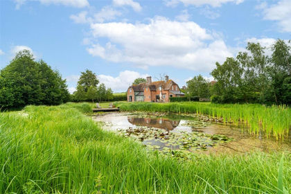
- Price
- £995,000
- Size
- 1.6 acres
Mill Lane, Hinton Parva, Wimborne, Dorset, BH21, Hinton, Dorset BH21 England
Added on 27/06/2026Cottage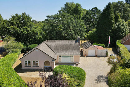
- Price
- £725,000
- Size
- 1.2 acres
Hurn Lane, Ringwood, BH24, St. Leonards and St. Ives, Dorset BH24 England
Added on 08/08/2026House with Land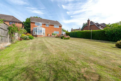
- Price
- Guide Price£970,000
- Size
- 1.5 acres
Furzehill, Wimborne, Dorset, BH21, Holt, Dorset BH21 England
Added on 16/04/2026House with Land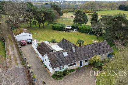
- Price
- £925,000
- Size
- 2.32 acres
Barrack Road, West Parley, Ferndown, BH22, West Parley, Dorset BH22 England
Added on 14/04/2026House with Land
- Price
- Guide Price£700,000
- Size
- 1.44 acres
Highwood, Ringwood, Hampshire, BH24, Ellingham, Harbridge and Ibsley, Hampshire BH24 England
Added on 10/05/2026Cottage
- Price
- Guide Price£795,000
- Size
- 1.1 acres
Fordingbridge - Equestrian/Commercial, Fordingbridge, Hampshire SP6 England
Added on 14/06/2026House with Land
- Price
- Guide Price£895,000
- Size
- 4 acres
Woodcutts, Salisbury, Dorset, SP5, Sixpenny Handley and Pentridge, Dorset SP5 England
Added on 20/02/2026Country Home
- Price
- £850,000
- Size
- 1.75 acres
Added on 10/04/2026Equestrian property
- Price
- £925,000
- Size
- 1.5 acres
Pitt House Lane, CHRISTCHURCH, Dorset, BH23, Hurn, Bournemouth, Christchurch and Poole BH23 England
Added on 08/08/2026House with Land
- Price
- Guide Price£799,000
- Size
- 2.17 acres
Sleight Lane, Corfe Mullen, Wimborne, Corfe Mullen, Dorset BH21 England
Added on 18/06/2026House with Land