Sterridge Valley, Berrynarbor, North Devon EX34
- Land size
- 11.6 acres
- Bedrooms
- 4
- Bathrooms
- 4
Key Features
- Character Devon longhouse – Period charm with a warm, grounded feel
- Option to purchase adjoining additional agricultural barn & land of 1.5+ acres for £250,000– Scope for future projects or uses
- Around 11.5+ acres – Space, privacy, and genuine lifestyle freedom
- Stunning contemporary vaulted live-in kitchen-Overlooking the grounds and lake
- Three-bedroom main house – Comfortable, practical family living
- Separate one-bedroom coach house/annex – Ideal for guests, income or multi-gen use
- Spring-fed lake with island – Standout feature with calm, natural setting-bordered by a stream
- Woodland valley position – Sheltered, private, and rich in wildlife
- Close to North Devon coast – Easy reach of beaches, surf and coastal walks- to the pub
- EPC: F & Council Tax: G
Description
Tucked into a quiet North Devon valley, Lower Rowes Farm offers a rare sense of space and calm. A restored longhouse, guest cottage and rolling land of some 11.5 acres, come together in a setting shaped by light, trees and open sky, with the coast and Exmoor both within easy reach.|Arrival and Setting
There is something special about the approach into Sterridge Valley. The lane narrows, the landscape folds in around you, and the sound of running water begins to replace everything else. Lower Rowes Farm sits quietly within this beautiful valley setting, surrounded by its own pasture, sheltered by wooded valley sides, and bordered by the river. It feels private, grounded and entirely at ease in its surroundings.
This is a rare pocket of North Devon where the landscape still feels natural and unspoilt. The house is not imposed on it, it sits within it, as though it has always belonged.
Accommodation
At its heart, Lower Rowes Farm is an original Devon longhouse, full of character and substance, yet carefully improved for modern living. The focal point is the vaulted kitchen extension, a striking space with extensive glazing overlooking the gardens and lake. Light moves through it across the day, and the outlook becomes part of everyday life. Doors open onto a terrace, allowing the house to flow easily into the garden.
From here, the accommodation unfolds with balance. A sitting room with warmth and depth, a panelled library offering a quieter retreat, and bedrooms that feel calm and private. The layout reflects the natural evolution of the house rather than something imposed.
Across the courtyard sits a separate one bedroom coach house style annexe. Independent yet connected, it provides flexible space for guests, family or working from home, and adds a further layer to how the property can be used.
Outside
The grounds shape the whole experience of living here. Formal gardens of around 1.862 acres sit around the house. The lake provides a natural focal point, while the river and valley floor bring movement and life through the seasons. The formal gardens lead each side into pasture land of approximately 4.939 acres and 1.626 acres together with a further 3.222 acres. In all around 11.6 acres.
There is also the option to acquire a separate agricultural barn on adjoining land. Set within around 1.569 acres and with a guide price of £250,000.
Positioned away from the main house with its own access, it offers clear potential for future use, subject to any necessary consents and gives additional scope for those looking at a range of further potential uses.
In total, the main holding extends to approximately 11.6 acres. With the additional barn, the whole would be around 13.2 acres.
This is land that feels part of daily life. It offers privacy, outlook and a genuine connection to the setting.
Berrynarbor and Sterridge Valley
Berrynarbor sits quietly above the coast, a village that has held onto its character without trying to prove it. White cottages, village lanes and a sense of familiarity that comes from people knowing where they belong.
From here, Sterridge Valley opens out in a softer, more sheltered landscape. The valley folds gently through pasture and woodland, with water running along its floor and light shifting across the slopes through the day. It feels calm and contained, a place where time slows without effort.
A short walk brings you back to the village, to the pub, the school and the small rhythms of daily life. Yet within the valley, you feel a world away.
Location and Connectivity
Despite its sense of seclusion, Lower Rowes Farm remains well connected. Berrynarbor lies less than a mile away, while Ilfracombe and Combe Martin provide everyday amenities and a traditional coastal setting.
Barnstaple is within easy reach and offers a full range of shopping, schooling and services.
Rail links connect through to Exeter, with onward services to London Paddington, while Tiverton Parkway provides a direct mainline alternative. The A361 links to the M5, giving straightforward access to the wider motorway network.
Exeter Airport is around an hour away, with Bristol Airport offering a broader range of destinations.
Schooling is well served, with Berrynarbor primary close by, secondary options in Ilfracombe and Barnstaple, and independent education available at West Buckland School.
North Devon
North Devon is a place people tend to feel rather than just describe. Its appeal lies in the contrast, long sandy beaches, hidden coves, open moorland, wooded valleys and a coastline that can feel both dramatic and restorative within the same afternoon.
This is a landscape that naturally draws life outdoors. Walkers, swimmers, surfers, golfers, cyclists and those who simply value open space and sea air are well served here. The coastline offers some of the South West’s most loved beaches, including Woolacombe, Croyde, Putsborough, Saunton Sands, Instow and Westward Ho!, while quieter coves, cliff paths and estuary walks give the area a softer, more hidden character.
Inland, the scenery changes again. Exmoor National Park opens up a very different world of moorland, wooded combes, river valleys and far-reaching views. The Tarka Trail, the Torridge Valley and the wider network of footpaths and lanes make the countryside part of everyday life rather than something saved for weekends.
There is also something increasingly valuable about the pace of life here. North Devon still feels grounded. The communities are real, the landscape is close, and there is a sense of breathing room that many buyers are now actively seeking. Homes in this part of the world appeal because they offer more than bricks and mortar. They offer space, rhythm, connection and a different quality of life.
Barnstaple provides the main commercial hub for the region, with shops, schools, leisure facilities, healthcare and rail links, while the North Devon Link Road gives access towards the M5, Tiverton Parkway and Exeter. It means North Devon can feel tucked away without being cut off, which is an important part of its appeal.
For many, the decision to move here is not simply about changing address. It is about choosing a life with more landscape in it, more time outdoors, more room to breathe, and a stronger connection to coast, countryside and community.
Overall
Lower Rowes Farm is a complete offering. A longhouse of real character, a vaulted kitchen extension looking out across gardens and water, a separate coach house annexe, and a beautiful valley setting with land that gives both purpose and privacy. Combined with the wider appeal of North Devon, it is a place to settle into and enjoy over the long term.
Useful Information
Tenure: Freehold
Listing: N/A
Council Tax Band: G
In an Area of Outstanding Natural Beauty (AONB)
Construction: Traditional stone with timber framed windows
Services: Mains electricity, mains water, private well, LPG gas
Septic tank drainage. (Compliance with current regulations has not been confirmed. Buyers must rely on their own enquiries and professional advice.)
Heating: Biomass system, LPG central heating, open fires
Broadband: Airband, approx 100 Mbps
Parking: Driveway and courtyard parking for multiple vehicles
Restrictions: None known
Management/Service Charges: None
Japanese Knotweed Disclosure
Japanese Knotweed has previously been identified within the vicinity of the land. Treatment works were undertaken historically; however, full documentation and guarantees are not currently available. Buyers are advised that the presence of Japanese Knotweed is considered material information and should make their own enquiries, including obtaining independent professional advice, to satisfy themselves as to its current status and any implications for lending or future maintenance.
AONB
Lower Rowes Farm lies within the North Devon Area of Outstanding Natural Beauty (AONB). This designation recognises the landscape’s national importance and helps protect its character, setting and views. Properties within the AONB may be subject to planning policies and controls designed to conserve and enhance the surrounding environment. This may influence future alterations, extensions or development on the property or nearby or adjoining land. Buyers should make their own enquiries with the local planning authority to understand any restrictions or requirements that may apply.
By Design Homes North Devon & Exmoor is part of the wider By Design Homes network – a collective of experienced, premium estate agents delivering bespoke one-to-one service across the UK and internationally. Based here in the heart of North Devon, I combine local knowledge and personal attention with the strength and reach of a national brand. For discreet, expert advice, please feel free to contact me directly.
Important Notice: By Design North Devon & Exmoor, for themselves and for the vendors of this property, give notice that:
Particulars: These details are provided as a general outline for intending purchasers and do not constitute, nor form part of, any offer or contract. Descriptions: All descriptions, dimensions, references to condition, necessary permissions, and other details are given in good faith and believed to be correct. Purchasers must not rely on them as statements of fact and should verify accuracy by inspection or otherwise. Warranty: No person employed by By Design North Devon & Exmoor has authority to make or give any representation or warranty in relation to this property. Measurements: All measurements are approximate. Wayleaves and easements. The property is sold subject to any wayleaves or easements, whether or not they are referred to within these particulars. Floor plans are for illustrative identification only and may not be to scale. Photography: Photographs are provided for general information only and should not be assumed to include any items shown. Images are not materially altered but may be enhanced for marketing purposes (e.g. skies, twilight effects, digital staging). Services: Services, systems, and appliances have not been tested and no guarantee of condition or functionality is given. Purchasers should satisfy themselves as to suitability and working order. Due Diligence: Buyers are responsible for verifying matters such as flood risk, private drainage compliance, planning consents, covenants, and all other property-related details before viewing or incurring expense. Availability: Properties may be withdrawn or sold at any time. Buyers should confirm availability and up-to-date information prior to viewing. Money Laundering Regulations: In compliance with the Money Laundering, Terrorist Financing and Transfer of Funds (Information on the Payer) Regulations 2017 (as amended), all purchasers must provide proof of identity, address, source, and proof of funds before any sale can be agreed. By Design North Devon & Exmoor use Credas, an FCA-regulated provider, to complete these checks. A fee of £50 plus VAT per buyer applies. A secure link will be issued. The property status cannot be changed to Sold Subject to Contract or a Memorandum of Sale produced until all checks are satisfactorily completed.
Map Location
Property details
- Tenure
- Freehold
- Council Tax Band
- G
- Date Posted
- 2026-04-06
Market Value Analysis
Compared with 189 Homes with Land listings in South West England (10+ acres).
Energy Performance Certificate
EPC Rating: F
Running costs are one side. Planning activity, flood history and ground risks for this location are in the full report.
Property Brochure
Seen the details? The full report adds the independent checks: planning activity, flood history, heritage and ground.
Utilities & Restrictions
Utilities
- Electricity
- Mains
- Water
- Mains
- Heating
- Biomass Boiler, Gas Heating, Wood Burner, Open Fire
- Broadband
- Fibre (FTTC)
- Sewerage
- Ask Agent
Rights & Restrictions
- Public Rights of Way
- Ask Agent
- Private Rights of Way
- Ask Agent
- Listed Property
- Ask Agent
- Restrictions
- Ask Agent
Listed status, conservation areas and planning constraints for this location are in the full report.
Property Features
- Accessibility
- Ask Agent
- Parking
- Gated Parking
- Garden
- Private Garden
Beyond the particulars: planning activity, flood history, heritage and ground risks, checked for this exact spot.
Connectivity
Broadband
Fastest speed available at this postcode
900 Mbps
Gigabit full fibre · available to 79% of premises
Suitable for
- 4K streaming on every screen
- Full-time home working
- Online gaming & big downloads
Fixed wireless access may also be an option here.
Mobile signal
Predicted 4G and 5G signal; indoor signal depends on building materials.
Ofcom Connected Nations postcode-level predictions. Speeds and signal are modelled, not measured, and vary between addresses and providers.
Signal is the easy part. Planning activity, flood history and protected designations here are in the full report.
Nearest Schools
Primary
- Berrynarbor Church of England Primary School0.7 milesOfsted: Good
- Ages
- 4 to 11
- Pupils
- 69
- Type
- Academy converter
- Faith
- Church of England
- Combe Martin Primary School1.8 milesOfsted: Requires improvement *
- Ages
- 2 to 11
- Pupils
- 137
- Type
- Academy converter
- Ilfracombe Church of England Junior School2.3 milesOfsted: Good *
- Ages
- 7 to 11
- Pupils
- 326
- Type
- Voluntary controlled school
- Faith
- Church of England
- Ilfracombe Infant and Nursery School2.3 milesOfsted: Requires improvement *
- Ages
- 2 to 7
- Pupils
- 207
- Type
- Community school
- West Down School3.4 milesOfsted: Good
- Ages
- 2 to 11
- Pupils
- 95
- Type
- Academy converter
Secondary
- The Ilfracombe Church of England Academy2 milesOfsted report card · Jan 2026
- Ages
- 11 to 18
- Pupils
- 1,016
- Type
- Academy sponsor led
- Faith
- Church of England
- Braunton Academy7.2 milesNo Ofsted rating
- Ages
- 11 to 16
- Pupils
- 828
- Type
- Academy converter
- Pilton Community College7.3 milesOfsted: Good
- Ages
- 11 to 16
- Pupils
- 1,165
- Type
- Academy converter
- The Park Community School8.6 milesOfsted: Good *
- Ages
- 11 to 16
- Pupils
- 1,408
- Type
- Academy converter
- Bideford College14 milesOfsted report card · May 2026
- Ages
- 11 to 18
- Pupils
- 1,455
- Type
- Academy sponsor led
* Latest graded judgement covers quality of education only; no overall grade was issued under the 2024-25 inspection framework.
Distances are straight-line from the advertised location. Source: the national school registers (DfE, Welsh Government, Scottish Government) and Ofsted.
Schools are just the start: sold prices nearby, planning activity and any flood history are in the full report.
Amenities
Supermarket
GP surgery
Pharmacy
Hospital
Green space
Walking trail
Straight-line distances from the advertised location. Sources: NHS records, Geolytix supermarket locations, OS Open Greenspace and the national trails registers.
The area stacks up? Now check the location itself: planning nearby, protected designations and past flooding.
Getting Around
Nearest station
Nearest bus stop
Typical drive times
Straight-line distances from the advertised location; drive times are typical free-flow times over OpenStreetMap road data, so allow more at peak. Public transport locations from DfT NaPTAN.
Easy to reach matters. So do planning activity, flood history and ground risks: all in the full report.
Flood Risk
Environment Agency open data, checked around the advertised map pin for the listed acreage. Long-term risk counts flood defences; the planning map's flood zones do not. Provided by LandSale, not the listing agent, and not part of the agent's particulars. Risk varies across a holding, so verify before committing.
Rivers and the sea
Not at the pin: mapped about 60 metres away.
Planning map: Flood Zone 3, about 30 metres away.
Surface water
These bandings are the summary. Where this location sits on the flood maps, plus planning activity, heritage and ground risks, is in the full report.
Important notice: Information, maps and tags on this page are drawn from the advertising agent's marketing materials or generated automatically. LandSale has not verified them. Relying on these details is at your own risk, always carry out independent checks before committing to a purchase.
LandSale full disclaimer
Marketing information only - not formal particulars. The details on this website are provided for general guidance and do not constitute an offer or contract. Neither LandSale nor the advertising estate/land agent accepts responsibility for any inaccuracy.
1. Source of information
- Listing content: Core description, asking price, tenure, measurements, photographs and planning history originate from the marketing materials of the advertising estate or land agent. LandSale does not author this content and cannot guarantee its accuracy.
- Automated tags & categorisation: Property type, land-use class, acreage bands and similar labels may be applied by machine-learning models. They are intended as a helpful guide only and may not reflect the property's legal status or permitted use.
- Third-party & enriched data layers: Maps, boundary outlines, planning designations, soil reports, broadband coverage and other environmental or location-based insights are licensed from external suppliers. Such data are supplied “as is", may be incomplete or out of date and are subject to change without notice.
2. Verification required
Prospective purchasers must verify critical matters, including but not limited to planning permission, title boundaries, public rights of way, environmental constraints, acreage, services, access and VAT status, through their own inspections, specialist surveys, legal advisers and the selling agent before relying on the information or entering into any contract.
3. No warranty or liability
LandSale gives no warranty, express or implied, as to the accuracy, completeness or fitness for any particular purpose of the information displayed. LandSale shall not be liable for any loss, damage, cost or expense arising directly or indirectly from any use of or reliance on such information, save where liability may not be excluded by law.
4. Updates & feedback
If you believe any detail on this listing is inaccurate, please let us know. We will investigate and, where appropriate, update the listing or notify the agent.
© LandSale | Version 1.3 - August 2026

Listing agent
By Design, covering Nationwide
12 Old Bond Street, Mayfair, London, W1S 4PW
Contact By Design, covering Nationwide
12 Old Bond Street, Mayfair, London, W1S 4PW
View agent profileSimilar properties for sale
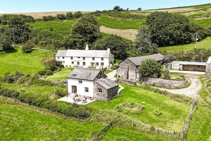
- Price
- Guide Price£1,500,000
- Size
- 56.95 acres
Combe Martin, Ilfracombe, EX34, Ilfracombe, Devon EX34 England
Added on 19/05/2026Smallholding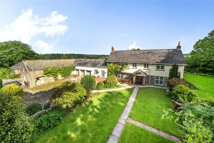
- Price
- Offers in Excess of£1,150,000
- Size
- 5.7 acres
Bratton Fleming, Barnstaple, Devon, EX31, Bratton Fleming, Devon EX31 England
Added on 04/06/2026House with Land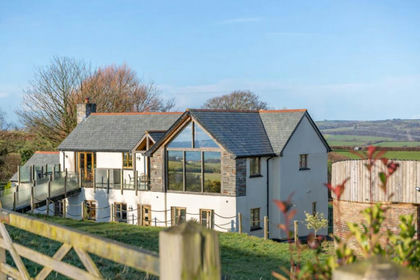
- Price
- £1,195,000
- Size
- 5 acres
Added on 29/01/2026Farmhouse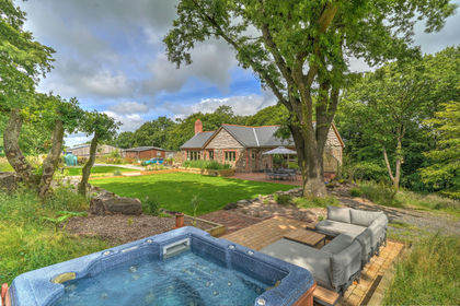
- Price
- Guide Price£1,350,000
- Size
- 22.12 acres
The Croft & Holiday Lodges, Mockham Down, Barnstaple, Devon EX32 England
Added on 27/07/2026Smallholding- Price
- Guide Price£1,350,000
- Size
- 22.12 acres
The Croft & Holiday Lodges, Mockham Down, Barnstaple, Devon EX32 England
Added on 27/07/2026House with Land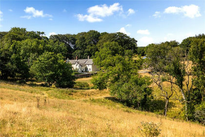
- Price
- Guide Price£1,500,000
- Size
- 29.6 acres
Exmoor National Park, Lynton, Devon, EX35, Lynton and Lynmouth, Devon EX35 England
Added on 02/08/2026House with Land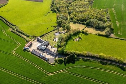
- Price
- Guide Price£1,225,000
- Size
- 5.44 acres
Horwood, Bideford, Horwood, Lovacott and Newton Tracey, Devon EX39 England
Added on 29/01/2026Barn Conversion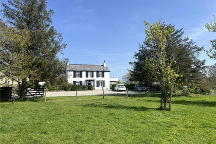
- Price
- Guide Price£1,500,000
- Size
- 5.58 acres
Eastleigh, Bideford, Devon, EX39, Westleigh, Devon EX39 England
Added on 10/04/2026Country Home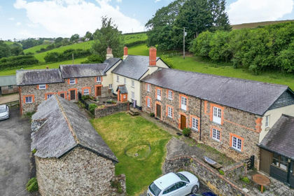
- Price
- Guide Price£1,150,000
- Size
- 5.2 acres
Chittlehampton, Umberleigh, Devon, EX37, Chittlehampton, Devon EX37 England
Added on 17/06/2026Farmhouse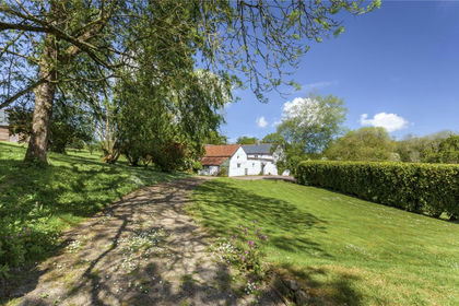
- Price
- Guide Price£1,250,000
- Size
- 14 acres
Monkleigh, Bideford, Devon, EX39, Monkleigh, Devon EX39 England
Added on 08/06/2026House with Land