Lewes Road, TN22
- Land size
- 2.3 acres
- Bedrooms
- 8
- Bathrooms
- 4
Key Features
- 8 bedrooms
- Historic home
- Orginal features
- Area of Outstanding Natural Beauty
- Approx. 2.3 acre garden area
- Up to 40 acres of additional land can be negotiated
Description
A home with heart
There's something special about a house that's been truly lived in and loved - and Brownings Manor has been the setting for big family gatherings, concerts on the lawn, and quiet mornings with a coffee in the conservatory, soaking in that seemingly endless view.
Built in 1904 and once part of the historic Possingworth Estate, it's only ever been home to four families. For the past 25 years, the current owners have carefully restored and cherished it, layering it with art and antiques that sit beautifully alongside the original features. Inside, the details tell the story - grand chandeliers, original fireplaces, beautiful tiles and servant bells, some still ringing into life. It's grand, yes - but it feels welcoming and homely, too.
Approached via a carriage driveway, this is a house that makes an entrance without being ostentatious. It sits within an Area of Outstanding Natural Beauty, with uninterrupted views across rolling fields, lakes and the South Downs National Park. No public rights of way cross the land, so it feels private and peaceful.
Inside the manor
Step through the original oak front door and the tone is set: beautiful wood panelling and ornate doors lead you through to a magnificent hall with a grand staircase, fireplace and striking triple-height window that floods the space with light.
The drawing room is refined and inviting, with a brass chandelier, original window shutters and an elegant fireplace. Sunlight pours in through the windows, which look out over the lawn and rows of daffodils. This space is made for quiet afternoons with a book or hosting friends and family after dinner.
The dining room has wraparound views of the landscape through the sash windows and doors leading out to the conservatory. The conservatory is a favourite space: a place to pot plants, potter and admire the view. In the kitchen, original tiled floors meet a wood-burning Rayburn, creating a country kitchen that feels timeless, warm and welcoming. A pantry sits next to the kitchen - with an original well and pump still in place just outside the window.
Upstairs, eight bedrooms offer plenty of space - many with original fireplaces and those same captivating views. The master suite includes a Jack-and-Jill en-suite shower room, while every room carries a sense of history and calm.
40 additional acres available
The walled garden and open lawns unfold into those extraordinary views - rolling countryside, ancient trees and big skies - connecting you with the great outdoors year-round. The current family in residence owns the fields as far as the eye can see, so this additional 40 acres of land, or a portion of it if you prefer, is available to purchase at extra cost.
A house like this doesn't come along often - full of character, steeped in history, and ready for its next chapter.
Location
Set in the village of Blackboys, East Sussex, Brownings Manor blends countryside living with easy connections to London and Brighton. The Blackboys Inn, a 14th-century coaching inn, is just a short stroll away for a pint of Harvey's and a Sunday roast, live music, or a wander around the popular summer car show.
Village life ticks along gently close by, with a primary school, coffee shops, and an artist's studio within easy reach. Tickerage Vineyard is also an easy walk - perfect for a wine tasting experience, by appointment only.
Buxted railway station is nine minutes away by car, with trains travellling up to London Bridge. Lewes is a 20-minute drive away, Brighton is 35 minutes by car, and Glyndebourne Opera House is 17 minutes away for a world-class programme of concerts and the chance to picnic in the grounds of the estate. It's countryside living, without feeling cut off.
Map Location
Property details
- Tenure
- Freehold
- Council Tax Band
- Ask Agent
- Date Posted
- 2026-04-03
Market Value Analysis
Compared with 1,735 Homes with Land listings in South East England (1+ acres).
Energy Performance Certificate
Energy Efficiency Rating
Based on UK Energy Performance Certificate standards (EU Directive 2002/91/EC)
Running costs are one side. Planning activity, flood history and ground risks for this location are in the full report.
Utilities & Restrictions
Utilities
- Electricity
- Ask Agent
- Water
- Ask Agent
- Heating
- Solar Water Heating, Oil Heating, Central Heating, Wood Burner
- Broadband
- Ask Agent
- Sewerage
- Ask Agent
Rights & Restrictions
- Public Rights of Way
- Ask Agent
- Private Rights of Way
- Ask Agent
- Listed Property
- Ask Agent
- Restrictions
- Ask Agent
Listed status, conservation areas and planning constraints for this location are in the full report.
Property Features
- Accessibility
- Ask Agent
- Parking
- Garage, Covered Parking, Driveway, Gated Parking, EV Charger
- Garden
- Front Garden, Private Garden, Enclosed Garden, Terrace, Rear Garden
Beyond the particulars: planning activity, flood history, heritage and ground risks, checked for this exact spot.
Connectivity
Broadband
Fastest speed available at this postcode
65 Mbps
Superfast · available to 63% of premises
Suitable for
- HD streaming
- Video calls
- Web & social
Mobile signal
Predicted 4G and 5G signal; indoor signal depends on building materials.
Ofcom Connected Nations postcode-level predictions. Speeds and signal are modelled, not measured, and vary between addresses and providers.
Signal is the easy part. Planning activity, flood history and protected designations here are in the full report.
Nearest Schools
Primary
- Blackboys Church of England Primary School727 metresOfsted: Good
- Ages
- 4 to 11
- Pupils
- 139
- Type
- Voluntary aided school
- Faith
- Church of England
- Framfield Church of England Primary School2 milesOfsted: Requires improvement *
- Ages
- 4 to 11
- Pupils
- 85
- Type
- Voluntary aided school
- Faith
- Church of England
- St Mark's Church of England Primary School2.1 milesOfsted: Good *
- Ages
- 5 to 11
- Pupils
- 58
- Type
- Voluntary aided school
- Faith
- Church of England
- Cross-in-Hand Church of England Primary School2.9 milesOfsted: Good
- Ages
- 5 to 11
- Pupils
- 379
- Type
- Voluntary controlled school
- Faith
- Church of England
- East Hoathly CofE Primary School2.9 milesNo Ofsted rating
- Ages
- 3 to 11
- Pupils
- 73
- Type
- Voluntary controlled school
- Faith
- Church of England
Secondary
- Uckfield College3.3 milesOfsted: Outstanding
- Ages
- 11 to 18
- Pupils
- 1,671
- Type
- Community school
- Heathfield Community College4.4 milesOfsted: Good
- Ages
- 11 to 18
- Pupils
- 1,416
- Type
- Community school
- Beacon Academy6.2 milesOfsted: Outstanding
- Ages
- 11 to 18
- Pupils
- 1,642
- Type
- Academy converter
- King's Academy Ringmer6.8 milesNo Ofsted rating
- Ages
- 11 to 16
- Pupils
- 659
- Type
- Academy converter
- Hailsham Academy7.7 milesOfsted: Inadequate
- Ages
- 2 to 18
- Pupils
- 1,577
- Type
- Academy converter
* Latest graded judgement covers quality of education only; no overall grade was issued under the 2024-25 inspection framework.
Distances are straight-line from the advertised location. Source: the national school registers (DfE, Welsh Government, Scottish Government) and Ofsted.
Schools are just the start: sold prices nearby, planning activity and any flood history are in the full report.
Amenities
Supermarket
GP surgery
Pharmacy
Hospital
Green space
Straight-line distances from the advertised location. Sources: NHS records, Geolytix supermarket locations, OS Open Greenspace and the national trails registers.
The area stacks up? Now check the location itself: planning nearby, protected designations and past flooding.
Getting Around
Nearest station
Nearest bus stop
Typical drive times
Straight-line distances from the advertised location; drive times are typical free-flow times over OpenStreetMap road data, so allow more at peak. Public transport locations from DfT NaPTAN.
Easy to reach matters. So do planning activity, flood history and ground risks: all in the full report.
Flood Risk
Environment Agency open data, checked around the advertised map pin for the listed acreage. Long-term risk counts flood defences; the planning map's flood zones do not. Provided by LandSale, not the listing agent, and not part of the agent's particulars. Risk varies across a holding, so verify before committing.
Rivers and the sea
Planning map: Flood Zone 1.
Surface water
Not at the pin: mapped about 50 metres away.
These bandings are the summary. Where this location sits on the flood maps, plus planning activity, heritage and ground risks, is in the full report.
Important notice: Information, maps and tags on this page are drawn from the advertising agent's marketing materials or generated automatically. LandSale has not verified them. Relying on these details is at your own risk, always carry out independent checks before committing to a purchase.
LandSale full disclaimer
Marketing information only - not formal particulars. The details on this website are provided for general guidance and do not constitute an offer or contract. Neither LandSale nor the advertising estate/land agent accepts responsibility for any inaccuracy.
1. Source of information
- Listing content: Core description, asking price, tenure, measurements, photographs and planning history originate from the marketing materials of the advertising estate or land agent. LandSale does not author this content and cannot guarantee its accuracy.
- Automated tags & categorisation: Property type, land-use class, acreage bands and similar labels may be applied by machine-learning models. They are intended as a helpful guide only and may not reflect the property's legal status or permitted use.
- Third-party & enriched data layers: Maps, boundary outlines, planning designations, soil reports, broadband coverage and other environmental or location-based insights are licensed from external suppliers. Such data are supplied “as is", may be incomplete or out of date and are subject to change without notice.
2. Verification required
Prospective purchasers must verify critical matters, including but not limited to planning permission, title boundaries, public rights of way, environmental constraints, acreage, services, access and VAT status, through their own inspections, specialist surveys, legal advisers and the selling agent before relying on the information or entering into any contract.
3. No warranty or liability
LandSale gives no warranty, express or implied, as to the accuracy, completeness or fitness for any particular purpose of the information displayed. LandSale shall not be liable for any loss, damage, cost or expense arising directly or indirectly from any use of or reliance on such information, save where liability may not be excluded by law.
4. Updates & feedback
If you believe any detail on this listing is inaccurate, please let us know. We will investigate and, where appropriate, update the listing or notify the agent.
© LandSale | Version 1.3 - August 2026
Similar properties for sale
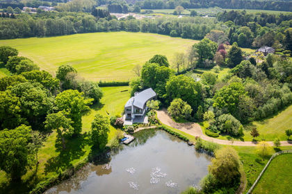
- Price
- £1,900,000
- Size
- 8 acres
London Road, East Hoathly, Lewes, BN8, East Hoathly with Halland, East Sussex BN8 England
Added on 09/04/2026Lakefront property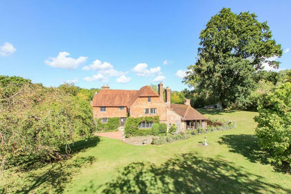
- Price
- Offers in Excess of£2,000,000
- Size
- 2 acres
Piccadilly Lane, Mayfield, TN20, Mayfield and Five Ashes, East Sussex TN20 England
Added on 13/05/2026Country Home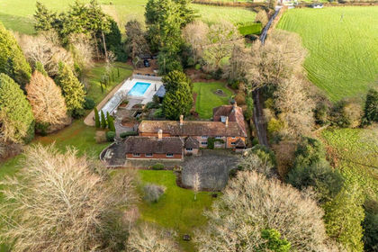
- Price
- Guide Price£2,000,000
- Size
- 7.5 acres
Burrells Lane, Maresfield, Uckfield, East Sussex, TN22, Maresfield, East Sussex TN22 England
Added on 10/09/2026Country Home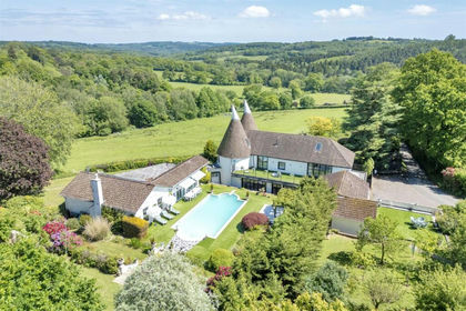
- Price
- Guide Price£1,800,000
- Size
- 13.23 acres
Tottingworth Park, Broad Oak, Heathfield and Waldron, East Sussex TN21 England
Added on 21/08/2026House with Land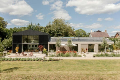
- Price
- £2,500,000
- Size
- 2.5 acres
Gibbs Barn, Mayfield, East Street, Mayfield and Five Ashes, East Sussex TN20 England
Added on 12/09/2026House with Land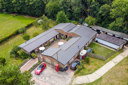
- Price
- Offers in Excess of£1,750,000
- Size
- 19 acres
Added on 21/07/2026Holiday Let Property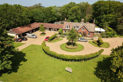
- Price
- Guide Price£2,400,000
- Size
- 21 acres
Greenwoods Lane, Punnetts Town, Heathfield, TN21, Heathfield and Waldron, East Sussex TN21 England
Added on 21/07/2026House with Land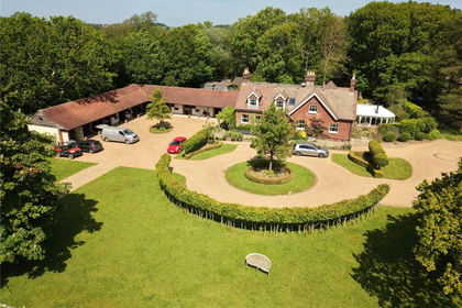
- Price
- Guide Price£1,995,000
- Size
- 5.86 acres
Greenwoods Lane, Punnetts Town, Heathfield, TN21, Heathfield and Waldron, East Sussex TN21 England
Added on 31/08/2026House with Land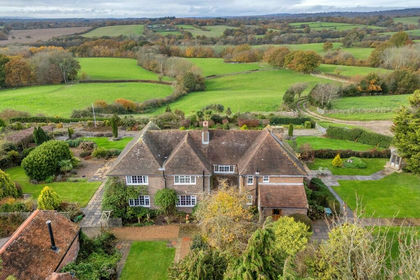
- Price
- Offers in Excess of£2,300,000
- Size
- 124.19 acres
Blackhurst Farm, Rushlake Green, TN21, Warbleton, East Sussex TN21 England
Added on 02/10/2026Farm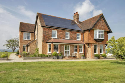
- Price
- £1,750,000
- Size
- 6.6 acres
Burwash Road, Broad Oak, East Sussex, Heathfield and Waldron, East Sussex TN21 England
Added on 18/04/2026Country Home