Catsfield, Battle, TN33
- Land size
- 433 acres
Description
A wonderful country estate in the historic Sussex village of Catsfield within the High Weald Area of Outstanding Natural Beauty with some 433 acres of farmland, woodland and lakes offering great potential to develop existing enterprises and for further diversification.
The estate essentially comprises a three bedroom converted barn; a two bedroom annexe; a pair of two bedroom, semi-detached cottages; an equestrian centre with fourteen stables including a tack/feed room large store barn, outdoor manège and adjoining grazing paddocks; a range of modern farm barns and outbuildings; about 235 acres of productive grazing and cropping land and approximately 191 acres of woodland incorporating about 4 acres of lakes.
EQUESTRIAN
There are a comprehensive range of equestrian facilities with independent access off the main Estate drive leading into a main yard with large areas of hard standing for lorries and trailers. In total there are 14 stables arranged in two blocks, and additionally 6 loose boxes within the
traditional brick built stables adjoining Broomham Barn. There is a large 11-bay portal frame barn 93’6 x 40’6, and adjoining tack room with w.c. At the rear of the yard is an excellent 2-bay portal frame barn 39’4 x 29’5 with concrete flooring and a purpose built wash down area.
Lying to the south of the yard is the outdoor manége (40m x 20m) and a rectangular block of pasture land extending to about 7 acres, presently arranged into a number of grazing enclosures to serve the stables. The Estate offers excellent riding out via private trails over the farm and woodland.
BUILDINGS
Adjoining the equestrian yard, a further surfaced yard area with a range of modern agricultural buildings and storage facilities serves the Estate, notably twin span 5-bay portal frame barns of 98’11 x 48’5 and 98’11 x 49’7 and a smaller
storage barn of 71’1 x 22’9. The farmyard can be accessed through the equestrian yard or via a surfaced trackway that runs between Broomham Barn and the Stable Annexe.
Separately, located at the northern end of the estate and close to the cottages is an older timber framed barn with lean to and old brick built kennel building.
FARM LAND
The farm land extends to about 235 acres of productive grazing and cropping land. About 138 acres of the farm land is let out on a Farm Business Tenancy Agreement with the residual element retained and used for horse grazing and forage production.
WOODLAND
The Estate encompasses several distinct areas of
woodland covering about 191 acres, predominantly a mix of chestnut coppice, birch and conifer plantations with some magnificent specimen trees including some majestic pines and mature oak standards. Compartments are well
laid out with an excellent network of tracks and rides with the woodland harbouring an abundance of wildlife making it ideal for walking, riding and sporting activities.
LAKES
Created in the late twentieth century there are two centrally located lakes on the estate, extending to approximately 4 acres, the lower and larger of which is stocked with a good variety of species including common carp, mirror carp, rudd, roach, perch and eels and is let to a local angling club on a license agreement. Additionally, there is a smaller lake known as Bridge Lake found within
woodland further north on the Estate.
The Estate stands in 1066 countryside; the village of Catsfield is referenced in the Domesday book of 1086 and is considered one of the oldest settlements in the area. Historically, the wider estate had a succession of notable owners including Thomas Alfraye, the sixteenth century Lord Mayor of Catsfield, a rich and influential iron master; John Fuller - the uncle of Mad Jack Fuller of Brightling and the Earl of Ashburnham.
In 1865 the Estate came into the hands of Thomas Brassey, followed by his son Lord Brassey in 1870. Thomas Brassey made his fortune in railway building and was one of the pioneers of Victorian railway engineering; by the time of his death in 1870 he had built one in every twenty miles of railway in the world. He was also active in the development of steamships, locomotive factories and marine telegraphy, being a major shareholder
in Brunel’s The Great Eastern, the only ship large enough at the time to lay the first transatlantic telegraph cable across the North Atlantic, in 1864.
The modern day Estate is a wonderful legacy of the Brasseys’ vision and Victorian landscape architecture. Between 1875 and 1912 the Brassey family carried out a careful programme of landscaping, lake creation and emparkment at Normanhurst with numerous tree and plant specimens collected on their global voyages. The Brassey family opened the parkland to a curious public to marvel at the exotic trees, beautiful camellias and then still unusual rhododendrons.
The Estate has only been in the hands of two owners since the early 1970s and during this period, there has been a focus on the preservation and enhancement of the beautiful woodland landscape as well as establishing income sources to support ongoing management and conservation on the estate.
The Normanhurst Estate is situated in a wonderful rural location in the High Weald Area of
Outstanding Natural Beauty. The principal estate drive emerges in the centre of the village
of Catsfield, a very popular village with its medieval church, well-respected primary school,
general store/post office, village hall and public house.
The historic town of Battle is some 3 miles with a good range of shops, supermarket,
public houses restaurants and a mainline station with regular services to London (London
Bridge/Charing Cross).
The property is well located giving access to a wide variety of diverse attractions, the
coastal town of Hastings with its charming Old Town and broad range of amenities is
about 9 miles. Bexhill-on-Sea and Eastbourne are about 5 and 13 miles respectively. Tunbridge Wells with its excellent modern shopping centre and wide ranging leisure opportunities is some 25 miles.
The estate has excellent access to the major road network; the A21 London Road is just
under five miles away and connects to the M25 London Orbital. Gatwick Airport, along
with Ashford International railway station and the Channel Tunnel at Folkestone are within
easy reach by road.
State and private schools in the area include both Ninfield and Catsfield Primary Schools, Claverham Community College and Battle Abbey at Battle; Bede’s at Upper Dicker; Vinehall Preparatory School at Robertsbridge; Claremont on the outskirts of Hastings and Senior School at Bodiam; Vinehall near Robertsbridge; St Ronan’s and Marlborough House at Hawkhurst.
Map Location
Property details
- Tenure
- Freehold
- Council Tax Band
- TBC
- Date Posted
- 2026-03-19
Market Value Analysis
Compared with 9 Farms & Smallholdings listings in South East England (250+ acres).
Property Brochure
Seen the details? The full report adds the independent checks: planning activity, flood history, heritage and ground.
Utilities & Restrictions
Utilities
- Electricity
- Ask Agent
- Water
- Ask Agent
- Heating
- Ask Agent
- Broadband
- Ask Agent
- Sewerage
- Ask Agent
Rights & Restrictions
- Public Rights of Way
- Ask Agent
- Private Rights of Way
- Ask Agent
- Listed Property
- Ask Agent
- Restrictions
- Ask Agent
Listed status, conservation areas and planning constraints for this location are in the full report.
Property Features
- Accessibility
- Ask Agent
- Parking
- Parking Available
- Garden
- Garden
Beyond the particulars: planning activity, flood history, heritage and ground risks, checked for this exact spot.
Connectivity
Broadband
Fastest speed available at this postcode
1 Gbps
Gigabit full fibre · available to 86% of premises
Suitable for
- 4K streaming on every screen
- Full-time home working
- Online gaming & big downloads
Mobile signal
Predicted 4G and 5G signal; indoor signal depends on building materials.
Ofcom Connected Nations postcode-level predictions. Speeds and signal are modelled, not measured, and vary between addresses and providers.
Signal is the easy part. Planning activity, flood history and protected designations here are in the full report.
Nearest Schools
Primary
- Catsfield Church of England Primary School668 metresOfsted: Good *
- Ages
- 4 to 11
- Pupils
- 105
- Type
- Voluntary controlled school
- Faith
- Church of England
- Ninfield Church of England Primary School1.3 milesOfsted: Inadequate
- Ages
- 4 to 11
- Pupils
- 129
- Type
- Academy sponsor led
- Faith
- Church of England
- Battle and Langton Church of England Primary School2 milesNo Ofsted rating
- Ages
- 4 to 11
- Pupils
- 412
- Type
- Voluntary controlled school
- Faith
- Church of England
- Crowhurst CofE Primary School2.5 milesNo Ofsted rating
- Ages
- 5 to 11
- Pupils
- 96
- Type
- Voluntary controlled school
- Faith
- Church of England
- Glenleigh Park Primary Academy2.9 milesOfsted: Good
- Ages
- 2 to 11
- Pupils
- 334
- Type
- Academy sponsor led
Secondary
- Claverham Community College1.6 milesNo Ofsted rating
- Ages
- 11 to 16
- Pupils
- 1,147
- Type
- Community school
- Bexhill High Academy3 milesOfsted: Good *
- Ages
- 11 to 16
- Pupils
- 1,441
- Type
- Academy converter
- St Richard's Catholic College4.2 milesOfsted: Good
- Ages
- 11 to 16
- Pupils
- 1,029
- Type
- Academy converter
- Faith
- Roman Catholic
- Mulberry Academy St Leonards4.9 milesOfsted: Inadequate *
- Ages
- 11 to 16
- Type
- Academy sponsor led
- Ark Alexandra Academy5.6 milesOfsted report card · Jun 2026
- Ages
- 11 to 16
- Pupils
- 1,315
- Type
- Academy sponsor led
- Faith
- Church of England
* Latest graded judgement covers quality of education only; no overall grade was issued under the 2024-25 inspection framework.
Distances are straight-line from the advertised location. Source: the national school registers (DfE, Welsh Government, Scottish Government) and Ofsted.
Schools are just the start: sold prices nearby, planning activity and any flood history are in the full report.
Amenities
Supermarket
GP surgery
Pharmacy
Hospital
Green space
Straight-line distances from the advertised location. Sources: NHS records, Geolytix supermarket locations, OS Open Greenspace and the national trails registers.
The area stacks up? Now check the location itself: planning nearby, protected designations and past flooding.
Getting Around
Nearest station
Nearest bus stop
Typical drive times
Straight-line distances from the advertised location; drive times are typical free-flow times over OpenStreetMap road data, so allow more at peak. Public transport locations from DfT NaPTAN.
Easy to reach matters. So do planning activity, flood history and ground risks: all in the full report.
Flood Risk
Environment Agency open data, checked around the advertised map pin for the listed acreage. Long-term risk counts flood defences; the planning map's flood zones do not. The map pin for this listing marks the postcode area rather than the exact location, so these readings describe the surrounding area. Provided by LandSale, not the listing agent, and not part of the agent's particulars. Risk varies across a holding, so verify before committing.
Rivers and the sea
Not at the pin: mapped about 60 metres away.
Planning map: Flood Zone 3, about 60 metres away.
Surface water
Not at the pin: mapped about 20 metres away.
These bandings are the summary. Where this location sits on the flood maps, plus planning activity, heritage and ground risks, is in the full report.
Important notice: Information, maps and tags on this page are drawn from the advertising agent's marketing materials or generated automatically. LandSale has not verified them. Relying on these details is at your own risk, always carry out independent checks before committing to a purchase.
LandSale full disclaimer
Marketing information only - not formal particulars. The details on this website are provided for general guidance and do not constitute an offer or contract. Neither LandSale nor the advertising estate/land agent accepts responsibility for any inaccuracy.
1. Source of information
- Listing content: Core description, asking price, tenure, measurements, photographs and planning history originate from the marketing materials of the advertising estate or land agent. LandSale does not author this content and cannot guarantee its accuracy.
- Automated tags & categorisation: Property type, land-use class, acreage bands and similar labels may be applied by machine-learning models. They are intended as a helpful guide only and may not reflect the property's legal status or permitted use.
- Third-party & enriched data layers: Maps, boundary outlines, planning designations, soil reports, broadband coverage and other environmental or location-based insights are licensed from external suppliers. Such data are supplied “as is", may be incomplete or out of date and are subject to change without notice.
2. Verification required
Prospective purchasers must verify critical matters, including but not limited to planning permission, title boundaries, public rights of way, environmental constraints, acreage, services, access and VAT status, through their own inspections, specialist surveys, legal advisers and the selling agent before relying on the information or entering into any contract.
3. No warranty or liability
LandSale gives no warranty, express or implied, as to the accuracy, completeness or fitness for any particular purpose of the information displayed. LandSale shall not be liable for any loss, damage, cost or expense arising directly or indirectly from any use of or reliance on such information, save where liability may not be excluded by law.
4. Updates & feedback
If you believe any detail on this listing is inaccurate, please let us know. We will investigate and, where appropriate, update the listing or notify the agent.
© LandSale | Version 1.3 - August 2026

Listing agent
Samuel and Son Chartered Surveyors, Horam
Bank House, High Street, Horam, TN21 0EH
Contact Samuel and Son Chartered Surveyors, Horam
Bank House, High Street, Horam, TN21 0EH
View agent profileSimilar properties for sale
 Added on 29/01/2026Development Land
- Price
- Guide Price£2,500,000
Added on 29/01/2026Development Land
- Price
- £2,500,000
- Size
- 3 acres
Added on 28/01/2026Development Land
- Price
- £4,950,000
Added on 29/01/2026Development Land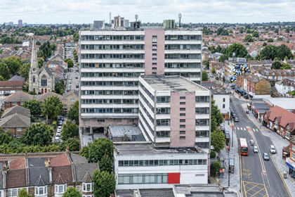
- Price
- Guide Price£2,600,000
Added on 07/10/2026Development LandLeasehold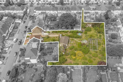
- Price
- Guide Price£2,950,000
Added on 03/09/2026Redevelopment Land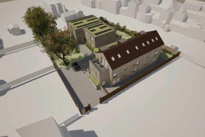
- Price
- Guide Price£2,500,000
- Size
- 0.41 acres
84 Rathmell Drive, Clapham, London, SW4, Clapham and Brixton Hill, Lambeth SW4 England
Added on 02/09/2026Development Land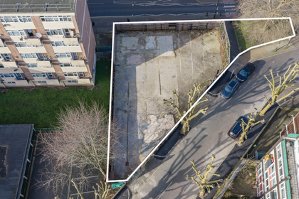
- Price
- Offers in Region of£3,000,000
- Size
- 0.15 acres
Rotherhithe New Road, Southwark, London, Bermondsey and Old Southwark, Southwark SE16 England
Added on 18/07/2026Development Land
- Price
- £3,950,000
- Size
- 1.48 acres
Ravenscroft Road, St George's Hill, KT13, Runnymede and Weybridge, Surrey KT13 England
Added on 13/08/2026Building Plot
- Price
- Guide Price£3,250,000
- Size
- 1.25 acres
Golf Club Road, St George's Hill, KT13, Runnymede and Weybridge, Surrey KT13 England
Added on 25/02/2026Development Land