Henllan Amgoed, Whitland, Carmarthenshire, SA34
- Land size
- 13 acres
- Bedrooms
- 5
- Bathrooms
- 3
Key Features
- Spacious 5 Bedroom Farmhouse
- Approx 13 Acres Of Land And Woodland
- Substantial Range Of Large Outbuildings
- Views Of Surrounding Countryside
- EPC Rating D
Description
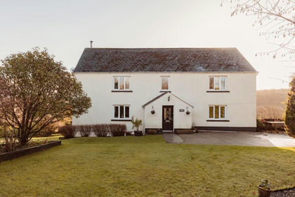
Spite House is a charming and beautifully modernised farmhouse that blends contemporary comfort with timeless country character. The property offers a spacious and well-balanced interior, featuring five bedrooms, one of which is currently arranged as a study, along with three bathrooms, including a generously proportioned en-suite serving the principal bedroom. The living accommodation is equally impressive, with three substantial reception rooms that provide both versatility and charm. A particularly striking feature is the conservatory snug, which flows seamlessly into the main sitting room where a cosy wood-burning stove creates a warm and inviting focal point. Outside, the landscaped garden is laid mainly to lawn and gently slopes towards a peaceful wooded boundary, enhancing the property’s tranquil rural setting.
A standout feature of Spite House is the land that accompanies it. The holding is fully enclosed within a secure ring fence and offers excellent potential for a small commercial venture or hobby farming. The fields benefit from dependable access to water and are bordered by strong, well-maintained fencing and gates. From across the land there are sweeping views of the surrounding rolling countryside, while the farmhouse itself sits below, approached via a private driveway that ensures a peaceful and secluded setting away from the road.
The farm enjoys a convenient yet rural location to the north of Whitland (approximately 1.5 miles) and west of St Clears (around 7 miles). It is just five minutes from the A40, which provides easy connections between Carmarthen and Haverfordwest. The popular seaside destination of Saundersfoot lies approximately 13 miles to the south, while the historic coastal town of Tenby is around 16 miles away.
From the services roundabout at St Clears, continue west along the A40 in the direction of Fishguard for approximately five miles. At the roundabout, take the second exit and after around 200 metres turn right, signposted Hellan Amgoed. Follow this road for about 1.5 miles, crossing the railway line and passing a solar development and a bungalow on the left-hand side. The entrance to Spite House can then be found on the right, adjacent to a telegraph pole.
Mains electricity and mains water are connected to the property. In addition, the farm benefits from a private spring water supply that surfaces above ground in the field below the farmhouse. Foul drainage is provided via a septic tank that was installed within the last six years.
The property is offered for sale freehold with vacant possession upon completion. Sporting, timber and mineral rights are included in the sale insofar as they are owned. The property falls within the jurisdiction of Carmarthenshire County Council and is rated within Council Tax Band F. The sale is subject to and with the benefit of all existing rights of way, whether public or private, together with any rights of light, support, drainage, water and electricity supplies, and all obligations, easements and wayleaves whether specifically referred to or not.
Viewing is to be arrange via John Francis Estate Agents in Narberth
Please note that an AML fee is chargeable once an offer is accepted to cover the cost of carrying out the required identity and anti-money laundering checks.
Conservatory Entrance
Very spacious and welcoming conservatory entrance, recently fitted double-glazed windows and French doors, tiled floor, radiator, polycarbonate roof, double door access through to lounge, door to:
Entrance Hall
Chestnut finished laminate flooring, carpeted staircase to first floor, wall lights, door to:
Lounge
Spacious and well appointed lounge, double door opening to front conservatory, double-glazed window to side, feature fireplace, tiled hearth housing wood burning stove, 2 radiators, timber laminate floor.
Bathroom 1
Recently refitted bathroom comprising "P" shaped bath with waterfall mixer tap, shower screen, wall mounted power shower over bath, wash hand basin with waterfall tap housed in vanity unit, low level WC, chrome heater towel rail, obscure double-glazed window to rear, partly tiled walls, laminate flooring.
Kitchen
Modern and beautifully styled kitchen refitted in 2018 with a range of wall and base units with soft close doors and drawers, timber effect work surfaces, full housing for American style fridge freezer, integrated dishwasher, self-cleaning double oven with induction hob and extractor fan over, 1 ½ bowl sink with drainer, attractive plinth lighting, partly tiled walls, breakfast bar, tiled floor, double-glazed looks through the conservatory to the countryside beyond.
Dining Room
Pair of double-glazed windows to front, Chestnut finished laminate flooring, radiator, door to rear conservatory, door to hallway.
Utility Room
Sink housed in base storage unit, space and plumbing for washing machine, storage cupboard, radiator. Newly installed oil combo boiler.
Rear Conservatory
5.54m long - Running the whole length of the property and currently being used as additional storage space, ideal for sun room with rural aspect.
First Floor Landing
Double-glazed window to side, access to loft space, fitted carpet, radiator.
Master Bedroom
Pair of double-glazed windows to front offering superb rural views, Chestnut finished laminate flooring, radiator, door to:
En Suite Bathroom
Double-glazed window to front, tiled and glazed walk-in shower enclosure with electric wall mounted shower, pedestal wash hand basin, panel bath, low level WC, fitted shelved storage, partly tiled walls, wall light, wood effect flooring, radiator.
Bedroom 2
Double-glazed window to rear, Chestnut finished laminate flooring, radiator, this room is currently being as office space by current owners but would make a good sized single guest room.
Bathroom 2
Refitted bathroom in 2018, double-glazed window to rear, low level WC, wash hand basin housed in vanity storage unit with waterfall mixer tap, "P" shaped bath with waterfall mixer tap and power shower over, chrome heated towel rail, tiled walls, wood effect floor covering.
Bedroom 3
Double-glazed window to side with superb views, double fitted wardrobe, Chestnut finished laminate floor, radiator.
Bedroom 4
Double-glazed window to side, superb rural views, double fitted wardrobe, Chestnut finished laminate flooring, radiator.
Bedroom 5
Double-glazed window to front with views along the valley, Chestnut finished laminate flooring, radiator.
Externally
The front of the farmhouse has an extensive parking area which can accommodate a number of vehicles. Newely fitted double glazed windows since 2018. The private garden has been landscaped and planted with mature trees and shrubs and a vegetable garden with raised beds providing the perfect space for the members of the family with green fingers.
Workshop
Double wooden doors to shelved workshop with power and lighting connected.
Secure Storage Unit
Lockable storage/office with with power and lighting connected.
Open Sided Barn/Pig Pen
Lighting and external power supply, feeding shed with mezzanine floor above.
Integral Stable Block
Lighting supply, split into 3 stables.
Lambing Shed
Lighting supply, timber clad shed.
Dutch Barn/Pig Pen
Gated dutch barn/pig pen.
Former Kennels
Implement Shed
The Land
The holding extends to approximately 13 acres of grounds with stock fenced paddocks which predominately have automatic water systems in place all set in the beautiful Pembrokeshire countryside. There are also some areas of woodland. The range of agricultural and domestic outbuildings makes this an ideal working smallholding.
Services
We are advised that mains services are connected.
Map Location
Property details
- Tenure
- Freehold
- Council Tax Band
- F
- Date Posted
- 2026-03-07
Market Value Analysis
Compared with 212 Homes with Land listings in Wales (10+ acres).
Energy Performance Certificate
Energy Efficiency Rating
Based on UK Energy Performance Certificate standards (EU Directive 2002/91/EC)
Running costs are one side. Planning activity, flood history and ground risks for this location are in the full report.
Utilities & Restrictions
Utilities
- Electricity
- Mains
- Water
- Mains
- Heating
- Oil Heating
- Broadband
- Standard Copper (ADSL)
- Sewerage
- Septic Tank / Private
Rights & Restrictions
- Public Rights of Way
- Ask Agent
- Private Rights of Way
- Ask Agent
- Listed Property
- Ask Agent
- Restrictions
- Ask Agent
Listed status, conservation areas and planning constraints for this location are in the full report.
Property Features
- Accessibility
- Ask Agent
- Parking
- Garage, Driveway
- Garden
- Garden
Beyond the particulars: planning activity, flood history, heritage and ground risks, checked for this exact spot.
Connectivity
Broadband
Fastest speed available at this postcode
33 Mbps
Superfast · available to 18% of premises
Suitable for
- HD streaming
- Video calls
- Web & social
Mobile signal
Outdoor predictions; indoor signal depends on building materials.
Ofcom Connected Nations postcode-level predictions. Speeds and signal are modelled, not measured, and vary between addresses and providers.
Signal is the easy part. Planning activity, flood history and protected designations here are in the full report.
Nearest Schools
Primary
- Llys Hywel2 miles
- Pupils
- 135
- Type
- Infants & Juniors
- Language
- Dual language school / provision (Welsh and English) (including transitional)
- Bro Brynach3.4 miles
- Pupils
- 90
- Type
- Nursery, Infants & Juniors
- Language
- Welsh medium school / provision (including transitional)
- Ysgol Gymunedol Brynconin3.9 miles
- Pupils
- 71
- Type
- Nursery, Infants & Juniors
- Language
- Welsh medium school / provision (including transitional)
- Tavernspite Community Primary School4 miles
- Pupils
- 208
- Type
- Nursery, Infants & Juniors
- Language
- English medium school / provision
- Narberth Community Primary School4.7 miles
- Pupils
- 281
- Type
- Nursery, Infants & Juniors
- Language
- Dual language school / provision (Welsh and English) (including transitional)
Secondary
- Dyffryn Taf1.7 miles
- Pupils
- 890
- Type
- Secondary (ages 11-19)
- Language
- Dual language school / provision (Welsh and English) (including transitional)
- Ysgol Bro Preseli9 miles
- Pupils
- 932
- Type
- Middle (ages 3-19)
- Language
- Welsh medium school / provision (including transitional)
- Ysgol Greenhill School12 miles
- Pupils
- 877
- Type
- Secondary (ages 11-19)
- Language
- English medium school / provision
- Ysgol Caer Elen14 miles
- Pupils
- 907
- Type
- Middle (ages 3-16)
- Language
- Welsh medium school / provision (including transitional)
- Queen Elizabeth High School14 miles
- Pupils
- 1,289
- Type
- Secondary (ages 11-19)
- Language
- English medium school / provision
Distances are straight-line from the advertised location. Source: the national school registers (DfE, Welsh Government, Scottish Government) and Ofsted.
Schools are just the start: sold prices nearby, planning activity and any flood history are in the full report.
Amenities
Supermarket
GP surgery
Pharmacy
Straight-line distances from the advertised location. Sources: NHS records, Geolytix supermarket locations, OS Open Greenspace and the national trails registers.
The area stacks up? Now check the location itself: planning nearby, protected designations and past flooding.
Getting Around
Nearest station
Nearest bus stop
Typical drive times
Straight-line distances from the advertised location; drive times are typical free-flow times over OpenStreetMap road data, so allow more at peak. Public transport locations from DfT NaPTAN.
Easy to reach matters. So do planning activity, flood history and ground risks: all in the full report.
Flood Risk
From Natural Resources Wales flood map open data, checked around the advertised map pin and allowing for the listed acreage where known. This summary comes from LandSale, the advertising platform, not from the listing agent, and is not part of the agent's particulars. Risk can vary across a single holding, so verify anything critical through your own searches before committing.
Rivers and the sea
Surface water
Mapped within the area searched, not at the advertised map pin itself.
The detail behind these bandings
The full report pinpoints where this location sits on the flood maps, and runs the deeper checks that usually only surface after an offer.
- Exact flood zones & annual chances (included in the full report)
- Any recorded past flooding (included in the full report)
- Planning activity nearby (included in the full report)
- Heritage & conservation (included in the full report)
- Protected nature designations (included in the full report)
- Ground risks (included in the full report)
- Sold prices nearby (included in the full report)
£14.99 · one-off purchase
By LandSale, the platform. Not provided by the listing agent. Ready in about a minute.
Important notice: Information, maps and tags on this page are drawn from the advertising agent's marketing materials or generated automatically. LandSale has not verified them. Relying on these details is at your own risk, always carry out independent checks before committing to a purchase.
LandSale full disclaimer
Marketing information only - not formal particulars. The details on this website are provided for general guidance and do not constitute an offer or contract. Neither LandSale nor the advertising estate/land agent accepts responsibility for any inaccuracy.
1. Source of information
- Listing content: Core description, asking price, tenure, measurements, photographs and planning history originate from the marketing materials of the advertising estate or land agent. LandSale does not author this content and cannot guarantee its accuracy.
- Automated tags & categorisation: Property type, land-use class, acreage bands and similar labels may be applied by machine-learning models. They are intended as a helpful guide only and may not reflect the property's legal status or permitted use.
- Third-party & enriched data layers: Maps, boundary outlines, planning designations, soil reports, broadband coverage and other environmental or location-based insights are licensed from external suppliers. Such data are supplied “as is", may be incomplete or out of date and are subject to change without notice.
2. Verification required
Prospective purchasers must verify critical matters, including but not limited to planning permission, title boundaries, public rights of way, environmental constraints, acreage, services, access and VAT status, through their own inspections, specialist surveys, legal advisers and the selling agent before relying on the information or entering into any contract.
3. No warranty or liability
LandSale gives no warranty, express or implied, as to the accuracy, completeness or fitness for any particular purpose of the information displayed. LandSale shall not be liable for any loss, damage, cost or expense arising directly or indirectly from any use of or reliance on such information, save where liability may not be excluded by law.
4. Updates & feedback
If you believe any detail on this listing is inaccurate, please let us know. We will investigate and, where appropriate, update the listing or notify the agent.
© LandSale | Version 1.3 - August 2026
Similar properties for sale
- Price
- Guide Price£775,000
- Size
- 34.89 acres
Waungron Uchaf, Velfrey Road, Whitland, Carmarthenshire, Lampeter Velfrey, Pembrokeshire SA34 Wales
Added on 28/01/2026Farmhouse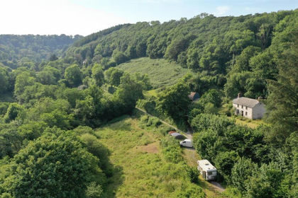
- Price
- Offers in Region of£695,000
- Size
- 8 acres
Added on 26/07/2026House with Land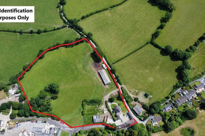
- Price
- Offers in Region of£700,000
- Size
- 9 acres
Lampeter Velfrey, Narberth, SA67, Lampeter Velfrey, Pembrokeshire SA67 Wales
Added on 03/04/2026House with Land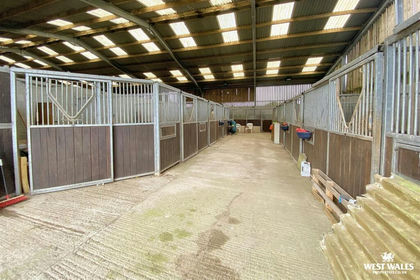
- Price
- £700,000
- Size
- 25 acres
Tavernspite, Whitland, Eglwyscummin, Carmarthenshire SA34 Wales
Added on 29/01/2026Smallholding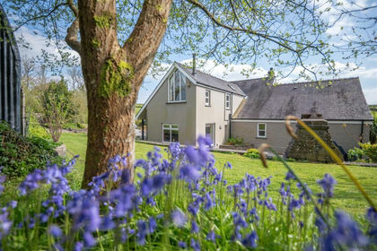
- Price
- £700,000
- Size
- 8.74 acres
St. Clears, Carmarthen, Llangynin, Carmarthenshire SA33 Wales
Added on 30/04/2026Farmhouse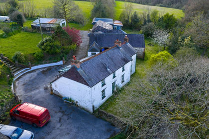
- Price
- Offers in Region of£725,000
- Size
- 15.67 acres
Penbontbren, Login, Whitland, SA34, Whitland, Carmarthenshire SA34 Wales
Added on 18/04/2026Smallholding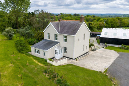
- Price
- Offers in Region of£795,000
- Size
- 20 acres
Llandissilio, Clynderwen, SA66, Clynderwen, Pembrokeshire SA66 Wales
Added on 20/05/2026Smallholding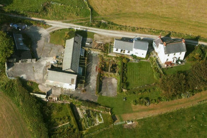
- Price
- Offers in Region of£760,000
- Size
- 15 acres
St. Clears, Carmarthen, SA33, Llangynin, Carmarthenshire SA33 Wales
Added on 23/05/2026Smallholding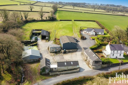
- Price
- Offers in Region of£599,950
- Size
- 10 acres
Princes Gate, Narberth, Pembrokeshire, SA67, Lampeter Velfrey, Pembrokeshire SA67 Wales
Added on 29/01/2026House with Land
- Price
- Offers in Region of£599,950
- Size
- 9 acres
Princes Gate, Narberth, SA67, Lampeter Velfrey, Pembrokeshire SA67 Wales
Added on 26/08/2026Smallholding