Park Farm Barns, Bylaugh, Norfolk, NR20
- Bedrooms
- 5
- Bathrooms
- 5
Description
The Smithy is a stunning Grade II* listed barn conversion offering 3,364 sq. ft of single storey living, five en-suite bedrooms, a vaulted reception room with beams and fireplace, bespoke kitchen, landscaped courtyard, gardens, triple garage, gated driveway and glorious Norfolk countryside views.
__________
KEY FEATURES
- Expansive and highly private plot set within the Norfolk countryside
- Protected views over conservation area looking toward River Wensum
- Part of Park Farm Barns - a Model farmstead of outstanding significance
- Grade II* Listed
- Exclusive barn development of 4 properties
- Single storey barn conversion
- Approx. 3291 sq. ft. living space
- Underfloor heating throughout
__________
OTHER
- Living room
- Kitchen/breakfast room
- Utility room
- Snug
- 5 double bedrooms
- 4 en suite bathrooms
- Shower room
__________
OUTSIDE
- Immaculately landscaped and mature gardens
- Beautifully designed central courtyard
- Rear terrace ideal for outdoor entertaining
- Private gated driveway
- Detached triple garage
- Ample off-road parking
- Far-reaching countryside views over River Wensum
- EV charging point
__________
ADDITIONAL FEATURES
Utilities
- Water supply: Park Farm Barns share a private borehole water supply
- Electricity: mains
- Oil: private supply
- LPG: Yes
- Heating: Boiler
- Drainage: Park Farm Barns share a private sewage system
- Broadband connection: FTTC
- Parking: Off road & triple garage
- EV charge point: Yes
Rights and Restrictions
- Private rights of way: Yes
- Public rights of way: No
- Listed Property: Yes Grade II*
- Restrictions: Yes
- Easements: Yes
- Conservation area: No
Risks
- Flooded in last 5 years: No
- Flood defences: No
- Source of flood: N/A
__________
TENURE & LAND REGISTRY
Freehold: NK339263
__________
LOCAL AUTHORITY
Breckland Council, Band: F
__________
HISTORIC ENGLAND
Grade II* - 1379764
__________
DESCRIPTION
The Smithy is a wonderful Grade II listed barn conversion offering five bedrooms and five bathrooms arranged across a single storey, set within the tranquil Norfolk countryside. Extending to approximately 3,364 sq. ft., the property is thoughtfully designed around a beautifully landscaped central courtyard, creating a private and peaceful setting.
Blending traditional flint and brick architecture with elegant modern finishes, the home delivers both character and comfort. At its centre is an impressive 26’ vaulted reception room featuring exposed timber beams, a striking brick fireplace with wood-burning stove, and extensive glazing that fills the space with natural light while opening directly onto the courtyard—ideal for relaxed living and entertaining alike.
Flowing seamlessly from the reception room is a spacious kitchen and breakfast room, fitted with bespoke cabinetry, granite worktops, a substantial central island with integrated wine storage, and a range cooker. French doors lead out to the terrace and gardens, enhancing the sense of indoor-outdoor living and framing uninterrupted countryside views.
A particularly special feature of The Smithy is its south-facing position, which provides stunning, far-reaching views across the River Wensum and open valley beyond. The surrounding land is protected, ensuring the outlook remains unspoilt, with no future development or pylons permitted—an aspect admired by neighbouring residents and greatly enjoyed by visitors.
Each of the five generously proportioned bedrooms benefits from direct access to the courtyard and its own en-suite bathroom, offering exceptional privacy and convenience. Outside, the grounds are beautifully maintained, with formal topiary gardens, a generous terrace, and sweeping views across the valley, creating a superb backdrop for outdoor dining and entertaining.
Located within the exclusive Park Farm Barns development, The Smithy also includes a detached triple garage and a private gated driveway providing parking for up to five vehicles.
An exceptional and rare offering, The Smithy combines character, privacy, and protected countryside views to deliver a truly outstanding Norfolk home.
__________
OUTSIDE
Set within immaculately maintained and mature grounds, The Smithy occupies a generous and highly private plot surrounded by manicured lawns, carefully structured planting, and established trees. A spacious rear terrace provides an idyllic setting for outdoor entertaining and relaxed al fresco dining, all while enjoying far-reaching views across the open Norfolk countryside.
The triple garage is constructed in traditional brick and flint and features classic black timber doors and offers excellent space for vehicle storage, hobbies, or workshop use. A substantial gravelled driveway sits to the front, providing plentiful off-road parking, all securely accessed via a private gated entrance.
Forming the centrepiece of the home, the beautifully designed internal courtyard is a true highlight. Expertly landscaped with sculpted topiary, ornamental planting, and striking focal features, it creates a peaceful sanctuary. Direct access from all principal rooms enhances the sense of space and light, delivering a seamless connection between indoors and out while providing a calm and elegant heart to the property.
__________
SITUATION
Nestled in the heart of Norfolk, Bylaugh is a quaint village that embodies the charm and peace of rural England. With its stunning landscapes and deep-rooted history, Bylaugh is a peaceful retreat, far removed from the fast pace of city life.
The village itself exudes classic English charm, with its picturesque cottages, narrow lanes, and a strong community vibe. The local pub is a popular gathering spot, offering a friendly and inviting atmosphere. The nearby River Wensum further enhances the area's beauty, providing spots for fishing, boating, and leisurely walks along the water.
One of the village's standout features is Bylaugh Hall, a grand 19th-century mansion set within expansive parkland. The hall and its estate offer a glimpse into a bygone era of wealth and grandeur, surrounded by lush gardens, ancient woods, and scenic walking paths. It’s a paradise for both nature lovers and history buffs.
Located in central Norfolk, Bylaugh is conveniently close to larger towns like Dereham, Fakenham and Norwich, offering easy access to more shops, amenities, and cultural experiences. Yet, despite its proximity to urban centres, the village retains its tranquil, rural atmosphere, with rolling fields, hedgerows, and abundant wildlife surrounding it.
Life in Bylaugh offers a perfect balance of peace and community, making it an ideal place for those looking to slow down and enjoy a more relaxed pace of living.
__________
DRIVING DISTANCES (approx.)
- Dereham: 5.5 miles
- Fakenham: 13 miles
- Norwich: 16 miles
- Holt: 17.6 miles
- Wells-next-to-sea: 21.5 miles
__________
WHAT3WORDS
We highly recommend the use of the what3words website/app. This allows the user to locate an exact point on the ground (within a 3-metre square) by simply using three words.
///loops.starch.tinny
__________
IMPORTANT NOTICE
1. These particulars have been prepared in good faith as a general guide, they are not exhaustive and include information provided to us by other parties including the seller, not all of which will have been verified by us.
2. We have not carried out a detailed or structural survey; we have not tested any services, appliances or fittings. Measurements, floor plans, orientation and distances are given as approximate only and should not be relied on.
3. The photographs are not necessarily comprehensive or current, aspects may have changed since the photographs were taken. No assumption should be made that any contents are included in the sale.
4. We have not checked that the property has all necessary planning, building regulation approval, statutory or regulatory permissions or consents. Any reference to any alterations or use of any part of the property does not mean that necessary planning, building regulations, or other consent has been obtained.
5. Prospective purchasers should satisfy themselves by inspection, searches, enquiries, surveys, and professional advice about all relevant aspects of the property.
6. These particulars do not form part of any offer or contract and must not be relied upon as statements or representations of fact; we have no authority to make or give any representation or warranties in relation to the property. If these are required, you should include their terms in any contract between you and the seller.
7. Note to potential purchasers who intend to view the property; if there is any point of particular importance to you, we ask you to discuss this with us before you make arrangements to visit or request a viewing appointment.
8. Viewings are strictly by prior appointment through Jackson-Stops.
__________
DATE DETAILS PRODUCED
March 2026
Map Location
Property details
- Tenure
- Freehold
- Council Tax Band
- F
- Date Posted
- 2026-03-05
Price history
| Date | Change | Price |
|---|---|---|
| 25 Aug 2026 | Reduced 7.9% (−£95,000) | £1,100,000 |
| Until 25 Aug 2026 | Asking price | £1,195,000 |
Utilities & Restrictions
Utilities
- Electricity
- Mains
- Water
- Private Supply
- Heating
- Oil Heating, Central Heating, Underfloor Heating, Wood Burner
- Broadband
- Fibre (FTTC)
- Sewerage
- Septic Tank / Private
Rights & Restrictions
- Public Rights of Way
- Ask Agent
- Private Rights of Way
- Ask Agent
- Listed Property
- Yes
- Restrictions
- Yes
Listed status, conservation areas and planning constraints for this location are in the full report.
Property Features
- Accessibility
- Ask Agent
- Parking
- Garage, Driveway, Gated Parking, Off-Street Parking
- Garden
- Garden
Beyond the particulars: planning activity, flood history, heritage and ground risks, checked for this exact spot.
Connectivity
Broadband
Fastest speed available at this postcode
7 Mbps
Under 10 Mbps here
Suitable for
- Basic browsing & email
Mobile signal
Outdoor predictions; indoor signal depends on building materials.
Ofcom Connected Nations postcode-level predictions. Speeds and signal are modelled, not measured, and vary between addresses and providers.
Signal is the easy part. Planning activity, flood history and protected designations here are in the full report.
Nearest Schools
Primary
- Swanton Morley VC Primary School1.4 milesNo Ofsted rating
- Ages
- 4 to 11
- Pupils
- 174
- Type
- Voluntary controlled school
- Faith
- Church of England
- Bawdeswell Community Primary School1.7 milesOfsted: Good
- Ages
- 5 to 11
- Pupils
- 85
- Type
- Academy sponsor led
- Lyng Church of England Primary Academy2.3 milesOfsted report card · Mar 2026
- Ages
- 4 to 11
- Pupils
- 87
- Type
- Academy converter
- Faith
- Church of England
- North Elmham Church of England Primary Academy & Nursery3.2 milesOfsted: Requires improvement
- Ages
- 2 to 11
- Pupils
- 60
- Type
- Academy sponsor led
- Faith
- Church of England
- St Mary's Community Primary School, Beetley3.4 milesOfsted: Requires improvement
- Ages
- 4 to 11
- Pupils
- 156
- Type
- Community school
Secondary
- Northgate High School3.7 milesOfsted: Good
- Ages
- 11 to 18
- Pupils
- 1,203
- Type
- Academy converter
- Dereham Neatherd High School3.7 milesOfsted: Requires improvement *
- Ages
- 11 to 18
- Pupils
- 1,079
- Type
- Academy converter
- Reepham High School and College4.9 milesOfsted: Good *
- Ages
- 11 to 18
- Pupils
- 959
- Type
- Academy converter
- Taverham High School8.1 milesOfsted: Good
- Ages
- 11 to 18
- Pupils
- 1,254
- Type
- Academy converter
- Litcham School8.9 milesOfsted: Good
- Ages
- 4 to 16
- Pupils
- 727
- Type
- Academy converter
* Latest graded judgement covers quality of education only; no overall grade was issued under the 2024-25 inspection framework.
Distances are straight-line from the advertised location. Source: the national school registers (DfE, Welsh Government, Scottish Government) and Ofsted.
Schools are just the start: sold prices nearby, planning activity and any flood history are in the full report.
Amenities
Supermarket
GP surgery
Pharmacy
Hospital
Straight-line distances from the advertised location. Sources: NHS records, Geolytix supermarket locations, OS Open Greenspace and the national trails registers.
The area stacks up? Now check the location itself: planning nearby, protected designations and past flooding.
Getting Around
Nearest station
Nearest bus stop
Typical drive times
Straight-line distances from the advertised location; drive times are typical free-flow times over OpenStreetMap road data, so allow more at peak. Public transport locations from DfT NaPTAN.
Easy to reach matters. So do planning activity, flood history and ground risks: all in the full report.
Flood Risk
From Environment Agency flood map open data, checked around the advertised map pin and allowing for the listed acreage where known. This summary comes from LandSale, the advertising platform, not from the listing agent, and is not part of the agent's particulars. Risk can vary across a single holding, so verify anything critical through your own searches before committing.
Rivers and the sea
Surface water
These bandings are the summary. Where this location sits on the flood maps, plus planning activity, heritage and ground risks, is in the full report.
Important notice: Information, maps and tags on this page are drawn from the advertising agent's marketing materials or generated automatically. LandSale has not verified them. Relying on these details is at your own risk, always carry out independent checks before committing to a purchase.
LandSale full disclaimer
Marketing information only - not formal particulars. The details on this website are provided for general guidance and do not constitute an offer or contract. Neither LandSale nor the advertising estate/land agent accepts responsibility for any inaccuracy.
1. Source of information
- Listing content: Core description, asking price, tenure, measurements, photographs and planning history originate from the marketing materials of the advertising estate or land agent. LandSale does not author this content and cannot guarantee its accuracy.
- Automated tags & categorisation: Property type, land-use class, acreage bands and similar labels may be applied by machine-learning models. They are intended as a helpful guide only and may not reflect the property's legal status or permitted use.
- Third-party & enriched data layers: Maps, boundary outlines, planning designations, soil reports, broadband coverage and other environmental or location-based insights are licensed from external suppliers. Such data are supplied “as is", may be incomplete or out of date and are subject to change without notice.
2. Verification required
Prospective purchasers must verify critical matters, including but not limited to planning permission, title boundaries, public rights of way, environmental constraints, acreage, services, access and VAT status, through their own inspections, specialist surveys, legal advisers and the selling agent before relying on the information or entering into any contract.
3. No warranty or liability
LandSale gives no warranty, express or implied, as to the accuracy, completeness or fitness for any particular purpose of the information displayed. LandSale shall not be liable for any loss, damage, cost or expense arising directly or indirectly from any use of or reliance on such information, save where liability may not be excluded by law.
4. Updates & feedback
If you believe any detail on this listing is inaccurate, please let us know. We will investigate and, where appropriate, update the listing or notify the agent.
© LandSale | Version 1.3 - August 2026
Listing agent
Jackson-Stops, Norwich
2 Redwell Street, Norwich, NR2 4SN
Similar properties for sale
- Price
- Guide Price£1,000,000
- Size
- 1.25 acres
Added on 29/01/2026Barn Conversion
- Price
- Guide Price£925,000
Low Road, North Tuddenham, Dereham, Norfolk, NR20, North Tuddenham, Norfolk NR20 England
Added on 20/08/2026Barn Conversion
- Price
- Guide Price£1,200,000
- Size
- 2.3 acres
Common Lane, Great Witchingham, NR9, Great Witchingham, Norfolk NR9 England
Added on 19/08/2026House with Land
- Price
- Guide Price£1,000,000
- Size
- 1.95 acres
Added on 16/06/2026House with Land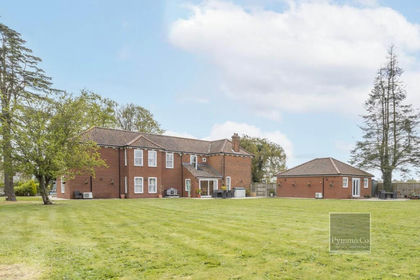
- Price
- Offers in Excess of£950,000
- Size
- 1.8 acres
Added on 29/01/2026House with Land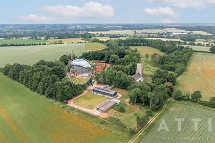
- Price
- Guide Price£1,200,000
- Size
- 2 acres
Church Farm Lane, Great Witchingham, Great Witchingham, Norfolk NR9 England
Added on 26/06/2026Barn Conversion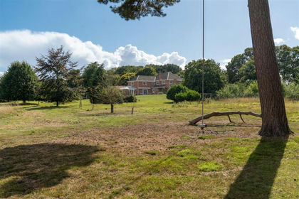
- Price
- Guide Price£1,350,000
- Size
- 20 acres
Weston Longville, NR9, Weston Longville, Norfolk NR9 England
Added on 20/08/2026Country Estate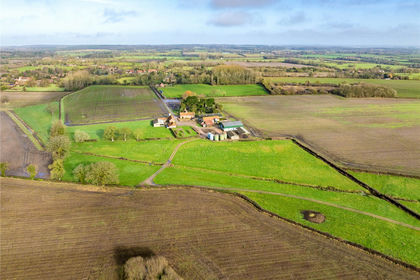
- Price
- Guide Price£1,200,000
- Size
- 15.3 acres
Hall Lane, Wood Norton, Dereham, NR20, Dereham, Norfolk NR20 England
Added on 10/03/2026Agricultural Land
- Price
- Guide Price£850,000
- Size
- 6.88 acres
Added on 18/04/2026Farm
- Price
- Offers in Excess of£1,250,000
- Size
- 3.72 acres
Added on 28/04/2026Farmhouse