Trunch Road, Trunch
- Land size
- 4.5 acres
- Bedrooms
- 4
- Bathrooms
- 3
Key Features
- NO ONWARD CHAIN
- Offers excellent potential for updating and modernisation to suit individual taste
- Unique barn conversion situated on 4.5 acres of woodland
- Open concept dining area with exposed beams, brick accents and charming wood burner
- Versatile home with a ground floor annexe
- First floor offers two master status bedrooms each with the luxury of an ensuite
- Immediate gardens with landscaped areas, thriving pond, mature shrubs and flower beds
- Large detached double garage for vehicles and workshop
- Annexe featuring two ground floor bedrooms, four piece bathroom, kitchen and sitting room access via the main house/private entry
- Sprawling woodland with walking paths and no restrictions - offering potential for glamping business opportunities
Description
This charming converted barn, offering scope for gentle updating, is set within approximately 4.5 acres (STMS) and presents a lifestyle defined by space, character and connection to nature. The open-plan lounge and dining area is rich in charm, with exposed beams, brick accents and a wood burner that creates a warm and inviting setting for relaxed evenings or entertaining with friends. Upstairs, a striking galleried landing with balcony frames beautiful woodland views. A thoughtfully designed annexe provides a self-contained retreat, featuring a lounge/diner, well-equipped kitchen, two bedrooms and a full bathroom, ideal for extended family, guests or potential supplementary income. Outside, landscaped gardens with a pond and established flower beds transition seamlessly into 4.5 acres of private woodland. The unrestricted grounds offer exciting scope for those with vision, from creating a boutique glamping experience nestled among the trees to adapting existing outbuildings into workshops, studios or additional accommodation (subject to any necessary consents).
The Location
The delightful coastal village of Mundesley has a thriving local community and is also a popular summer retreat. The village has a variety of shops including general stores, greengrocer, butcher, baker, post office, and pharmacy as well as a doctor’s surgery and village school. The beautiful sandy beach is designated a “Blue Flag Beach” and is renowned for the colourful beach huts along the promenade which characterise the village throughout the summer.
The seaside town of Cromer is 8 miles to the north-west and North Walsham is 5 miles to the south.The thriving town of Holt, renowned for its boutique independent shops, Byfords delicatessen and Gresham's School, is about 12 miles. Norwich, the cathedral city and regional centre of East Anglia, is approximately 20 miles to the south, and has a thriving business community together with cultural and leisure activities for most tastes and a regular rail service to London Liverpool Street with a journey time of 1 hour and 50 minutes. Norwich Airport provides domestic and international flights.
Trunch Road, Mundesley
Stepping inside this characterful barn conversion, you are welcomed into a spacious open-concept lounge and dining area where exposed beams and brick detailing reflect the building’s heritage. The wood burner forms a natural focal point, creating an atmosphere that feels both cosy and sociable throughout the seasons.
The kitchen continues the home’s warm aesthetic with rich wooden tones and practical layout, complemented by a separate utility area and convenient ground floor WC, designed to support modern living while maintaining charm.
A grand staircase rises to the first floor, opening onto a galleried landing with balcony, a standout feature that captures sweeping views across the surrounding woodland. This tranquil vantage point offers a quiet space to pause and unwind.
The first floor hosts two impressive master bedrooms, each benefitting from a private ensuite bathroom, providing a sense of retreat and comfort for both residents and guests.
The Annex
Accessed via its own dedicated porch, the annexe offers flexibility and independence. Inside, a welcoming lounge/diner provides space to relax or entertain, while the kitchen is well appointed with built-in microwave and room for dining.
Two bedrooms offer comfortable accommodation, served by a four-piece bathroom for complete functionality.
Whether used for extended family, visiting guests or as a potential income opportunity, this self-contained space adds versatility to the overall property.
Exterior
The estate’s unrestricted woodland setting creates a rare sense of privacy and possibility. Winding paths through the trees invite exploration, while the landscaped gardens closer to the house provide areas for relaxation beside the pond and established planting.
Existing outbuildings, including a large detached double garage, offer further potential for adaptation, whether for additional living space, creative studios, workshops or practical storage (subject to any necessary permissions).
Blending characterful interiors with expansive natural surroundings, this property offers an opportunity to shape a lifestyle that balances comfort, creativity and countryside living.
Agents Note
We understand this property will be sold freehold connected to mains water, electricity and mains gas.
Council Tax Band - D
EPC Rating: D
Disclaimer
Minors and Brady (M&B) along with their representatives, are not authorised to provide assurances about the property, whether on their own behalf or on behalf of their client. We don’t take responsibility for any statements made in these particulars, which don’t constitute part of any offer or contract. To comply with AML regulations, £52 is charged to each buyer which covers the cost of the digital ID check. It’s recommended to verify leasehold charges provided by the seller through legal representation. All mentioned areas, measurements, and distances are approximate, and the information, including text, photographs, and plans, serves as guidance and may not cover all aspects comprehensively. It shouldn’t be assumed that the property has all necessary planning, building regulations, or other consents. Services, equipment, and facilities haven’t been tested by M&B, and prospective purchasers are advised to verify the information to their satisfaction through inspection or other means.
Map Location
Property details
- Tenure
- Freehold
- Council Tax Band
- D
- Date Posted
- 2026-02-19
Market Value Analysis
Compared with 1,144 Homes with Land listings in East Anglia (1+ acres).
Energy Performance Certificate
Energy Efficiency Rating
Based on UK Energy Performance Certificate standards (EU Directive 2002/91/EC)
Running costs are one side. Planning activity, flood history and ground risks for this location are in the full report.
Utilities & Restrictions
Utilities
- Electricity
- Mains
- Water
- Mains
- Heating
- Gas Central Heating
- Broadband
- Ask Agent
- Sewerage
- Septic Tank / Private
Rights & Restrictions
- Public Rights of Way
- Ask Agent
- Private Rights of Way
- Ask Agent
- Listed Property
- Ask Agent
- Restrictions
- Ask Agent
Listed status, conservation areas and planning constraints for this location are in the full report.
Property Features
- Accessibility
- Ask Agent
- Parking
- Parking Available
- Garden
- Garden
Beyond the particulars: planning activity, flood history, heritage and ground risks, checked for this exact spot.
Connectivity
Broadband
Fastest speed available at this postcode
1.8 Gbps
Gigabit full fibre
Suitable for
- 4K streaming on every screen
- Full-time home working
- Online gaming & big downloads
Mobile signal
Predicted 4G and 5G signal; indoor signal depends on building materials.
Ofcom Connected Nations postcode-level predictions. Speeds and signal are modelled, not measured, and vary between addresses and providers.
Signal is the easy part. Planning activity, flood history and protected designations here are in the full report.
Nearest Schools
Primary
- Mundesley Infant School579 metresOfsted: Good *
- Ages
- 4 to 7
- Pupils
- 66
- Type
- Community school
- Mundesley Junior School579 metresNo Ofsted rating
- Ages
- 7 to 11
- Pupils
- 89
- Type
- Community school
- Antingham and Southrepps Primary School2.8 milesOfsted: Good
- Ages
- 3 to 11
- Pupils
- 37
- Type
- Academy sponsor led
- Bacton Primary School3.1 milesOfsted: Good
- Ages
- 2 to 11
- Pupils
- 77
- Type
- Community school
- North Walsham Junior School3.6 milesNo Ofsted rating
- Ages
- 7 to 11
- Pupils
- 248
- Type
- Academy converter
Secondary
- North Walsham High School3.9 milesOfsted: Good
- Ages
- 11 to 16
- Pupils
- 641
- Type
- Academy converter
- Cromer Academy6 milesNo Ofsted rating
- Ages
- 11 to 16
- Pupils
- 665
- Type
- Academy converter
- Stalham High School8 milesOfsted: Good
- Ages
- 11 to 16
- Pupils
- 492
- Type
- Academy sponsor led
- Aylsham High School8.5 milesNo Ofsted rating
- Ages
- 11 to 16
- Pupils
- 1,138
- Type
- Foundation school
- Sheringham High School10 milesOfsted: Good
- Ages
- 11 to 18
- Pupils
- 630
- Type
- Academy converter
* Latest graded judgement covers quality of education only; no overall grade was issued under the 2024-25 inspection framework.
Distances are straight-line from the advertised location. Source: the national school registers (DfE, Welsh Government, Scottish Government) and Ofsted.
Schools are just the start: sold prices nearby, planning activity and any flood history are in the full report.
Amenities
Supermarket
GP surgery
Pharmacy
Hospital
Green space
Straight-line distances from the advertised location. Sources: NHS records, Geolytix supermarket locations, OS Open Greenspace and the national trails registers.
The area stacks up? Now check the location itself: planning nearby, protected designations and past flooding.
Getting Around
Nearest station
Nearest bus stop
Typical drive times
Straight-line distances from the advertised location; drive times are typical free-flow times over OpenStreetMap road data, so allow more at peak. Public transport locations from DfT NaPTAN.
Easy to reach matters. So do planning activity, flood history and ground risks: all in the full report.
Flood Risk
Environment Agency open data, checked around the advertised map pin for the listed acreage. Long-term risk counts flood defences; the planning map's flood zones do not. Provided by LandSale, not the listing agent, and not part of the agent's particulars. Risk varies across a holding, so verify before committing.
Rivers and the sea
Planning map: Flood Zone 1.
Surface water
Not at the pin: mapped about 60 metres away.
These bandings are the summary. Where this location sits on the flood maps, plus planning activity, heritage and ground risks, is in the full report.
Important notice: Information, maps and tags on this page are drawn from the advertising agent's marketing materials or generated automatically. LandSale has not verified them. Relying on these details is at your own risk, always carry out independent checks before committing to a purchase.
LandSale full disclaimer
Marketing information only - not formal particulars. The details on this website are provided for general guidance and do not constitute an offer or contract. Neither LandSale nor the advertising estate/land agent accepts responsibility for any inaccuracy.
1. Source of information
- Listing content: Core description, asking price, tenure, measurements, photographs and planning history originate from the marketing materials of the advertising estate or land agent. LandSale does not author this content and cannot guarantee its accuracy.
- Automated tags & categorisation: Property type, land-use class, acreage bands and similar labels may be applied by machine-learning models. They are intended as a helpful guide only and may not reflect the property's legal status or permitted use.
- Third-party & enriched data layers: Maps, boundary outlines, planning designations, soil reports, broadband coverage and other environmental or location-based insights are licensed from external suppliers. Such data are supplied “as is", may be incomplete or out of date and are subject to change without notice.
2. Verification required
Prospective purchasers must verify critical matters, including but not limited to planning permission, title boundaries, public rights of way, environmental constraints, acreage, services, access and VAT status, through their own inspections, specialist surveys, legal advisers and the selling agent before relying on the information or entering into any contract.
3. No warranty or liability
LandSale gives no warranty, express or implied, as to the accuracy, completeness or fitness for any particular purpose of the information displayed. LandSale shall not be liable for any loss, damage, cost or expense arising directly or indirectly from any use of or reliance on such information, save where liability may not be excluded by law.
4. Updates & feedback
If you believe any detail on this listing is inaccurate, please let us know. We will investigate and, where appropriate, update the listing or notify the agent.
© LandSale | Version 1.3 - August 2026
Similar properties for sale
- Price
- Guide Price£600,000
- Size
- 2 acres
North Norfolk, Trimingham, NR11, Trimingham, Norfolk NR11 England
Added on 15/04/2026House with Land
- Price
- £700,000
- Size
- 3 acres
Added on 10/08/2026House with Land
- Price
- Guide Price£799,000
- Size
- 2 acres
Characterful Barn Conversion in Felbrigg, Felbrigg, Norfolk NR11 England
Added on 11/08/2026Barn Conversion
- Price
- Guide Price£575,000
- Size
- 2.85 acres
Causeway Farm, Sea Palling Road, Ingham, Norwich, Norfolk, NR12, Ingham, Norfolk NR12 England
Added on 16/06/2026House with Land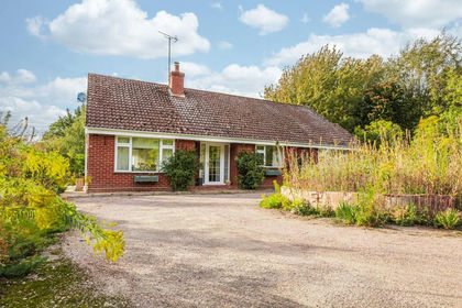
- Price
- Guide Price£730,000
- Size
- 3.25 acres
Detached Bungalow in Corpusty with 3.25 Acres (stms), Corpusty and Saxthorpe, Norfolk NR11 England
Added on 12/10/2026House with Land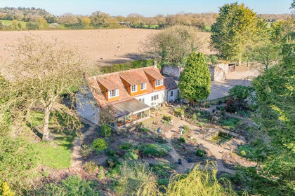
- Price
- Guide Price£825,000
- Size
- 4 acres
High Road, Briston, Melton Constable, Norfolk, NR24, Briston, Norfolk NR24 England
Added on 06/02/2026Cottage
- Price
- Guide Price£750,000
- Size
- 2 acres
Added on 21/05/2026House with Land
- Price
- £750,000
- Size
- 4 acres
Period Property with Private Riverside Access in Costessey, Costessey, Norfolk NR8 England
Added on 15/07/2026Cottage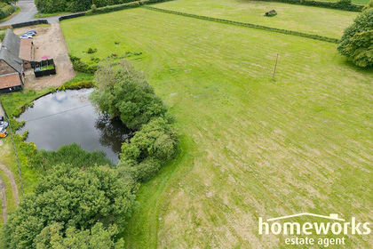
- Price
- Offers in Region of£650,000
- Size
- 5 acres
Added on 11/05/2026Barn Conversion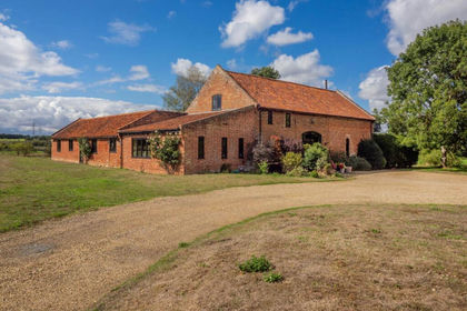
- Price
- Guide Price£825,000
- Size
- 2.7 acres
Stoke Road, Caistor St Edmund, Caistor St Edmund and Bixley, Norfolk NR14 England
Added on 07/09/2026Barn Conversion