Llys Y Fran
- Land size
- 0.25 acres
- Bedrooms
- 5
- Bathrooms
- 4
Key Features
- Outstanding self-build opportunity with extant planning permission
- Five Bedroom, Four Bathroom and Four Reception Room Family Home
- Proposed House Extends to 3,783 sqft.
- Private Driveway, Detached Garage and Ample Parking
- Plot Extends to 0.25 Acres.
- Significant preparatory works completed and paid for
Description
A ready-to-build rural home of real scale and presence, with planning secured and groundwork already in place.
A beautiful rural plot with conditional planning permission for a detached family home.
The plot extends to approximately 0.25 acres and the planning is extant due to work having been commenced.
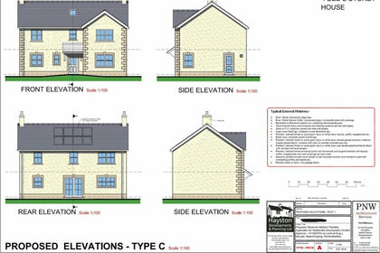
The planning permission is for a five bedroom home with four receptions and four bathrooms, which offers 3,783sqft of living space, a detached garage, private driveway and ample parking. To the rear there will be a generous south facing garden which backs onto woodland.
Llys Y Fran is a stunning rural village in the heart of Pembrokeshire, only a short distance from the Presili Hills and within easy access of the coast.
The Property - Plot Two occupies an enviable position within the peaceful village setting of Llys Y Fran, enjoying a gently elevated aspect and a natural backdrop of woodland to the rear. The plot extends to approximately 0.25 acres and benefits from conditional planning permission for a substantial five-bedroom detached family home offering 3,783sqft of internal accommodation, alongside a detached garage and ample private parking.
Importantly, planning permission remains extant, with works already commenced on site. Since acquisition, considerable investment and preparation have been undertaken to ensure a smooth build process for the next owner.
Building Regulations have been paid in full, and an exemption certificate from Natural Resources Wales has been obtained in respect of the approved treatment tank installation. A percolation test and full drainage design have been completed and paid for. The electricity supply has been regenerated on site, and a substantial gabion retaining wall has been installed to level the plot and prepare the ground for construction.
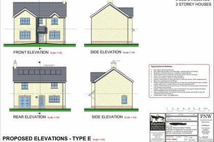
Amended architectural drawings have also been commissioned, enhancing the original design to allow for aluminium or UPVC windows, the removal of one chimney stack, the removal of the brick head detailing, and the introduction of natural slate sills — creating a cleaner, more refined exterior aesthetic in keeping with its rural setting.
The approved design provides for an impressive family home arranged over three floors. The ground floor incorporates four reception rooms, offering flexibility for formal and informal living, home working or entertaining. The layout includes a generous kitchen/breakfast room, family room, dining room, snug and living room, alongside practical utility and cloakroom facilities.
To the upper floors, five well-proportioned bedrooms are arranged across the first and second floors, with four bathrooms in total, including en-suite facilities and a principal suite arrangement. The design offers scale, balance and versatility — ideal for modern family living within a countryside setting.
To the rear, a generous south-facing garden will enjoy sunlight throughout the day and a peaceful woodland outlook, creating privacy and a natural extension of the home. The detached garage and private driveway provide practicality alongside the sense of arrival befitting a property of this size.
Tenure: Freehold
Services: Electricity supply regenerated on site; approved drainage design and treatment tank exemption certificate obtained; mains water subject to connection (to be confirmed by purchaser).
Council Tax Band: To be assessed upon completion of construction
EPC Rating: Not applicable (new build – rating to be confirmed upon completion)
The Location - The sea surrounds Pembrokeshire on all sides and on a clear day you can see across to Ireland from various vantage points.
A haven for wildlife, walks and the freshest seafood; all set in a wild and incredibly beautiful landscape.
The Pembrokeshire Coast Path is 186 miles of meandering trails with coves and harbours, over 50 beaches taking you through vibrant towns and villages.
Llys-Y-Fran is a small rural village lying at the heart of Pembrokeshire, lying at the foot of the Preseli Hills - a collection of gently rolling hills that span across the Pembrokeshire Coast National Park. The views of the coastline and the vistas are impressive – but it is their intimacy with the little villages that nestle amongst their folds that makes them so different.
Llys-Y-Fran is 10 miles North-east of Haverfordwest and 17 miles East of Newgale beach. Crymych is 13 miles away.
Map Location
Property details
- Tenure
- Freehold
- Council Tax Band
- TBC
- Date Posted
- 2026-02-15
Price history
| Date | Change | Price |
|---|---|---|
| 2 Sep 2026 | Reduced 3.3% (−£4,995) | £145,000 |
| Until 2 Sep 2026 | Asking price | £149,995 |
Utilities & Restrictions
Utilities
- Electricity
- Ask Agent
- Water
- Ask Agent
- Heating
- Ask Agent
- Broadband
- Ask Agent
- Sewerage
- Ask Agent
Rights & Restrictions
- Public Rights of Way
- Ask Agent
- Private Rights of Way
- Ask Agent
- Listed Property
- Ask Agent
- Restrictions
- Ask Agent
Listed status, conservation areas and planning constraints for this location are in the full report.
Property Features
- Accessibility
- Ask Agent
- Parking
- Parking Available
- Garden
- Garden
Beyond the particulars: planning activity, flood history, heritage and ground risks, checked for this exact spot.
Connectivity
Broadband
Fastest speed available at this postcode
1.8 Gbps
Gigabit full fibre
Suitable for
- 4K streaming on every screen
- Full-time home working
- Online gaming & big downloads
Fixed wireless access may also be an option here.
Mobile signal
Predicted 4G and 5G signal; indoor signal depends on building materials.
Ofcom Connected Nations postcode-level predictions. Speeds and signal are modelled, not measured, and vary between addresses and providers.
Signal is the easy part. Planning activity, flood history and protected designations here are in the full report.
Nearest Schools
Primary
- Ysgol Gymunedol Maenclochog3.2 miles
- Pupils
- 98
- Type
- Infants & Juniors
- Language
- Welsh medium school / provision (including transitional)
- St Aidans Church in Wales VA School4.1 miles
- Pupils
- 75
- Type
- Nursery, Infants & Juniors
- Language
- English medium school / provision
- Puncheston Community Primary School4.1 miles
- Pupils
- 76
- Type
- Infants & Juniors
- Language
- Welsh medium school / provision (including transitional)
- Spittal Church in Wales VC School4.4 miles
- Pupils
- 110
- Type
- Nursery, Infants & Juniors
- Language
- English medium school / provision
- Ysgol Gymunedol Brynconin5.3 miles
- Pupils
- 71
- Type
- Nursery, Infants & Juniors
- Language
- Welsh medium school / provision (including transitional)
Secondary
- Ysgol Caer Elen6.6 miles
- Pupils
- 907
- Type
- Middle (ages 3-16)
- Language
- Welsh medium school / provision (including transitional)
- Haverfordwest High VC School8.3 miles
- Pupils
- 1,699
- Type
- Secondary (ages 11-19)
- Language
- English medium school / provision
- Ysgol Bro Gwaun9.9 miles
- Pupils
- 574
- Type
- Secondary (ages 11-16)
- Language
- Dual language school / provision (Welsh and English) (including transitional)
- Ysgol Bro Preseli10 miles
- Pupils
- 932
- Type
- Middle (ages 3-19)
- Language
- Welsh medium school / provision (including transitional)
- Dyffryn Taf11 miles
- Pupils
- 890
- Type
- Secondary (ages 11-19)
- Language
- Dual language school / provision (Welsh and English) (including transitional)
Distances are straight-line from the advertised location. Source: the national school registers (DfE, Welsh Government, Scottish Government) and Ofsted.
Schools are just the start: sold prices nearby, planning activity and any flood history are in the full report.
Amenities
Supermarket
GP surgery
Pharmacy
Green space
Straight-line distances from the advertised location. Sources: NHS records, Geolytix supermarket locations, OS Open Greenspace and the national trails registers.
The area stacks up? Now check the location itself: planning nearby, protected designations and past flooding.
Getting Around
Nearest station
Nearest bus stop
Typical drive times
Straight-line distances from the advertised location; drive times are typical free-flow times over OpenStreetMap road data, so allow more at peak. Public transport locations from DfT NaPTAN.
Easy to reach matters. So do planning activity, flood history and ground risks: all in the full report.
Flood Risk
Natural Resources Wales open data, checked around the advertised map pin for the listed acreage. Long-term risk counts flood defences; the planning map's flood zones do not. Provided by LandSale, not the listing agent, and not part of the agent's particulars. Risk varies across a holding, so verify before committing.
Rivers and the sea
Planning map: Flood Zone 1.
Surface water
These bandings are the summary. Where this location sits on the flood maps, plus planning activity, heritage and ground risks, is in the full report.
Important notice: Information, maps and tags on this page are drawn from the advertising agent's marketing materials or generated automatically. LandSale has not verified them. Relying on these details is at your own risk, always carry out independent checks before committing to a purchase.
LandSale full disclaimer
Marketing information only - not formal particulars. The details on this website are provided for general guidance and do not constitute an offer or contract. Neither LandSale nor the advertising estate/land agent accepts responsibility for any inaccuracy.
1. Source of information
- Listing content: Core description, asking price, tenure, measurements, photographs and planning history originate from the marketing materials of the advertising estate or land agent. LandSale does not author this content and cannot guarantee its accuracy.
- Automated tags & categorisation: Property type, land-use class, acreage bands and similar labels may be applied by machine-learning models. They are intended as a helpful guide only and may not reflect the property's legal status or permitted use.
- Third-party & enriched data layers: Maps, boundary outlines, planning designations, soil reports, broadband coverage and other environmental or location-based insights are licensed from external suppliers. Such data are supplied “as is", may be incomplete or out of date and are subject to change without notice.
2. Verification required
Prospective purchasers must verify critical matters, including but not limited to planning permission, title boundaries, public rights of way, environmental constraints, acreage, services, access and VAT status, through their own inspections, specialist surveys, legal advisers and the selling agent before relying on the information or entering into any contract.
3. No warranty or liability
LandSale gives no warranty, express or implied, as to the accuracy, completeness or fitness for any particular purpose of the information displayed. LandSale shall not be liable for any loss, damage, cost or expense arising directly or indirectly from any use of or reliance on such information, save where liability may not be excluded by law.
4. Updates & feedback
If you believe any detail on this listing is inaccurate, please let us know. We will investigate and, where appropriate, update the listing or notify the agent.
© LandSale | Version 1.3 - August 2026
Listing agent
The Greenroom, Mumbles
Gower House 29-30 Dunns Lane Mumbles SA3 4AA
Similar properties for sale
- Price
- £150,000
- Size
- 6 acres
And 6 Acres, Ambleston, SA62, Ambleston, Pembrokeshire SA62 Wales
Added on 29/01/2026Building Plot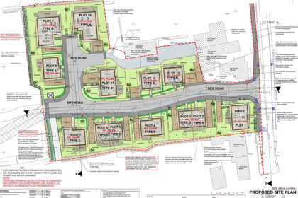 Added on 29/01/2026Building Plot
 Added on 29/01/2026Building Plot
 Added on 28/01/2026Building Plot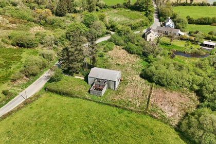
- Price
- Guide Price£131,000
Added on 13/08/2026Building Plot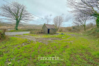 Added on 29/01/2026Building Plot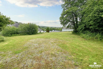
- Price
- Offers in Excess of£160,000
Llanglydwen, Hebron, Whitland, SA34, Llanboidy, Carmarthenshire SA34 Wales
Added on 29/01/2026Building Plot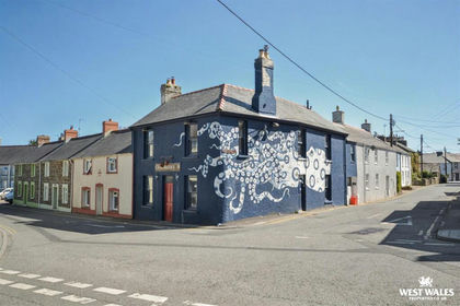
- Price
- Guide Price£110,000
Hamilton Street, Fishguard, Fishguard and Goodwick, Pembrokeshire SA65 Wales
Added on 30/04/2026Pub
- Price
- Offers in Excess of£130,000
- Size
- 0.99 acres
Cwmfelin Boeth, Whitland, Henllanfallteg, Carmarthenshire SA34 Wales
Added on 27/06/2026Building Plot
- Price
- £150,000
- Size
- 0.37 acres
Added on 29/01/2026Building Plot