Maenclochog, Clynderwen, SA66
- Land size
- 15.64 acres
Key Features
- 15.63 Acres of Woodland at the foothills of the Preseli Mountains.
- The Woodland is bisected by a Stream and there is also a Natural Spring.
- No Woodland Grant is currently paid but interested parties are advised to make their own enquires.
- Some of the Woodland has been partially felled with the remainder ready for clearing and felling.
- Sittka Spruce (picea sitchensis) was planted in the 1960's.
- There have been more recent plantings of woodland in the last 12 years.
Description
Nestled in the foothills of the Preseli Mountains on the outskirts of the village of Maenclochog, a unique opportunity to acquire approximately 15.64 Acres of Woodland with excellent gated access and hardstanding with ample space for vehicles/machinery, plus 2 useful storage container sheds.
We are advised that 'Sittka Spruce' (picea sitchensis) was planted in the 1960's and that these have now been partially felled, with the remainder ready for clearing and felling. We further understand that there has been more recent woodland planting (circa 500 trees) in the last 12 years.
While no Woodland grant is currently paid, interested parties are advised to make their own enquiries as to the possibility of any Grants/Aid that may or may not be available. The Woodland is bisected by a stream, and there is also a Natural Spring. Small Woodland Properties in Mid and North Pembrokeshire are rare, and the opportunity to purchase should not be missed.
Further Information
Sitka Spruce (Picea sitchensis) is a conifer native to the north west coast of America, introduced to the UK in 1831 by David Douglas. Valued for its fast growth and high quality, versatile timber, it is widely grown commercially. With a yield class of 14 cubic metres per hectare per year (compared to oak at about 4), it reaches maturity in 40–60 years, much faster than oak.
Its timber was first used in aircraft construction and is now common in boatbuilding, pallets, boxes and board manufacture; smaller trees are used for papermaking due to their pale wood and strong fibres.
The tree can grow up to 20m tall with a straight, conical trunk, grey brown bark, sharp needles, and red flowers that develop into brown cones. It thrives in deep, moist, well-drained soils, especially in northern and western uplands, and regenerates easily from seed. Dense canopies limit ground growth but provide shelter for wildlife such as deer, foxes, frogs, and birds of prey.
Directions
What3words: ///mammal.skims.disengage
From Maenclochog, pass the primary school on your right and take the first right hand turning just before leaving the village. Follow this road for a third of a mile or so and follow the road to the right, continue straight on until you get to the end of the track where there is the gated entrance to Cefn Eithin Wood on the right.
Public Footpath
A Public Footpath runs off the B4313 road and over the access lane leading to the Woodland and onwards up to Cwm Cerwyn.
General Planning Information
Forestry buildings and access tracks can be built without full planning permission under Permitted Development (PD) rights in Part 7 of the GPDO 1995, provided they are genuinely for forestry, not leisure or education.
There are no size limits, no requirement for forestry to be a business, and no minimum holding size. However, osier growing counts as agriculture and follows stricter agricultural PD rules, especially for holdings under 5 hectares.
Buildings must not be used as dwellings, must be at least 25 metres from a classified road, and must be reasonably necessary for forestry. Their design must clearly reflect a forestry purpose and not resemble a house or provide overnight accommodation.
--
Before building, landowners must notify the local planning authority through the Prior Notification Procedure, submitting a form, map and drawings. The authority has 28 days to require prior approval of siting, design and appearance, or to reject the proposal if it is not reasonably necessary.
Planning appeal T/APP/V2255/A/97/2861 93/P7 confirmed that a 6m by 18m wooden building for equipment storage, fence post production and office use was acceptable for managing a 21-hectare coppice woodland.
Caravans used for forestry purposes, such as storage or worker shelter, fall outside planning control if not used residentially. Under the Caravan Sites Act 1968, caravans (including mobile or self-built structures) need not have wheels but must meet size limits (60ft x 20ft x 10ft), be transportable in no more than two sections, and be movable as a single unit when assembled.
Grant Infomation
Under the Welsh "Glastir" scheme, there are two types of grant are available: the Woodland Creation Grant, for planting trees on land that is not currently woodland, and Glastir Woodland Management for thinning, restocking, infrastructure, pest control, and so forth
For more information on the Welsh grant schemes, see
Map Location
Property details
- Tenure
- Freehold
- Council Tax Band
- Ask Agent
- Date Posted
- 2026-02-13
Market Value Analysis
Compared with 10 Woodland listings in Wales (10+ acres).
Utilities & Restrictions
Utilities
- Electricity
- Ask Agent
- Water
- Ask Agent
- Heating
- Ask Agent
- Broadband
- Ask Agent
- Sewerage
- Ask Agent
Rights & Restrictions
- Public Rights of Way
- Ask Agent
- Private Rights of Way
- Ask Agent
- Listed Property
- Ask Agent
- Restrictions
- Ask Agent
Listed status, conservation areas and planning constraints for this location are in the full report.
Property Features
- Accessibility
- Ask Agent
- Parking
- Ask Agent
- Garden
- Ask Agent
Beyond the particulars: planning activity, flood history, heritage and ground risks, checked for this exact spot.
Connectivity
Broadband
Fastest speed available at this postcode
80 Mbps
Superfast
Suitable for
- HD streaming
- Video calls
- Web & social
Mobile signal
Outdoor predictions; indoor signal depends on building materials.
Ofcom Connected Nations postcode-level predictions. Speeds and signal are modelled, not measured, and vary between addresses and providers.
Signal is the easy part. Planning activity, flood history and protected designations here are in the full report.
Nearest Schools
Primary
- Ysgol Gymunedol Maenclochog366 metres
- Pupils
- 98
- Type
- Infants & Juniors
- Language
- Welsh medium school / provision (including transitional)
- Beca3.8 miles
- Pupils
- 46
- Type
- Infants & Juniors
- Language
- Welsh medium school / provision (including transitional)
- Puncheston Community Primary School4.8 miles
- Pupils
- 76
- Type
- Infants & Juniors
- Language
- Welsh medium school / provision (including transitional)
- Ysgol Gymunedol Brynconin4.8 miles
- Pupils
- 71
- Type
- Nursery, Infants & Juniors
- Language
- Welsh medium school / provision (including transitional)
- Ysgol Llanychllwydog4.9 miles
- Pupils
- 29
- Type
- Nursery, Infants & Juniors
- Language
- Welsh medium school / provision (including transitional)
Secondary
- Ysgol Bro Preseli7.3 miles
- Pupils
- 932
- Type
- Middle (ages 3-19)
- Language
- Welsh medium school / provision (including transitional)
- Ysgol Caer Elen9.8 miles
- Pupils
- 907
- Type
- Middle (ages 3-16)
- Language
- Welsh medium school / provision (including transitional)
- Dyffryn Taf9.9 miles
- Pupils
- 890
- Type
- Secondary (ages 11-19)
- Language
- Dual language school / provision (Welsh and English) (including transitional)
- Ysgol Bro Gwaun10 miles
- Pupils
- 574
- Type
- Secondary (ages 11-16)
- Language
- Dual language school / provision (Welsh and English) (including transitional)
- Haverfordwest High VC School12 miles
- Pupils
- 1,699
- Type
- Secondary (ages 11-19)
- Language
- English medium school / provision
Distances are straight-line from the advertised location. Source: the national school registers (DfE, Welsh Government, Scottish Government) and Ofsted.
Schools are just the start: sold prices nearby, planning activity and any flood history are in the full report.
Amenities
Supermarket
GP surgery
Pharmacy
Green space
Straight-line distances from the advertised location. Sources: NHS records, Geolytix supermarket locations, OS Open Greenspace and the national trails registers.
The area stacks up? Now check the location itself: planning nearby, protected designations and past flooding.
Getting Around
Nearest station
Nearest bus stop
Typical drive times
Straight-line distances from the advertised location; drive times are typical free-flow times over OpenStreetMap road data, so allow more at peak. Public transport locations from DfT NaPTAN.
Easy to reach matters. So do planning activity, flood history and ground risks: all in the full report.
Flood Risk
From Natural Resources Wales flood map open data, checked around the advertised map pin and allowing for the listed acreage where known. This summary comes from LandSale, the advertising platform, not from the listing agent, and is not part of the agent's particulars. Risk can vary across a single holding, so verify anything critical through your own searches before committing.
Rivers and the sea
Surface water
The detail behind these bandings
The full report pinpoints where this location sits on the flood maps, and runs the deeper checks that usually only surface after an offer.
- Exact flood zones & annual chances (included in the full report)
- Any recorded past flooding (included in the full report)
- Planning activity nearby (included in the full report)
- Heritage & conservation (included in the full report)
- Protected nature designations (included in the full report)
- Ground risks (included in the full report)
- Sold prices nearby (included in the full report)
£14.99 · one-off purchase
By LandSale, the platform. Not provided by the listing agent. Ready in about a minute.
Important notice: Information, maps and tags on this page are drawn from the advertising agent's marketing materials or generated automatically. LandSale has not verified them. Relying on these details is at your own risk, always carry out independent checks before committing to a purchase.
LandSale full disclaimer
Marketing information only - not formal particulars. The details on this website are provided for general guidance and do not constitute an offer or contract. Neither LandSale nor the advertising estate/land agent accepts responsibility for any inaccuracy.
1. Source of information
- Listing content: Core description, asking price, tenure, measurements, photographs and planning history originate from the marketing materials of the advertising estate or land agent. LandSale does not author this content and cannot guarantee its accuracy.
- Automated tags & categorisation: Property type, land-use class, acreage bands and similar labels may be applied by machine-learning models. They are intended as a helpful guide only and may not reflect the property's legal status or permitted use.
- Third-party & enriched data layers: Maps, boundary outlines, planning designations, soil reports, broadband coverage and other environmental or location-based insights are licensed from external suppliers. Such data are supplied “as is", may be incomplete or out of date and are subject to change without notice.
2. Verification required
Prospective purchasers must verify critical matters, including but not limited to planning permission, title boundaries, public rights of way, environmental constraints, acreage, services, access and VAT status, through their own inspections, specialist surveys, legal advisers and the selling agent before relying on the information or entering into any contract.
3. No warranty or liability
LandSale gives no warranty, express or implied, as to the accuracy, completeness or fitness for any particular purpose of the information displayed. LandSale shall not be liable for any loss, damage, cost or expense arising directly or indirectly from any use of or reliance on such information, save where liability may not be excluded by law.
4. Updates & feedback
If you believe any detail on this listing is inaccurate, please let us know. We will investigate and, where appropriate, update the listing or notify the agent.
© LandSale | Version 1.3 - August 2026
Listing agent
JJ Morris, Narberth
Hill House High Street, Narberth, SA67 7AR
Similar properties for sale
 Added on 29/01/2026Undeveloped Land
- Price
- Guide Price£60,000
- Size
- 2.11 acres
Added on 14/08/2026Pasture
- Price
- Guide Price£90,000
- Size
- 10.29 acres
Added on 18/03/2026Farmland
- Price
- Guide Price£75,000
- Size
- 5.61 acres
Added on 18/03/2026Grazing Land
- Price
- Guide Price£67,500
- Size
- 13.5 acres
Added on 29/01/2026Woodland
- Price
- Guide Price£130,000
- Size
- 16.14 acres
Land Associated With Pentre, Llanerfyl, Welshpool, Powys, SY21, Llanerfyl, Powys SY21 Wales
Added on 29/07/2026Agricultural Land
- Price
- Guide Price£60,000
- Size
- 14.2 acres
Added on 25/07/2026Woodland
- Price
- Guide Price£100,000
- Size
- 10.92 acres
Added on 29/01/2026Woodland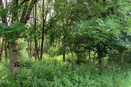
- Price
- Guide Price£100,000
- Size
- 16.45 acres
Added on 03/07/2026Woodland
- Price
- Guide Price£70,000
- Size
- 3 acres
Uffculme, Cullompton, Devon, EX15, Uffculme, Devon EX15 England
Added on 13/08/2026Agricultural Land