Distinguished Manor House in Tasburgh
- Land size
- 23 acres
- Bedrooms
- 8
- Bathrooms
- 7
Key Features
- Guide Price £2,750,000-£3,000,000
- A Compact Country Estate with Outstanding 18th Century Manor House with Later Additions
- Principal House with Three Bedroom Suites and Four Further Bedrooms
- Adorned with Luxury Brands Including Perrin & Rowe, Sottini and C.P Hart
- Self-Contained Four Bedroom Guest/Leisure Wing
- Two Bedroom Detached Gate Lodge with Lapsed Planning to Extend to Four Bedrooms
- Stunning Landscaped Grounds with Hard Tennis Court, in all Around 23 Acres (STMS)
- Stocked Fishing Lake
- Garaging for Eight Cars
Description
Guide Price £2,750,000-£3,000,000
Tasburgh Hall is a mansion of red brick in the late Jacobean style and stands in well-timbered grounds, with formal topiary gardens, orchard and lake.
Faden's map of 1797 shows a dwelling called "Tasburgh Lodge " on this site and it is this 17th century dwelling that incepted the story of Tasburgh Hall.
The earliest known occupants of Tasburgh Lodge were the Beevor Family, descended from Thomas Beevor of Peninstone. The property was sold around 1815 to General William Gwyn. Whites Directory of Norfolk 1836, stated that William Gwyn Esquire owned a pleasant seat called Tasburgh lodge.
Around 1880 the Tasburgh Lodge Estate was purchased by Edward Johnson, son of John Johnson of St Osyths Priory. The Hall then disappears from the county directories between 1885 and 1890 as the lodge was being replaced by the hall on the instructions of Philip Berney Ficklin, a collector of antiquities and philanthropist.
He made some substantial additions and renovations to the property including a gatehouse and entertaining room where private dance balls where held. His coat of arms is evident within the property and on the stone memorial in the garden, commemorating the findings of skeletal remains and pottery.
From the 1900s the Hall disappears from the electoral registers. The Hall was requisitioned early in the Second World War when it became the head quarters of an army search light unit.
Later in the war, the army vacated and it was used to house and educate evacuees. Subsequently the Hall became a Buddhist Centre. Ownership then passed to four families, who shared the house and resided in it as separate dwellings. It was from here that the current owners took over Tasburgh Hall in 2007, undertaking a 15 year project bringing the house back to a single home and returning it to its former glory.
Over the last fifteen years, the house has been renovated to exacting detail, incorporating elaborate plaster mouldings, gilded radiators, oak and stone flooring, luxury designer bathroom fittings including Lefroy brooks, Sottini & CP Hart. An extraordinary bespoke designed Clive Christian kitchen houses the Lacanche 7 burner and a Shaws butler sink adorned with Perrin & Rowe taps. Also to be discovered is a Neville Johnson study, six wood burners, under floor heating and much more.
As for the gardens, these have been enhanced with the planting of specimen trees, topiary gardens, formation of a stocked lake , boundary fencing, addition of two Hartley Botanic greenhouses and a cart lodge.
As one sweeps through the gates and along the gravel driveway, you are greeted by the ornately carved front door into the welcoming hallway profusely panelled with deep moulded plaster cornice above and the warmth of a flickering wood burner.
Tasburgh Hall has three bedroom suites including an outstanding principal suite, and four further bedrooms served by two further bathrooms.
The second floor of the property is accessed by two separate staircases, providing the potential for compartmental living and working.
A superb self-contained four bedroom guest wing is used for leisure on the ground floor, including a gym and a games room.
There is a detached two bedroom gatehouse with lapsed planning to extend, to create four bedrooms. This is an excellent opportunity for rental income.
The Hall, West Wing and South Lodge sit in 23 acres of stunning gardens and grounds including landscaped formal gardens, kitchen garden and orchard, stocked fishing lake, tennis court and beautiful parkland with an historic monument.
Solar panels cover electricity costs and generate further income.
MAKE MEMORIES WITH EVERY MOMENT IN TASBURGH
Tucked away a few miles to the south of Norwich, in the beautiful countryside, lies Tasburgh. Convenient for those wanting to reach the fine city of Norwich and is also just a short distance away from Wymondham and the A11 travel corridoor.
With the Suffolk boarder also only eight miles south, this home is perfectly positioned for those commuting to Cambridge or flying out of London Stansted. You are spoilt for choice if you are yearning for time by the sea as you are 20 miles from the north east coast and a similar distance from the Suffolk villages such as Southwold and Aldeburgh.
Norwich and Diss offer direct links to London with a 90 minute train journey ensuring this is an all-round perfect commuter location, while still encapsulating the magical countryside Norfolk has to offer.
Located in the beautiful valley of the River Tas are Tasburgh earthworks. Believed to date from the medieval period, they appear in an oval shape and lie close to the medieval Church of All Saints. The earthworks gave the village its name: from taese, originally meaning 'convenient, advantageous, or pleasant' and burgh meaning a 'defended place or fort.
Tasburgh offers a variety of walks and children's activities. Burrfeld Park provides a wildlife area accessable to all and is a relaxing tranquil area of natural interest. There is also an Ancient Defensive Area providing parkland walks and close by a playground and skate park within the grounds of the village hall.
"Tasburgh is a 'walking your dog village'. Peaceful, friendly and so pretty, it is the perfect combination of rural gems and close by city living"
SERVICES CONNECTED
Mains electricity, water, drainage via a Klargester treatment plant and oil-fired central heating.
COUNCIL TAX
Band H.
ENERGY EFFICIENCY RATING
F. Ref:- 9300-2467-1120-2099-7245
To retrieve the Energy Performance Certificate for this property please visit and enter in the reference number above. Alternatively, the full certificate can be obtained through Sowerbys.
TENURE
The property is freehold.
WEBSITE TAGS
village-spirit
garden-parties
room-to-roam
family-life
historical-homes
IMPORTANT NOTE: Please note that we have recently transitioned to a new CRM system. While we strive for accuracy, some property information may not have been fully verified during this changeover. For clarification on important details, including (but not limited to) flood risks, rights of way, restrictions and other critical matters, we strongly recommend contacting us directly. We apologise for any inconvenience and appreciate your understanding.
EPC Rating: F
Parking - Double garage
Parking - Car port
Parking - Off street
Disclaimer
These particulars are provided as a guide only and do not form part of any offer or contract. Sowerbys and its representatives have no authority to make or give representations or warranties. All descriptions, measurements, photographs and plans are for guidance only and should not be relied upon as statements of fact. Buyers should satisfy themselves as to the accuracy of the information through inspection or professional advice. Services, appliances and equipment have not been tested and no warranty can be given as to their condition. Planning permissions, building regulations and other consents should be verified by the buyer’s legal adviser. In accordance with Anti-Money Laundering regulations, proceeding buyers must complete a digital ID check through our compliance partner. A charge of £48 including VAT per sale or purchase applies. Leasehold buyers should confirm ground rent, service charges and lease details with their legal adviser.
Map Location
Property details
- Tenure
- Freehold
- Council Tax Band
- H
- Date Posted
- 2026-02-06
Market Value Analysis
Compared with 84 Homes with Land listings in East Anglia (10+ acres).
Energy Performance Certificate
Energy Efficiency Rating
Based on UK Energy Performance Certificate standards (EU Directive 2002/91/EC)
Running costs are one side. Planning activity, flood history and ground risks for this location are in the full report.
Utilities & Restrictions
Utilities
- Electricity
- Mains
- Water
- Mains
- Heating
- Oil Heating
- Broadband
- Ask Agent
- Sewerage
- Septic Tank / Private
Rights & Restrictions
- Public Rights of Way
- Ask Agent
- Private Rights of Way
- Ask Agent
- Listed Property
- Ask Agent
- Restrictions
- Ask Agent
Listed status, conservation areas and planning constraints for this location are in the full report.
Property Features
- Accessibility
- Ask Agent
- Parking
- Garage, Covered Parking, Off-Street Parking
- Garden
- Private Garden
Beyond the particulars: planning activity, flood history, heritage and ground risks, checked for this exact spot.
Connectivity
Broadband
Fastest speed available at this postcode
80 Mbps
Superfast
Suitable for
- HD streaming
- Video calls
- Web & social
Mobile signal
Outdoor predictions; indoor signal depends on building materials.
Ofcom Connected Nations postcode-level predictions. Speeds and signal are modelled, not measured, and vary between addresses and providers.
Signal is the easy part. Planning activity, flood history and protected designations here are in the full report.
Nearest Schools
Primary
- Preston Church of England Voluntary Controlled Primary School834 metresOfsted: Good
- Ages
- 5 to 11
- Pupils
- 105
- Type
- Voluntary controlled school
- Faith
- Church of England
- Hapton Church of England Voluntary Aided Primary School1.4 milesOfsted report card · Apr 2026
- Ages
- 4 to 11
- Pupils
- 18
- Type
- Voluntary aided school
- Faith
- Church of England
- St Mary's Church of England Junior Academy1.7 milesOfsted: Good *
- Ages
- 7 to 11
- Pupils
- 148
- Type
- Academy converter
- Faith
- Church of England
- Newton Flotman Church of England Primary Academy2 milesOfsted report card · May 2026
- Ages
- 4 to 11
- Pupils
- 75
- Type
- Academy sponsor led
- Faith
- Church of England
- Manor Field Infant and Nursery School2 milesNo Ofsted rating
- Ages
- 3 to 7
- Pupils
- 111
- Type
- Academy converter
Secondary
- Long Stratton High School1.8 milesOfsted report card · Feb 2026
- Ages
- 11 to 16
- Pupils
- 679
- Type
- Academy sponsor led
- University Technical College Norfolk6.1 milesOfsted: Good *
- Ages
- 14 to 19
- Pupils
- 451
- Type
- University technical college
- Hethersett Academy6.2 milesNo Ofsted rating
- Ages
- 11 to 16
- Pupils
- 1,250
- Type
- Academy sponsor led
- Framingham Earl High School6.3 milesNo Ofsted rating
- Ages
- 11 to 16
- Pupils
- 791
- Type
- Academy converter
- Wymondham High Academy6.5 milesNo Ofsted rating
- Ages
- 11 to 18
- Pupils
- 1,686
- Type
- Academy converter
* Latest graded judgement covers quality of education only; no overall grade was issued under the 2024-25 inspection framework.
Distances are straight-line from the advertised location. Source: the national school registers (DfE, Welsh Government, Scottish Government) and Ofsted.
Schools are just the start: sold prices nearby, planning activity and any flood history are in the full report.
Amenities
Supermarket
GP surgery
Pharmacy
Hospital
Green space
Straight-line distances from the advertised location. Sources: NHS records, Geolytix supermarket locations, OS Open Greenspace and the national trails registers.
The area stacks up? Now check the location itself: planning nearby, protected designations and past flooding.
Getting Around
Nearest station
Nearest bus stop
Typical drive times
Straight-line distances from the advertised location; drive times are typical free-flow times over OpenStreetMap road data, so allow more at peak. Public transport locations from DfT NaPTAN.
Easy to reach matters. So do planning activity, flood history and ground risks: all in the full report.
Flood Risk
From Environment Agency flood map open data, checked around the advertised map pin and allowing for the listed acreage where known. This summary comes from LandSale, the advertising platform, not from the listing agent, and is not part of the agent's particulars. Risk can vary across a single holding, so verify anything critical through your own searches before committing.
Rivers and the sea
Mapped within the area searched, not at the advertised map pin itself.
Surface water
Mapped within the area searched, not at the advertised map pin itself.
The detail behind these bandings
The full report pinpoints where this location sits on the flood maps, and runs the deeper checks that usually only surface after an offer.
- Exact flood zones & annual chances (included in the full report)
- Any recorded past flooding (included in the full report)
- Planning activity nearby (included in the full report)
- Heritage & conservation (included in the full report)
- Protected nature designations (included in the full report)
- Ground risks (included in the full report)
- Sold prices nearby (included in the full report)
£14.99 · one-off purchase
By LandSale, the platform. Not provided by the listing agent. Ready in about a minute.
Important notice: Information, maps and tags on this page are drawn from the advertising agent's marketing materials or generated automatically. LandSale has not verified them. Relying on these details is at your own risk, always carry out independent checks before committing to a purchase.
LandSale full disclaimer
Marketing information only - not formal particulars. The details on this website are provided for general guidance and do not constitute an offer or contract. Neither LandSale nor the advertising estate/land agent accepts responsibility for any inaccuracy.
1. Source of information
- Listing content: Core description, asking price, tenure, measurements, photographs and planning history originate from the marketing materials of the advertising estate or land agent. LandSale does not author this content and cannot guarantee its accuracy.
- Automated tags & categorisation: Property type, land-use class, acreage bands and similar labels may be applied by machine-learning models. They are intended as a helpful guide only and may not reflect the property's legal status or permitted use.
- Third-party & enriched data layers: Maps, boundary outlines, planning designations, soil reports, broadband coverage and other environmental or location-based insights are licensed from external suppliers. Such data are supplied “as is", may be incomplete or out of date and are subject to change without notice.
2. Verification required
Prospective purchasers must verify critical matters, including but not limited to planning permission, title boundaries, public rights of way, environmental constraints, acreage, services, access and VAT status, through their own inspections, specialist surveys, legal advisers and the selling agent before relying on the information or entering into any contract.
3. No warranty or liability
LandSale gives no warranty, express or implied, as to the accuracy, completeness or fitness for any particular purpose of the information displayed. LandSale shall not be liable for any loss, damage, cost or expense arising directly or indirectly from any use of or reliance on such information, save where liability may not be excluded by law.
4. Updates & feedback
If you believe any detail on this listing is inaccurate, please let us know. We will investigate and, where appropriate, update the listing or notify the agent.
© LandSale | Version 1.3 - August 2026
Similar properties for sale
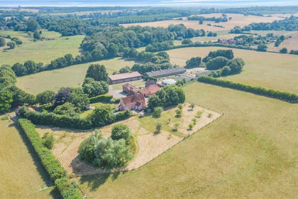
- Price
- £2,500,000
- Size
- 52.75 acres
Cookley, Halesworth, Suffolk, IP19, Cookley, Suffolk IP19 England
Added on 06/03/2026Farm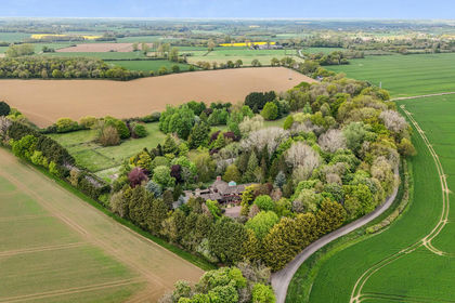
- Price
- Guide Price£2,250,000
- Size
- 15.7 acres
Gedding, Bury St Edmunds, Suffolk, Gedding, Suffolk IP30 England
Added on 22/05/2026Country Home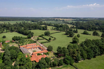
- Price
- Guide Price£2,350,000
- Size
- 78 acres
West Stow Stud, Icklingham Road, West Stow, Bury St Edmunds, IP28, West Stow, Suffolk IP28 England
Added on 12/07/2026Equestrian property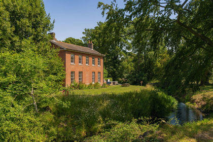
- Price
- £2,500,000
- Size
- 13.5 acres
Ringshall Grange, Stowmarket, IP14, Ringshall, Suffolk IP14 England
Added on 02/07/2026Country Estate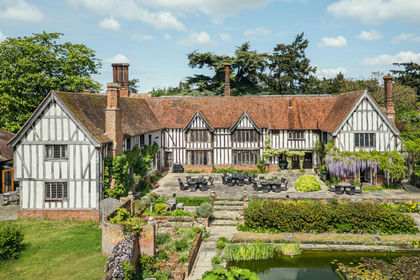
- Price
- Guide Price£2,950,000
- Size
- 21 acres
Benton Street, Hadleigh, Ipswich, IP7, Hadleigh, Suffolk IP7 England
Added on 28/05/2026House with Land