West Stow Stud, Icklingham Road, West Stow, Bury St Edmunds, IP28
- Land size
- 78 acres
- Bedrooms
- 7
- Bathrooms
- 5
Key Features
- An impressive modern 7 bedroom colonial style house
- Over 4,700 sq ft of accommodation
- An excellent range of stables and outbuildings
- 2 Bedroom Grooms' Cottage
- Superbly set in about 61 acres
- Extra 17 acres of grazing nearby
- Easy access to the Kings Forest, Bury St Edmunds, the A14/A11 and Newmarket
Description
An impressive modern colonial style house on the edge of the Kings Forest with a groom’s cottage, an excellent range of stables and outbuildings, superbly set in about 61 acres with an extra 17 acres of grazing nearby.
FEATURES
* Detached seven-bedroom modern colonial style house
* Two Bedroom grooms’ cottage
* Excellent range of equestrian facilities
* 16-18 box Victorian stable yard with sitting up room
* 5 box Victorian ‘back’ yard
* Detached former stallion box
* 6 box ‘isolation’ yard with tack/feed room
* General purpose barn and lunge ring
* About 61 acres (24.6 Ha) (sts) - 11 paddocks & 3 nursery turnout paddocks
* Separate 17-acre (6.9 Ha) (sts) grazing block of 3 paddocks included nearby with River Lark frontage
* Excellent access to the Kings Forest, Bury St Edmunds, the A14/A11 and Newmarket
THE PROPERTY
West Stow Stud House is a substantial home understood to have been built, to a very high standard in the 1970’s, adjacent to the pre-dating Victorian stud yard. The Stud shares the initial driveway access from the road, with West Stow Hall, the Grade I listed Tudor house next door, with a private drive off that to the house, stud buildings and groom’s cottage.
The house features modern red brick elevations under a clay pantile roofs that drop to ground floor level with rooms in the roof. A colonnade entrance gives access to the porch and central reception hall, with the well-presented and generously proportioned accommodation principally arranged on the ground floor with two bedrooms and a sitting room landing on the first floor.
The ground floor accommodation comprises a drawing room, dining room, study, open plan kitchen/breakfast/sitting room overlooking the gardens, paddocks and the pool and there is also a utility room and two cloakrooms. The ground floor bedroom wing offers a master bedroom with luxuriously fitted dressing room and en-suite bathroom, four further double/twin bedrooms, a further en-suite bathroom and a Jack & Jill family bathroom. On the first floor there are two bedrooms both with en-suite bathrooms and there is a useful box/storeroom.
OUTSIDE
Immediately to the north of the house is the former stallion box that is currently utilised as a storeroom also housing the oil tank and boiler for the house, subject to alterations this would make an excellent games room or home office. Gated access leads into the traditional Victorian red brick 16-18 box stud yard and a modern general purpose concrete portal frame barn set around a courtyard, with sitting up room and staff wc. To the rear of this yard is a two-bedroom single storey grooms’ cottage, attached to a further 5 box run of Victorian stables.
The property has been operated as a stud farm and offers excellent equestrian facilities including loading ramps, two separate blocks of post and rail paddocks, the one served by the yards and overlooked from the house being about 61 acres, and a short walk away is block 2 which is about 17 acres and access granted across Forestry Commission land hence affording direct access to The Kings Forest, with River Lark frontage. A public footpath runs along the riverbank.
The 11 large paddocks, in the main 61-acre block, all benefit from water and are divided by access tracks and tree shelter belts. A further 6 box isolation yard with feed store of timber construction is located towards the northeast corner, from which there is also separate gates access to the road. In addition to the large paddocks there are 3 small, sheltered turnout/nursery paddocks.
The ground in this area is predominantly a well-draining sandy loam ideal for year round safe pasture.
LOCATION
West Stow Stud is situated in the highly sought-after rural village of West Stow, which lies approximately 5 miles from Bury St Edmunds and the A14 and 6 miles from the A11 and is set on the on the edge of the Kings Forest. The village itself enjoys a fine parish church and Larkwood Lakes Nature Reserve with an open water swimming group, paddleboard tuition and hire and a dog training group. There is also the nearby Fullers Mill tearoom and open garden and the West Stow Country Park and Anglo Saxon village.
Kings Forest is about 5,700 acres of open access land available to the public and is part of the Breckland Forest Site of Special Scientific Interest (SSSI) dedicated for a range of rare flora and fauna, and a Special Protection Area (SPA) for the Woodlark and Nightjar. Most of Kings Forest is planted with pine which is sustainably managed for timber through a cycle of clear felling and replanting, providing habitat for these ground nesting birds.
More comprehensive facilities are available in the historic cathedral town of Bury St Edmunds, which offers an excellent range of amenities, extensive shopping facilities and a good range of leisure facilities including health clubs, swimming pools and golf clubs. Cultural amenities include the beautiful Georgian Theatre Royal and The Abbey Gardens.
The international airport at Stansted is about 49 miles away and in addition to air services there is an express train service to London.
Schooling: There are excellent local schools in both the public and private sectors including Finborough School, Old Buckenham Hall, Ipswich School, Framlingham College and St Joseph’s College.
Of particular significance, Culford private school which caters for ages 1 – 18 yrs, is approximately a 1 mile walk from the house.
DIRECTIONS
From Bury St Edmunds proceed northwest through the villages of Fornham St Martin and Fornham St Genevieve. Continue on the B1106 and at the fork in the road bear left. Proceed along this lane into West Stow. Proceed past the church on your left and take the next left into Icklingham Road (signposted Icklingham & Mildenhall). Continue along Icklingham Road and the driveway for West Stow Stud and West Stow Hall will be found on the right.
What 3 Words: /// locate.raven.topmost
PROPERTY INFORMATION
Services Mains water and electricity.
Private drainage. Oil fired central heating
Local Authority West Suffolk District Council
Council Tax Bands:
West Stow Stud – G
Groom Cottage - B
Tenure Freehold
Broadband Ofcom states speeds available of up to 5500Mbps
Mobile Coverage/Signal Yes - Varies depending on network provider. Please visit to check availability
Viewing Only by appointment with the sole agents Jackson-Stops Tel.
Map Location
Property details
- Tenure
- Freehold
- Council Tax Band
- G
- Date Posted
- 2026-07-12
Market Value Analysis
Compared with 4 Equestrian listings in East Anglia (25+ acres).
Energy Performance Certificate
Energy Efficiency Rating
Based on UK Energy Performance Certificate standards (EU Directive 2002/91/EC)
Running costs are one side. Planning activity, flood history and ground risks for this location are in the full report.
Utilities & Restrictions
Utilities
- Electricity
- Mains
- Water
- Mains
- Heating
- Oil Heating
- Broadband
- Ask Agent
- Sewerage
- Septic Tank / Private
Rights & Restrictions
- Public Rights of Way
- Ask Agent
- Private Rights of Way
- Ask Agent
- Listed Property
- Ask Agent
- Restrictions
- Ask Agent
Listed status, conservation areas and planning constraints for this location are in the full report.
Property Features
- Accessibility
- Ask Agent
- Parking
- Covered Parking, Driveway, Gated Parking, Off-Street Parking
- Garden
- Garden
Beyond the particulars: planning activity, flood history, heritage and ground risks, checked for this exact spot.
Connectivity
Broadband
Fastest speed available at this postcode
5.5 Gbps
Gigabit full fibre · available to 50% of premises
Suitable for
- 4K streaming on every screen
- Full-time home working
- Online gaming & big downloads
Mobile signal
Predicted 4G and 5G signal; indoor signal depends on building materials.
Ofcom Connected Nations postcode-level predictions. Speeds and signal are modelled, not measured, and vary between addresses and providers.
Signal is the easy part. Planning activity, flood history and protected designations here are in the full report.
Nearest Schools
Primary
- Risby Church of England Voluntary Controlled Primary School3 milesOfsted: Good
- Ages
- 4 to 11
- Pupils
- 203
- Type
- Voluntary controlled school
- Faith
- Church of England
- Howard Community Academy3.3 milesOfsted: Good *
- Ages
- 3 to 11
- Pupils
- 210
- Type
- Academy sponsor led
- Tollgate Primary School3.6 milesOfsted: Good
- Ages
- 3 to 11
- Pupils
- 437
- Type
- Academy sponsor led
- Sexton's Manor Primary School3.9 milesNo Ofsted rating
- Ages
- 3 to 11
- Pupils
- 165
- Type
- Academy converter
- St Edmundsbury CofE Primary Academy4.2 milesOfsted: Requires improvement
- Ages
- 5 to 11
- Pupils
- 168
- Type
- Academy sponsor led
- Faith
- Church of England
Secondary
- St Benedict's Catholic School3.6 milesNo Ofsted rating
- Ages
- 11 to 18
- Pupils
- 968
- Type
- Academy converter
- Faith
- Roman Catholic
- Bury St Edmunds County High School3.7 milesOfsted report card · May 2026
- Ages
- 11 to 16
- Pupils
- 657
- Type
- Academy converter
- King Edward VI CEVC School4.1 milesNo Ofsted rating
- Ages
- 11 to 16
- Pupils
- 1,189
- Type
- Voluntary controlled school
- Faith
- Church of England
- Sybil Andrews Academy5.8 milesOfsted: Good
- Ages
- 11 to 16
- Pupils
- 657
- Type
- Academy sponsor led
- Mildenhall College Academy6.3 milesNo Ofsted rating
- Ages
- 11 to 18
- Pupils
- 1,317
- Type
- Academy converter
* Latest graded judgement covers quality of education only; no overall grade was issued under the 2024-25 inspection framework.
Distances are straight-line from the advertised location. Source: the national school registers (DfE, Welsh Government, Scottish Government) and Ofsted.
Schools are just the start: sold prices nearby, planning activity and any flood history are in the full report.
Amenities
Supermarket
GP surgery
Pharmacy
Hospital
Green space
Straight-line distances from the advertised location. Sources: NHS records, Geolytix supermarket locations, OS Open Greenspace and the national trails registers.
The area stacks up? Now check the location itself: planning nearby, protected designations and past flooding.
Getting Around
Nearest station
Nearest bus stop
Typical drive times
Straight-line distances from the advertised location; drive times are typical free-flow times over OpenStreetMap road data, so allow more at peak. Public transport locations from DfT NaPTAN.
Easy to reach matters. So do planning activity, flood history and ground risks: all in the full report.
Flood Risk
Environment Agency open data, checked around the advertised map pin for the listed acreage. Long-term risk counts flood defences; the planning map's flood zones do not. Provided by LandSale, not the listing agent, and not part of the agent's particulars. Risk varies across a holding, so verify before committing.
Rivers and the sea
Not at the pin: mapped about 120 metres away.
Planning map: Flood Zone 3, about 110 metres away.
Surface water
Not at the pin: mapped about 80 metres away.
These bandings are the summary. Where this location sits on the flood maps, plus planning activity, heritage and ground risks, is in the full report.
Important notice: Information, maps and tags on this page are drawn from the advertising agent's marketing materials or generated automatically. LandSale has not verified them. Relying on these details is at your own risk, always carry out independent checks before committing to a purchase.
LandSale full disclaimer
Marketing information only - not formal particulars. The details on this website are provided for general guidance and do not constitute an offer or contract. Neither LandSale nor the advertising estate/land agent accepts responsibility for any inaccuracy.
1. Source of information
- Listing content: Core description, asking price, tenure, measurements, photographs and planning history originate from the marketing materials of the advertising estate or land agent. LandSale does not author this content and cannot guarantee its accuracy.
- Automated tags & categorisation: Property type, land-use class, acreage bands and similar labels may be applied by machine-learning models. They are intended as a helpful guide only and may not reflect the property's legal status or permitted use.
- Third-party & enriched data layers: Maps, boundary outlines, planning designations, soil reports, broadband coverage and other environmental or location-based insights are licensed from external suppliers. Such data are supplied “as is", may be incomplete or out of date and are subject to change without notice.
2. Verification required
Prospective purchasers must verify critical matters, including but not limited to planning permission, title boundaries, public rights of way, environmental constraints, acreage, services, access and VAT status, through their own inspections, specialist surveys, legal advisers and the selling agent before relying on the information or entering into any contract.
3. No warranty or liability
LandSale gives no warranty, express or implied, as to the accuracy, completeness or fitness for any particular purpose of the information displayed. LandSale shall not be liable for any loss, damage, cost or expense arising directly or indirectly from any use of or reliance on such information, save where liability may not be excluded by law.
4. Updates & feedback
If you believe any detail on this listing is inaccurate, please let us know. We will investigate and, where appropriate, update the listing or notify the agent.
© LandSale | Version 1.3 - August 2026
Listing agent
Jackson-Stops, Bury St Edmunds
11 Guildhall Street Bury St. Edmunds IP33 1PR
Contact Jackson-Stops, Bury St Edmunds
11 Guildhall Street Bury St. Edmunds IP33 1PR
View agent profileSimilar properties for sale
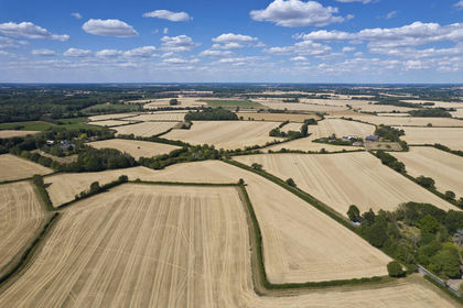
- Price
- From£2,110,000
- Size
- 156.6 acres
Added on 12/10/2026Farm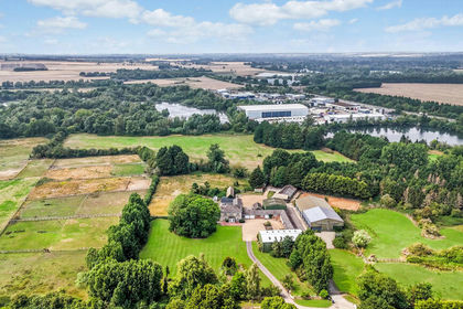
- Price
- Guide Price£2,700,000
- Size
- 146.22 acres
West End Farm, Fenstanton, Huntingdon, Cambridgeshire, PE28, Fenstanton, Cambridgeshire PE28 England
Added on 18/09/2026Farm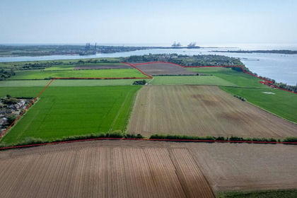
- Price
- Guide Price£2,750,000
- Size
- 229 acres
Added on 29/01/2026Farm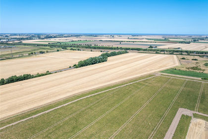
- Price
- £2,070,000
- Size
- 175 acres
Gibbons Farm, Sutton Bridge, PE12, Sutton Bridge, Lincolnshire PE12 England
Added on 30/09/2026Farm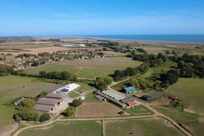
- Price
- Guide Price£2,400,000
- Size
- 138.46 acres
Hollesley, Nr Woodbridge, Suffolk, Hollesley, Suffolk IP12 England
Added on 09/10/2026Equestrian property
- Price
- Guide Price£2,400,000
- Size
- 138.46 acres
Hollesley, Nr Woodbridge, Suffolk, Hollesley, Suffolk IP12 England
Added on 09/10/2026Farm