Goudhurst, Kent
- Land size
- 0.5 acres
- Bedrooms
- 5
- Bathrooms
- 3
Key Features
- Beautifully converted Grade II Listed Kentish water mill
- Exposed beams, stonework and brickwork
- First floor, triple aspect drawing room overlooking the river with inglenook fireplace
- Farmhouse style kitchen and day room
- Dining room
- Utility room
- Master bedroom with ensuite
- Four further bedrooms
- Family bathroom
- Beautifully landscaped grounds featuring the mill wheel
Description
A beautiful Grade II Listed former water mill situated on the River Teise which dates back to around 1516. Set in approximately half an acre of delightful, and sympathetically designed, grounds the property is situated within the Cranbrook School Catchment Area.
Location:
Hope Mill is situated on the outskirts of the popular and beautiful Kentish village of Goudhurst, renowned for its’ architecture and hill top position. The village has a selection of local independent shops (including a bakery, Post Office and pharmacy) and three acclaimed pubs offering excellent food. Goudhurst has its own state primary school (awarded ‘Outstanding’ by Ofsted) and a large selection of prep schools nearby. The property falls within the catchment area for Cranbrook School but within easy commuting distance of a wide variety of alternative local private schools.
The village offers good access to the A21 and motorway network, and is only a 20 minute drive from Royal Tunbridge Wells. There is a mainline station at nearby Marden with fast and frequent trains serving London Bridge, Waterloo East, Cannon Street and Charing Cross (approximately 55 minutes) to the North, and Ashford to the South.
Description:
Hope Mill stands on the edge of the village, close to the public entrance to Finchcocks House. The Mill is one of five original mills situated along the River Teise from its source in Tunbridge Wells. The mill was an item in the Will of Richard Culpeper of Ardingly, son of Walter Culpeper of Bedgebury. Hope Mill appears on several maps of Kent during the 17th Century, famous for ground corn and “Brazool” for dyers, a dye extracted from Brazil wood. In 1837, the mill continued to operate and flood gates were installed in 1884. The mill was closed down during the 1914-1918 war as it was not grinding the correct kind of flour. After the war it continued to operate but ceased operations in 1925 and was abandoned in 1936. In 1937 much of the machinery was sold, the main wheel, however, remains intact but in need of refurbishment. Listed Building Consent was granted in 2003 to allow repair works to take place, but the work was never carried out by the then owner.
Water mills were used in Greece as early as the 3rd Century BC but it was the Romans who invented the mill as we know it today, incorporating a vertical wheel on a horizontal shaft. According to the Doomsday Book there were more than 6,000 water mills in England during the late 11th Century. By the 19th Century this figure had grown to an estimated 20,000, with their numbers beginning to dwindle after the Industrial Revolution and currently now only about 500 survive. Many of these remaining water mills have been skilfully converted into highly desirable homes, their combination of history, rarity and charming architecture, not to mention their tranquil setting, ensures that they are always very much in demand.
Hope Mill Today:
Some years ago, the mill had been painstakingly and extensively restored turning it into a delightful and historic family home. However, the mill has been unoccupied for some time and is now in need of refurbishment. The property has the benefit of oil-fired central heating which is currently untested. The accommodation is spacious, full of character and possibilities. Importantly the old water mill remains in situ but is in need of refurbishment, planning consent was granted but currently lapsed.
Viewing: by appointment only.
Directions: From the centre of Goudhurst village head down the hill (West) on the A262 in the direction of Tunbridge Wells. After approximately one mile you’ll see a sign for Finchcocks Museum on the left hand side by an Oast House. The driveway for Hope Mill is immediately after the Oast House. Parking for Mill House is on the right-hand side of the driveway in front of the house.
The property comprises:
· Beautifully converted Grade II Listed Kentish water mill
· Exposed beams, stonework and brickwork
· First floor, triple aspect drawing room overlooking the river with inglenook fireplace
· Farmhouse style kitchen and day room
· Dining room
· Utility room
· Master bedroom with ensuite
· Four further bedrooms
· Family bathroom
· Planning permission (lapsed) for new vehicular access
· Planning permission (lapsed) for two-bay oak-framed garage
· Large annex in the garden with expired planning permission for residential use
· Beautifully landscaped grounds featuring the mill wheel
Entrance Porch / Vestibule
7’12 x 3’8”
With natural stone tiled flooring
Door opening through to:
Potential Dining Room or possible garaging
22’3” x 12’5”
Heavily beamed with original door opening to side. Double aspect. Radiator (not working). Further door opening through to boiler room housing oil fired boiler, hot water tank and oil tank serving domestic hot water and central heating (not tested)
Utility Room
7’2” x 6’8”
With radiator, deep butler sink and plumbing for washing machine. Tiled flooring. Exposed beams.
Kitchen / Day Room
23’7” x 22’1”
The Kitchen was fitted out some years ago and probably in need of refurbishment. Currently finished with a granite worktop surface. Oil-fired two-plate double oven AGA (untested). Central island with disused cooker and hob. Inset traditional butler sink. Access hatch from kitchen to the first floor living room. The main living room area of the kitchen overlooks the garden and wheel. Lovely old oak steps and hand-made staircase leading from Kitchen to first floor landing.
(Approach from handmade staircase leading from Kitchen, heavily beamed opening through to:)
Drawing Room
31’11” x 23’6”
Heavily beamed with inglenook fireplace and hearth housing wood burning stove. Traditional hardwood floor. Three radiators. Triple aspect enjoying magnificent views. Interesting hatch through to second floor.
Master Bedroom
23’5” x 12’9”
Double aspect. Two radiators. Exposed beams. Leading through to:
Spacious Ensuite
With feature corner bath with Jacuzzi. Hand wash basin. WC. Room finished in limed oak. Latch door to small cupboard.
Staircase from First Floor landing to Second Floor:
Open Landing
10’7” x 11’3”
With exposed beams and chimney breast brickwork. Radiator.
Bedroom Two
17’4” x 19’3”
An elevated room with a wealth of exposed beams. Two Velux windows. A fine example of beam-work. Radiator.
Bedroom Three
12’8” x 10’1”
With window and radiator.
Bedroom Four
12’4” x 9’5”
With window, radiator and wash basin.
Bedroom Five
11’7” x 6’6” minimum
With window, radiator and wash basin.
Family Bathroom
With bath with shower attachment. WC. Wash basin. Beams. Window to roof. Chrome heated towel rail
Outside
Set in just over half an acre of delightful grounds, laid mainly to lawn with shrubs, herbaceous borders and mature trees. Until recently the gardens were nicely landscaped and with a little care could be restored it its formal glory.
Annex Building
A single storey traditionally built with brick and tiled roof, in need of complete refurbishment. Overall measurement 38’4” x 9’5” partially split with a shower room with WC and wash basin (not operative).
Agents Notes
Planning history.
The Planning Consents listed below have all now expired but could be renewed subject to approval by Tunbridge Wells Borough Council.
Planning application no. TW/04/00441/SUB/PJT. Date valid 16th February 2004. Submission of details for site lines for new access pursuant to condition 3 of TW/02/01487.
Planning application no. TW/01902/FUL/AJB. 2 bay oak framed garage. Approved 18th October 2001.
Retrospective planning permission for change of use of ancillary building to self-contained residential annex. Planning application no. TW/95/0432/DS. Date valid 4th August 1995.
Listed building consent for refurbishment of water wheel and reinstatement to working order. Planning application TW/03/01377/LBC/PJT dated 3rd November 2003.
Services: Mains water and electricity are connected to the property. Private drainage (water treatment centre).
ENERGY PERFORMANCE RATING
The property is Grade II listed and no EPC is applicable
COUNCIL TAX
Tunbridge Wells Borough Council Tax Band : G
MONEY LAUNDERING REGULATIONS
By law, we are required to conduct anti-money laundering checks on all potential buyers and sellers, and we take this responsibility very seriously. In line with HMRC guidelines, our trusted partner, Coadjute, will securely manage these checks on our behalf. Once an offer is accepted (subject to contract), Coadjute will send a secure link for you to complete the biometric checks electronically. A non-refundable fee of £27+ VAT per person will apply for these checks, and Coadjute will handle the payment for this service. These anti-money laundering checks must be completed before we can send the memorandum of sale to the solicitors to confirm the sale. Please contact the office if you have any questions in relation to this.
DISCLAIMER
These details and plans have been prepared to comply with the 1991 Property Misdescriptions Act. Great care has been taken to be as accurate as is realistic. Please note that it should not be assumed that any fixtures or fittings are automatically included within the sale of this property. None of the services, fittings or appliances within the property have been tested by the Agent and, therefore, prospective purchasers should satisfy themselves that any of the aforesaid mentioned in the Sales Particulars are in working order. All measurements are approximate, and these details are intended for guidance only and cannot be incorporated in any contract.
Map Location
Property details
- Tenure
- Freehold
- Council Tax Band
- Ask Agent
- Date Posted
- 2026-01-29
Utilities & Restrictions
Utilities
- Electricity
- Ask Agent
- Water
- Ask Agent
- Heating
- Ask Agent
- Broadband
- Ask Agent
- Sewerage
- Ask Agent
Rights & Restrictions
- Public Rights of Way
- Ask Agent
- Private Rights of Way
- Ask Agent
- Listed Property
- Yes
- Restrictions
- Ask Agent
Listed status, conservation areas and planning constraints for this location are in the full report.
Property Features
- Accessibility
- Ask Agent
- Parking
- Parking Available
- Garden
- Garden
Beyond the particulars: planning activity, flood history, heritage and ground risks, checked for this exact spot.
Connectivity
Broadband
Fastest speed available at this postcode
1.8 Gbps
Gigabit full fibre
Suitable for
- 4K streaming on every screen
- Full-time home working
- Online gaming & big downloads
Mobile signal
Predicted 4G and 5G signal; indoor signal depends on building materials.
Ofcom Connected Nations postcode-level predictions. Speeds and signal are modelled, not measured, and vary between addresses and providers.
Signal is the easy part. Planning activity, flood history and protected designations here are in the full report.
Nearest Schools
Primary
- Goudhurst and Kilndown Church of England Primary School1.3 milesOfsted: Outstanding *
- Ages
- 5 to 11
- Pupils
- 216
- Type
- Voluntary controlled school
- Faith
- Church of England
- Lamberhurst St Mary's CofE (Voluntary Controlled) Primary School2.2 milesNo Ofsted rating
- Ages
- 4 to 11
- Pupils
- 201
- Type
- Voluntary controlled school
- Faith
- Church of England
- Leigh Academy Horsmonden2.3 milesOfsted: Good
- Ages
- 5 to 11
- Pupils
- 195
- Type
- Academy converter
- Colliers Green Church of England Primary School3.2 milesNo Ofsted rating
- Ages
- 4 to 11
- Pupils
- 109
- Type
- Voluntary aided school
- Faith
- Church of England
- Brenchley and Matfield Church of England Primary School3.7 milesNo Ofsted rating
- Ages
- 4 to 11
- Pupils
- 209
- Type
- Academy converter
- Faith
- Church of England
Secondary
- Cranbrook School4.4 milesOfsted report card · May 2026
- Ages
- 11 to 18
- Pupils
- 958
- Type
- Academy converter
- Faith
- Christian
- Leigh Academy Mascalls4.8 milesOfsted report card · Apr 2026
- Ages
- 11 to 18
- Pupils
- 1,227
- Type
- Academy converter
- Uplands Academy5.5 milesNo Ofsted rating
- Ages
- 11 to 18
- Pupils
- 699
- Type
- Academy converter
- Skinners' Kent Academy6.8 milesOfsted: Good
- Ages
- 11 to 18
- Pupils
- 1,017
- Type
- Academy sponsor led
- The Skinners' School8.1 milesOfsted report card · Jan 2026
- Ages
- 11 to 18
- Pupils
- 1,149
- Type
- Academy converter
- Gender
- Boys
* Latest graded judgement covers quality of education only; no overall grade was issued under the 2024-25 inspection framework.
Distances are straight-line from the advertised location. Source: the national school registers (DfE, Welsh Government, Scottish Government) and Ofsted.
Schools are just the start: sold prices nearby, planning activity and any flood history are in the full report.
Amenities
Supermarket
GP surgery
Pharmacy
Hospital
Straight-line distances from the advertised location. Sources: NHS records, Geolytix supermarket locations, OS Open Greenspace and the national trails registers.
The area stacks up? Now check the location itself: planning nearby, protected designations and past flooding.
Getting Around
Nearest station
Nearest bus stop
Typical drive times
Straight-line distances from the advertised location; drive times are typical free-flow times over OpenStreetMap road data, so allow more at peak. Public transport locations from DfT NaPTAN.
Easy to reach matters. So do planning activity, flood history and ground risks: all in the full report.
Flood Risk
Environment Agency open data, checked around the advertised map pin for the listed acreage. Long-term risk counts flood defences; the planning map's flood zones do not. Provided by LandSale, not the listing agent, and not part of the agent's particulars. Risk varies across a holding, so verify before committing.
Rivers and the sea
Planning map: Flood Zone 1.
Surface water
Not at the pin: mapped about 10 metres away.
These bandings are the summary. Where this location sits on the flood maps, plus planning activity, heritage and ground risks, is in the full report.
Important notice: Information, maps and tags on this page are drawn from the advertising agent's marketing materials or generated automatically. LandSale has not verified them. Relying on these details is at your own risk, always carry out independent checks before committing to a purchase.
LandSale full disclaimer
Marketing information only - not formal particulars. The details on this website are provided for general guidance and do not constitute an offer or contract. Neither LandSale nor the advertising estate/land agent accepts responsibility for any inaccuracy.
1. Source of information
- Listing content: Core description, asking price, tenure, measurements, photographs and planning history originate from the marketing materials of the advertising estate or land agent. LandSale does not author this content and cannot guarantee its accuracy.
- Automated tags & categorisation: Property type, land-use class, acreage bands and similar labels may be applied by machine-learning models. They are intended as a helpful guide only and may not reflect the property's legal status or permitted use.
- Third-party & enriched data layers: Maps, boundary outlines, planning designations, soil reports, broadband coverage and other environmental or location-based insights are licensed from external suppliers. Such data are supplied “as is", may be incomplete or out of date and are subject to change without notice.
2. Verification required
Prospective purchasers must verify critical matters, including but not limited to planning permission, title boundaries, public rights of way, environmental constraints, acreage, services, access and VAT status, through their own inspections, specialist surveys, legal advisers and the selling agent before relying on the information or entering into any contract.
3. No warranty or liability
LandSale gives no warranty, express or implied, as to the accuracy, completeness or fitness for any particular purpose of the information displayed. LandSale shall not be liable for any loss, damage, cost or expense arising directly or indirectly from any use of or reliance on such information, save where liability may not be excluded by law.
4. Updates & feedback
If you believe any detail on this listing is inaccurate, please let us know. We will investigate and, where appropriate, update the listing or notify the agent.
© LandSale | Version 1.3 - August 2026
Listing agent
Radfords Estate Agents, Staplehurst
The Estate Office, Crampton House, High Street, Staplehurst, Kent, TN12 0AU
Contact Radfords Estate Agents, Staplehurst
The Estate Office, Crampton House, High Street, Staplehurst, Kent, TN12 0AU
View agent profileSimilar properties for sale
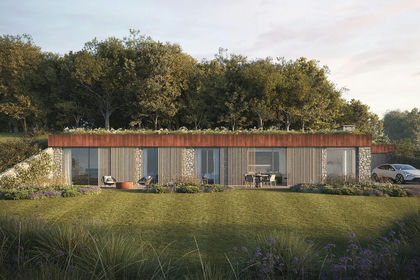
- Price
- £850,000
- Size
- 6.1 acres
Self build plot at Blind Lane, Goudhurst TN17, Goudhurst, Kent TN17 England
Added on 29/01/2026Self Build Plot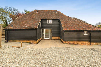
- Price
- Offers in Region of£700,000
Added on 06/05/2026Barn Conversion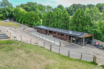
- Price
- £595,000
- Size
- 6 acres
Added on 06/02/2026Equestrian property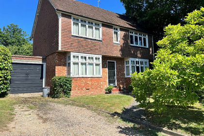
- Price
- Guide Price£545,000
- Size
- 0.3 acres
Hartley Road, Cranbrook, Kent, TN17, Cranbrook & Sissinghurst, Kent TN17 England
Added on 02/10/2026Building Plot
- Price
- Guide Price£675,000
Knowle Road, Tonbridge, TN12, Paddock Wood, Kent TN12 England
Added on 25/06/2026Self Build Plot
- Price
- Offers in Excess of£785,000
- Size
- 1 acres
Willow Lane, Paddock Wood, Tonbridge, Kent, TN12, Paddock Wood, Kent TN12 England
Added on 08/10/2026Barn Conversion
- Price
- Guide Price£795,000
Swattenden Lane, Cranbrook, Kent, TN17, Cranbrook & Sissinghurst, Kent TN17 England
Added on 11/07/2026Barn Conversion
- Price
- Guide Price£800,000
- Size
- 1.8 acres
Added on 23/07/2026House with Land
- Price
- Offers in Excess of£580,000
- Size
- 2.15 acres
Badsell Orchard, Tonbridge, Kent TN12, Capel, Kent TN12 England
Added on 30/04/2026Building Plot Added on 11/09/2026Barn Conversion