Maple Cottage, Langcliffe, BD24
- Bedrooms
- 2
Key Features
- Very Well Appointed 2 Bedroom Stone Built Barn Conversion
- Many Character Features Evident
- Decorated and Presented to a High Standard
- Pleasant Views
- Detached Garage & Parking
Description
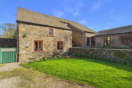
Very well appointed 2 bedroom stone built detached barn conversion located in a superb position on the edge of Langcliffe Village within The Yorkshire Dales National Park.
Spacious, light and airy accommodation with many character features evident including exposed beams and quality fixtures and fittings throughout.
Decorated and presented to a high standard, with double glazed windows and gas fired central heating, ready for immediate occupation.
Pleasant views, manageable gardens, detached garage and parking.
The property stands approximately 100 yards from the centre of the village and approximately 1 mile from the popular market town of Settle.
Langcliffe village has an active community spirit.
Ideal property for family, holiday cottage or investment.
Pretty house, well worthy of internal inspection to fully appreciate.
Don't miss this one!
ACCOMMODATION COMPRISES:
First Floor
External Steps to Kitchen, Cloakroom/WC, Lounge.
Ground Floor
2 Bedrooms, Lobby Area, Bathroom.
Outside
Manageable Gardens, Parking, Detached Garage.
ACCOMMODATION:
FIRST FLOOR:
External steps to kitchen.
Kitchen:
13'1" x 15'0" (3.98 x 4.57)
Side external entrance door, wide range of modern kitchen base units with complementary work surfaces, wall units, stainless steel sink with mixer taps, double glazed window, gas hob, Montpellier electric oven with hood over, plumbing for washing machine, recessed spotlights, radiator, cloakroom off.
Cloakroom:
3'3" x 4'7" (0.91 x 1.39) plus 3'3" x 5'7" (0.91 x 1.70)
Useful storage area, WC, wash hand basin, radiator.
?
Lounge:
15'0" x 17'8" (4.57 x 5.38)
Very nice large room with open ceiling, exposed roof truss and purlins, 4 double glazed windows with views, recessed fireplace, multi fuel stove on flagged hearth (installed in 2024), gas fired central heating boiler in cupboard,(installed in 2024), staircase down to ground floor, conservation roof light.
GROUND FLOOR:
Lobby:
6'0" x 5'6" (1.82 x 1.67)
Access to 2 bedrooms and shower room, double glazed window, electric heater.
Bedroom 1:
15'0" x 14'2"
Double bedroom, external entrance door, double glazed window, radiator, range of built in wardrobes.
?
Bedroom 2:
9'2" x 16'5" (2.79 x 5.00)
Double bedroom, 2 double glazed windows,
radiator, open under stairs.
Shower Room:
7'8" x 5'6" (2.33 x 1.67)
Very well appointed room with large shower enclosure with drencher shower over off the system, pedestal wash hand basin, WC with hidden cistern, vertical radiator, boarded walls.
OUTSIDE:
Shared driveway with access off the main road, parking space,
Garage:
18'3" x 11'5" (5.56 x 3.48)
Detached garage with double doors to the front, side door, power and light plus loft area, and canopy to side.
Manageable private gardens, drying area.
Directions:
Leave the Settle office down Church Street to Bridge End, turn right to Langcliffe Village, go approximately 1 mile, don't turn into the village. Maple Cottage is approximately 100 yards on the right hand side behind Mount Pleasant, a for sale board is erected.
Tenure:
Freehold with vacant possession on completion
Services:
All mains services are connected to the property.
Viewing:
Strictly by prior arrangement with and accompanied by a member of the selling agents, Neil Wright Associates Ltd.
Purchase Procedure:
If you would like to make an offer on this property, then please make an appointment with Neil Wright Associates so that a formal offer can be submitted to the Vendors.
Marketing:
Should you be interested in this property but have a house to sell, then we would be pleased to come and give you a free market valuation.
N.B. YOUR HOME MAY BE AT RISK IF YOU DO NOT KEEP UP PAYMENTS ON YOUR MORTGAGE OR ANY OTHER LOAN SECURED AGAINST IT.
N.B. No electrical/gas appliances have been checked to ensure that they are in working order. The would-be purchasers are to satisfy themselves.
N.B. Money Laundering, prospective buyers should be aware that in the event that they make an offer for the property, they will be required to provide the agent with documents in relation to the Money Laundering Regulations; one being photographic ID, i.e., driving licence or passport and the other being a utility bill showing the address. These can be provided in the following ways: by calling into the office with copies or by way of a certified copy provided via their solicitor. In addition, prospective buyers will be required to provide information regarding the source of funding as part of the offer procedure.
Local Authority:
North Yorkshire Council
1 Belle Vue Square
Broughton Road
SKIPTON
North Yorkshire
BD23 1FJ
Council Tax Band 'E'
Map Location
Property details
- Tenure
- Freehold
- Council Tax Band
- Ask Agent
- Date Posted
- 2026-01-29
Energy Performance Certificate
Energy Efficiency Rating
Based on UK Energy Performance Certificate standards (EU Directive 2002/91/EC)
Running costs are one side. Planning activity, flood history and ground risks for this location are in the full report.
Utilities & Restrictions
Utilities
- Electricity
- Ask Agent
- Water
- Ask Agent
- Heating
- Central Heating
- Broadband
- Ask Agent
- Sewerage
- Ask Agent
Rights & Restrictions
- Public Rights of Way
- Ask Agent
- Private Rights of Way
- Ask Agent
- Listed Property
- Ask Agent
- Restrictions
- Ask Agent
Listed status, conservation areas and planning constraints for this location are in the full report.
Property Features
- Accessibility
- Ask Agent
- Parking
- Garage, Off-Street Parking
- Garden
- Garden
Beyond the particulars: planning activity, flood history, heritage and ground risks, checked for this exact spot.
Connectivity
Broadband
Fastest speed available at this postcode
1 Gbps
Gigabit full fibre · available to 73% of premises
Suitable for
- 4K streaming on every screen
- Full-time home working
- Online gaming & big downloads
Mobile signal
Outdoor predictions; indoor signal depends on building materials.
Ofcom Connected Nations postcode-level predictions. Speeds and signal are modelled, not measured, and vary between addresses and providers.
Signal is the easy part. Planning activity, flood history and protected designations here are in the full report.
Nearest Schools
Primary
- Giggleswick Primary School0.9 milesOfsted: Good
- Ages
- 4 to 11
- Pupils
- 75
- Type
- Community school
- Settle Church of England Voluntary Controlled Primary School1 mileOfsted: Good
- Ages
- 3 to 11
- Pupils
- 188
- Type
- Voluntary controlled school
- Faith
- Church of England
- Austwick Church of England VA Primary School3.9 milesNo Ofsted rating
- Ages
- 4 to 11
- Pupils
- 53
- Type
- Voluntary aided school
- Faith
- Church of England
- Long Preston Endowed Voluntary Aided Primary School4.4 milesNo Ofsted rating
- Ages
- 3 to 11
- Pupils
- 53
- Type
- Voluntary aided school
- Faith
- Church of England
- Kirkby in Malhamdale United Voluntary Aided Primary School5.2 milesNo Ofsted rating
- Ages
- 3 to 11
- Pupils
- 55
- Type
- Voluntary aided school
Secondary
- Settle College0.8 milesNo Ofsted rating
- Ages
- 11 to 18
- Pupils
- 561
- Type
- Community school
- Upper Wharfedale School11 milesNo Ofsted rating
- Ages
- 11 to 16
- Pupils
- 351
- Type
- Community school
- Bowland High12 milesOfsted: Good
- Ages
- 11 to 16
- Pupils
- 644
- Type
- Academy converter
- West Craven High School12 milesOfsted: Requires improvement
- Ages
- 11 to 16
- Pupils
- 528
- Type
- Academy converter
- The Skipton Academy13 milesOfsted: Good
- Ages
- 11 to 16
- Pupils
- 736
- Type
- Academy sponsor led
Distances are straight-line from the advertised location. Source: the national school registers (DfE, Welsh Government, Scottish Government) and Ofsted.
Schools are just the start: sold prices nearby, planning activity and any flood history are in the full report.
Amenities
Supermarket
GP surgery
Pharmacy
Hospital
Green space
Walking trail
Straight-line distances from the advertised location. Sources: NHS records, Geolytix supermarket locations, OS Open Greenspace and the national trails registers.
The area stacks up? Now check the location itself: planning nearby, protected designations and past flooding.
Getting Around
Nearest station
Nearest bus stop
Typical drive times
Straight-line distances from the advertised location; drive times are typical free-flow times over OpenStreetMap road data, so allow more at peak. Public transport locations from DfT NaPTAN.
Easy to reach matters. So do planning activity, flood history and ground risks: all in the full report.
Flood Risk
From Environment Agency flood map open data, checked around the advertised map pin and allowing for the listed acreage where known. This summary comes from LandSale, the advertising platform, not from the listing agent, and is not part of the agent's particulars. Risk can vary across a single holding, so verify anything critical through your own searches before committing.
Rivers and the sea
Surface water
The detail behind these bandings
The full report pinpoints where this location sits on the flood maps, and runs the deeper checks that usually only surface after an offer.
- Exact flood zones & annual chances (included in the full report)
- Any recorded past flooding (included in the full report)
- Planning activity nearby (included in the full report)
- Heritage & conservation (included in the full report)
- Protected nature designations (included in the full report)
- Ground risks (included in the full report)
- Sold prices nearby (included in the full report)
£14.99 · one-off purchase
By LandSale, the platform. Not provided by the listing agent. Ready in about a minute.
Important notice: Information, maps and tags on this page are drawn from the advertising agent's marketing materials or generated automatically. LandSale has not verified them. Relying on these details is at your own risk, always carry out independent checks before committing to a purchase.
LandSale full disclaimer
Marketing information only - not formal particulars. The details on this website are provided for general guidance and do not constitute an offer or contract. Neither LandSale nor the advertising estate/land agent accepts responsibility for any inaccuracy.
1. Source of information
- Listing content: Core description, asking price, tenure, measurements, photographs and planning history originate from the marketing materials of the advertising estate or land agent. LandSale does not author this content and cannot guarantee its accuracy.
- Automated tags & categorisation: Property type, land-use class, acreage bands and similar labels may be applied by machine-learning models. They are intended as a helpful guide only and may not reflect the property's legal status or permitted use.
- Third-party & enriched data layers: Maps, boundary outlines, planning designations, soil reports, broadband coverage and other environmental or location-based insights are licensed from external suppliers. Such data are supplied “as is", may be incomplete or out of date and are subject to change without notice.
2. Verification required
Prospective purchasers must verify critical matters, including but not limited to planning permission, title boundaries, public rights of way, environmental constraints, acreage, services, access and VAT status, through their own inspections, specialist surveys, legal advisers and the selling agent before relying on the information or entering into any contract.
3. No warranty or liability
LandSale gives no warranty, express or implied, as to the accuracy, completeness or fitness for any particular purpose of the information displayed. LandSale shall not be liable for any loss, damage, cost or expense arising directly or indirectly from any use of or reliance on such information, save where liability may not be excluded by law.
4. Updates & feedback
If you believe any detail on this listing is inaccurate, please let us know. We will investigate and, where appropriate, update the listing or notify the agent.
© LandSale | Version 1.3 - August 2026
Similar properties for sale
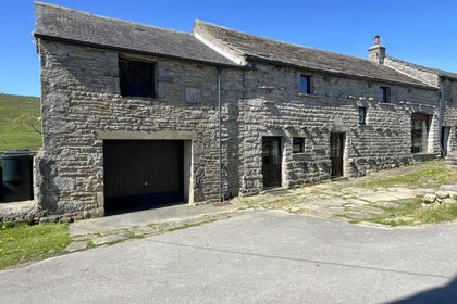
- Price
- Guide Price£335,000
Added on 15/05/2026Barn Conversion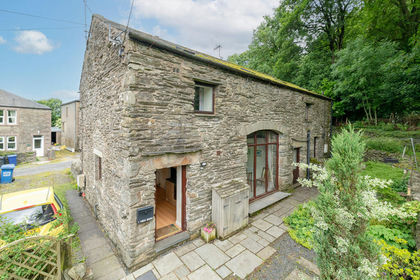
- Price
- £350,000
High Barn, Studfold, Horton-in-Ribblesdale, Horton in Ribblesdale, North Yorkshire BD24 England
Added on 08/07/2026Barn Conversion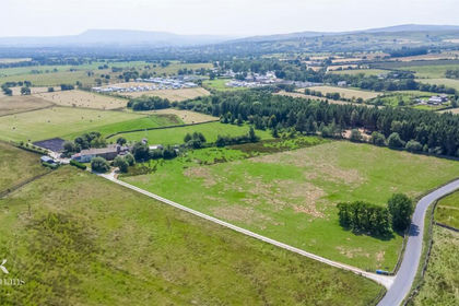
- Price
- £350,000
- Size
- 5.78 acres
Added on 20/07/2026Development Land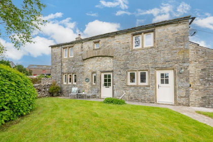
- Price
- Guide Price£389,950
Selside, Settle, North Yorkshire, BD24, Horton in Ribblesdale, North Yorkshire BD24 England
Added on 20/02/2026Barn Conversion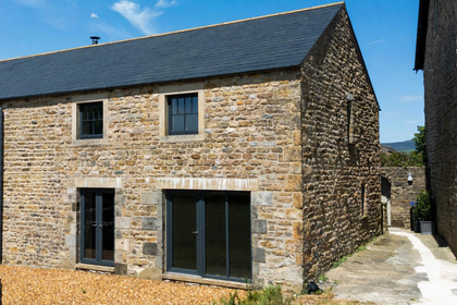 Added on 11/06/2026Barn Conversion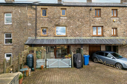
- Price
- Offers in Region of£295,000
4 Gale Green Barn, Westhouse, Ingleton., Thornton in Lonsdale, North Yorkshire LA6 England
Added on 10/03/2026Barn Conversion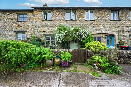 Added on 05/06/2026Barn ConversionLeasehold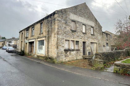
- Price
- Guide Price£345,000
Added on 28/01/2026Development Land Added on 29/01/2026Barn
 Added on 24/03/2026Barn Conversion