Dryfield Lane, Rivington, Bolton, BL6
- Land size
- 0.24 acres
- Bedrooms
- 4
- Bathrooms
- 2
Key Features
- Approx 2219sqft of accommodation and plot of approx 0.24 of an acre
- Substantial garage, house, large utility, ensuite, WC and main bathroom
- Stunning gardens
- Very rare opportunity to acquire such a property
- Flexible living accommodation
- The initial barn dates from the 1700’s and was converted in 2003
- Impressive kitchen with vaulted ceiling
- Mass of open countryside literally on the doorstep
- Approx 1.5 miles to motorway and train links
- Under 1 mile to Horwich Centre
Description
We were fortunate enough to market Hamers Barn around 20 years ago at which time the current owners purchased the property and have subsequently enhanced what was already a tremendous home.
It is fair to describe true bungalows as an increasingly rare breed of property and when we consider the special location and stone construction, we feel many buyers will consider this as a once in a lifetime opportunity. Approx 2219sqft of accommodation.
Sitting in predominantly level grounds of approx 0.24 of an acre, the stunning outside space will undoubtedly be embraced by those keen gardeners amongst us. The gardens are enhanced by their orientation and remarkable privacy. The garage and large utility form part of an extension by the current owners and their size offers further scope for conversion if greater living space would be required. Alternatively, we cannot fail to acknowledge that the facilities provided by a large garage and a substantial utility are sought after features. For those keen dog owners, the utility was made for ease of access and user-friendly facilities for washing and drying dogs after a muddy walk!
It is worthy of notes that historically there have been double doors between the rear most part of the kitchen and the adjoining room which could quite easily be reinstated and may well suit purchasers looking to have a larger open plan living space. The lead reception room alternatively could be used as a bedroom.
This well cared for home is presented in a modern neutral style and we expect strong rates of interest.
The property is Freehold
Council Tax is Band F - £3,545.31
Dryfield Lane is a highly regarded road in Rivington which is a village just on the outskirts of Horwich. The location blends a rural setting seamlessly with excellent access to facilities and an excellent transport links. The popular and independent Bolton School is around 5 miles away and Dryfield Lane is close to their bus route. Horwich town centre, which includes a good collection of largely independently owned shops and services is under one mile away whilst larger retail outlets can be found towards the Middlebrook development close to the football stadium which includes associated transport links (Horwich Parkway train station on the mainline to Manchester plus junction 6 of the M61).
Blackrod train station is physically the closest rail link, is on the main line to Manchester and is around 1.5 miles away whilst the motorway junction is around 3 miles away. Those busy working in Manchester city centre, for example, would no doubt relish their journey home to a rural retreat to enjoy the country park setting and enviable views. The area is synonymous with the philanthropist Lord Leverhulme who is understood to have socialised with the owners of properties in the area. To enjoy a slice of the town’s heritage along with an individual residence and proportionate garden then look no further. This could well be the home for you.
Entrance Hallway
9' 2" (max) x 12' 8" (max) (2.79m x 3.86m)
Inner Hallway 1
3' 1" x 6' 2" (0.94m x 1.88m) Large loft access.
Fitted Store Cupboard/Boiler Room
5' 10" x 2' 11" (1.78m x 0.89m) Gas central heating boiler by Potterton.
Bedroom 4
16' 1" x 10' 3" (4.90m x 3.12m) Positioned to the front. Windows to both the front and gable. Fitted furniture.
Reception Room 1
20' 8" x 17' 4" (6.30m x 5.28m) Windows to the front and gable. Beamed finish to the ceiling. Feature fireplace with currently an electric fire.
Inner Hallway 2
7' 1" x 10' 11" (2.16m x 3.33m) Two lightwells so this area is flooded with natural lights.
Bedroom 3
9' 6" (max) x 14' 2" (2.90m x 4.32m) Vaulted ceiling. Lightwell. Rooflight.
Bedroom 2
12' 9" x 14' 9" (3.89m x 4.50m) Vaulted ceiling. Lightwell Rooflight.
Bedroom 1
14' 11" x 14' 9" (4.55m x 4.50m) Windows to the garden.
Walk In Wardrobe
8' 0" x 3' 8" (2.44m x 1.12m) Fitted.
En-Suite Shower Room
7' 4" x 0' 0" (2.24m x 0.00m) 7' 2" x 6' 5" extending to 7' 4" (2.18m x 1.96m extending to 2.24m) Natural light with rooflight. Large corner shower. WC in a concealed cistern. Hand basin with vanity unit and mirror.
Bathroom
10' 9" x 8' 7" (3.28m x 2.62m) Large corner shower. Individual bath. WC. Hand basin with vanity unit. Natural light with lightwell and rooflight. Fully tiled to the floor. Splashback to the walls.
Kitchen/Dining Room
27' 4" x 13' 8" (8.33m x 4.17m) Two vaulted ceilings, one with two rooflights. Three gable windows. French doors to the rear. Access through to the annexed area. Island unit. Large gas AGA. Separate electric hob. Large fridge and freezer. Dishwasher.
Hall
7' 0" x 5' 3" (2.13m x 1.60m) Tiled floor. Double glass doors to the front looking to the garden at the rear.
Rear Porch
7' 9" x 3' 10" (2.36m x 1.17m) Opens up to and overlooks the garden.
Utility Room
16' 1" x 12' 3" (4.90m x 3.73m) Sub-compartmented there is a WC at 2' 10" x 5' 10" (0.86m x 1.78m) with a WC. Hand basin. Matching tiled floor. At the moment this is a large utility area with space for appliances. Sink. Space for two appliances. Plinth heater. Tiled floor. Plumbed into the main central heating.
Garage
16' 4" x 17' 1" (4.98m x 5.21m) Electric up and over door. Lighting. Power.
Map Location
Property details
- Tenure
- Freehold
- Council Tax Band
- F
- Date Posted
- 2026-01-28
Energy Performance Certificate
Energy Efficiency Rating
Based on UK Energy Performance Certificate standards (EU Directive 2002/91/EC)
Running costs are one side. Planning activity, flood history and ground risks for this location are in the full report.
Utilities & Restrictions
Utilities
- Electricity
- Mains
- Water
- Mains
- Heating
- Gas Central Heating
- Broadband
- Ask Agent
- Sewerage
- Mains
Rights & Restrictions
- Public Rights of Way
- Ask Agent
- Private Rights of Way
- Ask Agent
- Listed Property
- Ask Agent
- Restrictions
- Ask Agent
Listed status, conservation areas and planning constraints for this location are in the full report.
Property Features
- Accessibility
- Ask Agent
- Parking
- Parking Available
- Garden
- Garden
Beyond the particulars: planning activity, flood history, heritage and ground risks, checked for this exact spot.
Connectivity
Broadband
Fastest speed available at this postcode
67 Mbps
Superfast · available to 92% of premises
Suitable for
- HD streaming
- Video calls
- Web & social
Mobile signal
Outdoor predictions; indoor signal depends on building materials.
Ofcom Connected Nations postcode-level predictions. Speeds and signal are modelled, not measured, and vary between addresses and providers.
Signal is the easy part. Planning activity, flood history and protected designations here are in the full report.
Nearest Schools
Primary
- Beacon Primary School816 metresOfsted: Good
- Ages
- 2 to 11
- Pupils
- 209
- Type
- Academy sponsor led
- St Catherine's CofE Primary School0.9 milesNo Ofsted rating
- Ages
- 3 to 11
- Pupils
- 237
- Type
- Academy converter
- Faith
- Church of England
- Horwich Parish CofE Primary School0.9 milesOfsted report card · Mar 2026
- Ages
- 4 to 11
- Pupils
- 300
- Type
- Voluntary aided school
- Faith
- Church of England
- Rivington Foundation Primary School1.2 milesOfsted: Good
- Ages
- 3 to 11
- Pupils
- 109
- Type
- Foundation school
- St Mary's RC Primary School1.5 milesOfsted: Good
- Ages
- 5 to 11
- Pupils
- 214
- Type
- Voluntary aided school
- Faith
- Roman Catholic
Secondary
- Rivington and Blackrod High School604 metresOfsted: Good
- Ages
- 11 to 18
- Pupils
- 1,626
- Type
- Academy converter
- Faith
- Church of England
- St Joseph's RC High School1.9 milesOfsted: Good *
- Ages
- 11 to 16
- Pupils
- 1,047
- Type
- Voluntary aided school
- Faith
- Roman Catholic
- Albany Academy3.5 milesOfsted: Good
- Ages
- 11 to 16
- Pupils
- 725
- Type
- Academy converter
- Holy Cross Catholic High School3.7 milesNo Ofsted rating
- Ages
- 11 to 16
- Pupils
- 976
- Type
- Voluntary aided school
- Faith
- Roman Catholic
- Smithills School4.2 milesOfsted report card · Mar 2026
- Ages
- 11 to 16
- Pupils
- 1,203
- Type
- Academy converter
* Latest graded judgement covers quality of education only; no overall grade was issued under the 2024-25 inspection framework.
Distances are straight-line from the advertised location. Source: the national school registers (DfE, Welsh Government, Scottish Government) and Ofsted.
Schools are just the start: sold prices nearby, planning activity and any flood history are in the full report.
Amenities
Supermarket
GP surgery
Pharmacy
Hospital
Green space
Straight-line distances from the advertised location. Sources: NHS records, Geolytix supermarket locations, OS Open Greenspace and the national trails registers.
The area stacks up? Now check the location itself: planning nearby, protected designations and past flooding.
Getting Around
Nearest station
Nearest bus stop
Typical drive times
Straight-line distances from the advertised location; drive times are typical free-flow times over OpenStreetMap road data, so allow more at peak. Public transport locations from DfT NaPTAN.
Easy to reach matters. So do planning activity, flood history and ground risks: all in the full report.
Flood Risk
From Environment Agency flood map open data, checked around the advertised map pin and allowing for the listed acreage where known. This summary comes from LandSale, the advertising platform, not from the listing agent, and is not part of the agent's particulars. Risk can vary across a single holding, so verify anything critical through your own searches before committing.
Rivers and the sea
Surface water
These bandings are the summary. Where this location sits on the flood maps, plus planning activity, heritage and ground risks, is in the full report.
Important notice: Information, maps and tags on this page are drawn from the advertising agent's marketing materials or generated automatically. LandSale has not verified them. Relying on these details is at your own risk, always carry out independent checks before committing to a purchase.
LandSale full disclaimer
Marketing information only - not formal particulars. The details on this website are provided for general guidance and do not constitute an offer or contract. Neither LandSale nor the advertising estate/land agent accepts responsibility for any inaccuracy.
1. Source of information
- Listing content: Core description, asking price, tenure, measurements, photographs and planning history originate from the marketing materials of the advertising estate or land agent. LandSale does not author this content and cannot guarantee its accuracy.
- Automated tags & categorisation: Property type, land-use class, acreage bands and similar labels may be applied by machine-learning models. They are intended as a helpful guide only and may not reflect the property's legal status or permitted use.
- Third-party & enriched data layers: Maps, boundary outlines, planning designations, soil reports, broadband coverage and other environmental or location-based insights are licensed from external suppliers. Such data are supplied “as is", may be incomplete or out of date and are subject to change without notice.
2. Verification required
Prospective purchasers must verify critical matters, including but not limited to planning permission, title boundaries, public rights of way, environmental constraints, acreage, services, access and VAT status, through their own inspections, specialist surveys, legal advisers and the selling agent before relying on the information or entering into any contract.
3. No warranty or liability
LandSale gives no warranty, express or implied, as to the accuracy, completeness or fitness for any particular purpose of the information displayed. LandSale shall not be liable for any loss, damage, cost or expense arising directly or indirectly from any use of or reliance on such information, save where liability may not be excluded by law.
4. Updates & feedback
If you believe any detail on this listing is inaccurate, please let us know. We will investigate and, where appropriate, update the listing or notify the agent.
© LandSale | Version 1.3 - August 2026
Listing agent
Lancasters Estate Agents, Bolton
104 Winter Hey Lane, Horwich, BL6 7PJ
Similar properties for sale
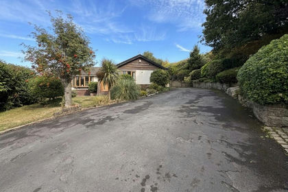
- Price
- £750,000
- Size
- 2 acres
Foxholes Road, Horwich, Bolton, Greater Manchester, BL6, Horwich, Bolton BL6 England
Added on 27/08/2026House with Land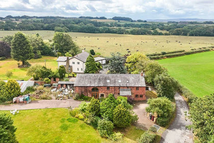
- Price
- £750,000
- Size
- 1.1 acres
The Barn, Arley Lane, Haigh, WN1, Blackrod, Bolton WN1 England
Added on 26/08/2026Barn Conversion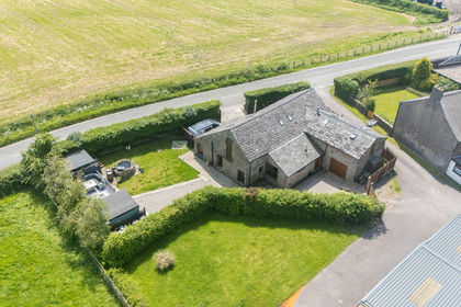
- Price
- Offers in Excess of£800,000
Barley Nook, Meadow Pit Lane, Haigh, WN2, Haigh, Wigan WN2 England
Added on 30/05/2026Barn Conversion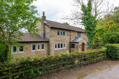
- Price
- Offers Over£799,995
- Size
- 3 acres
Long Lane, Heath Charnock, Chorley, Heath Charnock, Lancashire PR6 England
Added on 29/01/2026Cottage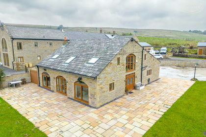
- Price
- £895,000
- Size
- 1 acres
Coal Pit Road, Smithills, Bolton, BL1, Bolton West, Bolton BL1 England
Added on 29/01/2026CottageLeasehold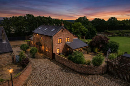
- Price
- £950,000
- Size
- 0.7 acres
Added on 02/07/2026Barn Conversion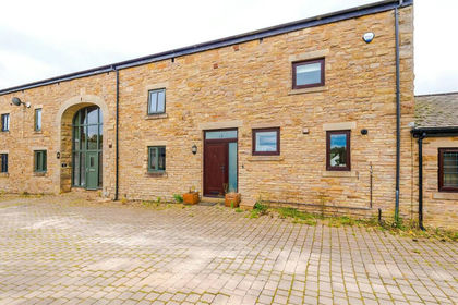
- Price
- Offers in Excess of£725,000
Boot Lane, Bolton, Greater Manchester, BL1, Bolton West, Bolton BL1 England
Added on 17/06/2026Barn Conversion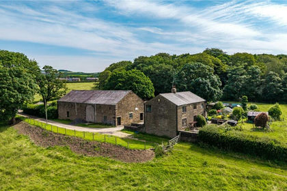
- Price
- Offers in Region of£950,000
- Size
- 19.99 acres
Cowling Road, Chorley, Lancashire, Chorley, Lancashire PR6 England
Added on 03/09/2026House with Land
- Price
- Offers in Region of£799,950
58A Barrow Bridge Road, Bolton, BL1, Bolton West, Bolton BL1 England
Added on 10/09/2026Barn Conversion
- Price
- £600,000
- Size
- 0.89 acres
Hornby Road, Chorley, Lancashire, PR6, Chorley, Lancashire PR6 England
Added on 18/06/2026Residential