Land Adjacent To Prestwick Airport, East Sanquhar, St Quivox, Ayr, KA6
- Land size
- 187.41 acres
Description
A unique and high-profile opportunity to acquire a block of strategic land with development potential adjacent to Prestwick Airport which is likely to attract a wide range of interest including those from overseas looking for an investment opportunity in Scotland.
The opportunity lends itself to investors, developers and/or farmers to acquire a highly productive block of land with scope to add value in future years by way of alternative uses for example commercial or industrial in a highly accessible area.
Extending in total to approximately 187.41 acres
(75.85ha) in total.
Offers and expressions of interest are invited particularly from developers, investors and farming businesses.
The land at East Sanquhar presents a unique opportunity to purchase approximately 187 acres of strategic land with potential value for future development in an enviable semi-rural setting near the towns of Prestwick and Ayr. The land is within the Prestwick Airport Masterplan area, and offers exciting development prospects for the future. The land is within the National Aerospace and Space Centre Strategy zone.
The fertile land is classed as a mixture of Grade 2 and Grade 3.2 by the James Hutton Institute and has been well maintained in productive arable tenure. The current owner would be interested to continue farming the land under a contract agreement.
Planning & Development
It is understood that the land is currently not zoned within the South Ayrshire Council Local Development Plan 2 however there may be scope for development in the future. The land is within National Aerospace and Space Centre Strategy Zone but we are aware that nothing is currently proceeding on that front. The planning history with regards to the property can be provided upon request. Prospective Purchasers should make their own investigations into the planning consents with the Council and seek professional advice. We have made no enquiries to the local authority and assume all current use is legal. Any development is likely to benefit from the sites existing access and services. It may be that the other uses for the site could be commercial, residential, renewables or mixed use including retail. Prospective Purchasers should make their own enquiries accordingly and any such use would be dependent on obtaining the relevant permissions.
Please Note: An overage payment in favour of the Seller will be reserved in respect of any future development of the land. The terms of this overage are to be agreed and will be secured by way of a standard security on the title.
Basic Payment Scheme (BPS) & IACS
The land is registered under the Basic Payment Scheme and all the land is allocated as region 1. The payment for 2024 will be retained by the vendors. The entitlements to the basic payment will be made available by separate negotiation.
Offers and Anti-Money Laundering (AML) Regulations
Formal offers, in the acceptable Scottish form, should be submitted through a Scottish Solicitor to the Selling Agent. Under The Money Laundering, Terrorist Financing and Transfer of Funds (Information on the Payer) Regulations 2017 we are required to carry out money laundering checks on purchasers. To facilitate this and to proceed promptly with submitting an offer, the following documentation must be provided to us in advance (i.e. prior to or alongside the formal offer submission):
- Valid proof of identification
- Proof of current address
- Evidence of purchase method (e.g., Mortgage in Principle, Proof of Funds)
Upon verbal acceptance of an offer, we require to verify the purchaser’s identity and use an online verification service provider to do so. We cannot enter a business relationship with a purchaser until they have been identified. Failure to provide required identification may result in an offer not being considered.
Broadband/Mobile signal
We understand that broadband & mobile reception is available. Buyers are advised to visit OFCOM website for an indication of supply and speeds: //checker.ofcom.org.uk/en-gb/broadband-coverage and carry out their own further due diligence.
The land at East Sanquhar Farm enjoys a rural setting yet has excellent accessibility being less than 2 miles from the coastal town of Prestwick. It is conveniently positioned within commuting distance of Ayr, Kilmarnock and Glasgow, and with easy access to the A77 providing links south to Cairnryan for the ferry to Northern Ireland. Prestwick International Airport is on the doorstep, while the beautiful Ayrshire coastline with its sandy beaches and world-renowned golf courses is just minutes away.
Map Location
Property details
- Tenure
- Ask Agent
- Council Tax Band
- TBC
- Date Posted
- 2026-01-29
Market Value Analysis
Compared with 13 Farmland & Pasture listings in Scotland (100+ acres).
Utilities & Restrictions
Utilities
- Electricity
- Ask Agent
- Water
- Ask Agent
- Heating
- Ask Agent
- Broadband
- Ask Agent
- Sewerage
- Ask Agent
Rights & Restrictions
- Public Rights of Way
- Ask Agent
- Private Rights of Way
- Ask Agent
- Listed Property
- Ask Agent
- Restrictions
- Ask Agent
Listed status, conservation areas and planning constraints for this location are in the full report.
Property Features
- Accessibility
- Ask Agent
- Parking
- Ask Agent
- Garden
- Ask Agent
Beyond the particulars: planning activity, flood history, heritage and ground risks, checked for this exact spot.
Connectivity
Broadband
Fastest speed available at this postcode
30 Mbps
Superfast · available to 21% of premises
Suitable for
- HD streaming
- Video calls
- Web & social
Mobile signal
Predicted 4G and 5G signal; indoor signal depends on building materials.
Ofcom Connected Nations postcode-level predictions. Speeds and signal are modelled, not measured, and vary between addresses and providers.
Signal is the easy part. Planning activity, flood history and protected designations here are in the full report.
Nearest Schools
Primary
- Glenburn Primary School0.9 miles
- Pupils
- 287
- Type
- Non-denominational
- St Ninian's Primary School0.9 miles
- Pupils
- 129
- Type
- Roman Catholic
- Kingcase Primary School1.3 miles
- Pupils
- 352
- Type
- Non-denominational
- Heathfield Primary School1.5 miles
- Pupils
- 414
- Type
- Non-denominational
- Dalmilling Primary School1.6 miles
- Pupils
- 329
- Type
- Non-denominational
Secondary
- Prestwick Academy1.2 miles
- Pupils
- 1,186
- Type
- Non-denominational
- Kyle Academy2.4 miles
- Pupils
- 821
- Type
- Non-denominational
- Ayr Academy2.5 miles
- Pupils
- 602
- Type
- Non-denominational
- South Ayrshire Council Virtual School3.1 miles
- Type
- Non-denominational
- Queen Margaret Academy3.5 miles
- Pupils
- 681
- Type
- Roman Catholic
Distances are straight-line from the advertised location. Source: the national school registers (DfE, Welsh Government, Scottish Government) and Ofsted.
Schools are just the start: planning activity, heritage and any flood history here are in the full report.
Amenities
Supermarket
GP surgery
Pharmacy
Green space
Straight-line distances from the advertised location. Sources: NHS records, Geolytix supermarket locations, OS Open Greenspace and the national trails registers.
The area stacks up? Now check the location itself: planning nearby, protected designations and past flooding.
Getting Around
Nearest station
Nearest bus stop
Typical drive times
Straight-line distances from the advertised location; drive times are typical free-flow times over OpenStreetMap road data, so allow more at peak. Public transport locations from DfT NaPTAN.
Easy to reach matters. So do planning activity, flood history and ground risks: all in the full report.
Flood Risk
SEPA open data, checked around the advertised map pin for the listed acreage. Provided by LandSale, not the listing agent, and not part of the agent's particulars. Risk varies across a holding, so verify before committing.
Rivers and the sea
Not at the pin: mapped about 20 metres away.
Surface water
Not at the pin: mapped about 20 metres away.
These bandings are the summary. Where this location sits on the flood maps, plus planning activity, heritage and ground risks, is in the full report.
Important notice: Information, maps and tags on this page are drawn from the advertising agent's marketing materials or generated automatically. LandSale has not verified them. Relying on these details is at your own risk, always carry out independent checks before committing to a purchase.
LandSale full disclaimer
Marketing information only - not formal particulars. The details on this website are provided for general guidance and do not constitute an offer or contract. Neither LandSale nor the advertising estate/land agent accepts responsibility for any inaccuracy.
1. Source of information
- Listing content: Core description, asking price, tenure, measurements, photographs and planning history originate from the marketing materials of the advertising estate or land agent. LandSale does not author this content and cannot guarantee its accuracy.
- Automated tags & categorisation: Property type, land-use class, acreage bands and similar labels may be applied by machine-learning models. They are intended as a helpful guide only and may not reflect the property's legal status or permitted use.
- Third-party & enriched data layers: Maps, boundary outlines, planning designations, soil reports, broadband coverage and other environmental or location-based insights are licensed from external suppliers. Such data are supplied “as is", may be incomplete or out of date and are subject to change without notice.
2. Verification required
Prospective purchasers must verify critical matters, including but not limited to planning permission, title boundaries, public rights of way, environmental constraints, acreage, services, access and VAT status, through their own inspections, specialist surveys, legal advisers and the selling agent before relying on the information or entering into any contract.
3. No warranty or liability
LandSale gives no warranty, express or implied, as to the accuracy, completeness or fitness for any particular purpose of the information displayed. LandSale shall not be liable for any loss, damage, cost or expense arising directly or indirectly from any use of or reliance on such information, save where liability may not be excluded by law.
4. Updates & feedback
If you believe any detail on this listing is inaccurate, please let us know. We will investigate and, where appropriate, update the listing or notify the agent.
© LandSale | Version 1.3 - August 2026
Listing agent
Davidson & Robertson, Edinburgh
The Rural Centre West Mains Ingliston Edinburgh EH28 8LT
Contact Davidson & Robertson, Edinburgh
The Rural Centre West Mains Ingliston Edinburgh EH28 8LT
View agent profileNearby properties for sale
- Price
- Offers Over£495,000
- Size
- 203.07 acres
Added on 29/01/2026Grazing Land
- Price
- Offers Over£1,450,000
- Size
- 228.61 acres
Nether Barr Farm, Barr, KA26, Ayr, Carrick and Cumnock, South Ayrshire KA26 Scotland
Added on 01/10/2026Farm
- Price
- Guide Price£425,000
- Size
- 71.43 acres
Added on 19/08/2026Timberland
- Price
- £600,000
- Size
- 26 acres
Added on 25/09/2026Smallholding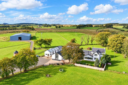
- Price
- Offers Over£950,000
- Size
- 52 acres
Crofthead Farm, Strathaven, East Kilbride and Strathaven, South Lanarkshire ML10 Scotland
Added on 14/10/2026Country Estate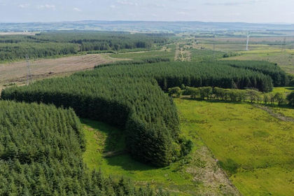
- Price
- Offers Over£450,000
- Size
- 51.1 acres
Ardochrig Wood, S.Lanarkshire G75, East Kilbride and Strathaven, South Lanarkshire G75 Scotland
Added on 28/01/2026Timberland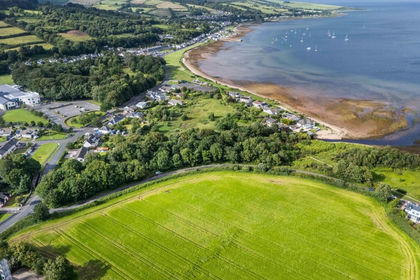
- Price
- Offers Over£850,000
- Size
- 13.42 acres
Added on 27/08/2026Development Land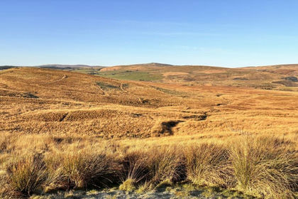
- Price
- Guide Price£360,000
- Size
- 255.13 acres
Land at Darnhunch Farm, Muirkirk, Ayrshire, Kilmarnock and Loudoun, East Ayrshire KA18 Scotland
Added on 22/05/2026Farmland
- Price
- Offers in Excess of£785,000
- Size
- 1.6 acres
Added on 18/08/2026House with Land
- Price
- Offers Over£785,000
- Size
- 1.6 acres
Brodick, Isle of Arran, KA27, North Ayrshire and Arran, Arran and Cumbrae KA27 Scotland
Added on 29/08/2026House with Land