Grazing Amenity land Wretton
- Land size
- 13.15 acres
Key Features
- 5.32 Hectares of bank land
- Adjacent to Cut Off Channel
- Available as a whole or Two Lots
Description
Introduction
Cruso & Wilkin are delighted to offer this rural area of amenity land, situated within West Norfolk, very close to the village of Wretton and adjacent to the Cut Off Channel.
The property comprises of approximately 13.15 acres (5.32 hectares) of amenity grass bank land. Access is available directly off the county maintained highway known as Wretton Fen Drove and a private access roadway known as Farhill Drove.
Location and Situation
The lands are situated to the south of the village of Wretton, this village is located approximately 2 miles east of Stoke Ferry and 4 miles south-east of Downham Market.
The fields can be identified from the attached location and site plans (for identification purposes only) and a direction board off the Wretton Fen Drove.
The location of the entrance to the land is:
Nearest Postcode: PE33 9QP
What3Words:
Local Amenities
The land is situate within the open countryside; there are various facilities and amenities within Stoke Ferry and Downham Market, with additional amenities including shopping, tourism attractions and schooling available within the towns of King’s Lynn and Swaffham.
The North Norfolk coast with its varied attractions is approximately 30 miles north of the property.
Railway stations are available within Downham Market and King’s Lynn, with direct access to King’s Cross station.
Method of Sale
The property is offered for sale by private treaty as a whole or in two lots, as described herein.
Depending on the level of interest the Vendors and their agents reserve the right to invite best and final offers.
Description
Lot 1:- (edged red) 9.21 acres (3.72 hectares) of bank land, historically used for grazing and more recently left unmanaged and permanent pasture. Access off Farhill Drove.
Lot 2:- (edged orange) 3.94 acres (1.59 hectares) of bank land, historically used for grazing and more recently left unmanaged and permanent pasture. Access off Farhill Drove.
Viewing and Health & Safety:
Viewing is with particulars to hand and ideally having confirmed viewing date with the Sole Agents, contact Cruso & Wilkin. Tel. . Given the potential hazards of the lands not being managed for some years, we ask you be as vigilant as possible when making your inspection.
Services
We are advised that the lands are not serviced.
Early Entry
Arrangements for early entry may be made if appropriate and upon the payment of a further 10% deposit of the total sale price following exchange of contracts (subject to cross compliance).
Soil and Land Classification
The land is shown as Grade 3 on the provisional Agricultural Land Classification Map prepared by the Ministry.
The Soil Survey of England and Wales map (prepared by the Soil Association), identifies the land as being Isleham 2 series which comprise of deep permeable sandy soils. The land is currently maintained as unmanaged grassland but was historically grazed with livestock.
Farhill Drove
The lots are offered with the section of Farhill Drove adjacent to the respective lots (as may be included within the Title), subject to all rights of way as may be enjoyed by adjoining landowners. It is further noted that Farhill Drove is recognised as a restricted byway.
The land is bordered on the southern boundary by the Cut Off Channel being the responsibility of the Environment Agency, they also own the “berm” to the channel bank, historically this has been let to the Sellers. We are making enquiries of the Environment Agency and/or their Agents to enquire whether they would agree to a continued arrangement on the relevant section(s).
Drainage Rates
We are advised that the lands are located within the Stoke Ferry Internal Drainage Board’s area; Downham Market Group of Internal Drainage Boards Tel:
Map Location
Property details
- Tenure
- Freehold
- Council Tax Band
- Ask Agent
- Date Posted
- 2026-01-29
Market Value Analysis
Compared with 3 Amenity Land listings in East Anglia (10+ acres).
Utilities & Restrictions
Utilities
- Electricity
- Ask Agent
- Water
- Ask Agent
- Heating
- Ask Agent
- Broadband
- Ask Agent
- Sewerage
- Ask Agent
Rights & Restrictions
- Public Rights of Way
- Ask Agent
- Private Rights of Way
- Ask Agent
- Listed Property
- Ask Agent
- Restrictions
- Ask Agent
Property Features
- Accessibility
- Ask Agent
- Parking
- Ask Agent
- Garden
- Ask Agent
Important notice: Information, maps and tags on this page are supplied by the advertising agent or generated automatically. LandSale has not verified them. Relying on these details is at your own risk, always carry out independent checks before committing to a purchase.
LandSale full disclaimer
Marketing information only - not formal particulars. The details on this website are provided for general guidance and do not constitute an offer or contract. Neither LandSale nor the advertising estate/land agent accepts responsibility for any inaccuracy.
1. Source of information
- Agent-supplied content: Core description, asking price, tenure, measurements, photographs and planning history are uploaded by the appointed agent, who remains solely responsible for their accuracy.
- Automated tags & categorisation: Property type, land-use class, acreage bands and similar labels may be applied by machine-learning models. They are intended as a helpful guide only and may not reflect the property's legal status or permitted use.
- Third-party & enriched data layers: Maps, boundary outlines, planning designations, soil reports, broadband coverage and other environmental or location-based insights are licensed from external suppliers. Such data are supplied “as is", may be incomplete or out of date and are subject to change without notice.
2. Verification required
Prospective purchasers must verify critical matters, including but not limited to planning permission, title boundaries, public rights of way, environmental constraints, acreage, services, access and VAT status, through their own inspections, specialist surveys, legal advisers and the selling agent before relying on the information or entering into any contract.
3. No warranty or liability
LandSale gives no warranty, express or implied, as to the accuracy, completeness or fitness for any particular purpose of the information displayed. LandSale shall not be liable for any loss, damage, cost or expense arising directly or indirectly from any use of or reliance on such information, save where liability may not be excluded by law.
4. Updates & feedback
If you believe any detail on this listing is inaccurate, please let us know. We will investigate and, where appropriate, update the listing or notify the agent.
© LandSale | Version 1.2 - January 2026
Listing agent
Cruso & Wilkin, Land & Commercial
The Estate Office, Church Farm, Station Road, Hillington, PE31 6DH
Contact Cruso & Wilkin, Land & Commercial
The Estate Office, Church Farm, Station Road, Hillington, PE31 6DH
View agent profileSimilar properties for sale

- Price
- Guide Price£100,000
- Size
- 11.78 acres
Land Swaffham Road Fincham, Fincham, Norfolk PE33 9DQ England
Added on 29/01/2026Arable Land
- Price
- Guide Price£53,000
- Size
- 76.97 acres
Added on 26/05/2026Agricultural Land
- Price
- Guide Price£105,000
- Size
- 7 acres
Added on 16/04/2026Grazing Land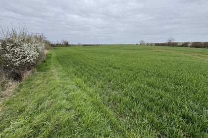
- Price
- Guide Price£100,000
- Size
- 12.61 acres
Added on 17/07/2026Arable Land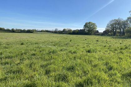
- Price
- From£90,000
- Size
- 7.09 acres
Added on 13/06/2026Grazing Land
- Price
- Offers in Region of£45,000
- Size
- 7.18 acres
Feldale Drove: Coates, Whittlesey, Cambridgeshire PE7 2BQ England
Added on 29/01/2026Agricultural Land- Price
- Offers in Region of£46,800
- Size
- 7.66 acres
Feldale Drove: Coates, Whittlesey, Cambridgeshire PE7 2BQ England
Added on 02/06/2026Agricultural Land
- Price
- Offers in Region of£90,000
- Size
- 14.84 acres
Feldale Drove: Coates, Whittlesey, Cambridgeshire PE7 2BQ England
Added on 29/01/2026Agricultural Land
- Price
- Guide Price£100,000
- Size
- 7.83 acres
Chequers Lane, South Lopham, South Lopham, Norfolk IP22 2HL England
Added on 29/01/2026Arable Land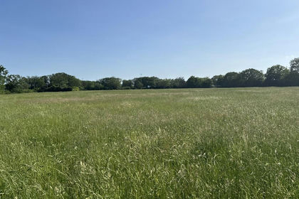
- Price
- Offers in Excess of£100,000
- Size
- 7.03 acres
Added on 11/06/2026Farmland