Martins Cash & Carry, Pennygillam Way, Launceston, Cornwall, PL15
- Land size
- 0.76 acres
- Use Class
- Use Classes: B2, E, B8
Key Features
- 1.90 acre Industrial site. Approximately 36,000 sq.ft of floor space
- Last remaining plots available from £625,000
- Different configurations of remaining plots possible
- Redevelopment/change of use potential
- Prominently located and Close to A30
Description
Location
Situated on the outskirts of the busy historic north Cornish town of Launceston the site is positioned in one of the most prominent positions on Pennygillam Industrial Estate, just off Pennygillam Way. The site sits alongside a number of local and national light industrial, service sector, professional, distribution, office, retail and retail/trade counter users. Nearby occupiers include Toolstation, Dominos, Greggs, Howdens, FedEx, Pallex (Intercounty), ATS, John Guest and Specsavers Recruitment as well as a number of regional and local businesses. The town centre is easily accessible as is the A30 dual carriageway, which can be joined near the entrance to the estate (approximately 280 metres from the site). Exeter, Plymouth and Truro are under an hour away by car.
Description
Approximately 1.90 acre (site and buildings) running parallel to Pennnygillam Way with numerous connected warehouses, a 2 storey office block and a cabin set within. The remainder of the site is currently vacant. Plots 1 and 4 at either end of the site are sold subject to contract. There will be new entrances installed at each end of the site to replace those that will be lost in the sales of Plot 1 and 4 (plans available upon request). The site has significant development/refurbishment potential and could be suitable for various uses (subject to planning).
Services
Water - Plots 2 and 3 are connected to mains water.
Electric - Plots 2 and 3 are connected to electrical power supplies.
Gas - Plots 2 and 4 have had gas connections in the past but are currently disconnected.
Drainage - Foul water drainage to Plots 2 and 3 is connected to the public sewer.
Phone/Internet - Plot 3 has a telephone/internet line.
Amenities
Launceston boasts the following amenities and nearby services:
Numerous independent shops and national chains, sports pitches and a leisure centre, primary, secondary and six form educational facilities and quality local restaurants and pubs.
North Cornish beaches from 17 miles by road (Crackington Beach), Railway services are available at Okehampton railway station (21 miles by road) and Exeter airport services international and domestic flights (50 miles by road). The A30 dual carriageway can be joined approximately 280m by road and the A39 Atlantic Highway (15 miles by road).
Accommodation (PLOT 2)
Plot 2 is in a prominent part of the site and is predominantly of hardstanding with boundary fences and a large recessed entrance. Divisions will be required to separate Plots 2 and 3 if they are sold separately. There are separate water, electricity and foul services to the Cabin Building which can serve Plot 2 if separated from Plot 3. Plot 2 could potentially be combined with part of Plot 3 if more warehouse space is required. The office block to the front could potentially be sold separately together with the parking area accessed by Entrance 3.
Sizes
Approximate Area Measured
PLOT 2 (vacant)
Site Area (including buildings) - 4,619.88 sq.m. (49,728 sq.ft. 1.14 Acres)
Warehouse (IPMS 2) - 1,004.05 sq.m. (10,808 sq.ft.)
Staff/store/trolley return extension (IPMS 2) - 135.05 sq.m. (1,454 sq.ft.)
Cabin Building (IPMS 2) - 156.15 sq.m. (1,681 sq.ft.)
Note: IPMS 2 includes internal walls, toilets and columns etc.
Note: Dimensions and areas are approximate and are measured and stated in accordance with RICS professional statement "RICS property measurement 2nd Edition, Jan 2018". IPMS 2 is reference to International Property Measurement Standards (All Buildings) published January 2023.
Accommodation (PLOT 3)
Plot 3 consists mainly of buildings, although there is a vehicle entrance from Pennygillam Way to a large parking area to the front. Access to the buildings is from pedestrian access points so some remodelling might be required if intending to access the warehousing for large goods storage. There are separate water, electricity and foul drainage services to the building which serve this plot. The office block to the front could potentially be sold separately together with the parking area accessed by Entrance 3 if additional warehouse space is required with an acquisition of Plot 2.
Sizes
Approximate Area Measured
PLOT 3 (Vacant)
Site Area (including buildings) - 3,078.16 sq.m. (33,133 sq.ft. 0.76 Acres)
Warehouses (IPMS 2) - 1,973.19 sq.m. (19,375 sq.ft.)
Offices (IPMS 3.2 -Office). Includes ground floor glazed entrance lobby. - 264.01 sq.m. (2,842 sq.ft.)
Note: Dimensions and areas are approximate and are measured and stated in accordance with RICS professional statement "RICS property measurement 2nd Edition, Jan 2018". IPMS 2 is reference to International Property Measurement Standards (All Buildings) published January 2023.
Planning & Building Regulations
The property does not have a recent planning history. Planning history can be viewed on the Cornwall Council Online Planning Register. Prospective purchasers should make investigations through their legal advisors as necessary to determine whether any proposals require planning consent.
Legal Costs
Each party will be responsible for their own legal costs.
Price Guide
Plot 2 - £950,000
Plot 3 - £625,000
The plots are shown indicatively and might need to be configured differently depending upon specific buyer requirements, site constraints and any building work required. The cost to separate plots can form part of negotiations. The Seller can demolish the buildings and provide a clear site subject to negotiation and agreement.
Business Rates
The current rateable values (RV) are as follows: Martins Cash & Carry is £97,500. Portacabin Stores (adj Martins Cash & Carry) is £8,700. The RV's are as stated on the Valuation Office Agency (VOA) website service (effective dates 1st April 2026). Information concerning how rates are calculated are available on the Cornwall Council website.
EPC
The buildings have the following EPC ratings:
Martins Cash & Carry - "DRAFT F", certificate ref: not yet lodged; to be confirmed depending upon Buyer requirements.
Cabin Building (former Café) - "DRAFT C", certificate ref: not yet lodged; to be confirmed depending upon Buyer requirements.
EPC's are available to download online from the Non-Domestic Energy Performance Certificate Register (ndepcregister.com).
VAT
The property is not understood to be elected for VAT.
Subject to Contract
This brochure is for guidance purposes only and does not constitute an offer or contract. All descriptions, particulars and dimensions stated are understood to be correct, but prospective purchasers or tenants must satisfy themselves that the information is correct and not rely on the information if entering into a contract or incurring expenses.
Viewing Arrangements
Viewings are by appointment only. Contact Phil Wiltshire on the website link below.
Map Location
Property details
- Tenure
- Freehold
- Council Tax Band
- Ask Agent
- Date Posted
- 2026-01-29
Utilities & Restrictions
Utilities
- Electricity
- Ask Agent
- Water
- Ask Agent
- Heating
- Ask Agent
- Broadband
- Ask Agent
- Sewerage
- Ask Agent
Rights & Restrictions
- Public Rights of Way
- Ask Agent
- Private Rights of Way
- Ask Agent
- Listed Property
- Ask Agent
- Restrictions
- Ask Agent
Listed status, conservation areas and planning constraints for this location are in the full report.
Property Features
- Accessibility
- Ask Agent
- Parking
- Parking Available
- Garden
- Ask Agent
Beyond the particulars: planning activity, flood history, heritage and ground risks, checked for this exact spot.
Connectivity
Broadband
Fastest speed available at this postcode
1.8 Gbps
Gigabit full fibre · available to 92% of premises
Suitable for
- 4K streaming on every screen
- Full-time home working
- Online gaming & big downloads
Fixed wireless access may also be an option here.
Mobile signal
Predicted 4G and 5G signal; indoor signal depends on building materials.
Ofcom Connected Nations postcode-level predictions. Speeds and signal are modelled, not measured, and vary between addresses and providers.
Signal is the easy part. Planning activity, flood history and protected designations here are in the full report.
Nearest Schools
Primary
- St Catherine's CofE Primary School479 metresNo Ofsted rating
- Ages
- 2 to 11
- Pupils
- 222
- Type
- Academy converter
- Faith
- Church of England
- Windmill Hill Academy1 mileNo Ofsted rating
- Ages
- 2 to 11
- Pupils
- 162
- Type
- Academy converter
- Launceston Primary School1.2 milesOfsted: Good
- Ages
- 4 to 11
- Pupils
- 101
- Type
- Free schools
- Tregadillett Primary School1.3 milesOfsted: Good
- Ages
- 4 to 11
- Pupils
- 206
- Type
- Foundation school
- St Stephens Community Academy1.4 milesOfsted: Good
- Ages
- 2 to 11
- Pupils
- 199
- Type
- Academy converter
Secondary
- Launceston College1 mileOfsted: Good
- Ages
- 11 to 18
- Pupils
- 1,205
- Type
- Academy converter
- Callington Community College8.9 milesOfsted: Good
- Ages
- 11 to 18
- Pupils
- 887
- Type
- Academy converter
- Tavistock College12 milesOfsted: Requires improvement
- Ages
- 11 to 18
- Pupils
- 1,200
- Type
- Academy converter
- Liskeard School and Community College12 milesNo Ofsted rating
- Ages
- 11 to 18
- Pupils
- 1,115
- Type
- Academy converter
- Holsworthy Community College13 milesNo Ofsted rating
- Ages
- 11 to 16
- Pupils
- 551
- Type
- Academy converter
Distances are straight-line from the advertised location. Source: the national school registers (DfE, Welsh Government, Scottish Government) and Ofsted.
Schools are just the start: sold prices nearby, planning activity and any flood history are in the full report.
Amenities
Supermarket
GP surgery
Pharmacy
Hospital
Green space
Straight-line distances from the advertised location. Sources: NHS records, Geolytix supermarket locations, OS Open Greenspace and the national trails registers.
The area stacks up? Now check the location itself: planning nearby, protected designations and past flooding.
Getting Around
Nearest station
Nearest bus stop
Typical drive times
Straight-line distances from the advertised location; drive times are typical free-flow times over OpenStreetMap road data, so allow more at peak. Public transport locations from DfT NaPTAN.
Easy to reach matters. So do planning activity, flood history and ground risks: all in the full report.
Flood Risk
Environment Agency open data, checked around the advertised map pin for the listed acreage. Long-term risk counts flood defences; the planning map's flood zones do not. Provided by LandSale, not the listing agent, and not part of the agent's particulars. Risk varies across a holding, so verify before committing.
Rivers and the sea
Planning map: Flood Zone 2, about 30 metres away.
Surface water
Not at the pin: mapped about 20 metres away.
These bandings are the summary. Where this location sits on the flood maps, plus planning activity, heritage and ground risks, is in the full report.
Important notice: Information, maps and tags on this page are drawn from the advertising agent's marketing materials or generated automatically. LandSale has not verified them. Relying on these details is at your own risk, always carry out independent checks before committing to a purchase.
LandSale full disclaimer
Marketing information only - not formal particulars. The details on this website are provided for general guidance and do not constitute an offer or contract. Neither LandSale nor the advertising estate/land agent accepts responsibility for any inaccuracy.
1. Source of information
- Listing content: Core description, asking price, tenure, measurements, photographs and planning history originate from the marketing materials of the advertising estate or land agent. LandSale does not author this content and cannot guarantee its accuracy.
- Automated tags & categorisation: Property type, land-use class, acreage bands and similar labels may be applied by machine-learning models. They are intended as a helpful guide only and may not reflect the property's legal status or permitted use.
- Third-party & enriched data layers: Maps, boundary outlines, planning designations, soil reports, broadband coverage and other environmental or location-based insights are licensed from external suppliers. Such data are supplied “as is", may be incomplete or out of date and are subject to change without notice.
2. Verification required
Prospective purchasers must verify critical matters, including but not limited to planning permission, title boundaries, public rights of way, environmental constraints, acreage, services, access and VAT status, through their own inspections, specialist surveys, legal advisers and the selling agent before relying on the information or entering into any contract.
3. No warranty or liability
LandSale gives no warranty, express or implied, as to the accuracy, completeness or fitness for any particular purpose of the information displayed. LandSale shall not be liable for any loss, damage, cost or expense arising directly or indirectly from any use of or reliance on such information, save where liability may not be excluded by law.
4. Updates & feedback
If you believe any detail on this listing is inaccurate, please let us know. We will investigate and, where appropriate, update the listing or notify the agent.
© LandSale | Version 1.3 - August 2026
Listing agent
PHILIPS ROGERS COMMERCIAL, Cornwall
Trudgeon Halling, The Platt, Wadebridge, PL27 7AE (Service Address Only)
View agent profileSimilar properties for sale
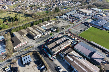
- Price
- Guide Price£750,000
- Size
- 0.74 acres
Added on 29/01/2026Warehouse
- Price
- Offers in Region of£624,950
Added on 17/07/2026Pub Added on 29/01/2026Pub
 Added on 29/01/2026Pub
- Price
- £595,000
- Size
- 0.19 acres
51-52 Brook Street, Tavistock, Devon, PL19, Tavistock, Devon PL19 England
Added on 29/01/2026Development Land
- Price
- Guide Price£565,000
- Size
- 0.24 acres
Added on 25/03/2026Pub Added on 29/01/2026Pub
- Price
- £550,000
- Size
- 0.11 acres
7 Kingsmill Business Park, Tamar View Industrial, Saltash, Saltash, Saltash, Cornwall PL12 England
Added on 16/09/2026Industrial Land
- Price
- £630,000
- Size
- 0.15 acres
Added on 15/05/2026Industrial Land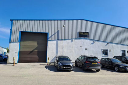
- Price
- £475,000
- Size
- 0.1 acres
Added on 15/05/2026Industrial Land