Fingle Bridge Inn, Drewsteignton, Exeter, Devon, EX6
Key Features
- First time ever on the open market
- Over 125 years of continuous hospitality history
- Landmark riverside Inn in a unique Dartmoor National Park setting
- Highly successful, profitable business with scope for weddings, events and extended trading.
- Extensive inside and outside trading areas.
- Substantial owner's accommodation, with flexible options for family use or letting.
Description
History & Heritage
For the very first time in its history, the Fingle Bridge Inn is being offered for sale on the open market. This landmark riverside Inn, steeped in more than a century of hospitality,
represents a rare chance to acquire a thriving and very profitable business and substantial property in one of Dartmoor National Park's most celebrated settings. Beautifully positioned beside the historic stone arches of Fingle Bridge on the River Teign, the Inn has long been a place of welcome for walkers, anglers, families and travellers. Its combination of heritage, natural beauty and trading success make it an offering of unique distinction - a property and business that simply cannot be replicated.
The story of Fingle Bridge Inn begins in 1897, when Jesse Ashplant first welcomed fishermen, grain carriers and early tourists to a simple tea shelter by the bridge. Over the years it grew into The Anglers Rest public house, before evolving into the Fingle Bridge Inn we know today. Although remaining in the original family ownership, the Inn underwent a total rebuild in 1957 resulting in the building that we see today. For more than 125 years, hospitality has been at the heart of the property, cherished by generations of visitors, with the current operators adding over 20 years of successful stewardship.
The Fingle Bridge Inn is a thriving food-led hospitality business, currently split approximately 70/30 in favour of food to wet sales. The atmospheric bar and restaurant
together seat over 130 covers, while the riverside terraces can accommodate a further 145 diners in what must be one of the South West's most enchanting outdoor pub settings.
In addition to its daily trade the Inn has historically been a very sort-after wedding reception and events venue, with the restaurant able to seat 120 guests for formal occasions.
There is scope to extend these offerings alongside the potential to increase opening hours and further raise the profile of the Inn through destination marketing. The property's generous living accommodation also adds significant commercial value.
The three-bedroom house and adjoining four-bedroom apartment make the Inn uniquely well-suited to a multi-generational family operation, offering the chance to live and work together in a private yet connected arrangement. Alternatively, the surplus accommodation could be developed into holiday lets, meeting the strong demand for high-quality visitor
accommodation in this part of Dartmoor. The ensuite layout of much of the apartment also lends itself naturally to letting rooms, whether catering for walkers, wedding parties
or longer-stay visitors.
The Fingle Bridge Inn is far more than a successful riverside Freehouse pub and restaurant. It is a piece of Dartmoor's history, woven irretrievably into the landscape. Its exceptional setting on the River Teign in Devon, together with its generous living accommodation and versatile trading space, make it an offering without parallel. For the incoming owner, the Fingle Bridge Inn offers the rare flexibility to be whatever its next custodian wishes it to be a lifestyle purchase, a business venture, or both. It combines the chance to live in one of the South West's most beautiful valleys with the opportunity to run a profitable enterprise supported by multiple income streams. With weddings, events, holiday letting and extended trading as all possible avenues, the Inn is perfectly placed for its next chapter.
Summer Trading hours
Monday and Tuesday: Open 11am-5pm Food: 11am-3pm
Wednesday -Saturday: Open 11am-9pm Food:11am-8pm
Sunday: Open 11am-5.30pm Food:11am-4.30pm
Winter opening hours may differ.
The pub is usually closed for two weeks in January.
Map Location
Property details
- Tenure
- Freehold
- Council Tax Band
- Ask Agent
- Date Posted
- 2026-01-29
Utilities & Restrictions
Utilities
- Electricity
- Ask Agent
- Water
- Ask Agent
- Heating
- Ask Agent
- Broadband
- Ask Agent
- Sewerage
- Ask Agent
Rights & Restrictions
- Public Rights of Way
- Ask Agent
- Private Rights of Way
- Ask Agent
- Listed Property
- Ask Agent
- Restrictions
- Ask Agent
Listed status, conservation areas and planning constraints for this location are in the full report.
Property Features
- Accessibility
- Ask Agent
- Parking
- Private Parking
- Garden
- Ask Agent
Beyond the particulars: planning activity, flood history, heritage and ground risks, checked for this exact spot.
Connectivity
Broadband
Fastest speed available at this postcode
15 Mbps
Standard (10-30 Mbps)
Suitable for
- Web & social
- Music streaming
- Standard video calls
Mobile signal
Predicted 4G and 5G signal; indoor signal depends on building materials.
Ofcom Connected Nations postcode-level predictions. Speeds and signal are modelled, not measured, and vary between addresses and providers.
Signal is the easy part. Planning activity, flood history and protected designations here are in the full report.
Nearest Schools
Primary
- Moretonhampstead Primary School2.3 milesNo Ofsted rating
- Ages
- 2 to 11
- Pupils
- 116
- Type
- Academy converter
- Chagford Church of England Primary School2.8 milesOfsted: Good
- Ages
- 2 to 11
- Pupils
- 137
- Type
- Academy converter
- Faith
- Church of England
- Cheriton Bishop Community Primary School2.9 milesOfsted report card · Feb 2026
- Ages
- 2 to 11
- Pupils
- 115
- Type
- Academy converter
- Dunsford Community Academy4.3 milesNo Ofsted rating
- Ages
- 2 to 11
- Pupils
- 97
- Type
- Academy converter
- Spreyton School5 milesOfsted: Good *
- Ages
- 3 to 11
- Pupils
- 30
- Type
- Foundation school
Secondary
- Queen Elizabeth's8.3 milesOfsted report card · May 2026
- Ages
- 11 to 18
- Pupils
- 1,096
- Type
- Academy converter
- Okehampton College10 milesOfsted report card · Jan 2026
- Ages
- 11 to 18
- Pupils
- 1,066
- Type
- Academy converter
- West Exe School11 milesOfsted report card · Jun 2026
- Ages
- 11 to 16
- Pupils
- 1,237
- Type
- Academy sponsor led
- Thomas Hall School11 milesOfsted: Requires improvement
- Ages
- 4 to 16
- Pupils
- 438
- Type
- Free schools
- Matford Brook Academy11 milesNo Ofsted rating
- Ages
- 2 to 16
- Pupils
- 276
- Type
- Free schools
* Latest graded judgement covers quality of education only; no overall grade was issued under the 2024-25 inspection framework.
Distances are straight-line from the advertised location. Source: the national school registers (DfE, Welsh Government, Scottish Government) and Ofsted.
Schools are just the start: sold prices nearby, planning activity and any flood history are in the full report.
Amenities
Supermarket
GP surgery
Pharmacy
Hospital
Green space
Straight-line distances from the advertised location. Sources: NHS records, Geolytix supermarket locations, OS Open Greenspace and the national trails registers.
The area stacks up? Now check the location itself: planning nearby, protected designations and past flooding.
Getting Around
Nearest station
Nearest bus stop
Typical drive times
Straight-line distances from the advertised location; drive times are typical free-flow times over OpenStreetMap road data, so allow more at peak. Public transport locations from DfT NaPTAN.
Easy to reach matters. So do planning activity, flood history and ground risks: all in the full report.
Flood Risk
Environment Agency open data, checked around the advertised map pin for the listed acreage. Long-term risk counts flood defences; the planning map's flood zones do not. Provided by LandSale, not the listing agent, and not part of the agent's particulars. Risk varies across a holding, so verify before committing.
Rivers and the sea
Planning map: Flood Zone 3.
Surface water
These bandings are the summary. Where this location sits on the flood maps, plus planning activity, heritage and ground risks, is in the full report.
Important notice: Information, maps and tags on this page are drawn from the advertising agent's marketing materials or generated automatically. LandSale has not verified them. Relying on these details is at your own risk, always carry out independent checks before committing to a purchase.
LandSale full disclaimer
Marketing information only - not formal particulars. The details on this website are provided for general guidance and do not constitute an offer or contract. Neither LandSale nor the advertising estate/land agent accepts responsibility for any inaccuracy.
1. Source of information
- Listing content: Core description, asking price, tenure, measurements, photographs and planning history originate from the marketing materials of the advertising estate or land agent. LandSale does not author this content and cannot guarantee its accuracy.
- Automated tags & categorisation: Property type, land-use class, acreage bands and similar labels may be applied by machine-learning models. They are intended as a helpful guide only and may not reflect the property's legal status or permitted use.
- Third-party & enriched data layers: Maps, boundary outlines, planning designations, soil reports, broadband coverage and other environmental or location-based insights are licensed from external suppliers. Such data are supplied “as is", may be incomplete or out of date and are subject to change without notice.
2. Verification required
Prospective purchasers must verify critical matters, including but not limited to planning permission, title boundaries, public rights of way, environmental constraints, acreage, services, access and VAT status, through their own inspections, specialist surveys, legal advisers and the selling agent before relying on the information or entering into any contract.
3. No warranty or liability
LandSale gives no warranty, express or implied, as to the accuracy, completeness or fitness for any particular purpose of the information displayed. LandSale shall not be liable for any loss, damage, cost or expense arising directly or indirectly from any use of or reliance on such information, save where liability may not be excluded by law.
4. Updates & feedback
If you believe any detail on this listing is inaccurate, please let us know. We will investigate and, where appropriate, update the listing or notify the agent.
© LandSale | Version 1.3 - August 2026
Listing agent
Vickery Holman, Leisure
Walsingham House, Newham Road, Truro, TR1 2DP
Similar properties for sale
 Added on 09/10/2026Commercial Land
- Price
- £1,300,000
- Size
- 0.33 acres
Added on 30/01/2026Industrial Land
- Price
- £1,105,000
- Size
- 0.26 acres
Added on 13/05/2026Industrial Land
- Price
- Guide Price£1,750,000
- Size
- 3.84 acres
Added on 29/01/2026Development Land Added on 25/03/2026Pub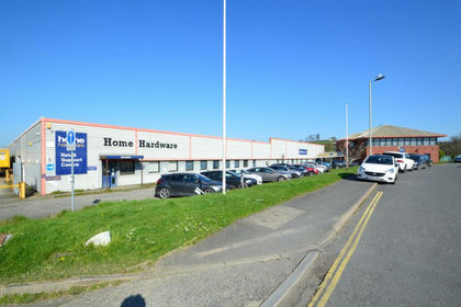
- Price
- £1,350,000
- Size
- 2.85 acres
Upcott Avenue, Pottington Business Park, Barnstaple, Barnstaple, Devon EX31 England
Added on 20/07/2026Warehouse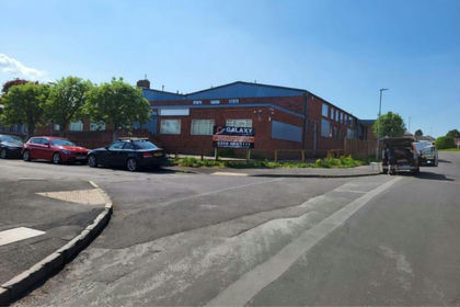
- Price
- Guide Price£1,250,000
- Size
- 0.49 acres
Blackdown Business Park, Sylvan Road, Wellington, Somerset, TA21, Wellington, Somerset TA21 England
Added on 16/04/2026Commercial Land