Sandleheath, Fordingbridge, SP6
- Bedrooms
- 4
- Bathrooms
- 3
Description
A newly built four-bedroom detached home of approximately 2,220 sq ft, finished to an exceptional specification with far-reaching views over surrounding farmland.
Acorns is a newly constructed detached house built by local developers Healthy Developments to a specification well beyond that of a typical new build. Positioned to take full advantage of its countryside setting, the house enjoys far-reaching views over surrounding farmland and has been designed with health and wellbeing at its heart, using natural and low-emission materials, plastic-free paints, traditionally wet plastered walls and a whole-house fresh air system. A striking vaulted entrance hall rises the full height of the building to a galleried landing, and the ground floor is centred on a superb open-plan kitchen/dining/sitting room with a hand-built solid wood kitchen. There are two bedrooms and a bathroom on the ground floor, and two further bedrooms on
the first floor, each with its own en-suite bathroom. The house is heated by an air source heat pump with underfloor heating throughout the ground floor, has an EPC rating of B and comes with a 10-year structural warranty.
The property sits within a wrap-around lawned garden, with a further area laid to wildflower meadow creating a natural, low-maintenance extension of the garden. A paved terrace adjoins the house and there is off-road parking for multiple vehicles.
Specification: Nuaire mechanical ventilation heat recovery system.
Bosch air-source heat pump and hot water cylinder.
Underfloor heating throughout the ground floor.
Solid wood kitchen with quartz worktops and Little Greene low-VOC eggshell to the cabinets. Traditionally wet plastered walls.
Edward Bulmer plastic-free paints to all walls and ceilings.
Artisan of Devizes tiling throughout.
Natural wool carpets to the bedrooms.
Healthy Developments' patented low electromagnetic radiation wiring design.
10-year structural warranty.
New Forest District Council. Band G.
Air source heat pump with underfloor heating throughout the ground floor. Mechanical ventilation heat recovery system.
ANTI-MONEY LAUNDERING REGULATION
We are legally required to conduct Anti-Money Laundering checks on all parties involved in the sale of a property - i.e. both buyers and sellers. We use a service offered by The Guild of Property Professionals called Verify365 to perform these checks. This is a service offered to Estate Agents who are members of the Guild of Property Professionals. These checks must be completed before a property is listed for sale and as soon as an offer is accepted (before we send out the Memorandum of Sale). There is a non-refundable fee of £25 (plus VAT) per person. Note: Woolley & Wallis receive a portion of this fee to cover our administration costs in processing these legal checks.
What3Words ///locker.drips.orbited
Acorns is situated in the popular village of Sandleheath, which has a village shop, village hall and a thriving tennis club. The Avonside town of Fordingbridge provides a comprehensive range of day-to-day services, including shops, restaurants, a library and a health centre, with schooling in both the state and private sectors in the area. The New Forest National Park lies a short distance to the east, offering a wealth of walking, riding and cycling, with sailing on the coast and golf at a number of highly regarded courses nearby.
Ringwood (approx. 9 miles) offers further shopping at the Furlong Shopping Centre. The excellent communications network allows ready access to the regional centres of Salisbury, Bournemouth and Southampton; Salisbury has a
direct rail service to London Waterloo, the M27 and M3 provide road links to London and there are airports at Bournemouth and Southampton.
Map Location
Property details
- Tenure
- Freehold
- Council Tax Band
- G
- Date Posted
- 2026-11-16
Energy Performance Certificate
Energy Efficiency Rating
Based on UK Energy Performance Certificate standards (EU Directive 2002/91/EC)
Running costs are one side. Planning activity, flood history and ground risks for this location are in the full report.
Utilities & Restrictions
Utilities
- Electricity
- Ask Agent
- Water
- Ask Agent
- Heating
- Ask Agent
- Broadband
- Ask Agent
- Sewerage
- Ask Agent
Rights & Restrictions
- Public Rights of Way
- Ask Agent
- Private Rights of Way
- Ask Agent
- Listed Property
- Ask Agent
- Restrictions
- Ask Agent
Listed status, conservation areas and planning constraints for this location are in the full report.
Property Features
- Accessibility
- Ask Agent
- Parking
- Parking Available
- Garden
- Garden
Beyond the particulars: planning activity, flood history, heritage and ground risks, checked for this exact spot.
Connectivity
Broadband
Fastest speed available at this postcode
1 Gbps
Gigabit full fibre · available to 33% of premises
Suitable for
- 4K streaming on every screen
- Full-time home working
- Online gaming & big downloads
Mobile signal
Predicted 4G and 5G signal; indoor signal depends on building materials.
Ofcom Connected Nations postcode-level predictions. Speeds and signal are modelled, not measured, and vary between addresses and providers.
Signal is the easy part. Planning activity, flood history and protected designations here are in the full report.
Nearest Schools
Primary
- St James' Church of England First School and Nursery, Alderholt1.4 milesNo Ofsted rating
- Ages
- 2 to 9
- Pupils
- 125
- Type
- Academy converter
- Faith
- Church of England
- Fordingbridge Junior School1.5 milesOfsted: Good
- Ages
- 7 to 11
- Pupils
- 217
- Type
- Community school
- Fordingbridge Infant School1.5 milesNo Ofsted rating
- Ages
- 4 to 7
- Pupils
- 160
- Type
- Community school
- Western Downland Church of England Aided Primary School2.2 milesNo Ofsted rating
- Ages
- 2 to 11
- Pupils
- 160
- Type
- Voluntary aided school
- Faith
- Church of England
- Breamore Church of England Primary School2.8 milesOfsted: Good *
- Ages
- 4 to 11
- Pupils
- 77
- Type
- Voluntary controlled school
- Faith
- Church of England
Secondary
- The Burgate School and Sixth Form1.6 milesNo Ofsted rating
- Ages
- 11 to 18
- Pupils
- 1,073
- Type
- Academy converter
- Cranborne Middle School4.2 milesNo Ofsted rating
- Ages
- 9 to 13
- Pupils
- 265
- Type
- Community school
- Emmanuel Church of England Middle School4.8 milesOfsted: Good
- Ages
- 9 to 13
- Pupils
- 434
- Type
- Academy sponsor led
- Faith
- Church of England
- The Trafalgar School at Downton5 milesOfsted: Good
- Ages
- 11 to 16
- Pupils
- 808
- Type
- Academy converter
- Ringwood School Academy6 milesNo Ofsted rating
- Ages
- 11 to 18
- Pupils
- 1,592
- Type
- Academy converter
* Latest graded judgement covers quality of education only; no overall grade was issued under the 2024-25 inspection framework.
Distances are straight-line from the advertised location. Source: the national school registers (DfE, Welsh Government, Scottish Government) and Ofsted.
Schools are just the start: sold prices nearby, planning activity and any flood history are in the full report.
Amenities
Supermarket
GP surgery
Pharmacy
Hospital
Green space
Straight-line distances from the advertised location. Sources: NHS records, Geolytix supermarket locations, OS Open Greenspace and the national trails registers.
The area stacks up? Now check the location itself: planning nearby, protected designations and past flooding.
Getting Around
Nearest station
Nearest bus stop
Typical drive times
Straight-line distances from the advertised location; drive times are typical free-flow times over OpenStreetMap road data, so allow more at peak. Public transport locations from DfT NaPTAN.
Easy to reach matters. So do planning activity, flood history and ground risks: all in the full report.
Flood Risk
Environment Agency open data, checked around the advertised map pin for the listed acreage. Long-term risk counts flood defences; the planning map's flood zones do not. Provided by LandSale, not the listing agent, and not part of the agent's particulars. Risk varies across a holding, so verify before committing.
Rivers and the sea
Planning map: Flood Zone 1.
Surface water
These bandings are the summary. Where this location sits on the flood maps, plus planning activity, heritage and ground risks, is in the full report.
Important notice: Information, maps and tags on this page are drawn from the advertising agent's marketing materials or generated automatically. LandSale has not verified them. Relying on these details is at your own risk, always carry out independent checks before committing to a purchase.
LandSale full disclaimer
Marketing information only - not formal particulars. The details on this website are provided for general guidance and do not constitute an offer or contract. Neither LandSale nor the advertising estate/land agent accepts responsibility for any inaccuracy.
1. Source of information
- Listing content: Core description, asking price, tenure, measurements, photographs and planning history originate from the marketing materials of the advertising estate or land agent. LandSale does not author this content and cannot guarantee its accuracy.
- Automated tags & categorisation: Property type, land-use class, acreage bands and similar labels may be applied by machine-learning models. They are intended as a helpful guide only and may not reflect the property's legal status or permitted use.
- Third-party & enriched data layers: Maps, boundary outlines, planning designations, soil reports, broadband coverage and other environmental or location-based insights are licensed from external suppliers. Such data are supplied “as is", may be incomplete or out of date and are subject to change without notice.
2. Verification required
Prospective purchasers must verify critical matters, including but not limited to planning permission, title boundaries, public rights of way, environmental constraints, acreage, services, access and VAT status, through their own inspections, specialist surveys, legal advisers and the selling agent before relying on the information or entering into any contract.
3. No warranty or liability
LandSale gives no warranty, express or implied, as to the accuracy, completeness or fitness for any particular purpose of the information displayed. LandSale shall not be liable for any loss, damage, cost or expense arising directly or indirectly from any use of or reliance on such information, save where liability may not be excluded by law.
4. Updates & feedback
If you believe any detail on this listing is inaccurate, please let us know. We will investigate and, where appropriate, update the listing or notify the agent.
© LandSale | Version 1.3 - August 2026
Contact Woolley & Wallis, Fordingbridge
33 Salisbury Street, Fordingbridge, SP6 1AB
View agent profileSimilar properties for sale
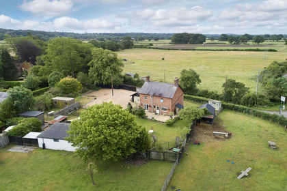
- Price
- Guide Price£795,000
- Size
- 1.1 acres
Fordingbridge - Equestrian Residential With Further Potential, Fordingbridge, Hampshire SP6 England
Added on 14/06/2026House with Land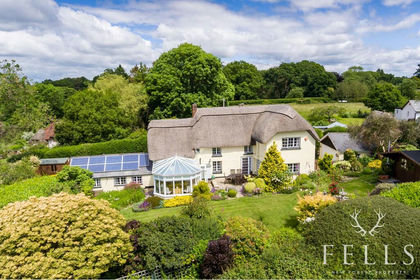
- Price
- Guide Price£950,000
- Size
- 0.34 acres
Added on 16/11/2026Cottage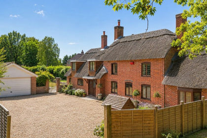
- Price
- Offers in Excess of£800,000
- Size
- 0.75 acres
Ibsley Drove, Ibsley, Ringwood, BH24, Ellingham, Harbridge and Ibsley, Hampshire BH24 England
Added on 16/11/2026Cottage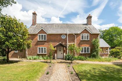
- Price
- Guide Price£1,200,000
- Size
- 1.2 acres
Rockford, Ringwood, BH24, Ellingham, Harbridge and Ibsley, Hampshire BH24 England
Added on 28/05/2026Cottage
- Price
- Guide Price£850,000
- Size
- 0.6 acres
Wick Lane, Downton, Salisbury, Wiltshire, SP5, Downton, Wiltshire SP5 England
Added on 16/11/2026Cottage
- Price
- Guide Price£750,000
- Size
- 3.6 acres
Jubilee Hill, Woodlands, Wimborne, Woodlands, Dorset BH21 England
Added on 13/11/2026Equestrian property
- Price
- Guide Price£1,195,000
- Size
- 3.1 acres
New Forest near Ringwood, Hampshire, Ringwood, Hampshire BH24 England
Added on 22/06/2026Equestrian property
- Price
- £1,200,000
- Size
- 1.75 acres
Added on 01/09/2026House with Land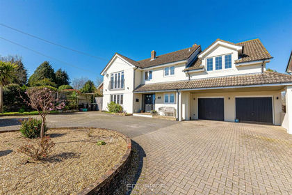
- Price
- Guide Price£1,200,000
- Size
- 1.75 acres
Added on 03/05/2026House with Land
- Price
- £1,175,000
- Size
- 1.25 acres
Hurn Road, RINGWOOD, BH24, St. Leonards and St. Ives, Dorset BH24 England
Added on 06/10/2026House with Land