Lammack Road, Blackburn
- Land size
- 0.12 acres
Key Features
- Building plot with planning permission
- Freehold
- Consent for 2.5 storey house
- Rural outlook
- Services readily available
Description
An individual plot on the northern boundary of Blackburn with Ribble Valley in a popular and convenient locality. Outline consent for 2.5 storey large detached dwelling with car parking and rural outlooks close to open countryside and yet convenient for schools as well as a range of retail and leisure and community facilities. Blackburn town centre is within three miles.
The plot will be offered for sale by Auction unless previously sold - Offers In Excess Of £85,000 invited.
PLOT SIZE 500m2 (0.12 acres) or thereabouts
PLANNING PERMISSION Reference Number: 10/26/0759
Decision Date: 28th October 2026
This is in outline only with all matters reserved for a subsequent application (reserved matters), these being access, appearance, landscaping, layout and scale.
The indicative layout shown on the approved outline plan indicates a dwelling of 2.5 storeys of 220m2 (2367 ft2) gross external measurement but this will need to be the subject to a detailed design application. There is scope to increase this building footprint, particularly noting the ground level falling away to the rear of the plot and distance between new houses on the land to the East. Copies of the Planning Decision Notice and Confirmed Public Footpath Diversion Order are available on request.
GENERAL A rare opportunity to construct an individual designed self build house within a popular edge of settlement location adjacent to Ribble Valley's open countryside, yet close to all urban amenities.
TENURE Freehold
SERVICES Readily available
PLEASE NOTE The public footpath diversion adjacent to the northerly boundary and watercourse has been formally confirmed by the Local Authority.
VIEWING ARRANGEMENTS Viewing at any reasonable time - further detailed enquiries to Richard Prest - Richard. Please Note that Lea Hough & Co's partners/consultants have a legal interest in the property being offered for sale.
OFFERS Offers should be unconditional save for contract clearly stating, the buyer, current address, appointed solicitor with proof of funding.
Map Location
Property details
- Tenure
- Freehold
- Council Tax Band
- Ask Agent
- Date Posted
- 2026-11-16
Utilities & Restrictions
Utilities
- Electricity
- Ask Agent
- Water
- Ask Agent
- Heating
- Ask Agent
- Broadband
- Ask Agent
- Sewerage
- Ask Agent
Rights & Restrictions
- Public Rights of Way
- Ask Agent
- Private Rights of Way
- Ask Agent
- Listed Property
- Ask Agent
- Restrictions
- Ask Agent
Listed status, conservation areas and planning constraints for this location are in the full report.
Property Features
- Accessibility
- Ask Agent
- Parking
- Parking Available
- Garden
- Ask Agent
Beyond the particulars: planning activity, flood history, heritage and ground risks, checked for this exact spot.
Connectivity
Broadband
Fastest speed available at this postcode
10 Gbps
Gigabit full fibre
Suitable for
- 4K streaming on every screen
- Full-time home working
- Online gaming & big downloads
Fixed wireless access may also be an option here.
Mobile signal
Predicted 4G and 5G signal; indoor signal depends on building materials.
Ofcom Connected Nations postcode-level predictions. Speeds and signal are modelled, not measured, and vary between addresses and providers.
Signal is the easy part. Planning activity, flood history and protected designations here are in the full report.
Nearest Schools
Primary
- Lammack Primary School218 metresNo Ofsted rating
- Ages
- 4 to 11
- Pupils
- 548
- Type
- Community school
- St Gabriel's Church of England Primary School0.6 milesOfsted: Good
- Ages
- 5 to 11
- Pupils
- 212
- Type
- Voluntary aided school
- Faith
- Church of England
- Holy Souls Roman Catholic Primary School Blackburn0.7 milesOfsted: Good
- Ages
- 3 to 11
- Pupils
- 189
- Type
- Voluntary aided school
- Faith
- Roman Catholic
- St James' Church of England Primary School Blackburn0.9 milesNo Ofsted rating
- Ages
- 2 to 11
- Pupils
- 395
- Type
- Voluntary aided school
- Faith
- Church of England
- Cedars Primary School1 mileOfsted: Good
- Ages
- 3 to 11
- Pupils
- 407
- Type
- Community school
Secondary
- Pleckgate High School691 metresOfsted: Outstanding
- Ages
- 11 to 16
- Pupils
- 1,339
- Type
- Academy sponsor led
- Queen Elizabeth's Grammar School1 mileOfsted: Good
- Ages
- 11 to 19
- Pupils
- 873
- Type
- Free schools
- Tauheedul Islam Girls' High School1.1 milesOfsted: Outstanding
- Ages
- 11 to 18
- Pupils
- 866
- Type
- Academy converter
- Faith
- Muslim
- Gender
- Girls
- St Wilfrid's Church of England Academy1.8 milesNo Ofsted rating
- Ages
- 11 to 18
- Pupils
- 1,483
- Type
- Academy converter
- Faith
- Church of England
- Tauheedul Islam Boys' High School1.8 milesOfsted: Outstanding
- Ages
- 11 to 18
- Pupils
- 746
- Type
- Free schools
- Faith
- Muslim
- Gender
- Boys
Distances are straight-line from the advertised location. Source: the national school registers (DfE, Welsh Government, Scottish Government) and Ofsted.
Schools are just the start: sold prices nearby, planning activity and any flood history are in the full report.
Amenities
Supermarket
GP surgery
Pharmacy
Hospital
Green space
Straight-line distances from the advertised location. Sources: NHS records, Geolytix supermarket locations, OS Open Greenspace and the national trails registers.
The area stacks up? Now check the location itself: planning nearby, protected designations and past flooding.
Getting Around
Nearest station
Nearest bus stop
Typical drive times
Straight-line distances from the advertised location; drive times are typical free-flow times over OpenStreetMap road data, so allow more at peak. Public transport locations from DfT NaPTAN.
Easy to reach matters. So do planning activity, flood history and ground risks: all in the full report.
Flood Risk
Environment Agency open data, checked around the advertised map pin for the listed acreage. Long-term risk counts flood defences; the planning map's flood zones do not. Provided by LandSale, not the listing agent, and not part of the agent's particulars. Risk varies across a holding, so verify before committing.
Rivers and the sea
Planning map: Flood Zone 1.
Surface water
These bandings are the summary. Where this location sits on the flood maps, plus planning activity, heritage and ground risks, is in the full report.
Important notice: Information, maps and tags on this page are drawn from the advertising agent's marketing materials or generated automatically. LandSale has not verified them. Relying on these details is at your own risk, always carry out independent checks before committing to a purchase.
LandSale full disclaimer
Marketing information only - not formal particulars. The details on this website are provided for general guidance and do not constitute an offer or contract. Neither LandSale nor the advertising estate/land agent accepts responsibility for any inaccuracy.
1. Source of information
- Listing content: Core description, asking price, tenure, measurements, photographs and planning history originate from the marketing materials of the advertising estate or land agent. LandSale does not author this content and cannot guarantee its accuracy.
- Automated tags & categorisation: Property type, land-use class, acreage bands and similar labels may be applied by machine-learning models. They are intended as a helpful guide only and may not reflect the property's legal status or permitted use.
- Third-party & enriched data layers: Maps, boundary outlines, planning designations, soil reports, broadband coverage and other environmental or location-based insights are licensed from external suppliers. Such data are supplied “as is", may be incomplete or out of date and are subject to change without notice.
2. Verification required
Prospective purchasers must verify critical matters, including but not limited to planning permission, title boundaries, public rights of way, environmental constraints, acreage, services, access and VAT status, through their own inspections, specialist surveys, legal advisers and the selling agent before relying on the information or entering into any contract.
3. No warranty or liability
LandSale gives no warranty, express or implied, as to the accuracy, completeness or fitness for any particular purpose of the information displayed. LandSale shall not be liable for any loss, damage, cost or expense arising directly or indirectly from any use of or reliance on such information, save where liability may not be excluded by law.
4. Updates & feedback
If you believe any detail on this listing is inaccurate, please let us know. We will investigate and, where appropriate, update the listing or notify the agent.
© LandSale | Version 1.3 - August 2026
Similar properties for sale
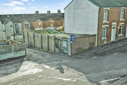
- Price
- Guide Price£55,000
Added on 29/01/2026Building Plot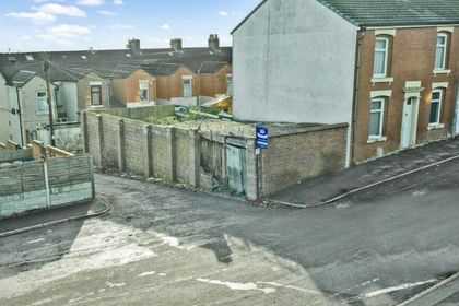
- Price
- Guide Price£55,000
Chatburn Street, Blackburn, Lancashire, BB2, Blackburn, Blackburn with Darwen BB2 England
Added on 29/01/2026Building Plot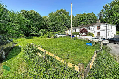
- Price
- Guide Price£90,000
- Size
- 0.25 acres
Land with planning, Darwen, Blackburn with Darwen BB3 England
Added on 30/05/2026Building Plot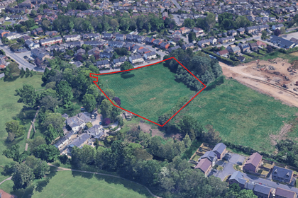
- Price
- Offers Invited£100,000
- Size
- 2.48 acres
Land at Preston Road, Grimsargh, Lancashire, Grimsargh, Lancashire PR2 England
Added on 05/11/2026Development Land Added on 26/03/2026Self Build Plot
- Price
- £45,000
- Size
- 0.06 acres
Wray Crescent, Leyland, Ulnes Walton, Lancashire PR26 England
Added on 10/11/2026Building Plot
- Price
- Guide Price£65,000
Chorley Old Road, Bolton, BL1, Bolton West, Bolton BL1 England
Added on 18/09/2026Building Plot
- Price
- Guide Price£100,000
- Size
- 0.165 acres
Land off Lancaster Road, Overton, Morecambe, Lancashire LA3, Overton, Lancashire LA3 England
Added on 03/11/2026Development Land
- Price
- Guide Price£100,000
5 - 7 St. Peters Place, Fleetwood, Lancashire FY7, Fleetwood, Lancashire FY7 England
Added on 05/11/2026Conversion Land Added on 05/09/2026Building Plot