Beach House & Old Pottery, West Myre, Sanday, KW17
- Land size
- 3.37 acres
Key Features
- EXCEPTIONAL RURAL OPPORTUNITY
- APPROXIMATELY 3.367 ACRES
- EXISTING BUILDINGS
- WATER AND ELECTRICITY TO SITE
- VIEWS AND A SHORT STROLL TO A STUNNING SANDY BEACH
- WHAT3WORDS LOCATION; ///opts.swimmer.common
- TO VIEW CONTACT OUR OFFICE OR SIMPLY VISIT THE SITE
Description
Situated in an enviable position looking over to the beautiful Pool Bay on the island of Sanday, this attractive site extends to approximately 3.367 acres (13,629sqm) and enjoys stunning views across the bay and surrounding farmland. Located just a short stroll from a white sandy beach and with direct roadside access, it offers an excellent opportunity to acquire a substantial parcel of land in a highly desirable setting.
The property comprises a traditional stone-built barn, a store and the remains of a former house, presenting a range of possibilities for future use. Some improvement works have already been undertaken, with the existing buildings benefiting from upgrades, resulting in structures that appear largely wind and watertight. The buildings are currently used for storage purposes.
Water and electricity are connected to the site (untested), providing a useful base for ongoing use or future development, subject to the necessary consents.
Extending to approximately 3.3677 acres, the grounds offer potential for a range of recreational uses, subject to any required permissions. Buyers considering development opportunities should note that no planning permission is currently in place, and any future proposals would be subject to approval from the relevant authorities.
Interested parties should make their own enquiries regarding any potential future development.
SERVICES
ELECTRICITY AND WATER TO SITE
COUNCIL TAX -N/A
EPC - N/A
VIEWINGS
By appointment only, arranged through K Allan Properties or simply visit the site.
Call 01856 876377 or email info@kallanproperties.co.uk
OFFERS TO
K Allan Properties
Watergate
Kirkwall
KW15 1PD
info@kallanproperties.co.uk
BEST ESTATE AGENT GUIDE
When you choose to work with us, you are officially working with one of the UK's Best Estate Agents. We first received this award in 2023 for sales and are delighted to have been recognised for our high standard of work every year since.
The very best agents are listed in The Best Estate Agent Guide – a website for sellers to help them choose who the best agents are in their area. If you want to achieve the best results for your property sale, while receiving the best customer service, we would love to help.
ANTI MONEY LAUNDERING LEGISLATION
As with all Estate Agents, K Allan Properties are subject to Anti Money Laundering Regulations. These regulations require us, as selling agents, to perform various checks on the property buyers. We will require certified photographic evidence of the buyer’s identity and proof of address on a recent utility statement. We are unable to progress any sale to completion until these requirements have been fully satisfied.
DISCLAIMER
Whilst we endeavour to make these particulars accurate, they do not offer/form any part of a contract on offer and are not guaranteed. Measurements are approximate. We have not tested electricity, gas, water services or any appliances. Photographs may have been taken with a wide-angle lens.
Map Location
Property details
- Tenure
- Freehold
- Council Tax Band
- Ask Agent
- Date Posted
- 2026-11-09
Market Value Analysis
Compared with 152 Development Land listings in Scotland (1+ acres).
Property Brochure
Seen the details? The full report adds the independent checks: planning activity, flood history, heritage and ground.
Utilities & Restrictions
Utilities
- Electricity
- Mains
- Water
- Mains
- Heating
- Ask Agent
- Broadband
- Ask Agent
- Sewerage
- Ask Agent
Rights & Restrictions
- Public Rights of Way
- Ask Agent
- Private Rights of Way
- Ask Agent
- Listed Property
- Ask Agent
- Restrictions
- Ask Agent
Listed status, conservation areas and planning constraints for this location are in the full report.
Property Features
- Accessibility
- Ask Agent
- Parking
- Off Street Parking
- Garden
- Garden
Beyond the particulars: planning activity, flood history, heritage and ground risks, checked for this exact spot.
Connectivity
Broadband
Fastest speed available at this postcode
1.8 Gbps
Gigabit full fibre · available to 89% of premises
Suitable for
- 4K streaming on every screen
- Full-time home working
- Online gaming & big downloads
Mobile signal
Predicted 4G and 5G signal; indoor signal depends on building materials.
Ofcom Connected Nations postcode-level predictions. Speeds and signal are modelled, not measured, and vary between addresses and providers.
Signal is the easy part. Planning activity, flood history and protected designations here are in the full report.
Nearest Schools
Primary
- Sanday Community School3.1 miles
- Pupils
- 29
- Type
- Non-denominational
- Eday Primary School5.9 miles
- Pupils
- 10
- Type
- Non-denominational
- Stronsay Junior High School7.6 miles
- Pupils
- 21
- Type
- Non-denominational
- Papa Westray Community School12 miles
- Pupils
- 7
- Type
- Non-denominational
- Rousay Primary School12 miles
- Pupils
- 13
- Type
- Non-denominational
Secondary
- Sanday Community School3.1 miles
- Pupils
- 25
- Type
- Non-denominational
- Stronsay Junior High School7.6 miles
- Pupils
- 16
- Type
- Non-denominational
- Westray Junior High School13 miles
- Pupils
- 35
- Type
- Non-denominational
- Kirkwall Grammar School20 miles
- Pupils
- 861
- Type
- Non-denominational
- Stromness Academy29 miles
- Pupils
- 338
- Type
- Non-denominational
Distances are straight-line from the advertised location. Source: the national school registers (DfE, Welsh Government, Scottish Government) and Ofsted.
Schools are just the start: planning activity, heritage and any flood history here are in the full report.
Amenities
Supermarket
GP surgery
Pharmacy
Straight-line distances from the advertised location. Sources: NHS records, Geolytix supermarket locations, OS Open Greenspace and the national trails registers.
The area stacks up? Now check the location itself: planning nearby, protected designations and past flooding.
Getting Around
Nearest station
Nearest bus stop
Typical drive times
Straight-line distances from the advertised location; drive times are typical free-flow times over OpenStreetMap road data, so allow more at peak. Public transport locations from DfT NaPTAN.
Easy to reach matters. So do planning activity, flood history and ground risks: all in the full report.
Flood Risk
SEPA open data, checked around the advertised map pin for the listed acreage. Provided by LandSale, not the listing agent, and not part of the agent's particulars. Risk varies across a holding, so verify before committing.
Rivers and the sea
Surface water
These bandings are the summary. Where this location sits on the flood maps, plus planning activity, heritage and ground risks, is in the full report.
Important notice: Information, maps and tags on this page are drawn from the advertising agent's marketing materials or generated automatically. LandSale has not verified them. Relying on these details is at your own risk, always carry out independent checks before committing to a purchase.
LandSale full disclaimer
Marketing information only - not formal particulars. The details on this website are provided for general guidance and do not constitute an offer or contract. Neither LandSale nor the advertising estate/land agent accepts responsibility for any inaccuracy.
1. Source of information
- Listing content: Core description, asking price, tenure, measurements, photographs and planning history originate from the marketing materials of the advertising estate or land agent. LandSale does not author this content and cannot guarantee its accuracy.
- Automated tags & categorisation: Property type, land-use class, acreage bands and similar labels may be applied by machine-learning models. They are intended as a helpful guide only and may not reflect the property's legal status or permitted use.
- Third-party & enriched data layers: Maps, boundary outlines, planning designations, soil reports, broadband coverage and other environmental or location-based insights are licensed from external suppliers. Such data are supplied “as is", may be incomplete or out of date and are subject to change without notice.
2. Verification required
Prospective purchasers must verify critical matters, including but not limited to planning permission, title boundaries, public rights of way, environmental constraints, acreage, services, access and VAT status, through their own inspections, specialist surveys, legal advisers and the selling agent before relying on the information or entering into any contract.
3. No warranty or liability
LandSale gives no warranty, express or implied, as to the accuracy, completeness or fitness for any particular purpose of the information displayed. LandSale shall not be liable for any loss, damage, cost or expense arising directly or indirectly from any use of or reliance on such information, save where liability may not be excluded by law.
4. Updates & feedback
If you believe any detail on this listing is inaccurate, please let us know. We will investigate and, where appropriate, update the listing or notify the agent.
© LandSale | Version 1.3 - August 2026
Contact K Allan Properties Ltd, Kirkwall
Watergate House Watergate, St. Ola, Orkney, KW15 1PD
View agent profileSimilar properties for sale
- Price
- Offers Over£40,000
- Size
- 7 acres
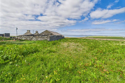
Land & Ruins Of Leaquoy, Stronsay, Orkney and Shetland, Orkney Islands KW17 Scotland
Added on 18/03/2026Grazing Land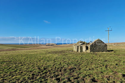
- Price
- Offers Over£60,000
- Size
- 1 acres
Langquoy, Sandwick, Orkney, KW16, Sandwick, Orkney Islands KW16 Scotland
Added on 14/10/2026Building Plot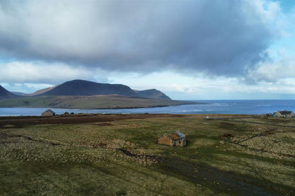
- Price
- Offers Over£60,000
- Size
- 14 acres
Quoynaknap, Graemsay, Orkney, KW16, Graemsay, Orkney Islands KW16 Scotland
Added on 22/04/2026Development Land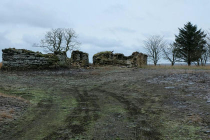
- Price
- Offers Over£50,000
- Size
- 1 acres
Watten, Wick, Highland. KW1, Caithness, Sutherland and Easter Ross, Highland KW1 Scotland
Added on 29/01/2026Development Land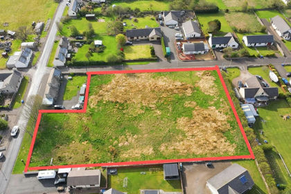
- Price
- Offers Over£59,000
- Size
- 1 acres
Potential plot, George Street, Halkirk, Caithness, KW12, Halkirk, Highland KW12 Scotland
Added on 29/01/2026Building Plot