Parc Bwyd Sir Benfro, Heol Llwyn Helyg, Hwlffordd, SA62
- Land size
- 9.3 acres
- Use Class
- Use Class: B1
Key Features
- Plotiau Datblygu Cynhyrchu a Dosbarthu
- Safleoedd ar gael fel Cyfan neu wedi'u Rhannu yn ôl yr angen
- Lesddaliadau Tir Newydd 125 Mlynedd
- Safleoedd Cyflogaeth Strategol
- Bwyd a Diod Penodol i'r Sector
Description
DISGRIFIAD
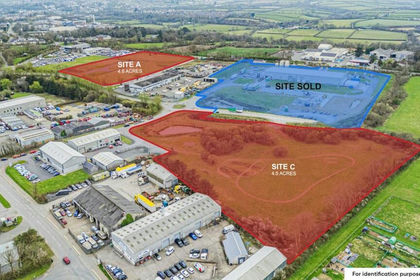
Mae'r Parc Bwyd wedi'i leoli o fewn Parc Busnes Llwyn Helyg ac mae'n darparu cyfleoedd twf i ystod eang o ddeiliaid sy'n gweithredu o fewn y sector bwyd a diod.
Mae Plot A yn ymestyn i 4.8 erw ac mae ar gael ar gyfer datblygiad sengl / meddiannwr neu wedi'i rannu o tua 0.7 erw i fyny yn dibynnu ar y gofyniad - Ar gael.
Mae Plot B wedi'i werthu ac wedi'i ddatblygu - Wedi'i werthu.
Mae Plot C yn ymestyn i 4.5 erw a gellir ei rannu'n ddau neu ei ddatblygu fel un cyfan - Ar gael.
LLEOLIAD
Mae'r Parc Bwyd wedi'i leoli wrth ymyl Maes Awyr Hwlffordd ac mae'n gorwedd yn uniongyrchol i'r dwyrain o gefnffordd yr A40 gan ganiatáu mynediad hawdd i derfynfeydd fferi Abergwaun a Doc Penfro yn ogystal â thuag at Gaerfyrddin a'r M4 i'r dwyrain.
Ar hyn o bryd mae'r Parc yn gartref i Hufenfa Sir Benfro a ddatblygwyd yn ddiweddar ac sy'n meddiannu safle B. Mae deiliaid lleol eraill yn cynnwys Puffin Produce, Premier Inn, Days Motor Company, Booker Wholesales a Totally Welsh
TELERAU
Mae buddiant lesddaliad 125 mlynedd (rhent hedyn pupur) ym mhob safle ar gael i'w werthu. Ymholiwch am fanylion pellach.
Mae'r safleoedd wedi'u dyrannu yn y Cynllun Datblygu fel safle cyflogaeth o fewn defnyddiau B1/B2/B8, yn benodol deiliaid o fewn y Sector Bwyd a Diod. Dylai darpar brynwyr wneud eu hymholiadau eu hunain i'r awdurdod cynllunio lleol ynghylch eu defnydd arfaethedig.
Noder, bydd rhwymedigaeth ar unrhyw brynwr/datblygwr i gydymffurfio â Pholisi Adeiladau Cynaliadwy Llywodraeth Cymru a'r sgôr BREEAM sy'n ofynnol ar gyfer unrhyw adeilad newydd.
Fe'n cynghorir bod capasiti gwasanaeth yn yr ardal ond bydd angen i bob parti wneud eu hymholiadau eu hunain.
Ar gyfarwyddyd Llywodraeth Cymru a Chyngor Sir Penfro.
Map Location
Property details
- Tenure
- Leasehold
- Council Tax Band
- Ask Agent
- Date Posted
- 2026-11-06
Leasehold Information
- Length of Lease
- 125 years remaining
Tenure is one layer. The full report checks the location itself: planning activity, flood history and heritage.
Utilities & Restrictions
Utilities
- Electricity
- Ask Agent
- Water
- Ask Agent
- Heating
- Ask Agent
- Broadband
- Ask Agent
- Sewerage
- Ask Agent
Rights & Restrictions
- Public Rights of Way
- Ask Agent
- Private Rights of Way
- Ask Agent
- Listed Property
- Ask Agent
- Restrictions
- Ask Agent
Listed status, conservation areas and planning constraints for this location are in the full report.
Property Features
- Accessibility
- Ask Agent
- Parking
- Ask Agent
- Garden
- Ask Agent
Beyond the particulars: planning activity, flood history, heritage and ground risks, checked for this exact spot.
Connectivity
Broadband
Fastest speed available at this postcode
1 Gbps
Gigabit full fibre · available to 50% of premises
Suitable for
- 4K streaming on every screen
- Full-time home working
- Online gaming & big downloads
Mobile signal
Predicted 4G and 5G signal; indoor signal depends on building materials.
Ofcom Connected Nations postcode-level predictions. Speeds and signal are modelled, not measured, and vary between addresses and providers.
Signal is the easy part. Planning activity, flood history and protected designations here are in the full report.
Nearest Schools
Primary
- Ysgol Caer Elen176 metres
- Pupils
- 907
- Type
- Middle (ages 3-16)
- Language
- Welsh medium school / provision (including transitional)
- Prendergast Community Primary School0.8 miles
- Pupils
- 446
- Type
- Nursery, Infants & Juniors
- Language
- English medium school / provision
- Fenton Community Primary School1.6 miles
- Pupils
- 359
- Type
- Nursery, Infants & Juniors
- Language
- English medium school / provision
- Mary Immaculate Catholic School1.9 miles
- Pupils
- 213
- Type
- Nursery, Infants & Juniors
- Language
- English medium school / provision
- Waldo Williams Primary School1.9 miles
- Pupils
- 228
- Type
- Nursery, Infants & Juniors
- Language
- English medium school / provision
Secondary
- Ysgol Caer Elen176 metres
- Pupils
- 907
- Type
- Middle (ages 3-16)
- Language
- Welsh medium school / provision (including transitional)
- Haverfordwest High VC School1.8 miles
- Pupils
- 1,699
- Type
- Secondary (ages 11-19)
- Language
- English medium school / provision
- Milford Haven School7.1 miles
- Pupils
- 1,045
- Type
- Secondary (ages 11-16)
- Language
- English medium school / provision
- Ysgol Harri Tudur / Henry Tudor School9.5 miles
- Pupils
- 1,152
- Type
- Secondary (ages 11-19)
- Language
- English medium school / provision
- Ysgol Penrhyn Dewi11 miles
- Pupils
- 606
- Type
- Middle (ages 3-16)
- Language
- English medium school / provision
Distances are straight-line from the advertised location. Source: the national school registers (DfE, Welsh Government, Scottish Government) and Ofsted.
Schools are just the start: sold prices nearby, planning activity and any flood history are in the full report.
Amenities
Supermarket
GP surgery
Pharmacy
Green space
Straight-line distances from the advertised location. Sources: NHS records, Geolytix supermarket locations, OS Open Greenspace and the national trails registers.
The area stacks up? Now check the location itself: planning nearby, protected designations and past flooding.
Getting Around
Nearest station
Nearest bus stop
Typical drive times
Straight-line distances from the advertised location; drive times are typical free-flow times over OpenStreetMap road data, so allow more at peak. Public transport locations from DfT NaPTAN.
Easy to reach matters. So do planning activity, flood history and ground risks: all in the full report.
Flood Risk
Natural Resources Wales open data, checked around the advertised map pin for the listed acreage. Long-term risk counts flood defences; the planning map's flood zones do not. The map pin for this listing is approximate, so these readings describe the surrounding area. Provided by LandSale, not the listing agent, and not part of the agent's particulars. Risk varies across a holding, so verify before committing.
Rivers and the sea
Planning map: Flood Zone 1.
Surface water
Not at the pin: mapped about 10 metres away.
These bandings are the summary. Where this location sits on the flood maps, plus planning activity, heritage and ground risks, is in the full report.
Important notice: Information, maps and tags on this page are drawn from the advertising agent's marketing materials or generated automatically. LandSale has not verified them. Relying on these details is at your own risk, always carry out independent checks before committing to a purchase.
LandSale full disclaimer
Marketing information only - not formal particulars. The details on this website are provided for general guidance and do not constitute an offer or contract. Neither LandSale nor the advertising estate/land agent accepts responsibility for any inaccuracy.
1. Source of information
- Listing content: Core description, asking price, tenure, measurements, photographs and planning history originate from the marketing materials of the advertising estate or land agent. LandSale does not author this content and cannot guarantee its accuracy.
- Automated tags & categorisation: Property type, land-use class, acreage bands and similar labels may be applied by machine-learning models. They are intended as a helpful guide only and may not reflect the property's legal status or permitted use.
- Third-party & enriched data layers: Maps, boundary outlines, planning designations, soil reports, broadband coverage and other environmental or location-based insights are licensed from external suppliers. Such data are supplied “as is", may be incomplete or out of date and are subject to change without notice.
2. Verification required
Prospective purchasers must verify critical matters, including but not limited to planning permission, title boundaries, public rights of way, environmental constraints, acreage, services, access and VAT status, through their own inspections, specialist surveys, legal advisers and the selling agent before relying on the information or entering into any contract.
3. No warranty or liability
LandSale gives no warranty, express or implied, as to the accuracy, completeness or fitness for any particular purpose of the information displayed. LandSale shall not be liable for any loss, damage, cost or expense arising directly or indirectly from any use of or reliance on such information, save where liability may not be excluded by law.
4. Updates & feedback
If you believe any detail on this listing is inaccurate, please let us know. We will investigate and, where appropriate, update the listing or notify the agent.
© LandSale | Version 1.3 - August 2026
Listing agent
Rees Richards & Blyth, Swansea11 AXIS Mallard Way, Riverside Business Park, Swansea Vale, Swansea, SA7 0AJ
Contact Rees Richards & Blyth, Swansea
11 AXIS Mallard Way, Riverside Business Park, Swansea Vale, Swansea, SA7 0AJ
View agent profileSimilar properties for sale
- Price
- POA
- Size
- 9.3 acres
Pembrokeshire Food Park, Withybush Road, Haverfordwest, SA62, Rudbaxton, Pembrokeshire SA62 Wales
Added on 06/11/2026Industrial LandLeasehold
- Price
- £500,000
- Size
- 11 acres
Llanboidy, Whitland, SA34, Llanboidy, Carmarthenshire SA34 Wales
Added on 29/01/2026Commercial Land
- Price
- £300,000
- Size
- 6.3 acres
Parc Teifi Business Park, Cardigan, SA43, Cardigan, Ceredigion SA43 Wales
Added on 29/01/2026Development Land
- Price
- Offers in Region of£795,000
- Size
- 9 acres
Dolbantau, Llanfihangel-Ar-Arth, Carms. SA39, Llandysul, Ceredigion SA39 Wales
Added on 02/04/2026Industrial Land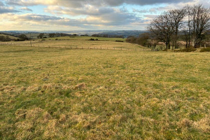
- Price
- £129,950
- Size
- 16.23 acres
Parc yr Rhos, Cwmann, Lampeter, SA48, Pencarreg, Carmarthenshire SA48 Wales
Added on 29/01/2026Agricultural Land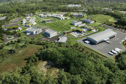
- Price
- POA
- Size
- 40 acres
Parc Felindre, Swansea, SA5, Llangyfelach, Swansea SA5 Wales
Added on 28/01/2026Development LandLeasehold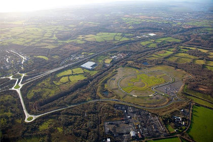
- Price
- POA
- Size
- 40 acres
Added on 18/06/2026Development Land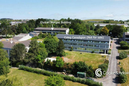
- Price
- POA
- Size
- 20 acres
Added on 17/07/2026Development Land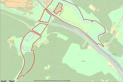
- Price
- POA
- Size
- 60.22 acres
Former Llynfi Power Station, Bridgend, CF34, Llangynwyd Middle, Bridgend CF34 Wales
Added on 29/01/2026Commercial Land