
Dunbeath Coastal Retreat, Dunbeath, North Highlands
- Land size
- 3 acres
- Dwelling size
- 646 sq ft
Key Features
- Coastal NC500 location
- Newly completed site
- Five luxury pods - 2 years old
- Two hot tub suites
- Consent for house
- Plots for three additional units
- Circa 3 acres
- Strong tourism trade
Description
Dunbeath Coastal Retreat is an exceptional lifestyle and investment opportunity on the spectacular east coast of Caithness, occupying an elevated position above Dunbeath Bay on the renowned North Coast 500 tourist route. Combining high-specification glamping accommodation with a serviced development platform for further pods and an outstanding building plot, the property is ideally placed to capitalise on the strong and growing tourism market in the North Highlands.
Location and setting
Dunbeath is a charming coastal village on the north-eastern section of the North Coast 500, offering dramatic coastal scenery, historic straths and easy access to beaches, Laidhay croft museum and waymarked walkways. The village benefits from a convenience store, Post Office, heritage centre and recreational facilities: including tennis courts, sports field, public hall, harbour, beach and newly installed childrens playground all within a 2 minute walk from the cabin site providing more facilities to guests than other eco cabin sites. Wider services are available in Wick and Thurso.
The retreat sits just off the A9 trunk road, providing direct road links south to Inverness and north towards Wick, Thurso and the ferry ports for Orkney. Regular bus services connect Dunbeath with neighbouring communities, and the regional centre of Inverness provides rail connections and an airport with UK and limited international flights. Local primary schooling is available in Dunbeath with secondary and further education provision in Wick and Thurso.
Property and accommodation
Completed 2 years ago, Dunbeath Coastal retreat is a an immaculate retreat that has been exceptionally well planned and constructed to the highest standards.
Dunbeath Coastal Retreat currently comprises five luxury eco glamping pods, carefully positioned within the hillside to maximise privacy and capture uninterrupted views across Dunbeath Bay and the North Sea. Finished to a very high standard, each pod provides contemporary open-plan accommodation with a well-appointed kitchen, comfortable living area, hotel-quality beds, spacious shower room, Smart TV and WiFi.
Two of the pods benefit from private hot tubs, together with robes and slippers, creating an indulgent, year-round coastal escape. Large glazing frames the sea views and allows natural light to flood the interiors, while modern finishes, efficient heating and quality fittings ensure an appealing, low-maintenance guest experience.
There is planning and a site ready for the installation of a sauna or BBQ area complete with power and water services.
Business operation and opportunity
The business trades as a self-catering coastal retreat, appealing to couples, short-break guests, walkers and North Coast 500 travellers seeking high-quality accommodation in a tranquil setting with unique sea views. The existing five pods are fully serviced, with infrastructure in place and prepared plots ready for the erection of a further three pods, offering a clear and deliverable growth trajectory. The pods are 4 season design so capable of being utilised throughout the year. There are additional opportunities by opening to families (especially with the addition of the new playpark) and pet owners. The retreat will be a short drive from the new Caithness Broch Project which will be a major Highland tourist attraction.
The business benefits from the sustained popularity of the NC500, which continues to attract strong domestic and international demand, underpinning high occupancy levels throughout the main season and increasingly across shoulder months. There is scope for new owners to develop additional revenue streams such as extended season operation, packaged breaks, partnerships with local activity providers and targeted marketing to walkers, cyclists and heritage visitors.
Tourism and wider hospitality context
The Caithness and Sutherland tourism market has shown resilient performance, supported by Scotland’s wider profile as a nature, heritage and adventure destination and by the NC500 brand. Dunbeath Coastal Retreat cabins offer a unique offering amongst a cluster of complimentary hospitality providers including self-catering, B&B and caravan parks, reinforcing the area’s position as a well-established stopping point on the route.
Local attractions include Dunbeath Strath, coastal and clifftop walks, historic brochs, Dunbeath Castle and a developing network of heritage experiences, all driving repeat and referral business. The site’s modern, eco-styled pods respond directly to visitor demand for high-quality, sustainable accommodation in authentic rural locations. The Broch project is also currently under development which will further increase demand for accommodation.
External grounds and building plot
The property extends to approximately 3 acres, attractively landscaped and terraced to create a sense of seclusion for each unit while preserving the outstanding panoramic outlook. Circulation roads and pathways are well laid out, with dedicated parking for guests and space to accommodate the planned additional pods.
Included within the title is a building plot with planning permission for a detached dwelling, perfectly suited to owners’ accommodation or an additional premium holiday unit. The plot enjoys arguably the finest views on the site, with established services and infrastructure nearby, enabling an efficient build programme and a highly desirable future home on the bay.
Map Location
Property details
- Tenure
- Freehold
- Council Tax Band
- Ask Agent
- Date Posted
- 2026-11-06
Market Value Analysis
Compared with 3 Glamping Sites listings in Scotland (1+ acres).
Property Brochure
Seen the details? The full report adds the independent checks: planning activity, flood history, heritage and ground.
Utilities & Restrictions
Utilities
- Electricity
- Ask Agent
- Water
- Ask Agent
- Heating
- Ask Agent
- Broadband
- Ask Agent
- Sewerage
- Ask Agent
Rights & Restrictions
- Public Rights of Way
- Ask Agent
- Private Rights of Way
- Ask Agent
- Listed Property
- Ask Agent
- Restrictions
- Ask Agent
Listed status, conservation areas and planning constraints for this location are in the full report.
Property Features
- Accessibility
- Ask Agent
- Parking
- Ask Agent
- Garden
- Ask Agent
Beyond the particulars: planning activity, flood history, heritage and ground risks, checked for this exact spot.
Connectivity
Broadband
Fastest speed available at this postcode
80 Mbps
Superfast
Suitable for
- HD streaming
- Video calls
- Web & social
Mobile signal
Predicted 4G and 5G signal; indoor signal depends on building materials.
Ofcom Connected Nations postcode-level predictions. Speeds and signal are modelled, not measured, and vary between addresses and providers.
Signal is the easy part. Planning activity, flood history and protected designations here are in the full report.
Nearest Schools
Primary
- Dunbeath Primary School580 metres
- Pupils
- 30
- Type
- Non-denominational
- Lybster Primary School6.5 miles
- Pupils
- 64
- Type
- Non-denominational
- Helmsdale Primary School12 miles
- Pupils
- 46
- Type
- Non-denominational
- Thrumster Primary School14 miles
- Pupils
- 30
- Type
- Non-denominational
- Watten Primary School16 miles
- Pupils
- 37
- Type
- Non-denominational
Secondary
- Wick High School18 miles
- Pupils
- 735
- Type
- Non-denominational
- Thurso High School24 miles
- Pupils
- 753
- Type
- Non-denominational
- Golspie High School28 miles
- Pupils
- 264
- Type
- Non-denominational
- Dornoch Academy34 miles
- Pupils
- 217
- Type
- Non-denominational
- Farr High School35 miles
- Pupils
- 68
- Type
- Non-denominational
Distances are straight-line from the advertised location. Source: the national school registers (DfE, Welsh Government, Scottish Government) and Ofsted.
Schools are just the start: planning activity, heritage and any flood history here are in the full report.
Amenities
Supermarket
GP surgery
Pharmacy
Green space
Walking trail
Straight-line distances from the advertised location. Sources: NHS records, Geolytix supermarket locations, OS Open Greenspace and the national trails registers.
The area stacks up? Now check the location itself: planning nearby, protected designations and past flooding.
Getting Around
Nearest station
Nearest bus stop
Typical drive times
Straight-line distances from the advertised location; drive times are typical free-flow times over OpenStreetMap road data, so allow more at peak. Public transport locations from DfT NaPTAN.
Easy to reach matters. So do planning activity, flood history and ground risks: all in the full report.
Flood Risk
SEPA open data, checked around the advertised map pin for the listed acreage. The map pin for this listing is approximate, so these readings describe the surrounding area. Provided by LandSale, not the listing agent, and not part of the agent's particulars. Risk varies across a holding, so verify before committing.
Rivers and the sea
Surface water
Not at the pin: mapped about 40 metres away.
These bandings are the summary. Where this location sits on the flood maps, plus planning activity, heritage and ground risks, is in the full report.
Important notice: Information, maps and tags on this page are drawn from the advertising agent's marketing materials or generated automatically. LandSale has not verified them. Relying on these details is at your own risk, always carry out independent checks before committing to a purchase.
LandSale full disclaimer
Marketing information only - not formal particulars. The details on this website are provided for general guidance and do not constitute an offer or contract. Neither LandSale nor the advertising estate/land agent accepts responsibility for any inaccuracy.
1. Source of information
- Listing content: Core description, asking price, tenure, measurements, photographs and planning history originate from the marketing materials of the advertising estate or land agent. LandSale does not author this content and cannot guarantee its accuracy.
- Automated tags & categorisation: Property type, land-use class, acreage bands and similar labels may be applied by machine-learning models. They are intended as a helpful guide only and may not reflect the property's legal status or permitted use.
- Third-party & enriched data layers: Maps, boundary outlines, planning designations, soil reports, broadband coverage and other environmental or location-based insights are licensed from external suppliers. Such data are supplied “as is", may be incomplete or out of date and are subject to change without notice.
2. Verification required
Prospective purchasers must verify critical matters, including but not limited to planning permission, title boundaries, public rights of way, environmental constraints, acreage, services, access and VAT status, through their own inspections, specialist surveys, legal advisers and the selling agent before relying on the information or entering into any contract.
3. No warranty or liability
LandSale gives no warranty, express or implied, as to the accuracy, completeness or fitness for any particular purpose of the information displayed. LandSale shall not be liable for any loss, damage, cost or expense arising directly or indirectly from any use of or reliance on such information, save where liability may not be excluded by law.
4. Updates & feedback
If you believe any detail on this listing is inaccurate, please let us know. We will investigate and, where appropriate, update the listing or notify the agent.
© LandSale | Version 1.3 - August 2026
Similar properties for sale
- Price
- Offers in Excess of£570,000
- Size
- 1.25 acres
Added on 18/06/2026Commercial Land
- Price
- Offers Over£375,000
- Size
- 1 acres
Bankburn Farm, St. Margarets Hope, Orkney, Orkney and Shetland, Orkney Islands KW17 Scotland
Added on 28/01/2026Development Land
- Price
- Offers Over£625,000
- Size
- 0.5 acres
Plot 1 Moyness Road, Auldearn, Nairn, IV12, Moray West, Nairn and Strathspey, Highland IV12 Scotland
Added on 01/04/2026Building Plot
- Price
- Offers Over£425,000
- Size
- 6.1 acres
Added on 29/01/2026Undeveloped Land
- Price
- Offers in Region of£375,000
- Size
- 12.5 acres
Former Quarry, Towiemore, Keith, Banffshire, Keith, Moray AB55 Scotland
Added on 25/06/2026Development Land
- Price
- £675,000
Added on 28/01/2026Commercial Land
- Price
- Offers Over£400,000
Added on 28/01/2026Development Land
- Price
- Offers in Region of£450,000
- Size
- 1.2 acres
Kirkhill Drive, Aberdeen, AB21, Aberdeen North, Aberdeen City AB21 Scotland
Added on 12/10/2026Industrial Land
- Price
- Offers in Region of£650,000
- Size
- 16.12 acres
Added on 29/01/2026Development Land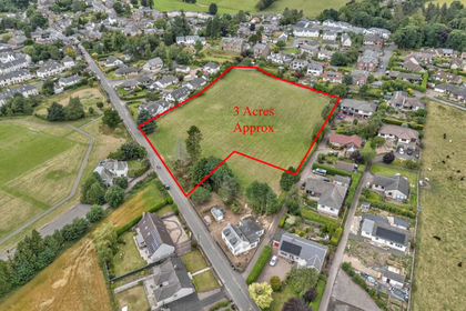
- Price
- Offers Over£495,000
- Size
- 3 acres
Losset Farm, Losset Road, Alyth, PH11, Angus and Perthshire Glens, Perth and Kinross PH11 Scotland
Added on 29/01/2026Redevelopment Land