Auction: Thursday 19 November 2026
Plot at Ryderston Drive, Cumnock, KA183DS
- Land size
- 0.7 acres
Key Features
- 0.7 acre Residential Development Site with mains services available. Proposed erection of 10 semi detached houses with new road access and additional visitor parking. Local Authority - East Ayrshire.
- Planning Application for the erection of 10 semi-detached houses (planning ref 25/0041/PAA). The buildings on the site have been demolished and cleared leaving a flat open area ready for development.
- The Adopted East Ayrshire Local Plan (2010) identifies the site suitable for residential development. Located within the The Cumnock Town Centre Regeneration Masterplan.
- The site is a brownfield site within the settlement boundary of Cumnock. The A70 and A76 trunk roads provide excellent road connections to Kilmarnock and throughout Ayrshire.
- The layout indicates a similar layout to Lamont Crescent to the west, and follows the same sweep of the road and house pattern, Potential end site valuation circa £1.5 million (10 units x £
Description
** SALE BY AUCTION - 19 November 2026 - Timed Online Auction **
Vacant Land West Of Netherthird Community Centre And Glaisnock Valley Bowling Club Ryderston Drive CUMNOCK, KA18 3AR. The site is a brownfield site within the settlement boundary of Cumnock. It is currently vacant and overgrown, with self seeded shrubs and grass. It was previously the Ryderston Road social club. To the east is Glaisnock Valley Bowling Club, to the south is the small square of shops and services, Post Office etc for the surrounding residential neighbourhood between Ryderston Drive and Craigens Road. To the north and west is the rear gardens of Lamont Crescent, a street of two storey post war local authority bult houses. Proposed erection of 10 semi detached houses with new road access and visitor parking. The houses are proposed at two storey, 3 bedroom semi-detached units with pitched roofs in Marley Modern roof tiles, small porch to the front elevation and French doors to the rear elevation. Doors, windows, RWG, fascia's, soffits, etc. are to be white UPVC and the walls are proposed to be white dash roughcast, with dark brown facing brick. Windows are proposed in the front and rear elevations, but not the side elevations. Units 1&2, and 3&4, are to be located either side of the access entry point, facing on to Ryderston Drive. The other 6 units are formed in a northern direction sweeping round to the north-east, internal to the site, in the same direction/angle as those to the east in Lamont Crescent. The rear gardens are proposed larger than the front gardens and in-curtilage parking is provided as is visitor parking, and some landscaping.
Located in the heart of an established residential district and popular housing close to Town Centre, several schools and ample shopping facilities. Cumnock, a popular town only 13 miles to Ayr and Kilmarnock. The A70 and A76 provide excellent road connections. Prestwick Airport is 17 miles. Cumnock offers a wide range of facilities including primary schooling, supported learning centre and secondary schooling, medical practice and local shops. The refurbished New Cumnock outdoor swimming pool (The Tamar Manoukian Pool) is open for the community to enjoy. There are excellent transport links in the area with a regular train service to Glasgow from New Cumnock and Ayr (17.5 miles). Prestwick Airport is about 22 miles away with regular scheduled flights and Glasgow International Airport is approximately 40 miles. The New Cumnock Access Network Paths has developed some interesting local walks in the area including the Knockshinnoch Lagoons which goes round a 130 hectare Scottish Wildlife Trust reserve, Burns Cairn and Glen Afton. Ayrshire is renowned for its many golf courses including the world famous facilities at Royal Troon and The Morris Equestrian Centre with fabulous equestrian facilities is about 21 miles away. The surrounding area has a network of quiet country roads, suitable for walking, hacking and cycling. There are excellent yachting facilities at the marinas at Troon, Ardrossan, Largs and Inverkip.
Auction Details
19 November 2026, 10am-3pm
Timed Online Auction
How to Bid Now
Submit an enquiry now or visit our website for full details on how to BID ON THIS PROPERTY.
Future Property Auctions - Scotland's Largest Land and Property Auction House. Over 700 lots available with weekly auctions including flats, houses, land & commercial.
Get a Fast Sale and a Fair Price with Future Property Auctions. Contact Us now for a FREE Auction Valuation.
Map Location
Property details
- Tenure
- Ask Agent
- Council Tax Band
- Ask Agent
- Date Posted
- 2026-11-04
Utilities & Restrictions
Utilities
- Electricity
- Ask Agent
- Water
- Ask Agent
- Heating
- Ask Agent
- Broadband
- Ask Agent
- Sewerage
- Ask Agent
Rights & Restrictions
- Public Rights of Way
- Ask Agent
- Private Rights of Way
- Ask Agent
- Listed Property
- Ask Agent
- Restrictions
- Ask Agent
Listed status, conservation areas and planning constraints for this location are in the full report.
Property Features
- Accessibility
- Ask Agent
- Parking
- Parking Available
- Garden
- Garden
Beyond the particulars: planning activity, flood history, heritage and ground risks, checked for this exact spot.
Connectivity
Broadband
Fastest speed available at this postcode
10 Gbps
Gigabit full fibre
Suitable for
- 4K streaming on every screen
- Full-time home working
- Online gaming & big downloads
Mobile signal
Predicted 4G and 5G signal; indoor signal depends on building materials.
Ofcom Connected Nations postcode-level predictions. Speeds and signal are modelled, not measured, and vary between addresses and providers.
Signal is the easy part. Planning activity, flood history and protected designations here are in the full report.
Nearest Schools
Primary
- Netherthird Primary School324 metres
- Pupils
- 205
- Type
- Non-denominational
- Lochnorris Primary School1.4 miles
- Pupils
- 493
- Type
- Non-denominational
- Logan Primary School1.4 miles
- Pupils
- 109
- Type
- Non-denominational
- St Patrick's Primary School2.6 miles
- Pupils
- 124
- Type
- Roman Catholic
- Auchinleck Primary School2.9 miles
- Pupils
- 171
- Type
- Non-denominational
Secondary
- Robert Burns Academy1.4 miles
- Pupils
- 1,734
- Type
- Non-denominational
- Doon Academy10 miles
- Pupils
- 240
- Type
- Non-denominational
- Loudoun Academy13 miles
- Pupils
- 888
- Type
- Non-denominational
- Sanquhar Academy14 miles
- Pupils
- 218
- Type
- Non-denominational
- Kyle Academy14 miles
- Pupils
- 821
- Type
- Non-denominational
Distances are straight-line from the advertised location. Source: the national school registers (DfE, Welsh Government, Scottish Government) and Ofsted.
Schools are just the start: planning activity, heritage and any flood history here are in the full report.
Amenities
Supermarket
GP surgery
Pharmacy
Green space
Walking trail
Straight-line distances from the advertised location. Sources: NHS records, Geolytix supermarket locations, OS Open Greenspace and the national trails registers.
The area stacks up? Now check the location itself: planning nearby, protected designations and past flooding.
Getting Around
Nearest station
Nearest bus stop
Typical drive times
Straight-line distances from the advertised location; drive times are typical free-flow times over OpenStreetMap road data, so allow more at peak. Public transport locations from DfT NaPTAN.
Easy to reach matters. So do planning activity, flood history and ground risks: all in the full report.
Flood Risk
SEPA open data, checked around the advertised map pin for the listed acreage. The map pin for this listing marks the postcode area rather than the exact location, so these readings describe the surrounding area. Provided by LandSale, not the listing agent, and not part of the agent's particulars. Risk varies across a holding, so verify before committing.
Rivers and the sea
Surface water
These bandings are the summary. Where this location sits on the flood maps, plus planning activity, heritage and ground risks, is in the full report.
Important notice: Information, maps and tags on this page are drawn from the advertising agent's marketing materials or generated automatically. LandSale has not verified them. Relying on these details is at your own risk, always carry out independent checks before committing to a purchase.
LandSale full disclaimer
Marketing information only - not formal particulars. The details on this website are provided for general guidance and do not constitute an offer or contract. Neither LandSale nor the advertising estate/land agent accepts responsibility for any inaccuracy.
1. Source of information
- Listing content: Core description, asking price, tenure, measurements, photographs and planning history originate from the marketing materials of the advertising estate or land agent. LandSale does not author this content and cannot guarantee its accuracy.
- Automated tags & categorisation: Property type, land-use class, acreage bands and similar labels may be applied by machine-learning models. They are intended as a helpful guide only and may not reflect the property's legal status or permitted use.
- Third-party & enriched data layers: Maps, boundary outlines, planning designations, soil reports, broadband coverage and other environmental or location-based insights are licensed from external suppliers. Such data are supplied “as is", may be incomplete or out of date and are subject to change without notice.
2. Verification required
Prospective purchasers must verify critical matters, including but not limited to planning permission, title boundaries, public rights of way, environmental constraints, acreage, services, access and VAT status, through their own inspections, specialist surveys, legal advisers and the selling agent before relying on the information or entering into any contract.
3. No warranty or liability
LandSale gives no warranty, express or implied, as to the accuracy, completeness or fitness for any particular purpose of the information displayed. LandSale shall not be liable for any loss, damage, cost or expense arising directly or indirectly from any use of or reliance on such information, save where liability may not be excluded by law.
4. Updates & feedback
If you believe any detail on this listing is inaccurate, please let us know. We will investigate and, where appropriate, update the listing or notify the agent.
© LandSale | Version 1.3 - August 2026
Similar properties for sale
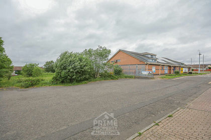
- Price
- Guide Price£55,000
- Size
- 1.06 acres
Added on 25/06/2026Vacant Land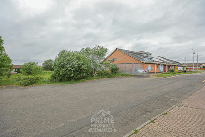
- Price
- £80,000
- Size
- 1.06 acres
Added on 18/07/2026Vacant Land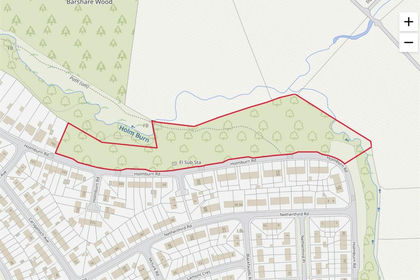
- Price
- Guide Price£59,000
- Size
- 5 acres
Holmburn Road, Cumnock, Ayr, Carrick and Cumnock, East Ayrshire KA18 Scotland
Added on 29/01/2026Undeveloped Land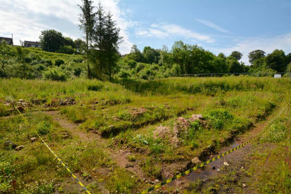
- Price
- Offers Over£60,000
Plot at 64 Newton Street, Catrine, KA5, Kilmarnock and Loudoun, East Ayrshire KA5 Scotland
Added on 09/07/2026Development Land
- Price
- Guide Price£55,000
5-7, Polwarth Street, Galston, KA4, Kilmarnock and Loudoun, East Ayrshire KA4 Scotland
Added on 24/07/2026Development Land
- Price
- Guide Price£50,000
Added on 09/04/2026Development Land- Price
- Guide Price£50,000
Added on 08/08/2026Development Land
- Price
- Guide Price£45,000
Added on 03/07/2026Development Land
- Price
- Guide Price£72,000
Added on 01/05/2026Building Plot- Price
- Guide Price£72,000
Added on 03/07/2026Building Plot