9 Copley Bent, Butterknowle, Bishop Auckland, Durham
- Land size
- 11.24 acres
Key Features
- Three bedroom property
- Adjoining 11.24 acres of grassland
- Opportunity to add value
- Available as a whole or in two lots
Description
A three bedroom, stone built, semi-detached property with a large garden, 11.24 acres of grassland and a small outbuilding, available as a whole or in two lots.
Lot 1 Guide Price £210,000
9 Copley Bent presents an exciting opportunity to modernise the house to create a good sized family home. There is potential to develop the site further, subject to the necessary consents.
The stone built house is semi-detached and comprises of a living room with large bay window to the front and an open fire. A central hallway leads to a kitchen fitted with wall and floor units and a large cupboard housing the air source heat pump equipment. The bathroom is to the rear of the property and is fitted with a WC, handbasin and bath with overhead electric shower.
There are three bedrooms, two of which are double rooms overlooking the front of the property. A large double to the rear has an ensuite WC and handbasin and overlooks the land and garden.
Lot 2 Guide Price £150,000
The land comprises two enclosures divided by a water course. The northern paddock is more suited to grazing and the southern paddock is suitable for mowing and/or grazing. The boundaries are mainly post and wire with some dry stone walls and hedges. There is a concrete bridge between the parcels over a small stream, which is in good condition.
Access to the land is via a gated track adjacent to 20 Copley Bent. The land is sold subject to a private right of way which runs from the highway along the track adjacent to the western boundary towards Copley Bent Farm. The bridge over the water course has been installed by the beneficiaries of the right of way. We are advised the seller has no liabilities in respect of repair or maintenance of the bridge.
A public footpath runs from the highway along the track, adjacent to the western boundary towards Copley Bent Farm.
Directions
From Bishop Auckland take Etherley Lane in a westerley direction through Etherley, High Etherley and Toft Hill. After passing through Toft Hill continue along the B6282 for approximately 3.6 miles and 9 Copley Bent will be on your left hand side.
What3words ///bleaching.tooth.mavericks
Location
Situated just outside of Butterknowle, 9 Copley Bent is within a small row of houses on Copley Bent. The property enjoys a rural setting overlooking the surrounding countryside.
The nearby towns of Barnard Castle and Bishop Auckland, both approximately 8 miles away provide a comprehensive range of amenities including shops, primary schools, and medical centres. The larger town of Darlington lies approximately 15 miles to the south east and provides a wider selection of retail, leisure, and professional services.
Services
The property benefits from mains water, mains drainage and a mains electricity supply together with an Vaillant air source heat pump central heating system, which was installed in 2024. The property is double glazed throughout. There is an array of solar panels, assisting the provision of hot water. There is a water source in the form of a stream on the land and there is also a mains water supply connected to a trough in the first land parcel. The water meter for the land is located on the roadside. We understand that fibre broadband and mobile telephone reception are available. For an indication of speeds and supply please see the OFCOM website: Off road, private parking is available at the property. No services, appliances, boilers or radiators have been tested. The house is of standard stone construction with a slate roof. The area shaded yellow on the floor plan is identified as an area of flying freehold. The Sellers solicitor will establish responsibility and maintenance requirements for this area.
Kitchen
Living room
Bathroom
Bedroom
Bedroom
4.42m 3.78m
Bedroom
Sporting and Mineral Rights
Any sporting rights which are owned are included in the sale. The mineral rights are excluded from the sale.
Access
Access to the property is directly off the public highway known as Copley Bent.
Council Tax & EPC
The council tax band is B, payable to Durham County Council. EPC: 54E
Burdens
The property is sold subject to all rights including rights of way, whether public or private, rights of light, support, drainage, water and electricity supplies and other rights, obligations and easements, quasi easements and restrictive covenants and all existing and proposed wayleaves for masts, pylons, stays, cables, drains and water, gas and other pipes, whether or not constituted in the title deeds or referred to in these particulars. The Buyers will be held to have satisfied themselves as to the nature of any such burdens where applicable. Method of Sale The property is offered for sale as a whole by Private Treaty. The Seller reserves the right to amalgamate, withdraw or exclude any of the property shown at any time or to generally amend the particulars. Please register your interest with H&H Land & Estates.
Money Laundering Regulations
Prospective Buyers should be aware that in the event that they are successful, they will be required to provide us with documents in relation to Money Laundering Regulations. The extent of the required documentation will be confirmed to the Buyer after acceptance of an offer.
Map Location
Property details
- Tenure
- Freehold
- Council Tax Band
- TBC
- Date Posted
- 2026-11-04
Market Value Analysis
Compared with 29 Homes with Land listings in North East England (10+ acres).
Energy Performance Certificate
Energy Efficiency Rating
Based on UK Energy Performance Certificate standards (EU Directive 2002/91/EC)
Running costs are one side. Planning activity, flood history and ground risks for this location are in the full report.
Utilities & Restrictions
Utilities
- Electricity
- Ask Agent
- Water
- Ask Agent
- Heating
- Ask Agent
- Broadband
- Ask Agent
- Sewerage
- Ask Agent
Rights & Restrictions
- Public Rights of Way
- Ask Agent
- Private Rights of Way
- Ask Agent
- Listed Property
- Ask Agent
- Restrictions
- Ask Agent
Listed status, conservation areas and planning constraints for this location are in the full report.
Property Features
- Accessibility
- Ask Agent
- Parking
- Parking Available
- Garden
- Garden
Beyond the particulars: planning activity, flood history, heritage and ground risks, checked for this exact spot.
Connectivity
Broadband
Fastest speed available at this postcode
8.5 Gbps
Gigabit full fibre
Suitable for
- 4K streaming on every screen
- Full-time home working
- Online gaming & big downloads
Mobile signal
Predicted 4G and 5G signal; indoor signal depends on building materials.
Ofcom Connected Nations postcode-level predictions. Speeds and signal are modelled, not measured, and vary between addresses and providers.
Signal is the easy part. Planning activity, flood history and protected designations here are in the full report.
Nearest Schools
Primary
- Butterknowle Primary School559 metresOfsted report card · Feb 2026
- Ages
- 3 to 11
- Pupils
- 54
- Type
- Community school
- Cockfield Primary School1.2 milesOfsted: Good
- Ages
- 2 to 11
- Pupils
- 115
- Type
- Community school
- Woodland Primary School2.2 milesOfsted: Good
- Ages
- 3 to 11
- Pupils
- 25
- Type
- Community school
- Ramshaw Primary School2.9 milesNo Ofsted rating
- Ages
- 4 to 11
- Pupils
- 54
- Type
- Community school
- Evenwood Church of England Primary School2.9 milesNo Ofsted rating
- Ages
- 2 to 11
- Pupils
- 97
- Type
- Academy converter
- Faith
- Church of England
Secondary
- Staindrop Academy3.2 milesOfsted: Good
- Ages
- 11 to 16
- Pupils
- 504
- Type
- Academy sponsor led
- Teesdale School and Sixth Form5.8 milesNo Ofsted rating
- Ages
- 11 to 18
- Pupils
- 684
- Type
- Academy sponsor led
- St John's Catholic School & Sixth Form College6.2 milesNo Ofsted rating
- Ages
- 11 to 18
- Pupils
- 1,229
- Type
- Academy converter
- Faith
- Roman Catholic
- Bishop Barrington Academy6.3 milesOfsted: Good
- Ages
- 11 to 16
- Pupils
- 599
- Type
- Academy converter
- King James I Academy Bishop Auckland7.2 milesOfsted report card · Mar 2026
- Ages
- 11 to 18
- Pupils
- 936
- Type
- Academy converter
Distances are straight-line from the advertised location. Source: the national school registers (DfE, Welsh Government, Scottish Government) and Ofsted.
Schools are just the start: sold prices nearby, planning activity and any flood history are in the full report.
Amenities
Supermarket
GP surgery
Pharmacy
Hospital
Green space
Straight-line distances from the advertised location. Sources: NHS records, Geolytix supermarket locations, OS Open Greenspace and the national trails registers.
The area stacks up? Now check the location itself: planning nearby, protected designations and past flooding.
Getting Around
Nearest station
Nearest bus stop
Typical drive times
Straight-line distances from the advertised location; drive times are typical free-flow times over OpenStreetMap road data, so allow more at peak. Public transport locations from DfT NaPTAN.
Easy to reach matters. So do planning activity, flood history and ground risks: all in the full report.
Flood Risk
Environment Agency open data, checked around the advertised map pin for the listed acreage. Long-term risk counts flood defences; the planning map's flood zones do not. Provided by LandSale, not the listing agent, and not part of the agent's particulars. Risk varies across a holding, so verify before committing.
Rivers and the sea
Planning map: Flood Zone 1.
Surface water
Not at the pin: mapped about 60 metres away.
These bandings are the summary. Where this location sits on the flood maps, plus planning activity, heritage and ground risks, is in the full report.
Important notice: Information, maps and tags on this page are drawn from the advertising agent's marketing materials or generated automatically. LandSale has not verified them. Relying on these details is at your own risk, always carry out independent checks before committing to a purchase.
LandSale full disclaimer
Marketing information only - not formal particulars. The details on this website are provided for general guidance and do not constitute an offer or contract. Neither LandSale nor the advertising estate/land agent accepts responsibility for any inaccuracy.
1. Source of information
- Listing content: Core description, asking price, tenure, measurements, photographs and planning history originate from the marketing materials of the advertising estate or land agent. LandSale does not author this content and cannot guarantee its accuracy.
- Automated tags & categorisation: Property type, land-use class, acreage bands and similar labels may be applied by machine-learning models. They are intended as a helpful guide only and may not reflect the property's legal status or permitted use.
- Third-party & enriched data layers: Maps, boundary outlines, planning designations, soil reports, broadband coverage and other environmental or location-based insights are licensed from external suppliers. Such data are supplied “as is", may be incomplete or out of date and are subject to change without notice.
2. Verification required
Prospective purchasers must verify critical matters, including but not limited to planning permission, title boundaries, public rights of way, environmental constraints, acreage, services, access and VAT status, through their own inspections, specialist surveys, legal advisers and the selling agent before relying on the information or entering into any contract.
3. No warranty or liability
LandSale gives no warranty, express or implied, as to the accuracy, completeness or fitness for any particular purpose of the information displayed. LandSale shall not be liable for any loss, damage, cost or expense arising directly or indirectly from any use of or reliance on such information, save where liability may not be excluded by law.
4. Updates & feedback
If you believe any detail on this listing is inaccurate, please let us know. We will investigate and, where appropriate, update the listing or notify the agent.
© LandSale | Version 1.3 - August 2026
Contact H&H Land & Estates, Carlisle
Borderway Mart, Rosehill, Carlisle, Cumbria, CA1 2RS
View agent profileSimilar properties for sale
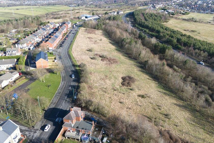
- Price
- Guide Price£365,000
- Size
- 5.2 acres
Gray Terrace, Stanley, County Durham, DH9, Stanley, County Durham DH9 England
Added on 29/01/2026Self Build Plot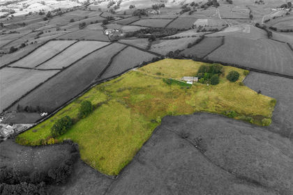
- Price
- Guide Price£375,000
- Size
- 15.69 acres
Lot 1 - Stone Hall, Whinfell, Kendal, LA8, Kendal, Westmorland and Furness LA8 England
Added on 29/09/2026Smallholding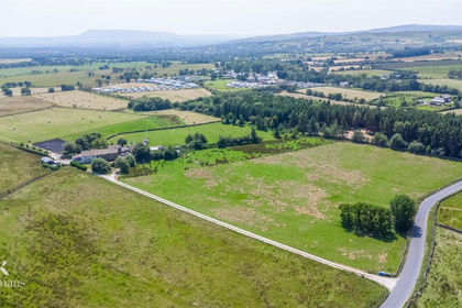
- Price
- £350,000
- Size
- 5.78 acres
Added on 20/07/2026Development Land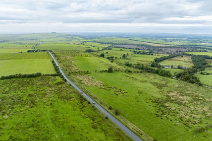
- Price
- Offers in Excess of£280,000
- Size
- 47.54 acres
PARK HEAD FARM, WELTON, CARLISLE, CA5 7HL - LOT 2, Sebergham, Cumberland CA5 England
Added on 17/07/2026Farm
- Price
- Guide Price£450,000
- Size
- 43.54 acres
43.54 Acres of Land off Low Lane, Swinton, Malton, Swinton, North Yorkshire YO17 England
Added on 16/10/2026Arable Land
- Price
- Offers Over£400,000
- Size
- 8.5 acres
Park Cottages, Hollin Hall, Colne, BB8, Trawden Forest, Lancashire BB8 England
Added on 08/09/2026House with Land