Auction: Friday 11 December 2026
Queen Street, Gillingham
- Bedrooms
- 3
- Bathrooms
- 3
Description
Prominent 3757 sq ft mixed-use opportunity, featuring a former restaurant/bar with beer garden and a well presented three-bedroom residential flat above.
For sale by Public Auction Friday 11 December 2026
• 3757 sq ft mixed use property
• Open plan restaurant/bar area
• Beer garden
• Commercial kitchen with fittings
• Three bedroom residential accommodation above, with separate access
• Close to Gillingham town centre Prominent 3757 sq ft mixed-use opportunity, featuring a former restaurant/bar with beer garden and a well presented three-bedroom residential flat above.
For sale by Public Auction and via Livestream on Friday 11 December 2026 at The Digby Memorial Church Hall, Digby Road, Sherborne, DT9 3NL
Description - AUCTION
For sale by Public Auction and via Livestream on Friday 11
December 2026 at 2pm at The Digby Memorial Church Hall,
Digby Road, Sherborne, Dorset, DT9 3NL and via Livestream.
Register to bid in the room, online, by telephone or by proxy via our
website.
THE PROPERTY
An 3757 sq ft mixed-use property comprising a spacious, open-plan
restaurant and bar on the ground floor, complete with a fully
equipped commercial kitchen, cellar and customer WCs. The
ground floor has previously operated as a successful restaurant/bar
and further benefits from an attractive beer garden, accessed via
French doors from the main dining area, creating an excellent
indoor-outdoor entertaining space. The first floor offers
modernised residential accommodation, comprising a kitchen
opening into a generous sitting/dining room, three bedrooms and a
family bathroom. The residential accommodation benefits from it's
own access or from the restaurant.
Location - Situated on Queen Street in the Dorset market town of Gillingham, the property is conveniently located for a range of local amenities,
including shops, supermarkets, cafés, public houses, healthcare facilities and schools. The town benefits from a mainline railway station providing services towards Salisbury and London Waterloo, while the A30 and A303 (c. 4 miles) offer access to the wider regional and national road network. Nearby towns include Mere
(approximately 3.5 miles), Shaftesbury (4.3 miles), Wincanton (6 miles), Sturminster Newton (8 miles) and Sherborne (12 miles),
providing further amenities and services.
Additional Information - AGENTS NOTES The property lies in Flood Risk Zone 2, with the garden in Flood Risk Zone 3. The neighbour at Ralton House has a pedestrian right over access over the garden. The property has the benefit of a right of access over the land to the north to provide access to Bay Road. There are various planning applications in the area, please refer to the Dorset Planning Portal for further information. SERVICES Mains electric, gas, water & drainage. Ultrafast broadband available, there is mobile coverage in the area, please refer to Ofcom’s website for more details. LOCAL AUTHORITY Dorset Council RV: £12,300 Flat Council Tax Band A SOLICITORS Trethowans Salisbury SP1 3HP JOINT AGENTS Chaffers Estate Agents AUCTION CONDITIONS OF SALE AND NOTES LEGAL AND INFORMATION PACK For full details please refer to the auction catalogue available online at A full legal pack can be purchased online. Please telephone the office below to check availability. We strongly recommend you instruct a solicitor to inspect the legal pack on your behalf. * Guides are provided as an indication of each seller's minimum expectation. They are not necessarily figures which a property will sell for and may change at any time prior to the auction. Each property will be offered subject to a Reserve (a figure below which the Auctioneer cannot sell the property during the auction). The reserve price is not disclosed and remains confidential between the seller and the auctioneer. Both the guide price and the reserve price can be subject to change up to and including the day of the auction. The ‘Reserve Price’ may exceed the ‘Guide Price’ listed. If so, it is customary for the ‘Reserve Price’ to exceed the guide price by no more than 10%. Additional Fees • The successful purchaser will be required to pay the Auctioneers a Purchaser's Administration Fee of £1,980 (£1,650 plus VAT) payable to Symonds & Sampson. For purchases of £50,000 or less the Administration fee will be £960 (£800 plus VAT). If two or more lots are offered together in the first instance, or lots are purchased under one contract, the administration fee will apply per lot and not per contract. The charge will apply to lots bought prior to and post auction. • In the event of non-payment or underpayment a deduction will be made from the deposit received. A VAT receipt will be issued in the name of the buyer. • Disbursements – Please see the legal pack for any disbursements listed that may become payable by the purchaser.
Map Location
Property details
- Tenure
- Freehold
- Council Tax Band
- Ask Agent
- Date Posted
- 2026-11-04
Utilities & Restrictions
Utilities
- Electricity
- Ask Agent
- Water
- Ask Agent
- Heating
- Ask Agent
- Broadband
- Ask Agent
- Sewerage
- Ask Agent
Rights & Restrictions
- Public Rights of Way
- Ask Agent
- Private Rights of Way
- Ask Agent
- Listed Property
- Ask Agent
- Restrictions
- Ask Agent
Listed status, conservation areas and planning constraints for this location are in the full report.
Property Features
- Accessibility
- Ask Agent
- Parking
- Ask Agent
- Garden
- Ask Agent
Beyond the particulars: planning activity, flood history, heritage and ground risks, checked for this exact spot.
Connectivity
Broadband
Fastest speed available at this postcode
1.8 Gbps
Gigabit full fibre
Suitable for
- 4K streaming on every screen
- Full-time home working
- Online gaming & big downloads
Mobile signal
Predicted 4G and 5G signal; indoor signal depends on building materials.
Ofcom Connected Nations postcode-level predictions. Speeds and signal are modelled, not measured, and vary between addresses and providers.
Signal is the easy part. Planning activity, flood history and protected designations here are in the full report.
Nearest Schools
Primary
- Gillingham Primary School369 metresOfsted report card · Jan 2026
- Ages
- 4 to 11
- Pupils
- 233
- Type
- Academy converter
- Wyke Primary School952 metresOfsted: Requires improvement
- Ages
- 4 to 11
- Pupils
- 161
- Type
- Academy sponsor led
- St Mary the Virgin Church of England Primary School1.1 milesNo Ofsted rating
- Ages
- 2 to 11
- Pupils
- 242
- Type
- Academy converter
- Faith
- Church of England
- Milton-on-Stour Church of England Primary School1.2 milesOfsted: Good
- Ages
- 4 to 11
- Pupils
- 119
- Type
- Academy converter
- Faith
- Church of England
- Motcombe CofE Primary School2.7 milesOfsted: Good
- Ages
- 4 to 11
- Pupils
- 146
- Type
- Academy converter
- Faith
- Church of England
Secondary
- Gillingham School658 metresNo Ofsted rating
- Ages
- 11 to 18
- Type
- Academy converter
- Shaftesbury School4.7 milesOfsted: Good
- Ages
- 11 to 18
- Pupils
- 782
- Type
- Academy converter
- Faith
- Church of England
- King Arthur's School6.5 milesOfsted: Requires improvement *
- Ages
- 11 to 16
- Pupils
- 450
- Type
- Academy sponsor led
- Sturminster Newton High School7.5 milesOfsted report card · Apr 2026
- Ages
- 11 to 18
- Pupils
- 605
- Type
- Academy converter
- Sexey's School9.3 milesOfsted: Good
- Ages
- 11 to 18
- Pupils
- 633
- Type
- Academy converter
- Faith
- Church of England
* Latest graded judgement covers quality of education only; no overall grade was issued under the 2024-25 inspection framework.
Distances are straight-line from the advertised location. Source: the national school registers (DfE, Welsh Government, Scottish Government) and Ofsted.
Schools are just the start: sold prices nearby, planning activity and any flood history are in the full report.
Amenities
Supermarket
GP surgery
Pharmacy
Hospital
Green space
Straight-line distances from the advertised location. Sources: NHS records, Geolytix supermarket locations, OS Open Greenspace and the national trails registers.
The area stacks up? Now check the location itself: planning nearby, protected designations and past flooding.
Getting Around
Nearest station
Nearest bus stop
Typical drive times
Straight-line distances from the advertised location; drive times are typical free-flow times over OpenStreetMap road data, so allow more at peak. Public transport locations from DfT NaPTAN.
Easy to reach matters. So do planning activity, flood history and ground risks: all in the full report.
Flood Risk
Environment Agency open data, checked around the advertised map pin for the listed acreage. Long-term risk counts flood defences; the planning map's flood zones do not. The map pin for this listing marks the postcode area rather than the exact location, so these readings describe the surrounding area. Provided by LandSale, not the listing agent, and not part of the agent's particulars. Risk varies across a holding, so verify before committing.
Rivers and the sea
Not at the pin: mapped about 10 metres away.
Planning map: Flood Zone 3, about 10 metres away.
Surface water
Not at the pin: mapped about 20 metres away.
These bandings are the summary. Where this location sits on the flood maps, plus planning activity, heritage and ground risks, is in the full report.
Important notice: Information, maps and tags on this page are drawn from the advertising agent's marketing materials or generated automatically. LandSale has not verified them. Relying on these details is at your own risk, always carry out independent checks before committing to a purchase.
LandSale full disclaimer
Marketing information only - not formal particulars. The details on this website are provided for general guidance and do not constitute an offer or contract. Neither LandSale nor the advertising estate/land agent accepts responsibility for any inaccuracy.
1. Source of information
- Listing content: Core description, asking price, tenure, measurements, photographs and planning history originate from the marketing materials of the advertising estate or land agent. LandSale does not author this content and cannot guarantee its accuracy.
- Automated tags & categorisation: Property type, land-use class, acreage bands and similar labels may be applied by machine-learning models. They are intended as a helpful guide only and may not reflect the property's legal status or permitted use.
- Third-party & enriched data layers: Maps, boundary outlines, planning designations, soil reports, broadband coverage and other environmental or location-based insights are licensed from external suppliers. Such data are supplied “as is", may be incomplete or out of date and are subject to change without notice.
2. Verification required
Prospective purchasers must verify critical matters, including but not limited to planning permission, title boundaries, public rights of way, environmental constraints, acreage, services, access and VAT status, through their own inspections, specialist surveys, legal advisers and the selling agent before relying on the information or entering into any contract.
3. No warranty or liability
LandSale gives no warranty, express or implied, as to the accuracy, completeness or fitness for any particular purpose of the information displayed. LandSale shall not be liable for any loss, damage, cost or expense arising directly or indirectly from any use of or reliance on such information, save where liability may not be excluded by law.
4. Updates & feedback
If you believe any detail on this listing is inaccurate, please let us know. We will investigate and, where appropriate, update the listing or notify the agent.
© LandSale | Version 1.3 - August 2026
Contact Chaffers Estate Agents Ltd, Gillingham
6 The Centre, High Street, Gillingham, SP8 4AB
View agent profileSimilar properties for sale
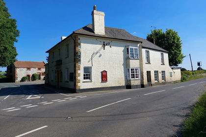
- Price
- £295,000
- Size
- 0.7 acres
Yeovil Road, Marston Magna, Yeovil, Somerset, BA22, , Somerset BA22 England
Added on 12/07/2026Pub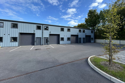
- Price
- Offers in Region of£199,950
Added on 29/01/2026Industrial Land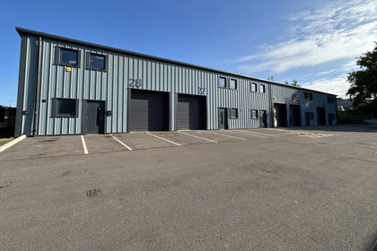
- Price
- Offers in Region of£295,000
Added on 29/01/2026Industrial Land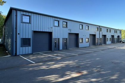
- Price
- Offers in Region of£275,000
Added on 29/01/2026Industrial Land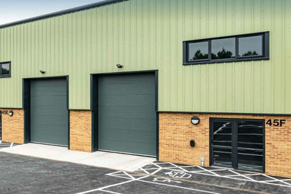
- Price
- £243,000
- Size
- 0.03 acres
Unit 45C, Area 45, Enterprise Park, DT2, Piddlehinton, Dorset DT2 England
Added on 17/07/2026Warehouse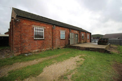
- Price
- £200,000
- Size
- 0.36 acres
Units 2 & 11, Enterprise Park - Unit for Lease or Sale, Piddlehinton, Dorset DT2 England
Added on 17/07/2026Commercial Land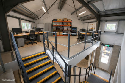
- Price
- £225,000
- Size
- 0.03 acres
Unit 8C, Enterprise Park - New Units for Sale or Lease, Piddlehinton, Dorset DT2 England
Added on 09/11/2026Industrial Land Added on 02/11/2026Development Land
- Price
- Offers in Region of£280,000
Added on 13/06/2026Warehouse
- Price
- Offers in Region of£220,000
Units, Bartletts Farm, Godney Road, Glastonbury, Somerset, BA6, Glastonbury, Somerset BA6 England
Added on 13/06/2026Industrial Land