Lower Farm, Edworth, Biggleswade, Beds, SG18
Key Features
- Conveniently situated approximately 0.8 miles from the A1, providing excellent road connections to Cambridge, Bedford, Stevenage and London
- Approximately 1.8 miles from Biggleswade, 2.5 miles from Ashwell, 5.25 miles from Letchworth Garden City
- The popular market town of Hitchin, renowned for its vibrant town centre, independent shops and restaurants, is located approximately 8 miles from the site
- Cambridge city centre is approximately a 30-minute drive away, offering further employment and educational opportunities
- Nearest Train stations: Biggleswade Station (2.9 miles), Ashwell & Morden Station (4.66 miles) and Baldock Station (4.5 miles), providing regular services to both London and Cambridge.
- Approximately 13.9 miles from London Luton Airport
- Benefits from a Certificate of Lawful Development (Reference: CB/25/03547/LDCP) confirming the permitted Class Q conversion of the agricultural buildings to create five residential dwellings.
Description
LOCATION
The site lies on the edge of the village of Edworth in Central Bedfordshire, to the south-east of Biggleswade and north-west of Hinxworth.
The thriving market town of Biggleswade provides an excellent range of amenities including supermarkets, independent shops, cafés, restaurants, schools, healthcare facilities and leisure amenities. Biggleswade railway station offers regular direct services to London King’s Cross, whilst the nearby A1 provides convenient access to London and Cambridge.
Additional facilities can be found within Stotfold, Baldock and Letchworth Garden City, whilst the surrounding villages provide access to a range of local amenities and attractive countryside walks.
THE PROPERTY
The Property comprises three existing agricultural buildings and the associated land required for their proposed residential conversion. Two of the buildings benefit from a Class Q Certificate of Lawful Development, establishing the principle of their conversion to residential use.
Building 1 is proposed to be converted into two dwellings. Unit 1.1 on the ground floor level consists of a kitchen/diner, living room, utility, study and WC. The first floor consists of 3 bedrooms, an en suite and bathroom. Unit 1.2 on ground floor level consists of a kitchen/diner, living room and WC. The first floor consists of 2 bedrooms, an en suite and a bathroom. The proposed floorspace of Building
1 is 240 sq m.
Building 2 is proposed to be converted into three dwellings, each consisting of an open plan living area, kitchen/diner, utility and one bedroom with en suite and W/C all contained on the ground floor. There are an additional 2 bedrooms and bathroom on the first floor of each unit. The proposed floorspace of Building 2 is 436.7 sq m
THE SITE
The site contains three agricultural buildings positioned within a rural setting. The proposed residential accommodation will be formed through conversion of two of the existing structures in accordance with the approved Class Q documentation.
The site is accessed from Lower Farm Road, leading from Hinxworth and connecting to Biggleswade via London Road. The site is bounded to the north, east and south-east by trees, hedging and vegetation, with views over the surrounding agricultural land. Existing residential properties are located immediately to the west of the site. The property is situated in the administrative boundary of Central Bedfordshire Council.
ACCESS
The property benefits from a right of access from Lower Farm Road to the boundary of the site shown edged red on the plan.
PLANNING
The site contains three agricultural buildings positioned within a rural setting. The proposed residential accommodation will be formed through conversion of two of the existing structures in accordance with the approved Class Q documentation.
The site is accessed from Lower Farm Road, leading from Hinxworth and connecting to Biggleswade via London Road. The site is bounded to the north, east and south-east by trees, hedging and vegetation, with views over the surrounding agricultural land. Existing residential properties are located immediately to the west of the site. The property is situated in the administrative boundary of Central Bedfordshire Council.
TECHNICAL INFORMATION
Full details on technical aspects regarding the site are contained in the additional information pack. We advise that all interested parties make themselves fully aware of the reports and the content therein.
TENURE AND OCCUPATION
The land is available freehold with vacant possession.
OVERAGE
Offers are invited to include overage provisions for any enhanced planning permission in excess of the 5 market dwellings secured. The particular terms of which are to be negotiated.
EASEMENTS, WAYLEAVES AND RIGHTS OF WAY
The property is sold subject to and with the benefit of all rights of way, easements, covenants, wayleaves and rights whether specifically referred to within these particulars or not.
No public rights of way are known to cross the property.
BOUNDARIES
The purchaser will be deemed to have full knowledge of the boundaries and neither the Vendors nor their Agent will be responsible for defining any other boundaries.
VAT
The sale will not attract VAT, however the Vendors reserve the right to charge VAT in addition to the purchase price on the whole of the land, should this become necessary.
ADDITIONAL INFORMATION PACK
An additional information pack is available via a dataroom upon request.
GENERAL INFORMATION
Central Bedfordshire Council-
VIEWING
Strictly by appointment only with the Vendors’ Agent.
T:
E: Abigail.
E: michael.
IMPORTANT NOTICE
Sworders for itself and the Vendor of this property give notice that the particulars are a general outline only for the guidance of intending Purchasers and do not constitute an offer or contract. All descriptions and any other details are given without responsibility and any intending Purchasers should not rely on them as statements or representations of fact but must satisfy themselves by inspection or otherwise as to their correctness. Any measurements, areas or distances referred to herein are approximate only. None of the services or fixtures or fittings has been tested and no warranty is given as to their suitability or condition. Nothing in these particulars shall be deemed to be a statement that the property is in good condition or otherwise. No employee of Sworders has any authority to make or give
any representations or warranty whatsoever in relation to theproperty. No responsibility can be accepted for the expenses incurred by any intending Purchasers in inspecting properties which have been sold, let or withdrawn. All plans included are not to scale and are based upon the Ordnance Survey Map with the sanction of the Controller of HM Stationery Office.. Crown Copyright Reserved.
MONEY LAUNDERING
In accordance with Anti Money Laundering Legislation, bidders will be required to provide proof of identity and the address to the Selling Agents.
DIRECTIONS
Follow signs for the A505 towards Hitchin and Letchworth Garden City. Continue east on the A505, then join the A1(M)/ A1 northbound towards Biggleswade. Leave the A1 for the local road network towards Hinxworth along Edworth Road for approximately 0.6 miles until you reach Lower Farm Road, take the right hand turning and continue for approximately 0.3 miles where the site is on your left
Map Location
Property details
- Tenure
- Ask Agent
- Council Tax Band
- Ask Agent
- Date Posted
- 2026-11-02
Utilities & Restrictions
Utilities
- Electricity
- Ask Agent
- Water
- Ask Agent
- Heating
- Ask Agent
- Broadband
- Ask Agent
- Sewerage
- Ask Agent
Rights & Restrictions
- Public Rights of Way
- Ask Agent
- Private Rights of Way
- Ask Agent
- Listed Property
- Ask Agent
- Restrictions
- Ask Agent
Listed status, conservation areas and planning constraints for this location are in the full report.
Property Features
- Accessibility
- Ask Agent
- Parking
- Ask Agent
- Garden
- Ask Agent
Beyond the particulars: planning activity, flood history, heritage and ground risks, checked for this exact spot.
Connectivity
Broadband
Fastest speed available at this postcode
1 Mbps
Under 10 Mbps here
Suitable for
- Basic browsing & email
Fixed wireless access may also be an option here.
Mobile signal
Predicted 4G and 5G signal; indoor signal depends on building materials.
Ofcom Connected Nations postcode-level predictions. Speeds and signal are modelled, not measured, and vary between addresses and providers.
Signal is the easy part. Planning activity, flood history and protected designations here are in the full report.
Nearest Schools
Primary
- Dunton CofE Junior School1.9 milesOfsted: Good
- Ages
- 7 to 11
- Pupils
- 66
- Type
- Voluntary controlled school
- Faith
- Church of England
- Biggleswade Academy2.4 milesOfsted: Good
- Ages
- 2 to 11
- Pupils
- 839
- Type
- Academy converter
- Langford Village Academy2.5 milesOfsted: Good
- Ages
- 4 to 11
- Pupils
- 295
- Type
- Academy sponsor led
- Ashwell Primary School2.8 milesOfsted report card · Jun 2026
- Ages
- 3 to 11
- Pupils
- 229
- Type
- Community school
- St Mary's CofE Academy Stotfold2.8 milesNo Ofsted rating
- Ages
- 5 to 9
- Pupils
- 297
- Type
- Academy converter
- Faith
- Church of England
Secondary
- Stratton School2.6 milesOfsted: Good *
- Ages
- 11 to 18
- Pupils
- 917
- Type
- Academy converter
- Pix Brook Academy2.8 milesOfsted: Good
- Ages
- 9 to 16
- Pupils
- 1,011
- Type
- Free schools
- Etonbury Academy2.9 milesOfsted: Good
- Ages
- 9 to 19
- Pupils
- 1,158
- Type
- Academy converter
- Edward Peake CofE VC School3.2 milesOfsted: Good *
- Ages
- 11 to 16
- Pupils
- 359
- Type
- Voluntary controlled school
- Faith
- Church of England
- Henlow Church of England Academy3.4 milesOfsted: Good *
- Ages
- 9 to 16
- Pupils
- 599
- Type
- Academy converter
- Faith
- Church of England
* Latest graded judgement covers quality of education only; no overall grade was issued under the 2024-25 inspection framework.
Distances are straight-line from the advertised location. Source: the national school registers (DfE, Welsh Government, Scottish Government) and Ofsted.
Schools are just the start: sold prices nearby, planning activity and any flood history are in the full report.
Amenities
Supermarket
GP surgery
Pharmacy
Hospital
Green space
Straight-line distances from the advertised location. Sources: NHS records, Geolytix supermarket locations, OS Open Greenspace and the national trails registers.
The area stacks up? Now check the location itself: planning nearby, protected designations and past flooding.
Getting Around
Nearest station
Nearest bus stop
Typical drive times
Straight-line distances from the advertised location; drive times are typical free-flow times over OpenStreetMap road data, so allow more at peak. Public transport locations from DfT NaPTAN.
Easy to reach matters. So do planning activity, flood history and ground risks: all in the full report.
Flood Risk
Environment Agency open data, checked around the advertised map pin for the listed acreage. Long-term risk counts flood defences; the planning map's flood zones do not. The map pin for this listing marks the postcode area rather than the exact location, so these readings describe the surrounding area. Provided by LandSale, not the listing agent, and not part of the agent's particulars. Risk varies across a holding, so verify before committing.
Rivers and the sea
Planning map: Flood Zone 1.
Surface water
Not at the pin: mapped about 10 metres away.
These bandings are the summary. Where this location sits on the flood maps, plus planning activity, heritage and ground risks, is in the full report.
Important notice: Information, maps and tags on this page are drawn from the advertising agent's marketing materials or generated automatically. LandSale has not verified them. Relying on these details is at your own risk, always carry out independent checks before committing to a purchase.
LandSale full disclaimer
Marketing information only - not formal particulars. The details on this website are provided for general guidance and do not constitute an offer or contract. Neither LandSale nor the advertising estate/land agent accepts responsibility for any inaccuracy.
1. Source of information
- Listing content: Core description, asking price, tenure, measurements, photographs and planning history originate from the marketing materials of the advertising estate or land agent. LandSale does not author this content and cannot guarantee its accuracy.
- Automated tags & categorisation: Property type, land-use class, acreage bands and similar labels may be applied by machine-learning models. They are intended as a helpful guide only and may not reflect the property's legal status or permitted use.
- Third-party & enriched data layers: Maps, boundary outlines, planning designations, soil reports, broadband coverage and other environmental or location-based insights are licensed from external suppliers. Such data are supplied “as is", may be incomplete or out of date and are subject to change without notice.
2. Verification required
Prospective purchasers must verify critical matters, including but not limited to planning permission, title boundaries, public rights of way, environmental constraints, acreage, services, access and VAT status, through their own inspections, specialist surveys, legal advisers and the selling agent before relying on the information or entering into any contract.
3. No warranty or liability
LandSale gives no warranty, express or implied, as to the accuracy, completeness or fitness for any particular purpose of the information displayed. LandSale shall not be liable for any loss, damage, cost or expense arising directly or indirectly from any use of or reliance on such information, save where liability may not be excluded by law.
4. Updates & feedback
If you believe any detail on this listing is inaccurate, please let us know. We will investigate and, where appropriate, update the listing or notify the agent.
© LandSale | Version 1.3 - August 2026
Contact Sworders, Hertfordshire
3 The Gatehouse, Hadham Hall, Little Hadham, Ware, SG11 2EB
View agent profileSimilar properties for sale
 Added on 29/01/2026Development Land
 Added on 24/04/2026Development Land
- Price
- Guide Price£680,000
- Size
- 0.45 acres
Added on 29/01/2026Development Land
- Price
- £750,000
- Size
- 1.21 acres
Added on 31/03/2026Conversion Land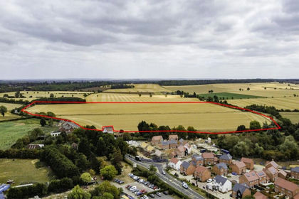
- Price
- Guide Price£565,000
Willington, Bedford, Bedfordshire, Willington, Bedford MK44 England
Added on 15/07/2026Arable Land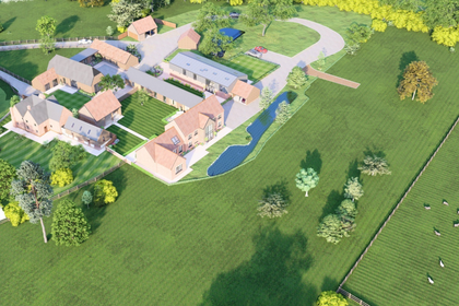
- Price
- Offers Over£800,000
- Size
- 5.7 acres
High Street, Toseland, St. Neots, Cambridgeshire, PE19, Toseland, Cambridgeshire PE19 England
Added on 18/06/2026Development Land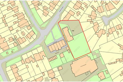
- Price
- Guide Price£750,000
- Size
- 0.56 acres
Added on 29/01/2026Development Land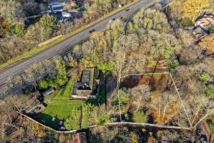
- Price
- Offers Over£700,000
- Size
- 0.35 acres
Added on 29/01/2026Development Land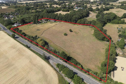
- Price
- £800,000
- Size
- 8.5 acres
High Cross Farm, Ermine Street, Ware, Hertfordshire, SG11, Thundridge, Hertfordshire SG11 England
Added on 23/10/2026Agricultural Land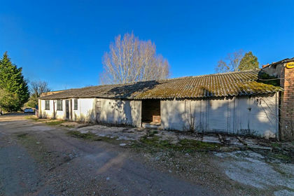
- Price
- Guide Price£800,000
Sewell, Dunstable, Houghton Regis, Central Bedfordshire LU6 England
Added on 29/01/2026Industrial Land