Closing date for offers: Tuesday 1 December 2026 at 12 noon
Brixham, Devon, TQ5
- Land size
- 3.53 acres
Key Features
- Extending to approximately 3.53 acres (1.43 hectares) in all
- Pony paddock/Amenity land
- Benefitting from a stable block with three stables, extending to 47sqm (506 sq ft) in all
- Other outbuildings & tack room
- Offering potential for residential development or other uses (subject to planning)
- Immediately adjacent to a site subject to planning for 175 homes
- Legal Pack available on request
- For sale by Formal Tender with a deadline date of Tuesday 1st December at 12 noon
- Sale by Formal Tender
Description
DIRECTIONS
From Churston Ferrers, follow Churston Road towards the A3022 and turn left at the junction. Continue for approximately 0.9 miles, then turn right onto Monksbridge Road and proceed for around 0.2 miles. At the roundabout, take the third exit onto Mathill Road and continue for a further 0.2 miles. The wooden gate giving access to the land will be on the right.
What3Words location: clockwork.tops.credited
SITUATION
The land at Mathill Paddock is situated on the outskirts of the coastal town of Brixham in South Devon.
The nearest village, Churston Ferrers, is situated approximately 2 miles to the northeast of the property. The council maintained highway Laywell Road forms the western boundary, and Mathill Road lies against the southern boundary while the northern and eastern boundaries adjoin neighbouring land.
The A380 dual carriageway expressway, which connects to the A38, lies around five miles to the northwest.
DESCRIPTION
The land at Mathill Paddock extends to approximately 3.53 acres (1.43 hectares) arranged as two field parcels, the full extent of which is outlined in red on the site plan below.
The land benefits from a stable block, comprising three stables and a tack room measuring [12.65m x 3.70m] extending to 47 square metres (506 sq ft) with a 1m overhang. The structure is timber-framed and clad under a corrugated roof with concrete floor throughout. There is also a useful concrete apron at the front of the stables.
There is also a dilapidated outbuilding used for hay storage and muck heap area.
Surrounding the stable block is a small paddock area enclosed by timber post and rail fencing.
The land is all of a gentle north facing gradient and is all down to grass and is well suited to agricultural or equestrian purposes and has potential for other uses including amenity and recreation subject to obtaining the necessary planning consents.
DEVELOPMENT POTENTIAL
That the land lies immediately adjacent to a site that is subject to a planning application to build 175 homes and is on the edge of a residential area, Mathill Paddock offers the potential for change of use to residential development in the future, subject to obtaining the necessary planning consent.
OVERAGE/UPLIFT CLAUSE
The land is not being sold subject to an overage or uplift clause in respect of change of use.
ACCESS
The land is accessed via a single vehicular-width wooden gateway directly from the council-maintained highway Mathill Road, adjoining the southern boundary.
SERVICES
The land benefits from a mains water supply, with the meter understood to be situated in Mathill Road. There are no other mains services connected to the property.
TENURE
The property is being offered for sale on a freehold basis with vacant possession available on completion.
PUBLIC RIGHTS OF WAY
There are no public footpaths or rights of way across the land as far as are known.
SPORTING RIGHTS AND MINERAL RIGHTS
All sporting and mineral rights are included in the sale, as far as are known.
METHOD OF SALE
Mathill Paddock is offered for sale by Formal Tender (unless sold prior).
The deadline date for the submission of tenders is Tuesday 1st December 2026 at 12 noon and all tenders must be submitted to 62 Fore Street, Kingsbridge in a sealed envelope clearly marked ‘Mathill Paddock’.
Buyers who wish to submit a tender will be required to complete and sign the forms and provide any supporting documentation as detailed within the Legal Pack available from the solicitor acting for the seller (see Legal Pack below).
Any tender by the deadline date received will be subject to contract. Prospective purchasers should be aware that upon acceptance of their tender offer, a 10% deposit of the agreed sale price will be payable to the agent acting for the seller (or via their own solicitor), within 24 hours of written acceptance of their offer; failure to do so may result in the tender being rejected.
Should a tender be acceptable to the seller and the 10% deposit received within the time frame outlined above, this will then constitute an exchange of contracts and legal completion and payment of the balance of the purchase price will follow approximately 28 days later or by the time frame set out in the legal pack. If the deposit is failed to be presented by the successful tender, then the Formal Tender Conditions will not be met, and this will result in the tender being rejected.
Moreover, the successful purchaser will be liable to pay the sum of £2,500 plus VAT as an administration fee in addition to their tender price on completion.
Please note, the seller does not undertake to accept the highest or any of the offers and the seller reserves the right to withdraw, alter or amend the way in which the land is offered for sale.
LEGAL PACK
A copy of the legal pack may be requested from the seller's solicitors, Windeatts Solicitors of 48 Fore Street, Kingsbridge, TQ7 1PE. Attention: Richard Wing Tel: 01548 858647 or e-mail: richard.wing@windeatts.co.uk or alternatively, please contact the Sole Selling Agent, Luscombe Maye.
GUIDE PRICE
£250,000
LOCAL AUTHORITY
Torbay Council, Torquay Town Hall, Castle Circus, Torquay, TQ1 3DR Tel: 01803 201 201
TREE PRESERVATION ORDER (TPO)
Mathill Paddock is contained in a blanket tree preservation order 2026, enforced by Torbay District Council and the Town and Country Planning Act 1990 covering all trees of whatever species in the area. Further detail is contained in the legal pack.
HEALTH & SAFETY
Any prospective purchasers of whom would like to view the land do so at their own risk. The vendors nor their selling agent accept any responsibility in any incident or accident that may happen.
VIEWING
Strictly by appointment with the Sole Agents, Luscombe Maye of 62 Fore Street, Kingsbridge TQ7 1PP Telephone for details.
Map Location
Property details
- Tenure
- Freehold
- Council Tax Band
- Ask Agent
- Date Posted
- 2026-10-28
Market Value Analysis
Compared with 66 Equestrian listings in South West England (1+ acres).
Property Brochure
Seen the details? The full report adds the independent checks: planning activity, flood history, heritage and ground.
Utilities & Restrictions
Utilities
- Electricity
- Ask Agent
- Water
- Ask Agent
- Heating
- Ask Agent
- Broadband
- Ask Agent
- Sewerage
- Ask Agent
Rights & Restrictions
- Public Rights of Way
- Ask Agent
- Private Rights of Way
- Ask Agent
- Listed Property
- Ask Agent
- Restrictions
- Ask Agent
Listed status, conservation areas and planning constraints for this location are in the full report.
Property Features
- Accessibility
- Ask Agent
- Parking
- Ask Agent
- Garden
- Ask Agent
Beyond the particulars: planning activity, flood history, heritage and ground risks, checked for this exact spot.
Connectivity
Broadband
Fastest speed available at this postcode
1.8 Gbps
Gigabit full fibre · available to 67% of premises
Suitable for
- 4K streaming on every screen
- Full-time home working
- Online gaming & big downloads
Mobile signal
Predicted 4G and 5G signal; indoor signal depends on building materials.
Ofcom Connected Nations postcode-level predictions. Speeds and signal are modelled, not measured, and vary between addresses and providers.
Signal is the easy part. Planning activity, flood history and protected designations here are in the full report.
Nearest Schools
Primary
- St Margaret Clitherow Catholic Primary School344 metresOfsted: Good
- Ages
- 5 to 11
- Pupils
- 56
- Type
- Academy converter
- Faith
- Roman Catholic
- Eden Park Primary & Nursery School562 metresOfsted: Good
- Ages
- 2 to 11
- Pupils
- 342
- Type
- Academy converter
- Furzeham Primary School0.9 milesOfsted report card · Jan 2026
- Ages
- 2 to 11
- Pupils
- 257
- Type
- Academy converter
- Brixham Church of England Primary School0.9 milesOfsted: Good
- Ages
- 3 to 11
- Pupils
- 187
- Type
- Academy converter
- Faith
- Church of England
- Galmpton Church of England Primary School1.7 milesOfsted: Outstanding
- Ages
- 4 to 11
- Pupils
- 222
- Type
- Academy converter
- Faith
- Church of England
Secondary
- Brixham College1 mileOfsted report card · Mar 2026
- Ages
- 11 to 18
- Pupils
- 1,012
- Type
- Academy converter
- Churston Ferrers Grammar School Academy1.5 milesOfsted: Good
- Ages
- 11 to 18
- Pupils
- 1,062
- Type
- Academy converter
- Paignton Academy4 milesOfsted: Requires improvement *
- Ages
- 11 to 16
- Pupils
- 1,568
- Type
- Academy converter
- Dartmouth Academy4.1 milesOfsted: Good
- Ages
- 3 to 19
- Pupils
- 435
- Type
- Academy sponsor led
- The Spires College6.2 milesNo Ofsted rating
- Ages
- 11 to 18
- Pupils
- 1,154
- Type
- Foundation school
* Latest graded judgement covers quality of education only; no overall grade was issued under the 2024-25 inspection framework.
Distances are straight-line from the advertised location. Source: the national school registers (DfE, Welsh Government, Scottish Government) and Ofsted.
Schools are just the start: sold prices nearby, planning activity and any flood history are in the full report.
Amenities
Supermarket
GP surgery
Pharmacy
Hospital
Green space
Walking trail
Straight-line distances from the advertised location. Sources: NHS records, Geolytix supermarket locations, OS Open Greenspace and the national trails registers.
The area stacks up? Now check the location itself: planning nearby, protected designations and past flooding.
Getting Around
Nearest station
Nearest bus stop
Typical drive times
Straight-line distances from the advertised location; drive times are typical free-flow times over OpenStreetMap road data, so allow more at peak. Public transport locations from DfT NaPTAN.
Easy to reach matters. So do planning activity, flood history and ground risks: all in the full report.
Flood Risk
Environment Agency open data, checked around the advertised map pin for the listed acreage. Long-term risk counts flood defences; the planning map's flood zones do not. Provided by LandSale, not the listing agent, and not part of the agent's particulars. Risk varies across a holding, so verify before committing.
Rivers and the sea
Planning map: Flood Zone 1.
Surface water
These bandings are the summary. Where this location sits on the flood maps, plus planning activity, heritage and ground risks, is in the full report.
Important notice: Information, maps and tags on this page are drawn from the advertising agent's marketing materials or generated automatically. LandSale has not verified them. Relying on these details is at your own risk, always carry out independent checks before committing to a purchase.
LandSale full disclaimer
Marketing information only - not formal particulars. The details on this website are provided for general guidance and do not constitute an offer or contract. Neither LandSale nor the advertising estate/land agent accepts responsibility for any inaccuracy.
1. Source of information
- Listing content: Core description, asking price, tenure, measurements, photographs and planning history originate from the marketing materials of the advertising estate or land agent. LandSale does not author this content and cannot guarantee its accuracy.
- Automated tags & categorisation: Property type, land-use class, acreage bands and similar labels may be applied by machine-learning models. They are intended as a helpful guide only and may not reflect the property's legal status or permitted use.
- Third-party & enriched data layers: Maps, boundary outlines, planning designations, soil reports, broadband coverage and other environmental or location-based insights are licensed from external suppliers. Such data are supplied “as is", may be incomplete or out of date and are subject to change without notice.
2. Verification required
Prospective purchasers must verify critical matters, including but not limited to planning permission, title boundaries, public rights of way, environmental constraints, acreage, services, access and VAT status, through their own inspections, specialist surveys, legal advisers and the selling agent before relying on the information or entering into any contract.
3. No warranty or liability
LandSale gives no warranty, express or implied, as to the accuracy, completeness or fitness for any particular purpose of the information displayed. LandSale shall not be liable for any loss, damage, cost or expense arising directly or indirectly from any use of or reliance on such information, save where liability may not be excluded by law.
4. Updates & feedback
If you believe any detail on this listing is inaccurate, please let us know. We will investigate and, where appropriate, update the listing or notify the agent.
© LandSale | Version 1.3 - August 2026
Listing agent
Luscombe Maye Farms & Land, Kingsbridge62 Fore Street Kingsbridge TQ7 1PP
Call agent
01548800183Contact Luscombe Maye Farms & Land, Kingsbridge
62 Fore Street Kingsbridge TQ7 1PP
Call agent
01548800183Similar properties for sale
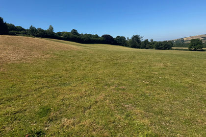
- Price
- Guide Price£210,000
- Size
- 23.57 acres
Chillington, Kingsbridge, TQ7, Kingsbridge, Devon TQ7 England
Added on 02/10/2026Undeveloped Land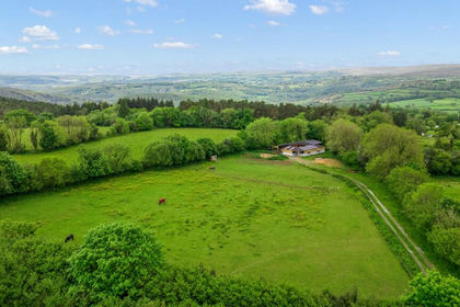
- Price
- Guide Price£250,000
- Size
- 5.4 acres
Ashburton, Newton Abbot, TQ13, Buckland in the Moor, Devon TQ13 England
Added on 18/08/2026Equestrian property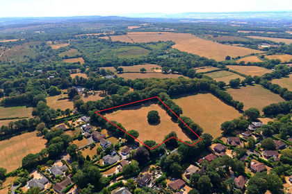
- Price
- Offers in Excess of£300,000
- Size
- 4.91 acres
Land Off Oak Road, West Hill, Ottery St. Mary, EX11, Ottery St. Mary, Devon EX11 England
Added on 08/09/2026Development Land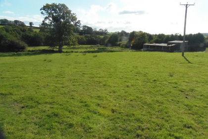
- Price
- £225,000
- Size
- 11.08 acres
Added on 29/01/2026Pasture