Castlehill, Fife
- Land size
- 15.8 acres
Key Features
- Nearly 16 acres of brownfield land with direct A907 access
- Planning permission granted for a 92-lodge holiday park, subject to conditions
- Development potential for a range of uses, subject to planning
Description
Auction House Scotland is delighted to bring to market this substantial brownfield site approximately 15.8 acres in West Fife
The site now comes to auction with an attractive guide price of £800,000.
Castlehill sits directly off the A907 between Dunfermline and Alloa, close to key transport links including the Kincardine Bridge. The site historically provided access and ventilation infrastructure in connection with the wider, surrounding Longannet mining complex. No mineral extraction took place on the site itself, no minerals were brought to the surface here, and the former access points have since been formally capped and sealed. What remains are concrete hardstandings, an internal roadway and an existing formed entrance with approved visibility splays. Tree-lined boundaries screen the site, with woodland to the south and east.
The site has a planning history that gives it a strong development precedent. Planning permission in principle for 38 houses and 6 live/work units was granted on part of the site in 2015 (Ref. 15/00816/PPP) and has since lapsed.
More recently, Fife Council granted full planning permission in July 2025 for a change of use to a holiday lodge park, subject to conditions (Ref. 24/00111/FULL). The approved layout shows 92 lodges, although alternative layouts and unit numbers may be possible, subject to any necessary approvals. The consent also includes a Class 1 retail unit and a path link to the adjacent West Fife Cycleway. The principal pre-commencement condition, relating to contaminated land, has already been discharged. The permission must be implemented by 1 July 2028 and is accompanied by a Section 75 Agreement.
Buyers may also wish to investigate alternative proposals such as storage, trade units, commercial workspace, renewable energy or a mix of residential and commercial uses. These alternatives do not currently benefit from the permissions described above and would require separate assessment and any necessary consents.
An existing water supply and electricity connection are reported on site. Purchasers should verify their condition, availability and capacity for any proposed use.
Planning, title and available technical documentation will be provided in the legal pack. Prospective purchasers must review the legal pack and carry out their own due diligence before bidding. They should satisfy themselves regarding planning conditions, the Section 75 Agreement, access rights, ground conditions, contamination, services, and the feasibility and cost of their proposed use.
What 3 Words ///iceberg.emporium.swan
Castle Hill lies in a rural part of West Fife, close to the villages of Blairhall, Oakley and Saline. Dunfermline and Alloa are both within easy reach, and both offer a full range of shops, services and amenities. The Kincardine and Clackmannanshire bridges, the M9 and the M90 connect the site to Stirling, Falkirk, Edinburgh and the wider Central Belt.
The historic village of Culross is a short drive to the south. The West Fife Cycleway, a traffic-free route linking Dunfermline and Alloa, runs along the site’s southern boundary.
PURCHASERS NOTES
Please note that these particulars have been prepared by us on the basis of information provided by our client. If there is any aspect of these particulars that you wish clarified or that you find misleading please contact the office where further information will be made available.
• No tests have been made of services, equipment or fittings.
• No warranty is given or implied as to the condition of buildings, services, fixtures, fittings etc.
• All measurements, distances and acres are approximate.
• Fixtures, fittings and other items are not included unless specified in these details.
This material is protected by the laws of copyright. The owner of the copyright is Auction House Scotland. The property sheet forms part of our database and is protected by the database rights and copyright laws. No unauthorised copying or distribution without permission. Auction House Scotland is revolutionising the sale of property in Scotland.
Remember, if you are buying a property which is being sold by Auction House Scotland you will normally be responsible for payment of a Buyer's Premium or Auction Fee of 3.6% of the purchase price subject to a minimum of £3600 inclusive of VAT. More details can be obtained on application.
Cybercrime Warning:
Please be aware that there is a significant risk posed by cyber fraud, specifically affecting email accounts and bank account details. PLEASE NOTE THAT OUR BANK ACCOUNT DETAILS WILL NOT CHANGE DURING THE COURSE OF A TRANSACTION AND WE WILL NOT CHANGE OUR BANK DETAILS VIA EMAIL. Please be careful to check account details with us in person if in any doubt. We will not accept responsibility if you transfer money into an incorrect account.
Map Location
Property details
- Tenure
- Freehold
- Council Tax Band
- Ask Agent
- Date Posted
- 2026-10-23
Market Value Analysis
Compared with 38 Development Land listings in Scotland (10+ acres).
Utilities & Restrictions
Utilities
- Electricity
- Ask Agent
- Water
- Ask Agent
- Heating
- Ask Agent
- Broadband
- Ask Agent
- Sewerage
- Ask Agent
Rights & Restrictions
- Public Rights of Way
- Ask Agent
- Private Rights of Way
- Ask Agent
- Listed Property
- Ask Agent
- Restrictions
- Ask Agent
Listed status, conservation areas and planning constraints for this location are in the full report.
Property Features
- Accessibility
- No Wheelchair Access
- Parking
- Ask Agent
- Garden
- Ask Agent
Beyond the particulars: planning activity, flood history, heritage and ground risks, checked for this exact spot.
Connectivity
Broadband
Fastest speed available at this postcode
5 Mbps
Under 10 Mbps here
Suitable for
- Basic browsing & email
Mobile signal
Predicted 4G and 5G signal; indoor signal depends on building materials.
Ofcom Connected Nations postcode-level predictions. Speeds and signal are modelled, not measured, and vary between addresses and providers.
Signal is the easy part. Planning activity, flood history and protected designations here are in the full report.
Nearest Schools
Primary
- Blairhall Primary School1.7 miles
- Pupils
- 64
- Type
- Non-denominational
- St Serf's R C Primary School2.6 miles
- Pupils
- 69
- Type
- Roman Catholic
- Culross Primary School2.7 miles
- Pupils
- 56
- Type
- Non-denominational
- Inzievar Primary School2.9 miles
- Pupils
- 210
- Type
- Non-denominational
- Holy Name RC Primary School2.9 miles
- Pupils
- 24
- Type
- Roman Catholic
Secondary
- Alloa Academy5.9 miles
- Pupils
- 757
- Type
- Non-denominational
- Bo'ness Academy6 miles
- Pupils
- 829
- Type
- Non-denominational
- Grangemouth High School6.7 miles
- Pupils
- 838
- Type
- Non-denominational
- Alva Academy6.9 miles
- Pupils
- 962
- Type
- Non-denominational
- Queen Anne High School7 miles
- Pupils
- 1,843
- Type
- Non-denominational
Distances are straight-line from the advertised location. Source: the national school registers (DfE, Welsh Government, Scottish Government) and Ofsted.
Schools are just the start: planning activity, heritage and any flood history here are in the full report.
Amenities
Supermarket
GP surgery
Pharmacy
Walking trail
Straight-line distances from the advertised location. Sources: NHS records, Geolytix supermarket locations, OS Open Greenspace and the national trails registers.
The area stacks up? Now check the location itself: planning nearby, protected designations and past flooding.
Getting Around
Nearest station
Nearest bus stop
Typical drive times
Straight-line distances from the advertised location; drive times are typical free-flow times over OpenStreetMap road data, so allow more at peak. Public transport locations from DfT NaPTAN.
Easy to reach matters. So do planning activity, flood history and ground risks: all in the full report.
Flood Risk
SEPA open data, checked around the advertised map pin for the listed acreage. Provided by LandSale, not the listing agent, and not part of the agent's particulars. Risk varies across a holding, so verify before committing.
Rivers and the sea
Not at the pin: mapped about 130 metres away.
Surface water
Not at the pin: mapped about 20 metres away.
These bandings are the summary. Where this location sits on the flood maps, plus planning activity, heritage and ground risks, is in the full report.
Important notice: Information, maps and tags on this page are drawn from the advertising agent's marketing materials or generated automatically. LandSale has not verified them. Relying on these details is at your own risk, always carry out independent checks before committing to a purchase.
LandSale full disclaimer
Marketing information only - not formal particulars. The details on this website are provided for general guidance and do not constitute an offer or contract. Neither LandSale nor the advertising estate/land agent accepts responsibility for any inaccuracy.
1. Source of information
- Listing content: Core description, asking price, tenure, measurements, photographs and planning history originate from the marketing materials of the advertising estate or land agent. LandSale does not author this content and cannot guarantee its accuracy.
- Automated tags & categorisation: Property type, land-use class, acreage bands and similar labels may be applied by machine-learning models. They are intended as a helpful guide only and may not reflect the property's legal status or permitted use.
- Third-party & enriched data layers: Maps, boundary outlines, planning designations, soil reports, broadband coverage and other environmental or location-based insights are licensed from external suppliers. Such data are supplied “as is", may be incomplete or out of date and are subject to change without notice.
2. Verification required
Prospective purchasers must verify critical matters, including but not limited to planning permission, title boundaries, public rights of way, environmental constraints, acreage, services, access and VAT status, through their own inspections, specialist surveys, legal advisers and the selling agent before relying on the information or entering into any contract.
3. No warranty or liability
LandSale gives no warranty, express or implied, as to the accuracy, completeness or fitness for any particular purpose of the information displayed. LandSale shall not be liable for any loss, damage, cost or expense arising directly or indirectly from any use of or reliance on such information, save where liability may not be excluded by law.
4. Updates & feedback
If you believe any detail on this listing is inaccurate, please let us know. We will investigate and, where appropriate, update the listing or notify the agent.
© LandSale | Version 1.3 - August 2026
Contact Auction House Scotland, Glasgow
Building 3, 46 Munro Place, Anniesland, Glasgow G13 2UP
View agent profileSimilar properties for sale
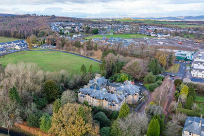
- Price
- Offers Over£770,000
Added on 29/01/2026Development Land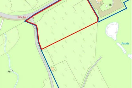
- Price
- £800,000
- Size
- 2.42 acres
Added on 04/10/2026Development Land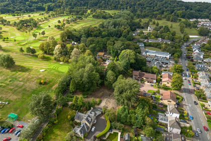
- Price
- Offers Over£795,000
Ravelston Dykes Road, Edinburgh, Edinburgh West, City of Edinburgh EH4 Scotland
Added on 04/04/2026Building Plot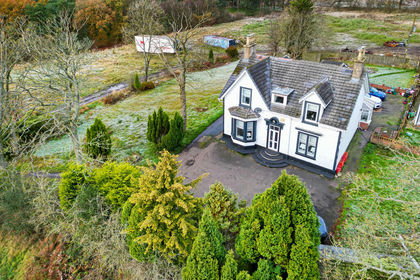
- Price
- Offers Over£595,000
- Size
- 3.5 acres
Greenfield, Glenmavis, Airdrie, Airdrie and Shotts, North Lanarkshire ML6 Scotland
Added on 29/01/2026Development Land
- Price
- Offers in Excess of£850,000
- Size
- 16.12 acres
Greyfriars Monastery, Uddingston, G71, Rutherglen, South Lanarkshire G71 Scotland
Added on 04/11/2026Redevelopment Land
- Price
- Offers in Excess of£950,000
- Size
- 2.1 acres
South Melville Farmhouse, Lasswade, EH18, Midlothian, Midlothian EH18 Scotland
Added on 18/08/2026Development Land
- Price
- Offers Over£500,000
- Size
- 0.9 acres
Drummohr Avenue, Wallyford, Musselburgh, East Lothian, Lothian East, East Lothian EH21 Scotland
Added on 29/01/2026Development Land
- Price
- Offers in Excess of£600,000
- Size
- 0.7 acres
Plot 2 Fordel Village, Dalkeith, EH22, Midlothian, Midlothian EH22 Scotland
Added on 20/03/2026Development Land
- Price
- Guide Price£650,000
- Size
- 6.44 acres
Added on 20/02/2026Undeveloped Land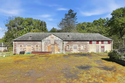
- Price
- Guide Price£765,000
- Size
- 72 acres
Added on 02/07/2026Development Land