Lot 3- Handale Bank Farm, Moorsholm Lane, Liverton, Redcar And Cleveland, TS13
- Land size
- 50 acres
Key Features
- 50 Acres
- Versatile block of arable land together with a small parcel of permanent pasture
- Divided into two regular and easily workable fields
- Access off both Liverton Road and Moorsholm Lane
Description
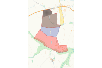
LOT 3: 50 ACRES OF ARABLE LAND (shaded brown)
Lot 3 comprises a versatile block of arable land together with a small parcel of permanent pasture. The arable land is divided into two regular and easily workable fields with direct access off both Liverton Road and Moorsholm Lane, which leads from the village to Handale
Banks Farm. The land is currently sown
GENERAL REMARKS & STIPULATIONS VIEWING
By appointment with Robin Jessop Ltd on or with the Joint Agents, Messrs
Richardson & Smith on . .
TENURE
The property is freehold with vacant possession given upon completion. The title is not registered. However, the solicitors are currently voluntarily registering the farm.
DEVELOPMENT CLAWBACK CLAUSE
In respect of lot 3 there is a development clawback clause on the area of land hatched brown. This area is subject to the clawback for a period of 30 years and 30% for any development other than that associated with either agricultural or equestrian use.
FARM PLAN
The farm plan is for identification purposes only. The field numbers and areas given may vary from old Ordnance Survey sheets, previous Field Data sheets and Rural Land Registry maps and the title deed plans.
INTEGRATED POLLUTION PREVENTION CONTROL (IPPC)
The IPPC permit number is EPR/EP3036UD. The date of issue was 31/01/2008. The current permit status is affective and the primary activity type is intensive farming for more than 2000 pigs (production pigs).
BOUNDARIES
The Vendors will only sell such interest (if any) as they have in the boundary fences, hedges, ditches, walls and other boundaries separating this property from other properties not
belonging to them.
EASEMENTS & RIGHTS OF WAY
The property is sold subject to all covenants, easements, rights of way whether mentioned in these particulars or not. Without prejudice to the foregoing, the property is sold subject:-
1. There is a Northern Power Grid line which crosses the land. 2. There are a number of public footpaths which cross the land. 3. The farm road is a Council maintained road to the farm-yard.
SERVICES
Mains Electricity and mains water are connected to the property. Drainage is to a septic tank.
NITRATE VULNERABLE ZONE The farm is currently NOT in an NVZ.
GROWING CROPS
The purchaser(s) will take over the growing crops. The valuation will be based on the cost of seeds, fertilisers, sprays and cultivations undertaken. The cost of cultivations carried out will be done as per the contractors charges.
SPORTING RIGHTS & MINERAL RIGHTS
Freehold with Vacant Possession will be given upon completion.
ASBESTOS
With regards to any asbestos on the holding, a detailed asbestos survey has not been carried out. On completion of the sale, it will be the responsibility of the purchaser(s) to comply with the Control of Asbestos Act at Work Regulations 2012.
COUNCIL TAX
Handale Banks Farm - Band B Handale Banks Farm House – Band G
MONEY LAUNDERING REGULATIONS
Please note that if you are the successful purchaser, it is now a legal requirement for you to provide two forms of identity. This will need to be provided personally into our office so that we can take copies of both this and proof of funds which will also be required to comply with Money Laundering Regulations.
METHOD OF SALE
The property is being offered for sale initially by private treaty. If after viewing the property you are seriously interested, then please kindly register your interest with either:- Andrew Dickins MRICS FAAV, Robin Jessop Ltd, 4 North End, Bedale, North Yorkshire DL8 1AB – . Ian Halley FRICS, Richardson & Smith, 8 Victoria Square, Whitby YO21 1EA – So that we can keep you informed of how we intend to conclude the sale.
USEFUL ADDRESSES
SOLICITORS
Messrs Harrowells, 31 Yorkersgate, Malton, York YO17 7AA. Acting Solicitors: Jacqueline Barr.
Tel :
Email: Jacqueline.
LOCAL AUTHORITY
Redcar & Cleveland Borough Council, 9 Kirkleatham Street, Redcar – . North Yorks Moors National Park, The Old Vicarage, Bondgate, Helmsley, North Yorkshire YO62 5BP – . Email:
Map Location
Property details
- Tenure
- Freehold
- Council Tax Band
- Ask Agent
- Date Posted
- 2026-10-23
Market Value Analysis
Compared with 12 Farmland & Pasture listings in North East England (50+ acres).
Utilities & Restrictions
Utilities
- Electricity
- Ask Agent
- Water
- Ask Agent
- Heating
- Ask Agent
- Broadband
- Ask Agent
- Sewerage
- Ask Agent
Rights & Restrictions
- Public Rights of Way
- Ask Agent
- Private Rights of Way
- Ask Agent
- Listed Property
- Ask Agent
- Restrictions
- Ask Agent
Listed status, conservation areas and planning constraints for this location are in the full report.
Property Features
- Accessibility
- Ask Agent
- Parking
- Ask Agent
- Garden
- Garden
Beyond the particulars: planning activity, flood history, heritage and ground risks, checked for this exact spot.
Connectivity
Broadband
Fastest speed available at this postcode
16 Mbps
Standard (10-30 Mbps)
Suitable for
- Web & social
- Music streaming
- Standard video calls
Fixed wireless access may also be an option here.
Mobile signal
Predicted 4G and 5G signal; indoor signal depends on building materials.
Ofcom Connected Nations postcode-level predictions. Speeds and signal are modelled, not measured, and vary between addresses and providers.
Signal is the easy part. Planning activity, flood history and protected designations here are in the full report.
Nearest Schools
Primary
- Saint Joseph's Catholic Primary School, A Catholic Voluntary Academy1.2 milesNo Ofsted rating
- Ages
- 2 to 11
- Pupils
- 182
- Type
- Academy converter
- Faith
- Roman Catholic
- Handale Primary School1.6 milesOfsted: Good
- Ages
- 2 to 11
- Pupils
- 183
- Type
- Academy converter
- Hummersea Primary School1.8 milesOfsted: Good *
- Ages
- 2 to 11
- Pupils
- 261
- Type
- Community school
- Whitecliffe Academy2.3 milesNo Ofsted rating
- Ages
- 3 to 11
- Pupils
- 91
- Type
- Academy converter
- Badger Hill Academy3 milesOfsted: Good
- Ages
- 2 to 11
- Pupils
- 138
- Type
- Academy converter
Secondary
- Freebrough Academy3.5 milesOfsted: Outstanding
- Ages
- 11 to 16
- Pupils
- 814
- Type
- Academy sponsor led
- Huntcliff School5 milesOfsted: Good
- Ages
- 11 to 16
- Pupils
- 544
- Type
- Academy sponsor led
- Laurence Jackson School6.4 milesOfsted: Good
- Ages
- 11 to 16
- Pupils
- 1,247
- Type
- Academy sponsor led
- Outwood Academy Bydales7 milesOfsted: Good *
- Ages
- 11 to 16
- Pupils
- 832
- Type
- Academy sponsor led
- Rye Hills Academy8.5 milesOfsted: Good
- Ages
- 11 to 16
- Pupils
- 763
- Type
- Academy sponsor led
* Latest graded judgement covers quality of education only; no overall grade was issued under the 2024-25 inspection framework.
Distances are straight-line from the advertised location. Source: the national school registers (DfE, Welsh Government, Scottish Government) and Ofsted.
Schools are just the start: sold prices nearby, planning activity and any flood history are in the full report.
Amenities
Supermarket
GP surgery
Pharmacy
Hospital
Straight-line distances from the advertised location. Sources: NHS records, Geolytix supermarket locations, OS Open Greenspace and the national trails registers.
The area stacks up? Now check the location itself: planning nearby, protected designations and past flooding.
Getting Around
Nearest station
Nearest bus stop
Typical drive times
Straight-line distances from the advertised location; drive times are typical free-flow times over OpenStreetMap road data, so allow more at peak. Public transport locations from DfT NaPTAN.
Easy to reach matters. So do planning activity, flood history and ground risks: all in the full report.
Flood Risk
Environment Agency open data, checked around the advertised map pin for the listed acreage. Long-term risk counts flood defences; the planning map's flood zones do not. Provided by LandSale, not the listing agent, and not part of the agent's particulars. Risk varies across a holding, so verify before committing.
Rivers and the sea
Planning map: Flood Zone 1.
Surface water
Not at the pin: mapped about 180 metres away.
These bandings are the summary. Where this location sits on the flood maps, plus planning activity, heritage and ground risks, is in the full report.
Important notice: Information, maps and tags on this page are drawn from the advertising agent's marketing materials or generated automatically. LandSale has not verified them. Relying on these details is at your own risk, always carry out independent checks before committing to a purchase.
LandSale full disclaimer
Marketing information only - not formal particulars. The details on this website are provided for general guidance and do not constitute an offer or contract. Neither LandSale nor the advertising estate/land agent accepts responsibility for any inaccuracy.
1. Source of information
- Listing content: Core description, asking price, tenure, measurements, photographs and planning history originate from the marketing materials of the advertising estate or land agent. LandSale does not author this content and cannot guarantee its accuracy.
- Automated tags & categorisation: Property type, land-use class, acreage bands and similar labels may be applied by machine-learning models. They are intended as a helpful guide only and may not reflect the property's legal status or permitted use.
- Third-party & enriched data layers: Maps, boundary outlines, planning designations, soil reports, broadband coverage and other environmental or location-based insights are licensed from external suppliers. Such data are supplied “as is", may be incomplete or out of date and are subject to change without notice.
2. Verification required
Prospective purchasers must verify critical matters, including but not limited to planning permission, title boundaries, public rights of way, environmental constraints, acreage, services, access and VAT status, through their own inspections, specialist surveys, legal advisers and the selling agent before relying on the information or entering into any contract.
3. No warranty or liability
LandSale gives no warranty, express or implied, as to the accuracy, completeness or fitness for any particular purpose of the information displayed. LandSale shall not be liable for any loss, damage, cost or expense arising directly or indirectly from any use of or reliance on such information, save where liability may not be excluded by law.
4. Updates & feedback
If you believe any detail on this listing is inaccurate, please let us know. We will investigate and, where appropriate, update the listing or notify the agent.
© LandSale | Version 1.3 - August 2026
Similar properties for sale
- Price
- Guide Price£390,000
- Size
- 50 acres
Added on 23/10/2026Arable Land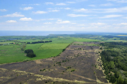
- Price
- Offers Over£325,000
- Size
- 108.66 acres
108 acres Staintondale, Scarborough, Staintondale, North Yorkshire YO13 England
Added on 24/05/2026Grazing Land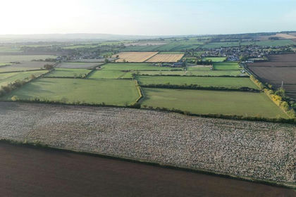
- Price
- Guide Price£450,000
- Size
- 43.54 acres
43.54 Acres of Land off Low Lane, Swinton, Malton, Swinton, North Yorkshire YO17 England
Added on 16/10/2026Arable Land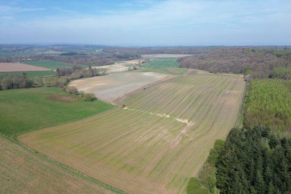
- Price
- Guide Price£325,000
- Size
- 32.5 acres
Added on 29/01/2026Arable Land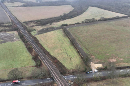
- Price
- Offers in Excess of£350,000
- Size
- 71.24 acres
Finchale Road, Newton Hall, Durham, City of Durham, County Durham DH1 England
Added on 17/07/2026Farm