
Freehold Plot End Of Garden Ashburnham Gardens South Queensferry, Edinburgh (EH30 9LB)
Key Features
- Trees, bush, grass
- Postal lockbox option "subject to investigating and satisfying planning consents
Description
=========================================================================
"Freehold Amenity Plot with Strategic Hope Value – South Queensferry (EH30 9LB) With "Potential for Future Planning (STPP)" | Offers Around £4,950
( 5 more plots down the road bit cheaper from only £1000)
PRIME ROAD PROXIMITY NEAR ESTABLISHED RESIDENTIAL BORDERS
A short car drive or bus ride to the city of Edinburgh
=========================================================================
Plot 4, Adjacent to 27 Ashburnham Gardens is
PERFECT FOR IMMEDIATE PRIVATE AMENITY, HOBBY & LEISURE USES
With full ownership and access rights etc granted post completion
Direct Roadside Access & Logistics Potential
This exceptional plot benefits from direct roadside access, positioned immediately adjacent to the paved street front and established residential boundaries at No. 27 Ashburnham Gardens. Unlike remote or landlocked plots, its tarmac-side positioning allows delivery vehicles to pull up directly to the boundary line.
The plot offers an exceptional, low-cost entry into the prestigious South Queensferry property market. This freehold parcel is strategically positioned directly adjacent to established premium homes on Ashburnham Gardens. Offered with excellent "Hope Value," and is perfectly configured for speculative investors, creative developers, or neighboring homeowners looking to secure and expand their current property boundaries.
The location is currently zoned as amenity land and wooded and is situated to the end of a garden plot with peak values on the road reaching up to £900,000
Soil type is clay mix with a high water-holding capacity so great as a pond liner
And one of the best natural substrates for creating ponds, rainwater catchment features/natural aquatic habitats/put freestanding above ground waterbutts
Fantastic recreational and ecological use and rights are completely protected
and backed by clear freehold title the plot is roughly rectangular in shape and of a generous size forming all that area in red shown see plan and benefiting from
Immediate Road Access Situated directly off Ashburnham Gardens and Ashburnham Loan. The plot sits a short distance from the primary road network
What You Can Legally Do With the Land:
Because the land is formally classified as Amenity Land, your structural development rights are tightly restricted, but your recreational and ecological rights are completely protected so you can immediately upon completion of sale
✅ Erect Temporary Shelters (100% Legal): You can legally set up a day-use canvas tarp, a pop-up gazebo, or a wildlife photography hide. Because it has a zero-footprint and is dismantled at the end of the day, it is a personal mobile asset (chattel), not a building, bypassing any need for City of Edinburgh Council planning approval.
✅ Execute "De Minimis" Personal Leisure: You can sit quietly, read, paint, family-camp occasionally, use push-mowers, and enjoy the wildlife without violating any land-use law.
✅ Install Surface Water Management: The deed grants explicit "Service Connection Rights." While you can't build a massive concrete drain without checking, you can legally implement simple surface-water management like rain-harvesting setups, above-ground micro-cisterns, or a shallow wildlife watering holes.
3. What You Can Practically Do With the Land
Turn the Clay into a Bird Magnet: Heavy, damp soil is incredibly rich in organic matter and soil invertebrates. Instead of fighting the mud, layer it with decaying logs and leaf mulch. This will create a hyper-active ground-feeding zone for native birds like Song Thrushes, Blackbirds, Robins, and Dunnocks seeking worms and larvae.
Establish a "Mown Path" System: Instead of paying thousands to drain or level the plot, leave the boundaries wild with native shrubs and edge-of-woods ground cover (like brambles or wild ivy) to provide cover for nesting birds. Use a basic manual mower to slice out a tidy, short-grass seating area for your shelter. It looks managed, intentional, and takes minutes to maintain.
Use Ground Protection Mats: Because the soil will get soft underfoot in winter, lay down a small path of woodchips or temporary, permeable interlocking matrix mats where you intend to stand your shelter.
• Email: landinvestmentstd@gmail.com or Text Tim on 07386 601087
BONUS: Free Legal Fees / Conveyancing Included! or use your own solicitor
The deposit of 10% can be made by Paypal or paid via bank transfer to suit
🌿 Complimentary Buyer’s Pack: Sale includes a free environmental report and initial planning history checks, saving you immediate upfront outof-pocket costs and providing instant baseline data on the plot.
⚖️ Important Notice to Purchaser:
While baseline planning checks and environmental data are provided in good faith, buyers are advised to carry out their own independent due diligence and site assessments prior to purchase to satisfy themselves that the plot meets their specific architectural or operational requirements. All sales contracts are legally binding and final upon completion of payment.
Map Location
Property details
- Tenure
- Ask Agent
- Council Tax Band
- Ask Agent
- Date Posted
- 2026-10-22
Utilities & Restrictions
Utilities
- Electricity
- Ask Agent
- Water
- Ask Agent
- Heating
- Ask Agent
- Broadband
- Ask Agent
- Sewerage
- Ask Agent
Rights & Restrictions
- Public Rights of Way
- Yes
- Private Rights of Way
- Yes
- Listed Property
- Ask Agent
- Restrictions
- Yes
Listed status, conservation areas and planning constraints for this location are in the full report.
Property Features
- Accessibility
- Ask Agent
- Parking
- On-Street Parking
- Garden
- Ask Agent
Beyond the particulars: planning activity, flood history, heritage and ground risks, checked for this exact spot.
Connectivity
Broadband
Fastest speed available at this postcode
1.8 Gbps
Gigabit full fibre
Suitable for
- 4K streaming on every screen
- Full-time home working
- Online gaming & big downloads
Mobile signal
Predicted 4G and 5G signal; indoor signal depends on building materials.
Ofcom Connected Nations postcode-level predictions. Speeds and signal are modelled, not measured, and vary between addresses and providers.
Signal is the easy part. Planning activity, flood history and protected designations here are in the full report.
Nearest Schools
Primary
- St Margaret's RC Primary School150 metres
- Pupils
- 85
- Type
- Roman Catholic
- Queensferry Primary School588 metres
- Pupils
- 535
- Type
- Non-denominational
- Dalmeny Primary School0.7 miles
- Pupils
- 85
- Type
- Non-denominational
- Echline Primary School1 mile
- Pupils
- 286
- Type
- Non-denominational
- North Queensferry Primary School1.7 miles
- Pupils
- 66
- Type
- Non-denominational
Secondary
- Queensferry Community High School218 metres
- Pupils
- 1,129
- Type
- Non-denominational
- Inverkeithing High School3.3 miles
- Pupils
- 1,643
- Type
- Non-denominational
- Sinclair Academy4 miles
- Pupils
- 79
- Type
- Roman Catholic
- Winchburgh Academy4.1 miles
- Pupils
- 110
- Type
- Non-denominational
- The Royal High School4.3 miles
- Pupils
- 1,476
- Type
- Non-denominational
Distances are straight-line from the advertised location. Source: the national school registers (DfE, Welsh Government, Scottish Government) and Ofsted.
Schools are just the start: planning activity, heritage and any flood history here are in the full report.
Amenities
Supermarket
GP surgery
Pharmacy
Green space
Walking trail
Straight-line distances from the advertised location. Sources: NHS records, Geolytix supermarket locations, OS Open Greenspace and the national trails registers.
The area stacks up? Now check the location itself: planning nearby, protected designations and past flooding.
Getting Around
Nearest station
Nearest bus stop
Typical drive times
Straight-line distances from the advertised location; drive times are typical free-flow times over OpenStreetMap road data, so allow more at peak. Public transport locations from DfT NaPTAN.
Easy to reach matters. So do planning activity, flood history and ground risks: all in the full report.
Flood Risk
SEPA open data, checked around the advertised map pin for the listed acreage. The map pin for this listing marks the postcode area rather than the exact location, so these readings describe the surrounding area. Provided by LandSale, not the listing agent, and not part of the agent's particulars. Risk varies across a holding, so verify before committing.
Rivers and the sea
Surface water
These bandings are the summary. Where this location sits on the flood maps, plus planning activity, heritage and ground risks, is in the full report.
Important notice: Information, maps and tags on this page are drawn from the advertising agent's marketing materials or generated automatically. LandSale has not verified them. Relying on these details is at your own risk, always carry out independent checks before committing to a purchase.
LandSale full disclaimer
Marketing information only - not formal particulars. The details on this website are provided for general guidance and do not constitute an offer or contract. Neither LandSale nor the advertising estate/land agent accepts responsibility for any inaccuracy.
1. Source of information
- Listing content: Core description, asking price, tenure, measurements, photographs and planning history originate from the marketing materials of the advertising estate or land agent. LandSale does not author this content and cannot guarantee its accuracy.
- Automated tags & categorisation: Property type, land-use class, acreage bands and similar labels may be applied by machine-learning models. They are intended as a helpful guide only and may not reflect the property's legal status or permitted use.
- Third-party & enriched data layers: Maps, boundary outlines, planning designations, soil reports, broadband coverage and other environmental or location-based insights are licensed from external suppliers. Such data are supplied “as is", may be incomplete or out of date and are subject to change without notice.
2. Verification required
Prospective purchasers must verify critical matters, including but not limited to planning permission, title boundaries, public rights of way, environmental constraints, acreage, services, access and VAT status, through their own inspections, specialist surveys, legal advisers and the selling agent before relying on the information or entering into any contract.
3. No warranty or liability
LandSale gives no warranty, express or implied, as to the accuracy, completeness or fitness for any particular purpose of the information displayed. LandSale shall not be liable for any loss, damage, cost or expense arising directly or indirectly from any use of or reliance on such information, save where liability may not be excluded by law.
4. Updates & feedback
If you believe any detail on this listing is inaccurate, please let us know. We will investigate and, where appropriate, update the listing or notify the agent.
© LandSale | Version 1.3 - August 2026
Similar properties for sale
- Price
- Guide Price£9,000
- Size
- 0.58 acres
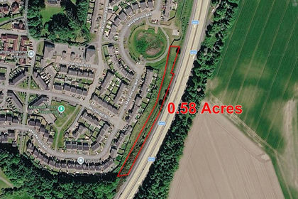
0.58 Acre Plot West of M90, Dunfermline, KY118ZY, Dunfermline and Dollar, Fife KY11 Scotland
Added on 24/09/2026Cheap Land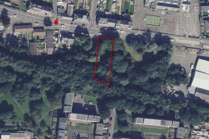
- Price
- Guide Price£5,000
Plot at Balridgeburn, Dunfermline, KY129EE, Dunfermline and Dollar, Fife KY12 Scotland
Added on 28/10/2026Development Land
- Price
- POA
- Size
- 0.58 acres
250 Broad Street, Cowdenbeath, KY48JE, Cowdenbeath and Kirkcaldy, Fife KY4 Scotland
Added on 20/05/2026Warehouse
- Price
- Guide Price£8,000
- Size
- 0.06 acres
Added on 03/07/2026Small Plot of Land
- Price
- Guide Price£5,000
- Size
- 0.28 acres
Land at Ardgay Road, Bonnybridge, FK42FL, Falkirk, Falkirk FK4 Scotland
Added on 03/07/2026Development Land
- Price
- Guide Price£2,000
- Size
- 0.06 acres
Site, Milnquarter Road, Bonnybridge, Falkirk, FK42FL, Falkirk, Falkirk FK4 Scotland
Added on 28/08/2026Small Plot of Land
- Price
- Guide Price£7,500
- Size
- 0.2 acres
Plot at Bridge End, Shotts, Lanarkshire, Airdrie and Shotts, North Lanarkshire ML7 Scotland
Added on 15/10/2026Development Land
- Price
- Guide Price£8,000
293-297, Bank Street, Coatbridge, ML51EG, Coatbridge and Bellshill, North Lanarkshire ML5 Scotland
Added on 02/07/2026Development Land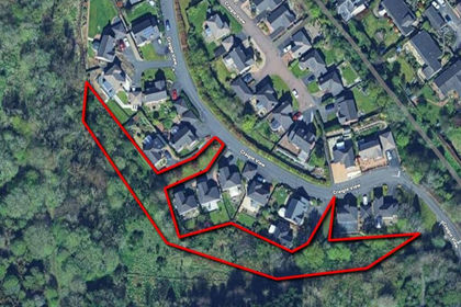
- Price
- Guide Price£9,500
Land at Craigie View, Perth, PH20DP, Perth and Kinross-shire, Perth and Kinross PH2 Scotland
Added on 30/09/2026Development Land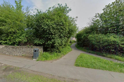
- Price
- Guide Price£4,000
Added on 02/07/2026Development Land