
Wanlockhead, Biggar, ML12
- Land size
- 3.7 acres
- Bedrooms
- 4
- Bathrooms
- 1
Description
Agent ref CHS01
Perched in the dramatic Lowther Hills, Wanlockhead proudly holds the title of Scotland’s highest village. This historic and welcoming community offers an idyllic escape from city life, where panoramic hill views and untouched natural beauty sit right on your doorstep. While the cottage requires a schedule of refurbishment, it presents a spectacular blank canvas and an unmatched opportunity to create your dream rural retreat or premium investment. The property is surrounded by approximately 3.4 acres of land, which is included within the property sale.
Accommodation
The property opens into a large, welcoming vestibule leading into a central hallway that connects the primary ground-floor accommodation.
The living room is the real highlight of the home, this generously sized room is designed for relaxing or entertaining, featuring an open fire and framing spectacular, panoramic views of the countryside.
The kitchen is fitted with a range of wall and floor units alongside dedicated space for white goods. Requiring modernisation, it benefits from a highly practical, large walk-in larder/utility space off the main kitchen area.
Serving the ground floor, the family bathroom is well-balanced and complete with a bath, over-bath electric shower, wash hand basin, and WC. A practical fitted cupboard houses the property's central heating boiler while offering excellent additional storage space for linens and essentials.
Located on the lower level, this generously sized double bedroom offers exceptional versatility, making it ideal as a principal bedroom, a guest suite, or a peaceful home office. The room features a generous footprint and boasts a lovely, picturesque outlook directly over the historic village.
Upstairs, the bright landing leads to three additional, good sized bedrooms that offer exceptional flexibility for growing families or those requiring dedicated home-working spaces. Each bedroom features a comfortable, spacious layout and frames stunning, elevated views that capture a perfect blend of the rolling countryside and the historic village below.
Practicality is built-in, with additional integrated cupboard space located at the top of the upstairs landing.
The property benefits from oil-fired central heating and double-glazed windows throughout.
Generous wrap-around garden grounds surround the cottage, offering incredible potential for landscaping, vegetable plots, or outdoor entertaining spaces. Beyond the gardens lies adjoining grazing land, bringing the total plot size to approximately 3.7 acres.
To the rear, the grounds benefit from a single garage and traditional outbuildings, providing excellent scope for restoration or additional storage.
Location
Situated in Scotland’s highest village and surrounded by breathtaking countryside and rich local history, Wanlockhead feels like a beautifully remote highland retreat. Remarkably accessible despite its tranquil setting, the village is positioned just a short drive from the M74 motorway network, offering a straightforward commute to Glasgow, Edinburgh, Carlisle, and beyond. It provides the ideal balance of peaceful country living without sacrificing seamless connections to major cities.
The property lies within a conservation area, and within an area designated as a scheduled monument (Ref: SM5597 - Wanlockhead, remains of lead mining and smelting)
The seller is aware that the property lies approximately 1.5km east of the boundary of the proposed Glensalloch Wind Farm. The purchaser will be held to have satisfied themselves on the details of this proposed development
Early viewing is highly recommended to fully appreciate the potential this property has to offer.
Services: Mains electricity, mains water, mains drainage, oil fired central heating, double glazing.
Important Notice (The Disclaimer)
These particulars are intended to give a fair and substantially correct overall description for the guidance of intending purchasers and do not constitute an offer or part of a contract. The property is sold subject to all existing servitude rights, burdens, reservations and wayleaves, including rights of access and rights of way whether contained in the Title Deeds or informally constituted and whether referred to in the General Remarks or not. The Purchaser(s) will be held to have satisfied themselves as to the nature of such servitude rights and others. All descriptions, dimensions, areas, and permissions for use and occupation are given in good faith and are believed to be correct, but any intending purchasers should not rely on them as statements or representations of fact, but must satisfy themselves by inspection or otherwise as to the correctness of each of them. All measurements are approximate.
Offers
Offers should be submitted in Scottish legal form to iAD Estate Agents. A closing date may be set, and the seller is not bound to accept the highest or any offer.
Map Location
Property details
- Tenure
- Freehold
- Council Tax Band
- Ask Agent
- Date Posted
- 2026-10-20
Market Value Analysis
Compared with 452 Homes with Land listings in Scotland (1+ acres).
Utilities & Restrictions
Utilities
- Electricity
- Ask Agent
- Water
- Ask Agent
- Heating
- Ask Agent
- Broadband
- Ask Agent
- Sewerage
- Ask Agent
Rights & Restrictions
- Public Rights of Way
- Ask Agent
- Private Rights of Way
- Ask Agent
- Listed Property
- Ask Agent
- Restrictions
- Ask Agent
Listed status, conservation areas and planning constraints for this location are in the full report.
Property Features
- Accessibility
- Ask Agent
- Parking
- Ask Agent
- Garden
- Ask Agent
Beyond the particulars: planning activity, flood history, heritage and ground risks, checked for this exact spot.
Connectivity
Broadband
Fastest speed available at this postcode
1.8 Gbps
Gigabit full fibre
Suitable for
- 4K streaming on every screen
- Full-time home working
- Online gaming & big downloads
Mobile signal
Predicted 4G and 5G signal; indoor signal depends on building materials.
Ofcom Connected Nations postcode-level predictions. Speeds and signal are modelled, not measured, and vary between addresses and providers.
Signal is the easy part. Planning activity, flood history and protected designations here are in the full report.
Nearest Schools
Primary
- Leadhills Primary School1.8 miles
- Pupils
- 20
- Type
- Non-denominational
- Sanquhar Primary School6 miles
- Pupils
- 166
- Type
- Non-denominational
- Crawford Primary School7.2 miles
- Pupils
- 12
- Type
- Non-denominational
- Abington Primary School7.7 miles
- Pupils
- 40
- Type
- Non-denominational
- Kelloholm School8.3 miles
- Pupils
- 161
- Type
- Non-denominational
Secondary
- Sanquhar Academy6.1 miles
- Pupils
- 218
- Type
- Non-denominational
- Wallace Hall Academy11 miles
- Pupils
- 551
- Type
- Non-denominational
- Moffat Academy14 miles
- Pupils
- 254
- Type
- Non-denominational
- Lesmahagow High School18 miles
- Pupils
- 634
- Type
- Non-denominational
- Biggar High School19 miles
- Pupils
- 637
- Type
- Non-denominational
Distances are straight-line from the advertised location. Source: the national school registers (DfE, Welsh Government, Scottish Government) and Ofsted.
Schools are just the start: planning activity, heritage and any flood history here are in the full report.
Amenities
Supermarket
GP surgery
Pharmacy
Green space
Walking trail
Straight-line distances from the advertised location. Sources: NHS records, Geolytix supermarket locations, OS Open Greenspace and the national trails registers.
The area stacks up? Now check the location itself: planning nearby, protected designations and past flooding.
Getting Around
Nearest station
Nearest bus stop
Typical drive times
Straight-line distances from the advertised location; drive times are typical free-flow times over OpenStreetMap road data, so allow more at peak. Public transport locations from DfT NaPTAN.
Easy to reach matters. So do planning activity, flood history and ground risks: all in the full report.
Flood Risk
SEPA open data, checked around the advertised map pin for the listed acreage. Provided by LandSale, not the listing agent, and not part of the agent's particulars. Risk varies across a holding, so verify before committing.
Rivers and the sea
Surface water
Not at the pin: mapped about 20 metres away.
These bandings are the summary. Where this location sits on the flood maps, plus planning activity, heritage and ground risks, is in the full report.
Important notice: Information, maps and tags on this page are drawn from the advertising agent's marketing materials or generated automatically. LandSale has not verified them. Relying on these details is at your own risk, always carry out independent checks before committing to a purchase.
LandSale full disclaimer
Marketing information only - not formal particulars. The details on this website are provided for general guidance and do not constitute an offer or contract. Neither LandSale nor the advertising estate/land agent accepts responsibility for any inaccuracy.
1. Source of information
- Listing content: Core description, asking price, tenure, measurements, photographs and planning history originate from the marketing materials of the advertising estate or land agent. LandSale does not author this content and cannot guarantee its accuracy.
- Automated tags & categorisation: Property type, land-use class, acreage bands and similar labels may be applied by machine-learning models. They are intended as a helpful guide only and may not reflect the property's legal status or permitted use.
- Third-party & enriched data layers: Maps, boundary outlines, planning designations, soil reports, broadband coverage and other environmental or location-based insights are licensed from external suppliers. Such data are supplied “as is", may be incomplete or out of date and are subject to change without notice.
2. Verification required
Prospective purchasers must verify critical matters, including but not limited to planning permission, title boundaries, public rights of way, environmental constraints, acreage, services, access and VAT status, through their own inspections, specialist surveys, legal advisers and the selling agent before relying on the information or entering into any contract.
3. No warranty or liability
LandSale gives no warranty, express or implied, as to the accuracy, completeness or fitness for any particular purpose of the information displayed. LandSale shall not be liable for any loss, damage, cost or expense arising directly or indirectly from any use of or reliance on such information, save where liability may not be excluded by law.
4. Updates & feedback
If you believe any detail on this listing is inaccurate, please let us know. We will investigate and, where appropriate, update the listing or notify the agent.
© LandSale | Version 1.3 - August 2026
Similar properties for sale
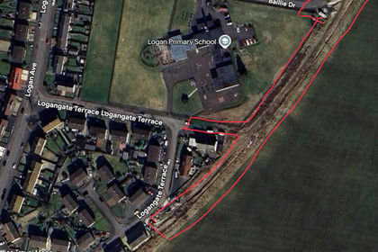
- Price
- Offers in Region of£150,000
- Size
- 1.22 acres
Logangate Terace, Logan, Logan, Kilmarnock and Loudoun, East Ayrshire KA18 Scotland
Added on 05/06/2026Development Land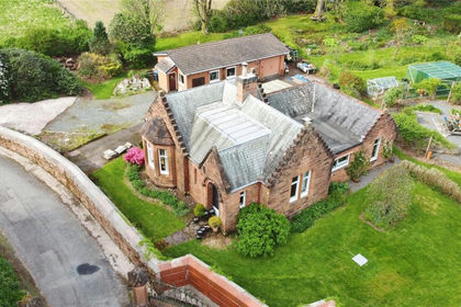
- Price
- Guide Price£160,000
- Size
- 1.4 acres
Added on 20/10/2026House with Land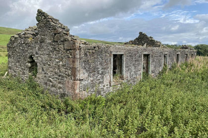
- Price
- Offers Over£200,000
- Size
- 6.5 acres
Added on 24/06/2026Building Plot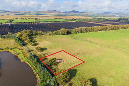
- Price
- Offers Over£225,000
- Size
- 1 acres
Plot A The Beeches, Leadburn, EH46, Midlothian, Midlothian EH46 Scotland
Added on 20/10/2026Building Plot
- Price
- Offers Over£225,000
- Size
- 1 acres
Plot B The Beeches, Leadburn, EH46, Midlothian, Midlothian EH46 Scotland
Added on 20/10/2026Building Plot