Hornblotton, Glastonbury
- Land size
- 41.54 acres
- Bedrooms
- 5
- Bathrooms
- 2
Key Features
- Detached period 5-bedroom farmhouse
- Range of traditional and modern agricultural buildings
- Planning permission for two four-bedroom barn conversions
- Good access onto the A37 (0.3 miles)
- Outstanding views of surrounding countryside
- Quiet rural hamlet location
- In all 41.54 acres (16.80 hectares)
Description
A former dairy farm set in a scenic and easily accessible position with far-reaching views of the surrounding countryside, including a period farmhouse, a range of traditional and modern agricultural buildings with planning permission for conversion and 41.54 acres (16.80 hectares) of productive agricultural land
Introduction - Set in a quiet rural location, Church Farm is brought to the market for the first time in over 100 years. Having previously been run as a dairy farm, in recent years the farm has been utilised as a livestock holding. The farm is nestled in a private yet easily accessible position. The period farmhouse, full of history, boasts extensive accommodation with five bedrooms, alongside an adaptable range of traditional and modern farm buildings, benefitting from approved planning permission for two four-bedroom barn conversions. The farmyard and farm buildings are set to the northeast of the farmhouse, and the land is set further north, east, south and west, leading up to the A37 and to the southern end of the hamlet.
Lot A – Farmhouse, Buildings & 41.54 Acres - The detached five-bedroom farmhouse boasts a handsome approach leading from the driveway. It provides spacious accommodation over two floors with period features throughout.
The ground floor provides a conservatory upon entry, a generously sized kitchen/dining room, a separate utility, sitting room, and study. Attached to the farmhouse is a large garage and storage shed. The first floor has five bedrooms, a family bathroom and a shower room. The farmhouse enjoys gardens and paddocks on three sides. The gardens are mature and laid to lawn, with mature trees, shrubs, and flowers, plus a double tandem garage and ample parking.
The farm buildings are set to the northeast of the farmyard and are set on good concrete yards. They offer a functional and adaptable range of traditional and modern construction. The traditional buildings are constructed of block and stone under fibre cement/asbestos roofs, whilst the modern buildings are constructed of steel frame under fibre cement/asbestos roofs.
1 Silage pit and cubicle houses (560 sq. m.)
2 Cubicle house and loose housing (350 sq. m.)
3 Loose housing and handling area (173 sq. m.)
4 Traditional buildings with planning permission – cow stall, dairy and old parlour (285 sq. m.)
5 Former chicken shed (192 sq. m.)
6 Slurry tower – uncovered
The traditional farm buildings (4) benefit from full planning permission to create two four-bedroom barn conversions. The planning was granted on 20th August 2024 under planning reference: 2023/2367/FUL.
The design for the scheme is to retain the ‘U’-shaped courtyard of traditional farm buildings, and to incorporate a new-build element to echo a taller building within this group. The permission is for conversion and extension to create two four-bedroom dwellings (one incorporating a self-contained annexe). These are set over two floors, with bedrooms located on both the ground and first floors. Please see further details in the approved drawings.
The land in Lot A wraps around the farmhouse and farm buildings and comprises seven enclosures of level productive land, currently all laid to grass. The land in Lot A totals 41.54 acres (16.80 hectares), together with the farm buildings and farmhouse. The land is accessed by an internal track included within Lot A and is classified as Grade 3 on the Agricultural Land Classification Maps. The soil is recorded as slowly permeable seasonally wet slightly acid but base-rich loamy and clayey soils.
Services - Lot A – Mains water and electricity. Oil-fired central heating via radiators. Private drainage via a septic tank. A bank of solar panels is sited to the north of the buildings (owned outright by the sellers).
Lot E has a mains water connection.
Broadband - Ultrafast broadband is available.
Mobile signal/coverage - There is mobile coverage in the area. Please refer to Ofcom’s website for more details.
Council Tax Band: E
Agricultural Schemes - There are no existing Sustainable Farming Incentive or Countryside Stewardship agreements in place.
Situation - Hornblotton is a small hamlet located just off the A37, not far from Castle Cary and Shepton Mallet. It offers a sense of community with easy access to local amenities.
Bruton is 8 miles away and is home to Hauser and Wirth Gallery and the Roth Bar and Grill. Bruton has a good range of local shops, boutiques, pubs, and restaurants, including The Chapel.
The Newt (7.5 miles) at Castle Cary is a popular new destination with exceptional gardens and grounds, with a country house hotel.
The nearby towns of Frome, Shepton Mallet and Wells have a wider range of shopping and leisure facilities.
Road links are excellent, with Bath and Bristol within commuting distance, and the A303 (M3) and M5 within easy reach.
Access by rail is available at Castle Cary (Paddington within 2 hours) and Templecombe (Waterloo within 2.5 hours).
An exceptional variety of schools can be found in the area to suit all abilities and interests; Bruton (King's and Sexey's), Hazelgrove at nearby Sparkford, Street (Millfield), Wells (Cathedral and The Blue School). Sherborne and Bath both offer further state and independent schooling. There are state primary schools at the nearby villages of Ditcheat and Keinton Mandeville, and Ansford School, a state secondary school in Castle Cary.
The local area, particularly the nearby Mendip Hills, offers a variety of leisure pursuits, such as horse riding, hunting, walking, and cycling.
Sporting, Timber & Mineral Rights - All sporting, timber and mineral rights are understood to be owned and included.
Fixtures & Fittings - All freestanding equipment and any other equipment not specifically mentioned in the details above are excluded from the sale.
Rights, Easements & Boundaries - The farm is sold subject to and with the benefit of all rights including rights of way whether public or private, light, support, drainage, water and electricity supplies and other rights and obligations, easements and quasi-easements and restrictive covenants and all existing and proposed wayleaves or masts, pylons, stays, cables, drains and water, gas or other pipes whether referred to in the General Remarks and Stipulations or particulars of sale or not. The purchaser shall be deemed to have full knowledge of the boundaries of the ownership thereof.
A public footpath crosses Lot A, Lot B and Lot C. See the sale plan for the exact location.
Tenure & Possession - Freehold with vacant possession upon completion.
Viewings - Strictly by prior appointment with sole agents Symonds & Sampson LLP. Further information, if required, is available from Lucy Carnell on or Joanna Down on .
Map Location
Property details
- Tenure
- Freehold
- Council Tax Band
- E
- Date Posted
- 2026-10-15
Market Value Analysis
Compared with 65 Farms & Smallholdings listings in South West England (25+ acres).
Energy Performance Certificate
Energy Efficiency Rating
Based on UK Energy Performance Certificate standards (EU Directive 2002/91/EC)
Running costs are one side. Planning activity, flood history and ground risks for this location are in the full report.
Utilities & Restrictions
Utilities
- Electricity
- Mains
- Water
- Mains
- Heating
- Oil Heating
- Broadband
- Ask Agent
- Sewerage
- Mains
Rights & Restrictions
- Public Rights of Way
- Yes
- Private Rights of Way
- Ask Agent
- Listed Property
- Ask Agent
- Restrictions
- Ask Agent
Listed status, conservation areas and planning constraints for this location are in the full report.
Property Features
- Accessibility
- Ask Agent
- Parking
- Off-Street Parking
- Garden
- Garden
Beyond the particulars: planning activity, flood history, heritage and ground risks, checked for this exact spot.
Connectivity
Broadband
Fastest speed available at this postcode
1 Gbps
Gigabit full fibre
Suitable for
- 4K streaming on every screen
- Full-time home working
- Online gaming & big downloads
Fixed wireless access may also be an option here.
Mobile signal
Predicted 4G and 5G signal; indoor signal depends on building materials.
Ofcom Connected Nations postcode-level predictions. Speeds and signal are modelled, not measured, and vary between addresses and providers.
Signal is the easy part. Planning activity, flood history and protected designations here are in the full report.
Nearest Schools
Primary
- Lovington Church of England Primary School1.3 milesOfsted: Inadequate
- Ages
- 4 to 11
- Pupils
- 35
- Type
- Academy sponsor led
- Faith
- Church of England
- Ditcheat Primary School2.8 milesOfsted report card · Jan 2026
- Ages
- 4 to 11
- Pupils
- 89
- Type
- Community school
- Baltonsborough Church of England VC Primary School2.9 milesOfsted: Requires improvement
- Ages
- 4 to 11
- Pupils
- 70
- Type
- Academy converter
- Faith
- Church of England
- Keinton Mandeville Primary School3.1 milesOfsted: Good
- Ages
- 4 to 11
- Pupils
- 149
- Type
- Community school
- Castle Cary Community Primary School3.3 milesOfsted: Requires improvement
- Ages
- 4 to 11
- Pupils
- 177
- Type
- Academy sponsor led
Secondary
- Ansford Academy3.3 milesOfsted report card · Feb 2026
- Ages
- 11 to 16
- Pupils
- 469
- Type
- Academy converter
- Sexey's School5.5 milesOfsted: Good
- Ages
- 11 to 18
- Pupils
- 633
- Type
- Academy converter
- Faith
- Church of England
- Whitstone6.5 milesOfsted: Good
- Ages
- 11 to 16
- Pupils
- 545
- Type
- Academy converter
- Crispin School Academy6.6 milesNo Ofsted rating
- Ages
- 11 to 16
- Pupils
- 978
- Type
- Academy converter
- St Dunstan's School6.7 milesOfsted: Good
- Ages
- 11 to 16
- Pupils
- 529
- Type
- Academy converter
Distances are straight-line from the advertised location. Source: the national school registers (DfE, Welsh Government, Scottish Government) and Ofsted.
Schools are just the start: sold prices nearby, planning activity and any flood history are in the full report.
Amenities
Supermarket
GP surgery
Pharmacy
Hospital
Straight-line distances from the advertised location. Sources: NHS records, Geolytix supermarket locations, OS Open Greenspace and the national trails registers.
The area stacks up? Now check the location itself: planning nearby, protected designations and past flooding.
Getting Around
Nearest station
Nearest bus stop
Typical drive times
Straight-line distances from the advertised location; drive times are typical free-flow times over OpenStreetMap road data, so allow more at peak. Public transport locations from DfT NaPTAN.
Easy to reach matters. So do planning activity, flood history and ground risks: all in the full report.
Flood Risk
Environment Agency open data, checked around the advertised map pin for the listed acreage. Long-term risk counts flood defences; the planning map's flood zones do not. Provided by LandSale, not the listing agent, and not part of the agent's particulars. Risk varies across a holding, so verify before committing.
Rivers and the sea
Planning map: Flood Zone 1.
Surface water
Not at the pin: mapped about 10 metres away.
These bandings are the summary. Where this location sits on the flood maps, plus planning activity, heritage and ground risks, is in the full report.
Important notice: Information, maps and tags on this page are drawn from the advertising agent's marketing materials or generated automatically. LandSale has not verified them. Relying on these details is at your own risk, always carry out independent checks before committing to a purchase.
LandSale full disclaimer
Marketing information only - not formal particulars. The details on this website are provided for general guidance and do not constitute an offer or contract. Neither LandSale nor the advertising estate/land agent accepts responsibility for any inaccuracy.
1. Source of information
- Listing content: Core description, asking price, tenure, measurements, photographs and planning history originate from the marketing materials of the advertising estate or land agent. LandSale does not author this content and cannot guarantee its accuracy.
- Automated tags & categorisation: Property type, land-use class, acreage bands and similar labels may be applied by machine-learning models. They are intended as a helpful guide only and may not reflect the property's legal status or permitted use.
- Third-party & enriched data layers: Maps, boundary outlines, planning designations, soil reports, broadband coverage and other environmental or location-based insights are licensed from external suppliers. Such data are supplied “as is", may be incomplete or out of date and are subject to change without notice.
2. Verification required
Prospective purchasers must verify critical matters, including but not limited to planning permission, title boundaries, public rights of way, environmental constraints, acreage, services, access and VAT status, through their own inspections, specialist surveys, legal advisers and the selling agent before relying on the information or entering into any contract.
3. No warranty or liability
LandSale gives no warranty, express or implied, as to the accuracy, completeness or fitness for any particular purpose of the information displayed. LandSale shall not be liable for any loss, damage, cost or expense arising directly or indirectly from any use of or reliance on such information, save where liability may not be excluded by law.
4. Updates & feedback
If you believe any detail on this listing is inaccurate, please let us know. We will investigate and, where appropriate, update the listing or notify the agent.
© LandSale | Version 1.3 - August 2026
Listing agent
Symonds & Sampson, Yeovil
2 Court Ash, Yeovil, BA20 1HG
Similar properties for sale
- Price
- Guide Price£1,450,000
- Size
- 43 acres
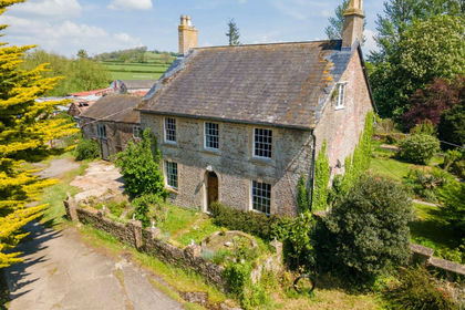
Farm-43 acres, Horwood, Wincanton, BA9, Wincanton, Somerset BA9 England
Added on 29/01/2026Farm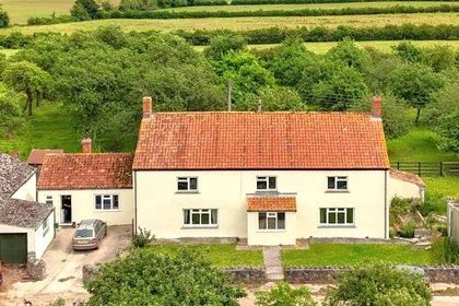
- Price
- Guide Price£1,750,000
- Size
- 220.63 acres
Nythe, Ashcott, Bridgwater, TA7, Bridgwater, Somerset TA7 England
Added on 22/06/2026Farm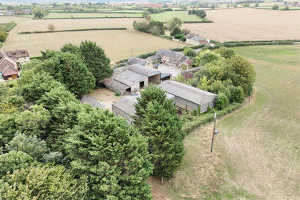
- Price
- Guide Price£1,335,000
- Size
- 67.15 acres
Gannetts, Todber, Sturminster Newton, Marnhull, Dorset DT10 England
Added on 30/09/2026Farm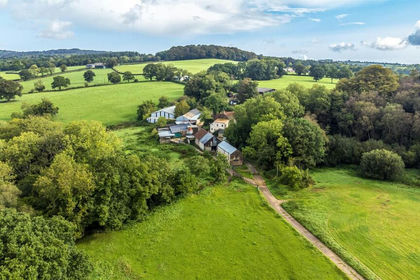
- Price
- Guide Price£1,420,000
- Size
- 81.13 acres
Whitestaunton, Chard, Somerset, Whitestaunton, Somerset TA20 England
Added on 17/06/2026Farm
- Price
- Guide Price£1,100,000
- Size
- 97.25 acres
Llwyn-y-Celyn Farm Lot 2, Shirenewton, Chepstow, NP16, Shirenewton, Monmouthshire NP16 Wales
Added on 29/01/2026Dairy Farm