Burrington, Umberleigh, EX37
- Land size
- 2 acres
- Bedrooms
- 3
- Bathrooms
- 2
Key Features
- Three bedroom detached property
- Lovely garden
- Parking
- Shared ownership of a 2 acre paddock/woodland
- No onward chain
Description
A charming three bedroom extended rural retreat with a delightful garden, parking and shared ownership of a 2 acre paddock and woodland. No onward chain.
Marsh Cottage is a charming and characterful three-bedroom home, offering a peaceful rural lifestyle within an attractive courtyard setting of just four cottages. The property provides well-balanced and versatile accommodation throughout.
The ground floor features a welcoming reception room, which offers flexibility for a variety of uses and benefits from a wood-burning stove set on a slate hearth. Patio doors open directly onto the garden, creating an excellent connection between the indoor and outdoor spaces. This room flows through to the spacious open-plan kitchen, dining and sitting area, a particularly appealing space full of charm, featuring a further wood-burning stove and an attractive window seat.
The recently renovated kitchen is fitted with a range of wall and base units and provides space and plumbing for both a washing machine and dishwasher. A stable door offers access to the side garden, while stairs rise to the first floor. Completing the ground floor is the principal bedroom, served by an en suite shower room.
On the first floor, a galleried landing leads to two further bedrooms. Bedroom two is a generous double room with built-in wardrobes, while bedroom three is a comfortable single bedroom, also benefitting from built-in storage. The family bathroom is fitted with a panelled bath, wash hand basin, WC and heated towel rail.
Overall, Marsh Cottage presents an excellent opportunity to acquire a delightful countryside home combining character features with well-proportioned living accommodation.
For layout and approximate room measurement please see the enclosed floorplan.
OUTSIDE
The front of the property benefits from an allocated parking space. Gated access leads to additional parking and the beautifully landscaped gardens beyond.
Enjoying a delightful riverside setting, the gardens are predominantly laid to lawn and have been thoughtfully designed to make the most of their surroundings. A patio seating area to the rear provides an ideal space for outdoor entertaining, whilst a private courtyard garden is situated to the side of the property. Further features include a summer house and useful storage shed.
Marsh Cottage enjoys shared ownership of approximately 2 acres of stream-bordered grassland and woodland, located close to the property, offering a wonderful natural amenity and further enhancing the appeal of this idyllic setting.
SERVICES & OUTGOINGS
Mains electricity, oil fired central heating, drainage to a private system and private borehole water.
Mullybrook Mill Management Company is responsible for the maintenance of the shared communal gardens, water borehole and foul drainage system. It is understood that an owner of each of the 4 properties is a director of the company and that there is a monthly Management Fee of £60.00 approximately.
Torridge Council tax band C.
ADDITIONAL INFORMATION
Broadband: Broadband is available—highest available download speed 21 Mbps, highest available upload speed 1 Mbps. (Based on Openreach data).
Mobile Coverage: There is very poor coverage via EE , THREE, O2 and Vodaphone. For an indication of specific speeds and supply or coverage in the area we recommend contacting your own provider. (Based on Ofcom data). However WIFI calling is available with certain providers
Flooding: The property is in an area at a HIGH RISK from River/Sea ('High' means more than 3.3% chance of a flood each year.)
VERY LOW surface water flooding (defined as the chance of flooding each year as less than 0.1%)Gov UK data).
Covenant: There is a Holiday let restrictive covenant attached to this property.
Construction Type: cob / stone
Marsh Cottage is situated approximately 1 mile from the village of Burrington, which offers a community run village shop, a village hall, public house and a church. The property is surrounded by picturesque North Devon countryside which provides a wealth of outdoor activities including walking, horse riding, cycling, sea, coarse and game fishing, and golf courses. The nearby popular small country town of Chulmleigh provides a thriving and very active local community which has managed to retain a good range of local services. The town has highly regarded schools including pre-school and an Academy College providing primary and secondary levels, a sports centre, various shops, a health centre, dentist, public houses and restaurants and a historic town hall. Despite its rural position the town still enjoys easy access to the surrounding districts and further afield with the larger towns of South Molton, Barnstaple, Crediton and city of Exeter providing an extensive range of everyday shopping, banking, recreational and educational facilities. To the north the Exmoor National Park offers beautiful moorland scenery with many foot and bridle paths, whilst the stunning North Devon coast is easily accessible, with popular sandy beaches at Instow, Saunton Sands, Croyde Bay, Putsborough and Woolacombe.
Directions
What3Words://////revamping.besotted.cultivation
Map Location
Property details
- Tenure
- Freehold
- Council Tax Band
- C
- Date Posted
- 2026-10-14
Market Value Analysis
Compared with 1,624 Homes with Land listings in South West England (1+ acres).
Energy Performance Certificate
Energy Efficiency Rating
Based on UK Energy Performance Certificate standards (EU Directive 2002/91/EC)
Running costs are one side. Planning activity, flood history and ground risks for this location are in the full report.
Property Brochure
Seen the details? The full report adds the independent checks: planning activity, flood history, heritage and ground.
Utilities & Restrictions
Utilities
- Electricity
- Ask Agent
- Water
- Ask Agent
- Heating
- Ask Agent
- Broadband
- Ask Agent
- Sewerage
- Ask Agent
Rights & Restrictions
- Public Rights of Way
- Ask Agent
- Private Rights of Way
- Ask Agent
- Listed Property
- Ask Agent
- Restrictions
- Ask Agent
Listed status, conservation areas and planning constraints for this location are in the full report.
Property Features
- Accessibility
- Ask Agent
- Parking
- Ask Agent
- Garden
- Ask Agent
Beyond the particulars: planning activity, flood history, heritage and ground risks, checked for this exact spot.
Connectivity
Broadband
Fastest speed available at this postcode
17 Mbps
Standard (10-30 Mbps)
Suitable for
- Web & social
- Music streaming
- Standard video calls
Fixed wireless access may also be an option here.
Mobile signal
Predicted 4G and 5G signal; indoor signal depends on building materials.
Ofcom Connected Nations postcode-level predictions. Speeds and signal are modelled, not measured, and vary between addresses and providers.
Signal is the easy part. Planning activity, flood history and protected designations here are in the full report.
Nearest Schools
Primary
- Chulmleigh Primary School2.7 milesOfsted: Good
- Ages
- 2 to 11
- Pupils
- 226
- Type
- Academy converter
- Kings Nympton Community Primary School3.3 milesNo Ofsted rating
- Ages
- 4 to 11
- Pupils
- 17
- Type
- Foundation school
- High Bickington Church of England Primary Academy4.3 milesOfsted report card · Mar 2026
- Ages
- 2 to 11
- Pupils
- 84
- Type
- Academy converter
- Faith
- Church of England
- Winkleigh Primary School4.8 milesOfsted: Good
- Ages
- 0 to 11
- Pupils
- 224
- Type
- Foundation school
- Dolton Church of England Academy5.2 milesOfsted: Good
- Ages
- 2 to 11
- Pupils
- 31
- Type
- Academy converter
- Faith
- Church of England
Secondary
- Chulmleigh Community College2.6 milesNo Ofsted rating
- Ages
- 11 to 16
- Pupils
- 735
- Type
- Academy converter
- South Molton Community College7.5 milesOfsted: Good *
- Ages
- 11 to 16
- Pupils
- 656
- Type
- Foundation school
- Great Torrington School9.3 milesNo Ofsted rating
- Ages
- 11 to 16
- Pupils
- 863
- Type
- Academy converter
- The Park Community School11 milesOfsted: Good *
- Ages
- 11 to 16
- Pupils
- 1,408
- Type
- Academy converter
- Pilton Community College13 milesOfsted: Good
- Ages
- 11 to 16
- Pupils
- 1,165
- Type
- Academy converter
* Latest graded judgement covers quality of education only; no overall grade was issued under the 2024-25 inspection framework.
Distances are straight-line from the advertised location. Source: the national school registers (DfE, Welsh Government, Scottish Government) and Ofsted.
Schools are just the start: sold prices nearby, planning activity and any flood history are in the full report.
Amenities
Supermarket
GP surgery
Pharmacy
Hospital
Straight-line distances from the advertised location. Sources: NHS records, Geolytix supermarket locations, OS Open Greenspace and the national trails registers.
The area stacks up? Now check the location itself: planning nearby, protected designations and past flooding.
Getting Around
Nearest station
Nearest bus stop
Typical drive times
Straight-line distances from the advertised location; drive times are typical free-flow times over OpenStreetMap road data, so allow more at peak. Public transport locations from DfT NaPTAN.
Easy to reach matters. So do planning activity, flood history and ground risks: all in the full report.
Flood Risk
Environment Agency open data, checked around the advertised map pin for the listed acreage. Long-term risk counts flood defences; the planning map's flood zones do not. Provided by LandSale, not the listing agent, and not part of the agent's particulars. Risk varies across a holding, so verify before committing.
Rivers and the sea
Planning map: Flood Zone 3.
Surface water
These bandings are the summary. Where this location sits on the flood maps, plus planning activity, heritage and ground risks, is in the full report.
Important notice: Information, maps and tags on this page are drawn from the advertising agent's marketing materials or generated automatically. LandSale has not verified them. Relying on these details is at your own risk, always carry out independent checks before committing to a purchase.
LandSale full disclaimer
Marketing information only - not formal particulars. The details on this website are provided for general guidance and do not constitute an offer or contract. Neither LandSale nor the advertising estate/land agent accepts responsibility for any inaccuracy.
1. Source of information
- Listing content: Core description, asking price, tenure, measurements, photographs and planning history originate from the marketing materials of the advertising estate or land agent. LandSale does not author this content and cannot guarantee its accuracy.
- Automated tags & categorisation: Property type, land-use class, acreage bands and similar labels may be applied by machine-learning models. They are intended as a helpful guide only and may not reflect the property's legal status or permitted use.
- Third-party & enriched data layers: Maps, boundary outlines, planning designations, soil reports, broadband coverage and other environmental or location-based insights are licensed from external suppliers. Such data are supplied “as is", may be incomplete or out of date and are subject to change without notice.
2. Verification required
Prospective purchasers must verify critical matters, including but not limited to planning permission, title boundaries, public rights of way, environmental constraints, acreage, services, access and VAT status, through their own inspections, specialist surveys, legal advisers and the selling agent before relying on the information or entering into any contract.
3. No warranty or liability
LandSale gives no warranty, express or implied, as to the accuracy, completeness or fitness for any particular purpose of the information displayed. LandSale shall not be liable for any loss, damage, cost or expense arising directly or indirectly from any use of or reliance on such information, save where liability may not be excluded by law.
4. Updates & feedback
If you believe any detail on this listing is inaccurate, please let us know. We will investigate and, where appropriate, update the listing or notify the agent.
© LandSale | Version 1.3 - August 2026

Listing agent
Greenslade Taylor Hunt, South Molton
23 Broad Street, South Molton, EX36 3AQ
Contact Greenslade Taylor Hunt, South Molton
23 Broad Street, South Molton, EX36 3AQ
View agent profileSimilar properties for sale
- Price
- Guide Price£375,000
- Size
- 1.81 acres
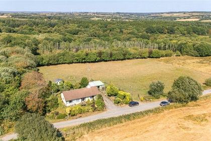
South Grendon - Lot 2, Grendon Lane, Witheridge, Tiverton, EX16, Tiverton, Devon EX16 England
Added on 10/09/2026House with Land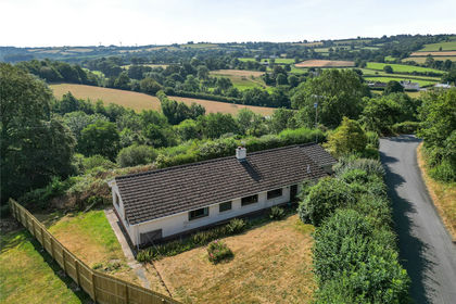
- Price
- Guide Price£350,000
- Size
- 1.8 acres
Ash Mill, South Molton, EX36, South Molton, Devon EX36 England
Added on 28/07/2026House with Land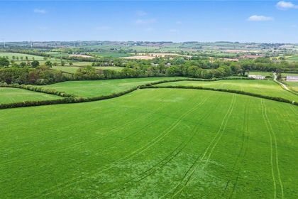
- Price
- Guide Price£265,000
- Size
- 33.17 acres
Station Farm - Lot 3, 33.17 Acres - Bow, Crediton, EX17, Crediton, Devon EX17 England
Added on 05/06/2026Agricultural Land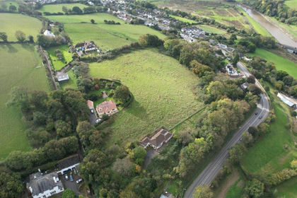
- Price
- Guide Price£400,000
- Size
- 4.13 acres
Hammetts Lane, Bishops Tawton, Barnstaple, North Devon, EX32, Bishop's Tawton, Devon EX32 England
Added on 13/08/2026House with Land
- Price
- Guide Price£375,000
- Size
- 2.2 acres
Woodtown, Bideford, Devon, EX39, Alverdiscott, Devon EX39 England
Added on 24/05/2026Barn Conversion
- Price
- Guide Price£295,000
- Size
- 33.03 acres
Added on 03/07/2026Farm
- Price
- Offers in Region of£325,000
- Size
- 1.86 acres
SUPERB SINGLE BUILDING PLOT, Tennacott Lane, Bideford, Devon, Bideford, Devon EX39 England
Added on 02/10/2026Building Plot
- Price
- £295,000
- Size
- 2.5 acres
Southland Park, Highampton, Beaworthy, Black Torrington, Devon EX21 England
Added on 08/08/2026Development Land
- Price
- Offers in Region of£375,000
- Size
- 7 acres
Yelland Road, Fremington, Barnstaple, Fremington, Devon EX31 England
Added on 08/07/2026Building Plot
- Price
- Offers in Region of£400,000
- Size
- 11 acres
Added on 24/06/2026Smallholding