The Shieling, Bogside, FK10
- Land size
- 1 acres
- Bedrooms
- 3
- Bathrooms
- 1
Key Features
- Detached bungalow with Detached outbuilding
- Lounge
- Kitchen
- 3 Bedrooms & Shower Room
- Approximately 1 acre
- Large Parking areas
- Private grounds
- Rural setting
Description
Excellent opportunity to aquire The Shieling - set in just over an acre of land with separate outbuilding, solar panels and patio area. This three-bedroom bungalow offers 1,425 square feet of accommodation in total, comprising a well-proportioned main house together with a fully self-contained annexe, set in the rural surroundings of Bogside. The main house is centred on a superb living room stretching to almost 22 feet in length, together with a substantial 14-foot kitchen. Three bedrooms are served by a well-appointed shower room. The separate annexe offers outstanding versatility, comprising a dedicated office space/bedroom, a WC/wash room, and a generous 17-foot living/kitchen, ideal for multi-generational living, guest accommodation, a home business, or rental potential. The property enjoys a peaceful rural setting while remaining within easy reach of Dunfermline city, making it an excellent choice for those seeking space, flexibility, and privacy.
LOCATION
The Shieling is set within a highly central and accessible rural position in West Fife surrounded by open countryside. Ideally located for Culross coastal path. The property benefits from excellent communication links within easy driving distance of Scotland's major cities. The two bridges at Kincardine plus the Forth Road Bridge provide fast access to the national motorway network and the international airports at Edinburgh and Glasgow. Nearby Alloa Railway Station offers direct links to Glasgow and the West. Also within travel distance is the acclaimed Dollar Academy private school. There are local shopping facilities and services at Oakley (5 minutes by car) with a wide range of national and boutique shops at Dunfermline (15 minutes away). This home is well located to take advantage of the numerous leisure and recreational opportunities throughout Scotland. In addition to sailing on the Firth of Forth, golfing on local courses, fishing on local reservoirs and forest walks in the beautiful countryside there is a wealth of recreational opportunities in the vicinity.
EXTRAS INC. IN SALE AND AGENTS NOTE
This property is being Sold as Seen in its present condition and no warranty will be given to any purchaser with regard to the existence or condition of the services or any heating or other system within the property or white goods. Any intending purchaser will require to accept the position as it exists.
From 1st February 2022, residential properties in Scotland are required by law to have installed a system of inter-linked smoke alarms, carbon monoxide detectors and heat detectors (the 'inter-linked system'). No warranty is given that any interlinked system has been installed in this property and interested parties should make their own enquiries.
Map Location
Property details
- Tenure
- Freehold
- Council Tax Band
- D
- Date Posted
- 2026-10-12
Market Value Analysis
Compared with 457 Homes with Land listings in Scotland (1+ acres).
Utilities & Restrictions
Utilities
- Electricity
- Ask Agent
- Water
- Ask Agent
- Heating
- Gas Heating
- Broadband
- Ask Agent
- Sewerage
- Ask Agent
Rights & Restrictions
- Public Rights of Way
- Ask Agent
- Private Rights of Way
- Ask Agent
- Listed Property
- Ask Agent
- Restrictions
- Ask Agent
Listed status, conservation areas and planning constraints for this location are in the full report.
Property Features
- Accessibility
- Ask Agent
- Parking
- Private Parking
- Garden
- Garden
Beyond the particulars: planning activity, flood history, heritage and ground risks, checked for this exact spot.
Connectivity
Broadband
Fastest speed available at this postcode
5 Mbps
Under 10 Mbps here
Suitable for
- Basic browsing & email
Mobile signal
Predicted 4G and 5G signal; indoor signal depends on building materials.
Ofcom Connected Nations postcode-level predictions. Speeds and signal are modelled, not measured, and vary between addresses and providers.
Signal is the easy part. Planning activity, flood history and protected designations here are in the full report.
Nearest Schools
Primary
- Blairhall Primary School2 miles
- Pupils
- 64
- Type
- Non-denominational
- St Serf's R C Primary School3 miles
- Pupils
- 69
- Type
- Roman Catholic
- Culross Primary School3 miles
- Pupils
- 56
- Type
- Non-denominational
- Tulliallan Primary School3 miles
- Pupils
- 188
- Type
- Non-denominational
- Inzievar Primary School3.3 miles
- Pupils
- 210
- Type
- Non-denominational
Secondary
- Alloa Academy5.5 miles
- Pupils
- 757
- Type
- Non-denominational
- Bo'ness Academy6.3 miles
- Pupils
- 829
- Type
- Non-denominational
- Alva Academy6.5 miles
- Pupils
- 962
- Type
- Non-denominational
- Lornshill Academy6.7 miles
- Pupils
- 1,028
- Type
- Non-denominational
- Grangemouth High School6.8 miles
- Pupils
- 838
- Type
- Non-denominational
Distances are straight-line from the advertised location. Source: the national school registers (DfE, Welsh Government, Scottish Government) and Ofsted.
Schools are just the start: planning activity, heritage and any flood history here are in the full report.
Amenities
Supermarket
GP surgery
Pharmacy
Walking trail
Straight-line distances from the advertised location. Sources: NHS records, Geolytix supermarket locations, OS Open Greenspace and the national trails registers.
The area stacks up? Now check the location itself: planning nearby, protected designations and past flooding.
Getting Around
Nearest station
Nearest bus stop
Typical drive times
Straight-line distances from the advertised location; drive times are typical free-flow times over OpenStreetMap road data, so allow more at peak. Public transport locations from DfT NaPTAN.
Easy to reach matters. So do planning activity, flood history and ground risks: all in the full report.
Flood Risk
SEPA open data, checked around the advertised map pin for the listed acreage. Provided by LandSale, not the listing agent, and not part of the agent's particulars. Risk varies across a holding, so verify before committing.
Rivers and the sea
Surface water
Not at the pin: mapped about 30 metres away.
These bandings are the summary. Where this location sits on the flood maps, plus planning activity, heritage and ground risks, is in the full report.
Important notice: Information, maps and tags on this page are drawn from the advertising agent's marketing materials or generated automatically. LandSale has not verified them. Relying on these details is at your own risk, always carry out independent checks before committing to a purchase.
LandSale full disclaimer
Marketing information only - not formal particulars. The details on this website are provided for general guidance and do not constitute an offer or contract. Neither LandSale nor the advertising estate/land agent accepts responsibility for any inaccuracy.
1. Source of information
- Listing content: Core description, asking price, tenure, measurements, photographs and planning history originate from the marketing materials of the advertising estate or land agent. LandSale does not author this content and cannot guarantee its accuracy.
- Automated tags & categorisation: Property type, land-use class, acreage bands and similar labels may be applied by machine-learning models. They are intended as a helpful guide only and may not reflect the property's legal status or permitted use.
- Third-party & enriched data layers: Maps, boundary outlines, planning designations, soil reports, broadband coverage and other environmental or location-based insights are licensed from external suppliers. Such data are supplied “as is", may be incomplete or out of date and are subject to change without notice.
2. Verification required
Prospective purchasers must verify critical matters, including but not limited to planning permission, title boundaries, public rights of way, environmental constraints, acreage, services, access and VAT status, through their own inspections, specialist surveys, legal advisers and the selling agent before relying on the information or entering into any contract.
3. No warranty or liability
LandSale gives no warranty, express or implied, as to the accuracy, completeness or fitness for any particular purpose of the information displayed. LandSale shall not be liable for any loss, damage, cost or expense arising directly or indirectly from any use of or reliance on such information, save where liability may not be excluded by law.
4. Updates & feedback
If you believe any detail on this listing is inaccurate, please let us know. We will investigate and, where appropriate, update the listing or notify the agent.
© LandSale | Version 1.3 - August 2026
Listing agent
Morgans, Dunfermline
33 East Port, Dunfermline, KY12 7JE
Similar properties for sale
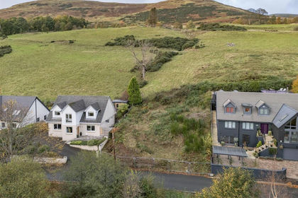
- Price
- Offers Over£280,000
30 Back Road, Dollar FK14, Dunfermline and Dollar, Clackmannanshire FK14 Scotland
Added on 29/01/2026Building Plot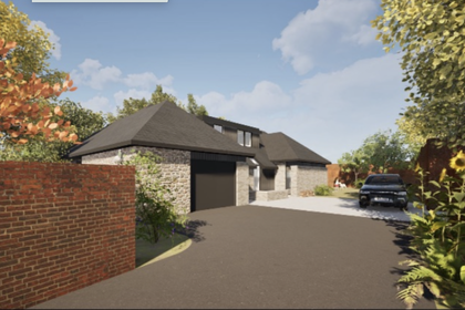
- Price
- Offers Over£265,000
130A, Main Street, Larbert, Falkirk, FK5, Alloa and Grangemouth, Falkirk FK5 Scotland
Added on 24/07/2026Building Plot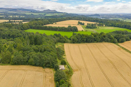
- Price
- Offers Over£250,000
- Size
- 0.53 acres
Hillside of Row, Stirling and Strathallan, Stirling FK15 Scotland
Added on 29/01/2026Building Plot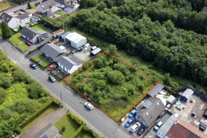
- Price
- Offers in Region of£300,000
80-84 Main Street, Airdrie, ML6, Airdrie and Shotts, North Lanarkshire ML6 Scotland
Added on 29/01/2026Development Land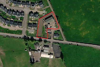
- Price
- Offers Over£285,000
- Size
- 0.69 acres
Added on 02/09/2026Development Land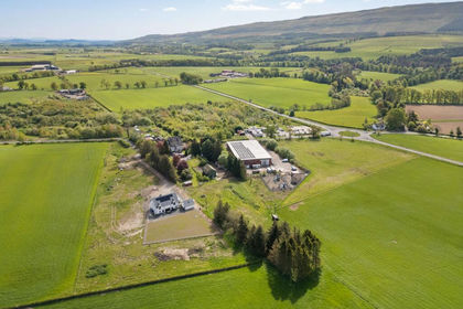
- Price
- Guide Price£395,000
Station House, Kippen, FK8, Stirling and Strathallan, Stirling FK8 Scotland
Added on 28/01/2026Building Plot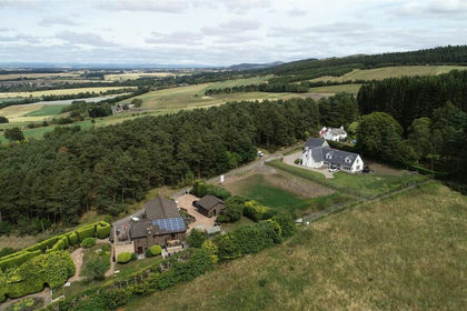
- Price
- Offers Over£275,000
- Size
- 0.48 acres
Corsiehill, Perth, Perth and Kinross, Perth and Kinross-shire, Perth and Kinross PH2 Scotland
Added on 29/01/2026Building Plot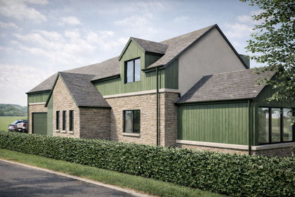
- Price
- Offers Over£300,000
- Size
- 1.67 acres
Pitcairngreen, Perth, PH1, Perth and Kinross-shire, Perth and Kinross PH1 Scotland
Added on 24/03/2026Building Plot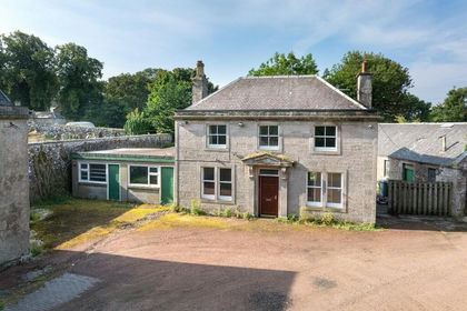
- Price
- Offers Over£370,000
- Size
- 1.9 acres
Added on 01/08/2026Development Land
- Price
- Guide Price£375,000
- Size
- 2.04 acres
Corner Plot Morris Road, Newton Grange, EH22, Midlothian, Midlothian EH22 Scotland
Added on 29/01/2026Undeveloped Land