Sticker, St. Austell, Cornwall, PL26
- Land size
- 3 acres
- Bedrooms
- 5
- Bathrooms
- 3
Key Features
- 5 Bedroom Property
- Substantial Period Home
- 3 Acres of Parkland Styled Gardens
- Triple Garage
- Versatile Accommodation
- 1 Bedroom Annexe
Description
The Property:
Impressive detached barn conversion offering just over 3000 sq. foot of accommodation, situated in a quiet rural hamlet epitomising country living and elegance. The property offers a great deal of versatility with the option to enjoy as one large family home, or separate one wing as a self contained annex for a dependant relative or as in income stream as a letting unit / AirBnB. Close to village amenities the nearby town of St Austell is only a few minutes drive away and the South coast and Roseland peninsular are both easily accessible by car.
Accommodation:
One enters a substantial 32 foot conservatory off which the front door leads into a generous reception hall. There is a cloakroom/WC, Large sitting room and extensive Farmhouse style kitchen/breakfast room which makes a truly delightful hub for this home. There is a generously proportioned Boot Room/Utility room, ideal for muddy boots, wet coats and dirty dogs, with a useful range of storage cupboards, boiler cupboard and space for a washing machine and tumble dryer as well as a sink. From the reception hall a door connects to the Annex where there is a double bedroom and shower room/WC and stairs lead to an open plan living Kitchen dining room with double doors opening out onto a balcony with views over the gardens and surrounding countryside. From here a further door connects the first floor to the main house. On the first floor is a spacious landing and study area and a further four double bedrooms, the principle bedroom having its own built in wardrobes and en-suite facilities and a further family bathroom.
Outside:
Set down a quiet lane one turns into a sweeping private driveway offering parking for numerous vehicles and circles an established Magnolia tree. The formal gardens have been lovingly landscaped over three decades with a large Mediterranean style patio garden directly to the front of the house. Around the side there is further parking and a Double and Single Garage along with two former stables. The gardens lead past a productive area ideal for fruit and vegetables, and a pathway leads into a spectacular parkland style area of gardens with a wide variety of specimen trees, open lawn areas, bordering open countryside. This really is not only a gardeners paradise but also an amazingly relaxing and remarkable setting where you can unwind, or enjoy with family and friends for parties and BBQ's. There is also an small but established Orchard with a variety of fruit trees.
Location:
Nestled in the parish of St Mewan where the pretty grade II listed church, St Marks Mission, dates back to 1877. Sticker is a picturesque village in South Cornwall offering, Post Office, General Stores and Community Hall, as well as the Hewas Inn established in 1825, along with a vibrant community. Approximately three miles from the bustling town of St Austell, offering excellent rail and road links, the property is within easy striking distance of a number of beautiful sandy beaches, coastal walks and holiday attractions such as The Lost Gardens of Heligan and The Eden Project. The nearby city of Truro and Plymouth are both easily accessible by car or rail and there is a regular bus service from the village.
Material Information
Tenure: Freehold
Council tax band: G
EPC rating: E (49)
The Building
Standard construction
Accessibility adaptations: None
Services
Mains electricity
Mains water
Private foul drainage
Private surface water drainage
Heating: LPG
Broadband: FTTP
Mobile coverage: O2 good, Vodafone good, Three good, EE good
Parking: Private
Risks and restrictions
CL22751: RESTRICTION: No disposition by a sole proprietor of the registered estate (except a trust corporation) under which capital money arises is to be registered unless authorised by an order of the court.
Not listed
Not in a conservation area
No tree preservation order
Disclaimer
Smart Property Group and its clients give notice that; they have no authority to make or give any representations or warranties in relation to the property. These particulars do not form part of any offer or contract and must not be relied upon as statements or representations of fact. Any areas, measurements or distances are approximate. The text, photographs and plans are for guidance only and are not necessarily comprehensive. It should not be assumed that the property has all necessary planning, building regulation, or other consents, and Smart Property Group has not tested any services, equipment, or facilities. Purchasers must satisfy themselves by inspection or otherwise. Smart Property Group is a member of The Property Ombudsman scheme and subscribes to "The Property Ombudsman Code of Practice.”
Map Location
Property details
- Tenure
- Freehold
- Council Tax Band
- G
- Date Posted
- 2026-09-30
Market Value Analysis
Compared with 1,628 Homes with Land listings in South West England (1+ acres).
Energy Performance Certificate
Energy Efficiency Rating
Based on UK Energy Performance Certificate standards (EU Directive 2002/91/EC)
Running costs are one side. Planning activity, flood history and ground risks for this location are in the full report.
Utilities & Restrictions
Utilities
- Electricity
- Mains
- Water
- Mains
- Heating
- Gas Heating
- Broadband
- Full Fibre (FTTP)
- Sewerage
- Septic Tank / Private
Rights & Restrictions
- Public Rights of Way
- Ask Agent
- Private Rights of Way
- Ask Agent
- Listed Property
- Ask Agent
- Restrictions
- Ask Agent
Listed status, conservation areas and planning constraints for this location are in the full report.
Property Features
- Accessibility
- Lateral Living
- Parking
- Private Parking
- Garden
- Garden
Beyond the particulars: planning activity, flood history, heritage and ground risks, checked for this exact spot.
Connectivity
Broadband
Fastest speed available at this postcode
1 Gbps
Standard (10-30 Mbps)
Suitable for
- 4K streaming on every screen
- Full-time home working
- Online gaming & big downloads
Mobile signal
Predicted 4G and 5G signal; indoor signal depends on building materials.
Ofcom Connected Nations postcode-level predictions. Speeds and signal are modelled, not measured, and vary between addresses and providers.
Signal is the easy part. Planning activity, flood history and protected designations here are in the full report.
Nearest Schools
Primary
- St Mewan Community Primary School1.5 milesNo Ofsted rating
- Ages
- 3 to 11
- Pupils
- 441
- Type
- Academy converter
- Foxhole Learning Academy2.1 milesOfsted: Good
- Ages
- 5 to 11
- Pupils
- 83
- Type
- Academy sponsor led
- Pondhu Primary School2.2 milesNo Ofsted rating
- Ages
- 2 to 11
- Pupils
- 187
- Type
- Academy converter
- St Stephen Churchtown Academy2.4 milesNo Ofsted rating
- Ages
- 2 to 11
- Pupils
- 284
- Type
- Academy sponsor led
- Nanpean Community Primary School2.8 milesOfsted report card · Jun 2026
- Ages
- 4 to 11
- Pupils
- 105
- Type
- Academy converter
Secondary
- Brannel School2 milesOfsted: Good
- Ages
- 11 to 16
- Pupils
- 888
- Type
- Academy sponsor led
- Poltair School2.9 milesOfsted: Good
- Ages
- 11 to 16
- Pupils
- 882
- Type
- Academy sponsor led
- Penrice Academy3.6 milesOfsted: Outstanding *
- Ages
- 11 to 16
- Pupils
- 1,405
- Type
- Academy converter
- The Roseland Academy4.8 milesNo Ofsted rating
- Ages
- 11 to 16
- Pupils
- 665
- Type
- Academy converter
- Fowey River Academy9.1 milesOfsted: Good *
- Ages
- 11 to 16
- Pupils
- 676
- Type
- Academy sponsor led
* Latest graded judgement covers quality of education only; no overall grade was issued under the 2024-25 inspection framework.
Distances are straight-line from the advertised location. Source: the national school registers (DfE, Welsh Government, Scottish Government) and Ofsted.
Schools are just the start: sold prices nearby, planning activity and any flood history are in the full report.
Amenities
Supermarket
GP surgery
Pharmacy
Hospital
Green space
Straight-line distances from the advertised location. Sources: NHS records, Geolytix supermarket locations, OS Open Greenspace and the national trails registers.
The area stacks up? Now check the location itself: planning nearby, protected designations and past flooding.
Getting Around
Nearest station
Nearest bus stop
Typical drive times
Straight-line distances from the advertised location; drive times are typical free-flow times over OpenStreetMap road data, so allow more at peak. Public transport locations from DfT NaPTAN.
Easy to reach matters. So do planning activity, flood history and ground risks: all in the full report.
Flood Risk
Environment Agency open data, checked around the advertised map pin for the listed acreage. Long-term risk counts flood defences; the planning map's flood zones do not. Provided by LandSale, not the listing agent, and not part of the agent's particulars. Risk varies across a holding, so verify before committing.
Rivers and the sea
Planning map: Flood Zone 1.
Surface water
Not at the pin: mapped about 10 metres away.
These bandings are the summary. Where this location sits on the flood maps, plus planning activity, heritage and ground risks, is in the full report.
Important notice: Information, maps and tags on this page are drawn from the advertising agent's marketing materials or generated automatically. LandSale has not verified them. Relying on these details is at your own risk, always carry out independent checks before committing to a purchase.
LandSale full disclaimer
Marketing information only - not formal particulars. The details on this website are provided for general guidance and do not constitute an offer or contract. Neither LandSale nor the advertising estate/land agent accepts responsibility for any inaccuracy.
1. Source of information
- Listing content: Core description, asking price, tenure, measurements, photographs and planning history originate from the marketing materials of the advertising estate or land agent. LandSale does not author this content and cannot guarantee its accuracy.
- Automated tags & categorisation: Property type, land-use class, acreage bands and similar labels may be applied by machine-learning models. They are intended as a helpful guide only and may not reflect the property's legal status or permitted use.
- Third-party & enriched data layers: Maps, boundary outlines, planning designations, soil reports, broadband coverage and other environmental or location-based insights are licensed from external suppliers. Such data are supplied “as is", may be incomplete or out of date and are subject to change without notice.
2. Verification required
Prospective purchasers must verify critical matters, including but not limited to planning permission, title boundaries, public rights of way, environmental constraints, acreage, services, access and VAT status, through their own inspections, specialist surveys, legal advisers and the selling agent before relying on the information or entering into any contract.
3. No warranty or liability
LandSale gives no warranty, express or implied, as to the accuracy, completeness or fitness for any particular purpose of the information displayed. LandSale shall not be liable for any loss, damage, cost or expense arising directly or indirectly from any use of or reliance on such information, save where liability may not be excluded by law.
4. Updates & feedback
If you believe any detail on this listing is inaccurate, please let us know. We will investigate and, where appropriate, update the listing or notify the agent.
© LandSale | Version 1.3 - August 2026
Listing agent
Miller Town & Country, Okehampton
2 Jacob's Pool House, West Street, Okehampton, EX20 1HQ
Contact Miller Town & Country, Okehampton
2 Jacob's Pool House, West Street, Okehampton, EX20 1HQ
View agent profileSimilar properties for sale
- Price
- £1,000,000
- Size
- 1 acres
South Street, St. Austell, Cornwall, St Austell, Cornwall PL25 England
Added on 16/04/2026House with Land
- Price
- £1,250,000
- Size
- 1 acres
Charlestown Road, St Austell, PL25, St Austell Bay, Cornwall PL25 England
Added on 30/05/2026House with Land
- Price
- Guide Price£999,950
- Size
- 2.58 acres
Brighton Cross, Truro, Cornwall, TR2, Ladock, Cornwall TR2 England
Added on 29/01/2026Holiday Let Property
- Price
- Guide Price£1,350,000
- Size
- 3 acres
Gorran, St. Austell, Cornwall, PL26, St. Goran, Cornwall PL26 England
Added on 10/05/2026House with Land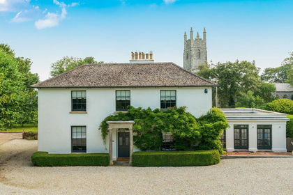
- Price
- £1,250,000
- Size
- 1 acres
St. Enoder, near Newquay - North Cornish Coast, Cornwall, St. Enoder, Cornwall TR8 England
Added on 25/08/2026Country Home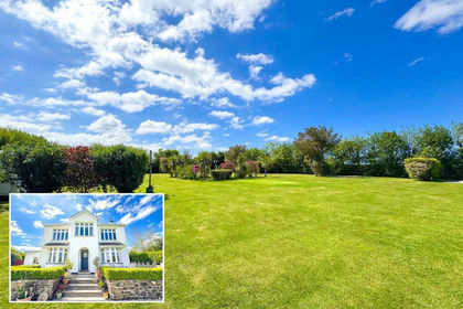
- Price
- Guide Price£899,999
- Size
- 1.3 acres
Resparva House, Chapel Town, Summercourt, Newquay, Cornwall, TR8, St. Enoder, Cornwall TR8 England
Added on 16/06/2026House with Land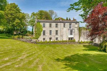
- Price
- £1,250,000
- Size
- 3.13 acres
Added on 06/05/2026Country Home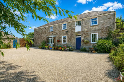
- Price
- Guide Price£1,250,000
- Size
- 9 acres
Walhalla, St. Columb, TR9, St. Columb Major, Cornwall TR9 England
Added on 25/09/2026House with Land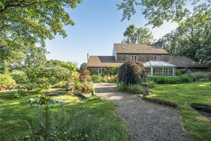
- Price
- Offers in Excess of£899,950
- Size
- 9 acres
Added on 29/01/2026Equestrian property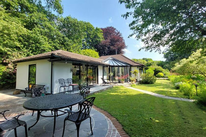
- Price
- Guide Price£875,000
- Size
- 2 acres
Added on 02/05/2026House with Land