Land at Frognal Avenue, Sidcup, Kent, DA14
- Land size
- 11.59 acres
Key Features
- Substantial 11.59 Acre Landholding
- Exceptional Roadside Visibility
- Residential, Care, Commercial & Other Uses
- Promotion / Option / Conditional Sale Considered
Description
An exciting opportunity to acquire or promote approximately 11.59 acres (4.69 hectares) of land at Frognal Avenue, Sidcup, DA14 6LT.
Occupying a highly prominent roadside position adjoining the Sidcup Bypass and Frognal Corner Roundabout, the site enjoys excellent visibility from the surrounding highway network and sits immediately adjacent to established residential communities.
Vehicular access is understood to be available from Frognal Avenue, providing a direct connection to the local road network.
The combination of the site's scale, prominence, accessibility and established surrounding uses creates an opportunity for an experienced developer, operator or land promoter to investigate a range of potential future uses.
The Vendor is particularly interested in hearing from parties active in the following sectors:
- Residential development
- Care and assisted living
- Retirement living
- Self-storage
- Logistics and employment uses
- Roadside commercial uses
- Supermarket / foodstore
- Other appropriate alternative uses
The site's prominent position could also offer opportunities for strong visual presence, signage and branding, subject to the necessary planning and highway consents.
Relevant Local Development Precedent:
There is a potentially relevant precedent at the north western end of Frognal Avenue, where a substantial care home and assisted living development has been delivered.
We understand that the development addressed a number of planning considerations and constraints which may be relevant when considering the subject site.
Whilst every site must be assessed on its own merits and no assumption should be made regarding the outcome of any future planning application, the development provides an important local precedent for significant development within the immediate area and may warrant consideration as part of any future planning strategy.
In addition, immediately beyond the eastern end of the site, at the next slip road and roundabout along the Sidcup Bypass, is an established business park incorporating prominent occupiers.
This provides a further relevant example of commercial and retail activity established along this section of the Sidcup Bypass, and may be of interest when assessing the wider range of potential uses that could be explored.
Together, these surrounding developments provide an interesting local context, demonstrating that substantial care, assisted living, commercial and retail uses have been delivered within the wider vicinity.
Planning & Environmental Considerations:
The site is subject to a number of planning, environmental and policy designations which will need to be carefully considered as part of any future planning strategy.
These include, but are not limited to:
- London Green Belt
- Site of Importance to Nature Conservation (SINC)
- Tree Preservation Order 5209776
- Minerals Safeguarding Area
- Strategic Green Wildlife Corridors
- Areas of deciduous woodland
- Established footpaths crossing and/or serving parts of the site
These matters will require detailed assessment and appropriate mitigation as part of any future development proposals.
Interested parties should undertake their own detailed planning, environmental, highways, legal and technical due diligence before proceeding.
Telecommunications Mast:
There is an existing cell site agreement relating to a telecommunications mast, understood to be located within the north-western corner of the site.
Our understanding is that the mast arrangement may be capable of being removed or relocated to facilitate future development, subject to the terms of the existing agreement and the appropriate process being followed.
Further information can be made available to interested parties as appropriate.
Flexible Planning-Led Acquisition Structures:
The Vendor is open to considering a range of structures with a suitably experienced party, including:
- Land Promotion Agreement
- Conditional Sale Agreement
- Option Agreement
- Unconditional Sale
The Vendor is particularly interested in engaging with parties with the expertise, resources and track record to undertake a comprehensive assessment of the site's potential and progress an appropriate planning strategy.
A Significant Land Opportunity in a Highly Visible Location:
The site presents an opportunity for an experienced developer, operator or land promoter to assess the potential of a substantial and exceptionally prominent landholding in Sidcup.
With its significant scale, roadside prominence, accessibility and proximity to established residential and commercial uses, the site warrants detailed consideration across a range of potential sectors.
The opportunity is particularly suited to a party capable of undertaking the necessary planning, highways, environmental, technical and viability assessments and developing a robust strategy for unlocking the site's longer-term potential.
For further information please contact us on or at
Agents Note
We may refer you to recommended providers of ancillary services such as Conveyancing, Financial Services, Insurance and Surveying. We may receive a commission payment fee or other benefit (known as a referral fee) for recommending their services. You are not under any obligation to use the services of the recommended provider. The ancillary service provider may be an associated company of Kallars Property Agents Ltd. 2% (min. £15k) + VAT fee applicable.
AML Disclaimer
Please note it is a legal requirement that we require verified ID from purchasers before instructing a sale. Please also note we shall require proof of funds before we instruct the sale, together with your instructed solicitors.
Map Location
Property details
- Tenure
- Freehold
- Council Tax Band
- Ask Agent
- Date Posted
- 2026-09-28
Utilities & Restrictions
Utilities
- Electricity
- Ask Agent
- Water
- Ask Agent
- Heating
- Ask Agent
- Broadband
- Ask Agent
- Sewerage
- Ask Agent
Rights & Restrictions
- Public Rights of Way
- Ask Agent
- Private Rights of Way
- Ask Agent
- Listed Property
- Ask Agent
- Restrictions
- Ask Agent
Listed status, conservation areas and planning constraints for this location are in the full report.
Property Features
- Accessibility
- Ask Agent
- Parking
- Off-Street Parking
- Garden
- Ask Agent
Beyond the particulars: planning activity, flood history, heritage and ground risks, checked for this exact spot.
Connectivity
Broadband
Fastest speed available at this postcode
57 Mbps
Superfast
Suitable for
- HD streaming
- Video calls
- Web & social
Mobile signal
Predicted 4G and 5G signal; indoor signal depends on building materials.
Ofcom Connected Nations postcode-level predictions. Speeds and signal are modelled, not measured, and vary between addresses and providers.
Signal is the easy part. Planning activity, flood history and protected designations here are in the full report.
Nearest Schools
Primary
- Orchard Primary School693 metresOfsted: Good
- Ages
- 3 to 11
- Pupils
- 207
- Type
- Community school
- Midfield Primary School710 metresNo Ofsted rating
- Ages
- 3 to 11
- Pupils
- 481
- Type
- Academy converter
- St Peter Chanel Catholic Primary School0.7 milesOfsted: Good
- Ages
- 2 to 11
- Pupils
- 182
- Type
- Academy converter
- Faith
- Roman Catholic
- Hope Community School0.7 milesOfsted: Good
- Ages
- 4 to 11
- Pupils
- 112
- Type
- Free schools
- Faith
- Christian
- Gray's Farm Primary Academy0.8 milesOfsted report card · Mar 2026
- Ages
- 3 to 11
- Pupils
- 420
- Type
- Academy sponsor led
Secondary
- Kemnal Technology College752 metresOfsted: Requires improvement *
- Ages
- 11 to 18
- Pupils
- 439
- Type
- Academy converter
- Chislehurst School for Girls976 metresNo Ofsted rating
- Ages
- 11 to 18
- Pupils
- 1,227
- Type
- Academy converter
- Gender
- Girls
- Cleeve Park School1.1 milesOfsted: Good
- Ages
- 11 to 18
- Pupils
- 994
- Type
- Academy converter
- Chislehurst and Sidcup Grammar School1.3 milesNo Ofsted rating
- Ages
- 11 to 18
- Pupils
- 1,561
- Type
- Academy converter
- Orion Coopers1.4 milesNo Ofsted rating
- Ages
- 11 to 18
- Pupils
- 1,339
- Type
- Academy converter
* Latest graded judgement covers quality of education only; no overall grade was issued under the 2024-25 inspection framework.
Distances are straight-line from the advertised location. Source: the national school registers (DfE, Welsh Government, Scottish Government) and Ofsted.
Schools are just the start: sold prices nearby, planning activity and any flood history are in the full report.
Amenities
Supermarket
GP surgery
Pharmacy
Hospital
Green space
Straight-line distances from the advertised location. Sources: NHS records, Geolytix supermarket locations, OS Open Greenspace and the national trails registers.
The area stacks up? Now check the location itself: planning nearby, protected designations and past flooding.
Getting Around
Nearest station
Nearest bus stop
Typical drive times
Straight-line distances from the advertised location; drive times are typical free-flow times over OpenStreetMap road data, so allow more at peak. Public transport locations from DfT NaPTAN.
Easy to reach matters. So do planning activity, flood history and ground risks: all in the full report.
Flood Risk
Environment Agency open data, checked around the advertised map pin for the listed acreage. Long-term risk counts flood defences; the planning map's flood zones do not. Provided by LandSale, not the listing agent, and not part of the agent's particulars. Risk varies across a holding, so verify before committing.
Rivers and the sea
Planning map: Flood Zone 1.
Surface water
Not at the pin: mapped about 40 metres away.
These bandings are the summary. Where this location sits on the flood maps, plus planning activity, heritage and ground risks, is in the full report.
Important notice: Information, maps and tags on this page are drawn from the advertising agent's marketing materials or generated automatically. LandSale has not verified them. Relying on these details is at your own risk, always carry out independent checks before committing to a purchase.
LandSale full disclaimer
Marketing information only - not formal particulars. The details on this website are provided for general guidance and do not constitute an offer or contract. Neither LandSale nor the advertising estate/land agent accepts responsibility for any inaccuracy.
1. Source of information
- Listing content: Core description, asking price, tenure, measurements, photographs and planning history originate from the marketing materials of the advertising estate or land agent. LandSale does not author this content and cannot guarantee its accuracy.
- Automated tags & categorisation: Property type, land-use class, acreage bands and similar labels may be applied by machine-learning models. They are intended as a helpful guide only and may not reflect the property's legal status or permitted use.
- Third-party & enriched data layers: Maps, boundary outlines, planning designations, soil reports, broadband coverage and other environmental or location-based insights are licensed from external suppliers. Such data are supplied “as is", may be incomplete or out of date and are subject to change without notice.
2. Verification required
Prospective purchasers must verify critical matters, including but not limited to planning permission, title boundaries, public rights of way, environmental constraints, acreage, services, access and VAT status, through their own inspections, specialist surveys, legal advisers and the selling agent before relying on the information or entering into any contract.
3. No warranty or liability
LandSale gives no warranty, express or implied, as to the accuracy, completeness or fitness for any particular purpose of the information displayed. LandSale shall not be liable for any loss, damage, cost or expense arising directly or indirectly from any use of or reliance on such information, save where liability may not be excluded by law.
4. Updates & feedback
If you believe any detail on this listing is inaccurate, please let us know. We will investigate and, where appropriate, update the listing or notify the agent.
© LandSale | Version 1.3 - August 2026
Listing agent
Kallars, Sidcup
148 Station Road, Sidcup, DA15 7AB
Similar properties for sale
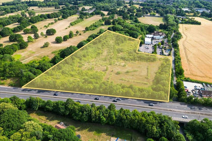
- Price
- £2,000,000
- Size
- 9 acres
Land On The South East Side of Sandy Lane, Orpington, Kent, BR5, Orpington, Bromley BR5 England
Added on 29/01/2026Development Land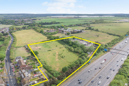
- Price
- Offers in Excess of£2,300,000
- Size
- 6.28 acres
Hawley Road, Dartford, Kent, Sutton-at-Hone and Hawley, Kent DA2 England
Added on 29/08/2026Industrial Land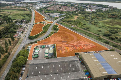
- Price
- POA
- Size
- 9.84 acres
Added on 02/06/2026Industrial Land
- Price
- Guide Price£120,000
- Size
- 5.7 acres
Beech Farm Barn, Beech Farm Road, Warlingham, Surrey, Chelsham and Farleigh, Surrey CR6 England
Added on 01/09/2026Amenity Land
- Price
- Offers in Excess of£4,150,000
- Size
- 5.81 acres
Added on 28/09/2026Industrial Land
- Price
- POA
- Size
- 5 acres
Land at Chadwell Heath, Station Road, Chadwell Heath, RM8, Ilford South, Redbridge RM6 England
Added on 14/07/2026Development Land
- Price
- POA
- Size
- 32.42 acres
Churchill Green (Land), Little Thurrock, Grays, Essex, RM18, Thurrock, Thurrock RM18 England
Added on 13/10/2026Development Land
- Price
- Guide Price£440,000
- Size
- 21.94 acres
Sutton Hall, Langdon Hills, Basildon, South Basildon and East Thurrock, Thurrock SS16 England
Added on 05/06/2026Agricultural Land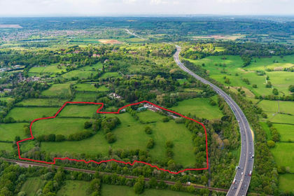
- Price
- POA
- Size
- 51 acres
Centenary Hall, Coopers Hill Road, Nutfield, RH1, Nutfield, Surrey RH1 England
Added on 03/09/2026Commercial Land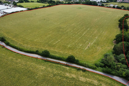
- Price
- Guide Price£625,000
- Size
- 47.2 acres
LAND AT BREACH BARNS LANE Waltham Abbey, Essex, Waltham Abbey, Essex EN9 England
Added on 17/08/2026Undeveloped Land