Hendrians Fountain, Lower Cwmyoy, Nr Abergavenny, Monmouthshire, NP7
- Land size
- 1.75 acres
Key Features
- Approximately 1.75 Acres Of Rare Wet Woodland
- Exceptional Nature Conservation Interest
- Coed y Cerrig NNR, SSSI & SAC
- Within Bannau Brycheiniog National Park
- Totally Dilapidated Building
- Unique Woodland Restoration Opportunity
- Secluded Position In The Black Mountains
- Natural Spring & Stream
- Approximately 4 Miles From Abergavenny
- Rich Wildlife & Woodland Habitat
Description
Front Cover
A Totally Dilapidated Dwelling Set Within An Area Of Special Scientific Interest Forming Rare Wet Woodland Extending To Approximately 1.75 Acres Adjacent To The Coed-Y-Cerrig National Nature Reserve In The Foothills Of The Black Mountains
Description
Tucked away in the southern Black Mountains, this fascinating and highly unusual property occupies an exceptionally secluded position within the Bannau Brycheiniog National Park, close to Coed y Cerrig National Nature Reserve.
The land extends to approximately 1.75 acres and comprises predominantly mature, densely wooded ground, including areas of wet woodland. The site has a narrow section of road frontage and is currently approached on foot via a track from the public footpath. The track winds through the woodland and up the sloping site towards the building, known locally as 'The Stone Tree'.
At the upper part of the site is Hendre'r-ffynnon, or 'Hendrian's Fountain', a natural spring which feeds a stream through the woodland.
The setting is particularly notable from a nature conservation perspective. Coed y Cerrig is recognised as a National Nature Reserve, Site of Special Scientific Interest and Special Area of Conservation, with the latter designation recognising the importance of its alluvial wet woodland habitat. The site is regarded as an excellent example of this type of woodland in southern Wales, with alder, ash and willow amongst the characteristic trees and a rich variety of wet woodland plants.
The neighbouring National Nature Reserve is particularly attractive in spring, when the woodland floor is carpeted with bluebells, while the wider reserve supports a notable range of woodland wildlife. NRW highlights species including pied flycatcher, redstart and wood warbler, together with early purple orchids and other woodland flora.
For anyone with a genuine interest in wildlife, woodland management, conservation or the restoration of an unusual historic structure, this is a setting rarely encountered on the open market.
The Building
'The Stone Tree' is currently in a totally dilapidated condition and should be regarded as a project requiring significant investigation.
Its secluded woodland position and existing structure will undoubtedly appeal to purchasers looking for something far removed from a conventional residential property. The current owners had visions of restoring the property into a bird observatory, to enjoy the secluded and tranquil setting.
Any purchaser should make their own enquiries regarding planning, building regulations, access, services, environmental designations and the potential for restoration or redevelopment. No assumption should be made regarding the availability of residential or other planning consent.
Location
Abergavenny is approximately 4 miles to the south and provides a comprehensive range of everyday amenities, independent shops, restaurants and leisure facilities, together with a mainline railway station. The historic city of Hereford is also within easy reach.
A Note From The Sellers
"The bluebells were right next to the Folly and the marsh marigolds were lower down in the marshy part, alongside the road.
We've also got primroses, yellow pimpernel, meadowsweet, water mint, hemlock water dropwort, and lesser pond sedge. Plus Wet Alder, Willow and Ash trees, to name but a few - we're certainly not experts! And across the road in the Nature Reserve, the Bluebells are very densely clumped and there are lots of marsh marigold too. Our Spring Hendre'r - ffynnon, (Hendrian's Fountain), actually drains into the Nature Reserve, which makes it extremely important for managing the Wet Woodland's status as a Site of Special Scientific Interest (SSSI). The property is described as a rare Wet Woodland, inside the Coed-y-Cerrig National Nature Reserve which is within the Brecon Beacons National Park.
We've also seen many woodland birds in or soaring above the property, for example - Robin, Wren, Blackcap, Pied Flycatcher, Jay, Buzzard, Red Kite, Blue Tit, Great Tit, Long-tailed Tit, Blackbird, Tree creeper, and Chiff Chaff, to name but a few..."
Tenure
The property is freehold and is registered. Registration of a possessory title is dated 12th June 2013. Title Number CYM590115.
Environmental Designations
The wider Coed y Cerrig site is of exceptional nature conservation interest and benefits from three significant designations:
Coed y Cerrig National Nature Reserve
Coed y Cerrig Site of Special Scientific Interest (SSSI)
Coed y Cerrig Special Area of Conservation (SAC)
The SAC designation recognises the importance of the area's alluvial woodland, including wet woodland dominated by alder and ash and supporting a diverse ground flora.
Prospective purchasers are strongly advised to make their own enquiries with Natural Resources Wales regarding the precise extent of each designation and any implications for the management, alteration or development of the land.
Viewing
Site inspection at any reasonable time.
Directions
From Abergavenny take the A465 road northwards in the direction of Herefordshire. About 4 miles outside of Abergavenny turn left into the village of Llanfihangl Crucorney. This is signposted towards the Skirrid Mountain Inn. After a short distance turn left immediately beside the Skirrid Mountain Inn onto a minor raod signposted towards Llanthony. After approximately 1 and a half miles turn left towards Crickhowell. The land will be found after approximately 1 mile along this minor road and immediately past a little settlement of houses which include Dellwood and Sunset Cottage. If you continue along the lane there is a car park for Coed-Cerrig National Nature Reserve and it's a relatively short walk back from the car park.
VIEWERS ARE ADVISED TO USE WHAT 3 WORDS TO LOCATE THE SITE: GROVE.LOTS.LOSS
PLEASE NOTE
Viewers are kindly requested to use the style and public footpath from the lane to access the land and to respect adjacent fences and hedges.
Services
We understand that there are no main services currently available at the site and viewers are advised to make their own enquiries with regard to the availability of service.
Map Location
Property details
- Tenure
- Freehold
- Council Tax Band
- Ask Agent
- Date Posted
- 2026-09-24
Market Value Analysis
Compared with 35 Woodland listings in Wales (1+ acres).
Utilities & Restrictions
Utilities
- Electricity
- Ask Agent
- Water
- Ask Agent
- Heating
- Ask Agent
- Broadband
- No Internet Connection
- Sewerage
- Ask Agent
Rights & Restrictions
- Public Rights of Way
- Ask Agent
- Private Rights of Way
- Ask Agent
- Listed Property
- Ask Agent
- Restrictions
- Ask Agent
Listed status, conservation areas and planning constraints for this location are in the full report.
Property Features
- Accessibility
- No Wheelchair Access
- Parking
- Parking Available
- Garden
- Ask Agent
Beyond the particulars: planning activity, flood history, heritage and ground risks, checked for this exact spot.
Connectivity
Broadband
Fastest speed available at this postcode
1.8 Gbps
Gigabit full fibre
Suitable for
- 4K streaming on every screen
- Full-time home working
- Online gaming & big downloads
Mobile signal
Predicted 4G and 5G signal; indoor signal depends on building materials.
Ofcom Connected Nations postcode-level predictions. Speeds and signal are modelled, not measured, and vary between addresses and providers.
Signal is the easy part. Planning activity, flood history and protected designations here are in the full report.
Nearest Schools
Primary
- Llanvihangel Crucorney County Primary School2.2 miles
- Pupils
- 67
- Type
- Infants & Juniors
- Language
- English medium school / provision
- Llantilio Pertholey CV Primary3.2 miles
- Pupils
- 203
- Type
- Infants & Juniors
- Language
- English medium school / provision
- Ysgol Gymraeg Y Fenni3.6 miles
- Pupils
- 271
- Type
- Nursery, Infants & Juniors
- Language
- Welsh medium school / provision (including transitional)
- King Henry VIII 3193.8 miles
- Pupils
- 1,310
- Type
- Middle (ages 3-19)
- Language
- English medium school / provision
- Cantref Primary4 miles
- Pupils
- 235
- Type
- Infants & Juniors
- Language
- English medium school / provision
Secondary
- King Henry VIII 3193.8 miles
- Pupils
- 1,310
- Type
- Middle (ages 3-19)
- Language
- English medium school / provision
- Crickhowell High School5.3 miles
- Pupils
- 942
- Type
- Secondary (ages 11-19)
- Language
- English medium school / provision
- Brynmawr Foundation School8.3 miles
- Pupils
- 569
- Type
- Secondary (ages 11-16)
- Language
- English medium school / provision
- Ebbw Fawr Learning Community11 miles
- Pupils
- 1,406
- Type
- Middle (ages 3-16)
- Language
- English medium school / provision
- Abersychan Comprehensive11 miles
- Pupils
- 739
- Type
- Secondary (ages 11-16)
- Language
- English medium school / provision
Distances are straight-line from the advertised location. Source: the national school registers (DfE, Welsh Government, Scottish Government) and Ofsted.
Schools are just the start: sold prices nearby, planning activity and any flood history are in the full report.
Amenities
Supermarket
GP surgery
Pharmacy
Straight-line distances from the advertised location. Sources: NHS records, Geolytix supermarket locations, OS Open Greenspace and the national trails registers.
The area stacks up? Now check the location itself: planning nearby, protected designations and past flooding.
Getting Around
Nearest station
Nearest bus stop
Typical drive times
Straight-line distances from the advertised location; drive times are typical free-flow times over OpenStreetMap road data, so allow more at peak. Public transport locations from DfT NaPTAN.
Easy to reach matters. So do planning activity, flood history and ground risks: all in the full report.
Flood Risk
Natural Resources Wales open data, checked around the advertised map pin for the listed acreage. Long-term risk counts flood defences; the planning map's flood zones do not. Provided by LandSale, not the listing agent, and not part of the agent's particulars. Risk varies across a holding, so verify before committing.
Rivers and the sea
Planning map: Flood Zone 1.
Surface water
These bandings are the summary. Where this location sits on the flood maps, plus planning activity, heritage and ground risks, is in the full report.
Important notice: Information, maps and tags on this page are drawn from the advertising agent's marketing materials or generated automatically. LandSale has not verified them. Relying on these details is at your own risk, always carry out independent checks before committing to a purchase.
LandSale full disclaimer
Marketing information only - not formal particulars. The details on this website are provided for general guidance and do not constitute an offer or contract. Neither LandSale nor the advertising estate/land agent accepts responsibility for any inaccuracy.
1. Source of information
- Listing content: Core description, asking price, tenure, measurements, photographs and planning history originate from the marketing materials of the advertising estate or land agent. LandSale does not author this content and cannot guarantee its accuracy.
- Automated tags & categorisation: Property type, land-use class, acreage bands and similar labels may be applied by machine-learning models. They are intended as a helpful guide only and may not reflect the property's legal status or permitted use.
- Third-party & enriched data layers: Maps, boundary outlines, planning designations, soil reports, broadband coverage and other environmental or location-based insights are licensed from external suppliers. Such data are supplied “as is", may be incomplete or out of date and are subject to change without notice.
2. Verification required
Prospective purchasers must verify critical matters, including but not limited to planning permission, title boundaries, public rights of way, environmental constraints, acreage, services, access and VAT status, through their own inspections, specialist surveys, legal advisers and the selling agent before relying on the information or entering into any contract.
3. No warranty or liability
LandSale gives no warranty, express or implied, as to the accuracy, completeness or fitness for any particular purpose of the information displayed. LandSale shall not be liable for any loss, damage, cost or expense arising directly or indirectly from any use of or reliance on such information, save where liability may not be excluded by law.
4. Updates & feedback
If you believe any detail on this listing is inaccurate, please let us know. We will investigate and, where appropriate, update the listing or notify the agent.
© LandSale | Version 1.3 - August 2026
Listing agent
John Goodwin FRICS, Ledbury
3 - 5, New Street, Ledbury, HR8 2DX
Similar properties for sale
- Price
- Guide Price£20,000
Added on 18/09/2026Development Land
- Price
- Guide Price£30,000
Hanbury Road, Pontnewynydd, NP4, Pen Tranch, Torfaen NP4 Wales
Added on 07/06/2026Undeveloped Land
- Price
- Guide Price£33,000
Building Plot, Fflorens Road, Newbridge, Newport, Gwent, NP11, Crumlin, Caerphilly NP11 Wales
Added on 21/09/2026Building Plot
- Price
- Guide Price£40,000
- Size
- 0.2 acres
Canonmoor Street, Hereford, Herefordshire, HR4, Hereford, Herefordshire, County of HR4 England
Added on 19/09/2026Redevelopment Land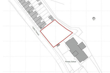
- Price
- Guide Price£40,000
Added on 21/09/2026Development Land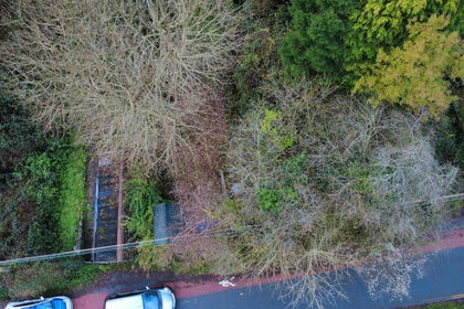
- Price
- Offers in Region of£20,000
Added on 25/05/2026Development Land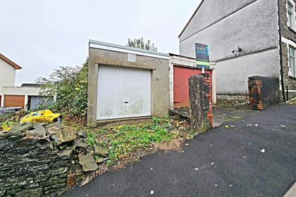
- Price
- Offers Over£30,000
Penygraig Terrace, Ynysybwl, Pontypridd, Ynysybwl and Coed-y-cwm, Rhondda Cynon Taf CF37 Wales
Added on 29/01/2026Small Plot of Land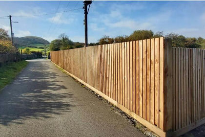
- Price
- Guide Price£30,000
Added on 03/09/2026Undeveloped Land
- Price
- Guide Price£44,000
Added on 13/08/2026Small Plot of Land
- Price
- £25,000
Fenwick Street, Ferndale, Rhondda Cynon Taff, CF43, Tylorstown, Rhondda Cynon Taf CF43 Wales
Added on 03/09/2026Small Plot of Land