Beach Andrea Flimby, Flimby, Maryport, Cumbria, CA15
- Land size
- 3.89 acres
Description
FOR SALE BY ONLINE AUCTION - Lot 14 - 3.89 Acres of Cumbrian Coastline
ONLINE AUCTION from 6th October-8th October 2026
3.89 Acres of Cumbrian coastline. Freehold. And a policy window that's just opened.
In July 2024 the Government scrapped the planning tests that had effectively blocked onshore wind in England since 2015. Schemes under 100MW are now decided locally, by Cumberland Council, as ordinary planning applications. Landowners with coastal sites have noticed the difference.
Across the UK, developers currently pay landowners in the region of £10,000 per MW per year, or 68% of gross revenue, on consented wind schemes plus option payments of £5,000£10,000 a year while consent is pursued. Those are national market benchmarks for schemes elsewhere. No assessment has been carried out on this land, and any development would be subject to planning, grid connection and all necessary consents.
Other notable uses for beaches and income streams:
Film, TV and stills
Location work is worth setting up properly because the cost is a morning's admin and the income needs nothing built.
Register with Screen Cumbria and the Creative England location library, both free. Then build a location sheet: drone stills and ground-level shots in different light, exact grid reference, access route and width, unit parking, nearest power and water, tide times, mobile signal, and who else's permission a production would need. Productions rule sites out on logistics, not looks, so answer the logistics before they ask.
What you actually get paid for is broader than the shoot day. Recce fees, prep and strike days, facilities or unit base charges if there's anywhere to park trucks, and standby fees where a production books a weather cover date. A single drama block can be several days at a few hundred to low four figures each.
Stills is the underrated half. Fashion, catalogue and automotive shoots move faster, need less kit, and book more often than drama. Empty coastline is exactly what car commercials and press shoots want, and your motorsport contacts are a more direct line into automotive production and agency work than a location library listing will ever be. One or two calls there is probably worth more than the registration.
Subject to vehicle access, parking and any consents required for the activity.
Beach motorsport events
The strongest activity idea for this land, and one you're unusually well placed on. Beach racing is an established UK format Weston and Mablethorpe both run large sand races drawing thousands of spectators and entries. A promoter needs a firm beach, an access route, and a landowner willing to do a deal. You know the promoters and clubs side of this already, which is the part most landowners can't do.
Realistically you'd licence the site to an established club or promoter rather than run it yourself, taking a fee or a share of entries and gate. Requires planning permission for change of use unless it falls within permitted temporary use limits, plus event licensing, marine and environmental consents, and full public liability cover.
Horse gallops
Racehorse trainers pay for beach access for salt-water and sand work. It's an established arrangement on several English coasts. Low money per session but recurring, no infrastructure, and a licence rather than a lease. Subject to ground suitability and safe access.
Watersports and clubs
Land yachting, kitesurfing and kite buggying all need wide firm sand and are already active on this coast. A club will take a long licence, insure their own activity, and effectively manage the site for you. Sailing and jetski clubs the same. Subject to consents and any navigation rights.
Temporary and seasonal use
England's permitted development right allows temporary use of land for a limited number of days per year without a full planning application, which is the mechanism behind most pop-up coastal ventures mobile sauna operators, outdoor cinema, cold-water swimming groups, fitness bootcamps, seasonal parking. Mobile saunas in particular have gone from nothing to a genuine coastal business in a few years. Check the current day limits and excluded uses before relying on it; some activities and some land types fall outside the right.
Campervan and motorhome stopovers
A certificated location under one of the club exemption schemes allows a small number of vans without full site licensing. Coastal pitches command a premium and the setup cost is close to nothing. Subject to the relevant exemption scheme's rules, access and facilities requirements.
Corporate and volunteering days
Companies pay for CSR days, and organised beach cleans on a privately owned frontage are an easy sell to local employers, particularly the energy and nuclear employers on that coast. Modest fees, and it generates goodwill and photos that help every other line on this list.
Tenure:
Advised Freehold - to be verified by solicitor
Tenancies:
To be sold with vacant possession
Map Location
Property details
- Tenure
- Freehold
- Council Tax Band
- Ask Agent
- Date Posted
- 2026-09-17
Market Value Analysis
Compared with 6 Cheap Land listings in North West England (1+ acres).
Utilities & Restrictions
Utilities
- Electricity
- Ask Agent
- Water
- Ask Agent
- Heating
- Ask Agent
- Broadband
- Ask Agent
- Sewerage
- Ask Agent
Rights & Restrictions
- Public Rights of Way
- Ask Agent
- Private Rights of Way
- Ask Agent
- Listed Property
- Ask Agent
- Restrictions
- Ask Agent
Listed status, conservation areas and planning constraints for this location are in the full report.
Property Features
- Accessibility
- Ask Agent
- Parking
- Parking Available
- Garden
- Ask Agent
Beyond the particulars: planning activity, flood history, heritage and ground risks, checked for this exact spot.
Connectivity
Broadband
Fastest speed available at this postcode
1.8 Gbps
Gigabit full fibre
Suitable for
- 4K streaming on every screen
- Full-time home working
- Online gaming & big downloads
Mobile signal
Outdoor predictions; indoor signal depends on building materials.
Ofcom Connected Nations postcode-level predictions. Speeds and signal are modelled, not measured, and vary between addresses and providers.
Signal is the easy part. Planning activity, flood history and protected designations here are in the full report.
Nearest Schools
Primary
- Flimby Primary School359 metresNo Ofsted rating
- Ages
- 2 to 11
- Pupils
- 112
- Type
- Academy converter
- Grasslot Infant School1.1 milesOfsted: Good
- Ages
- 2 to 7
- Pupils
- 65
- Type
- Community school
- Our Lady and St Patrick's Catholic Primary School, Maryport1.2 milesOfsted: Good *
- Ages
- 2 to 11
- Pupils
- 204
- Type
- Academy converter
- Faith
- Roman Catholic
- Ewanrigg Junior School1.3 milesOfsted: Requires improvement *
- Ages
- 7 to 11
- Pupils
- 133
- Type
- Community school
- Ellenborough Academy1.5 milesNo Ofsted rating
- Ages
- 2 to 7
- Pupils
- 50
- Type
- Academy converter
Secondary
- Netherhall School1.9 milesOfsted: Requires improvement *
- Ages
- 11 to 18
- Pupils
- 894
- Type
- Community school
- Workington Academy3.8 milesOfsted: Good
- Ages
- 11 to 18
- Pupils
- 1,234
- Type
- Academy sponsor led
- St Josephs Catholic High School, Workington4 milesOfsted: Requires improvement
- Ages
- 11 to 16
- Pupils
- 539
- Type
- Academy converter
- Faith
- Roman Catholic
- Energy Coast UTC5.5 milesOfsted: Good
- Ages
- 14 to 19
- Pupils
- 383
- Type
- University technical college
- Cockermouth School6.9 milesNo Ofsted rating
- Ages
- 11 to 18
- Pupils
- 1,254
- Type
- Academy converter
* Latest graded judgement covers quality of education only; no overall grade was issued under the 2024-25 inspection framework.
Distances are straight-line from the advertised location. Source: the national school registers (DfE, Welsh Government, Scottish Government) and Ofsted.
Schools are just the start: sold prices nearby, planning activity and any flood history are in the full report.
Amenities
Supermarket
GP surgery
Pharmacy
Hospital
Green space
Straight-line distances from the advertised location. Sources: NHS records, Geolytix supermarket locations, OS Open Greenspace and the national trails registers.
The area stacks up? Now check the location itself: planning nearby, protected designations and past flooding.
Getting Around
Nearest station
Nearest bus stop
Typical drive times
Straight-line distances from the advertised location; drive times are typical free-flow times over OpenStreetMap road data, so allow more at peak. Public transport locations from DfT NaPTAN.
Easy to reach matters. So do planning activity, flood history and ground risks: all in the full report.
Flood Risk
From Environment Agency flood map open data, checked around the advertised map pin and allowing for the listed acreage where known. This summary comes from LandSale, the advertising platform, not from the listing agent, and is not part of the agent's particulars. Risk can vary across a single holding, so verify anything critical through your own searches before committing.
Rivers and the sea
Surface water
These bandings are the summary. Where this location sits on the flood maps, plus planning activity, heritage and ground risks, is in the full report.
Important notice: Information, maps and tags on this page are drawn from the advertising agent's marketing materials or generated automatically. LandSale has not verified them. Relying on these details is at your own risk, always carry out independent checks before committing to a purchase.
LandSale full disclaimer
Marketing information only - not formal particulars. The details on this website are provided for general guidance and do not constitute an offer or contract. Neither LandSale nor the advertising estate/land agent accepts responsibility for any inaccuracy.
1. Source of information
- Listing content: Core description, asking price, tenure, measurements, photographs and planning history originate from the marketing materials of the advertising estate or land agent. LandSale does not author this content and cannot guarantee its accuracy.
- Automated tags & categorisation: Property type, land-use class, acreage bands and similar labels may be applied by machine-learning models. They are intended as a helpful guide only and may not reflect the property's legal status or permitted use.
- Third-party & enriched data layers: Maps, boundary outlines, planning designations, soil reports, broadband coverage and other environmental or location-based insights are licensed from external suppliers. Such data are supplied “as is", may be incomplete or out of date and are subject to change without notice.
2. Verification required
Prospective purchasers must verify critical matters, including but not limited to planning permission, title boundaries, public rights of way, environmental constraints, acreage, services, access and VAT status, through their own inspections, specialist surveys, legal advisers and the selling agent before relying on the information or entering into any contract.
3. No warranty or liability
LandSale gives no warranty, express or implied, as to the accuracy, completeness or fitness for any particular purpose of the information displayed. LandSale shall not be liable for any loss, damage, cost or expense arising directly or indirectly from any use of or reliance on such information, save where liability may not be excluded by law.
4. Updates & feedback
If you believe any detail on this listing is inaccurate, please let us know. We will investigate and, where appropriate, update the listing or notify the agent.
© LandSale | Version 1.3 - August 2026
Listing agent
Paul Fosh Auctions, Newport
108 Lower Dock Street, Newport, NP20 2AG
Similar properties for sale
- Price
- £1
- Size
- 0.15 acres
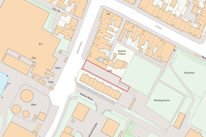
The Old Station Yard, Station Road, Silloth, Silloth-on-Solway, Cumberland CA7 England
Added on 04/09/2026Small Plot of Land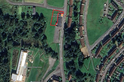
- Price
- Guide Price£5,000
Land at, Dalcairney Drive, Dalmellington, KA6, Ayr, Carrick and Cumnock, East Ayrshire KA6 Scotland
Added on 03/07/2026Building Plot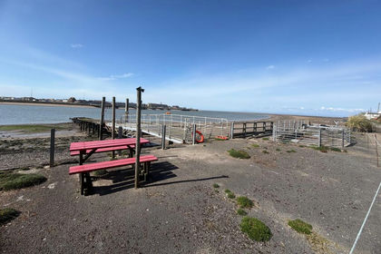
- Price
- Guide Price£3,000
Mooring 2, Lancashire, FY6, Preesall, Lancashire FY6 England
Added on 10/08/2026Small Plot of Land
- Price
- Guide Price£5,000
- Size
- 0.4 acres
Added on 03/07/2026Cheap Land
- Price
- Guide Price£7,000
Added on 03/07/2026Development Land
- Price
- Guide Price£5,000
- Size
- 0.06 acres
Plot 1 Aysgarth, Aysgarth, Leyburn, North Yorkshire, DL8, Aysgarth, North Yorkshire DL8 England
Added on 17/09/2026Small Plot of Land
- Price
- Guide Price£6,000
Burns Country 2, Ayr, South Ayrshire, KA7, Ayr, Carrick and Cumnock, South Ayrshire KA7 Scotland
Added on 06/06/2026Amenity Land
- Price
- Guide Price£5,000
Burns Country 1, Ayr, South Ayrshire, KA7, Ayr, Carrick and Cumnock, South Ayrshire KA7 Scotland
Added on 08/08/2026Amenity Land
- Price
- Guide Price£5,000
Site of 23 to 25, Crabtree Street, Colne, Lancashire BB8, Colne, Lancashire BB8 England
Added on 25/08/2026Development LandLeasehold
- Price
- Guide Price£5,000
- Size
- 1.5 acres
Taylors Lane, Ince-in-Makerfield, Wigan, Makerfield, Wigan WN3 England
Added on 04/09/2026Cheap Land