Murton Lane, Newton, Swansea, SA3
- Land size
- 1.27 acres
- Bedrooms
- 4
- Bathrooms
- 3
Key Features
- Substantial Detached Home
- Four Bedrooms
- Approx. 1.27 Acres of Freehold Land
- Three Floors
- Traditional-Style Kitchen
- Modernisation & Upgrading Opportunity
- Close to Caswell Bay & Gower Coastline
- Extensive Private Grounds
- Desirable Newton Location
Description
Substantial Detached Home | 4 Bedrooms | 3 Bathrooms | Approx. 1.27 Acres | Three Floors | Bishopston Catchment | Close to Caswell Bay
An exceptional opportunity to acquire a substantial detached home extending over three floors, set within an impressive overall holding of approximately 1.27 acres of freehold land in the highly sought-after area of Newton.
The property offers four bedrooms and three bathrooms, including one en-suite, with a versatile layout providing excellent potential for family and multi-generational living.
A particularly striking feature is the impressive open-plan, galleried hallway, which immediately showcases the scale and character of this unique home. The accommodation includes a substantial living room and further reception room, both offering excellent proportions and a wealth of character. Throughout the property are a number of distinctive features, including ornate fireplaces, decorative wall panelling, feature chandeliers and beautiful timber detailing.
The dining room provides an elegant space for entertaining, while the adjoining traditional-style kitchen features a large brick-built fireplace with range-style cooker, extensive cabinetry and doors leading directly outside.
The property offers an exciting upgrading and modernisation opportunity, allowing a purchaser to put their own stamp on the accommodation while retaining the many original and characterful features. There is also potential to extend the property, subject to the necessary planning consents, providing the opportunity to further enhance the accommodation and potentially add value.
Externally, the land is a particularly rare feature of the property and is arranged as follows:
House & gardens: approximately 0.44 acres
First field: approximately 0.40 acres
Further/furthest field: approximately 0.43 acres
Total: approximately 1.27 acres
The extensive grounds provide an exceptional amount of space and privacy, with the additional parcels of land offering a multitude of possibilities, subject to any necessary permissions.
The property enjoys an enviable location within the Bishopston school catchment area and is ideally positioned for access to the stunning Gower coastline, with Caswell Bay and its beautiful sandy beach close by.
The aerial photography particularly highlights the property's green and private setting, while also demonstrating how conveniently positioned it is for the surrounding residential area and coastline.
A truly individual and substantial home offering three floors of accommodation, extensive freehold land, superb character, multi-generational potential and significant scope for modernisation and extension — all within one of Swansea's most desirable coastal locations.
2 Knotweed patches has been identified in the fields away from the property. There is a knotweed plan in place.
DISCLAIMER
These particulars are issued in good faith but do not constitute representations of fact or form part of any offer or contract. The matters referred to in these particulars should be independently verified by prospective buyers or tenants. Neither Belvoir nor any of its employees or agents has any authority to make or give any representation or warranty whatever in relation to this property.
REFERRALS DISCLAIMER
Belvoir and our partners provide a range of services to buyers, although you are free to use an alternative provider. We can refer you on to The Mortgage Advice Bureau (MAB) for help with finance/mortgages/insurance. We may receive a fee of up to £500 (incl VAT) if you take out a mortgage through them. If you require a solicitor to handle your purchase, we can refer you on to a number of local solicitors. We may receive a fee of up to £150 (incl VAT) if you use their conveyancing services. If you require a survey, we can refer you to Structural Surveys UK, and we may receive a fee of £60 (incl vat) if you use them. For more information, please speak to a member of the team.
Map Location
Property details
- Tenure
- Ask Agent
- Council Tax Band
- H
- Date Posted
- 2026-09-11
Market Value Analysis
Compared with 1,207 Homes with Land listings in Wales (1+ acres).
Utilities & Restrictions
Utilities
- Electricity
- Ask Agent
- Water
- Ask Agent
- Heating
- Gas Central Heating
- Broadband
- Ask Agent
- Sewerage
- Ask Agent
Rights & Restrictions
- Public Rights of Way
- Ask Agent
- Private Rights of Way
- Ask Agent
- Listed Property
- Ask Agent
- Restrictions
- Ask Agent
Listed status, conservation areas and planning constraints for this location are in the full report.
Property Features
- Accessibility
- Ask Agent
- Parking
- Driveway
- Garden
- Private Garden
Beyond the particulars: planning activity, flood history, heritage and ground risks, checked for this exact spot.
Connectivity
Broadband
Fastest speed available at this postcode
10 Gbps
Gigabit full fibre
Suitable for
- 4K streaming on every screen
- Full-time home working
- Online gaming & big downloads
Mobile signal
Outdoor predictions; indoor signal depends on building materials.
Ofcom Connected Nations postcode-level predictions. Speeds and signal are modelled, not measured, and vary between addresses and providers.
Signal is the easy part. Planning activity, flood history and protected designations here are in the full report.
Nearest Schools
Primary
- Newton Primary School346 metres
- Pupils
- 204
- Type
- Nursery, Infants & Juniors
- Language
- English medium school / provision
- Whitestone Primary801 metres
- Pupils
- 122
- Type
- Nursery, Infants & Juniors
- Language
- English medium school / provision
- Oystermouth Primary School0.7 miles
- Pupils
- 222
- Type
- Nursery, Infants & Juniors
- Language
- English medium school / provision
- St. David'S Rc Primary School0.8 miles
- Pupils
- 197
- Type
- Nursery, Infants & Juniors
- Language
- English medium school / provision
- Grange Primary School0.8 miles
- Pupils
- 144
- Type
- Nursery, Infants & Juniors
- Language
- English medium school / provision
Secondary
- Bishopston Comprehensive1.4 miles
- Pupils
- 1,128
- Type
- Secondary (ages 11-16)
- Language
- English medium school / provision
- Olchfa School3 miles
- Pupils
- 1,907
- Type
- Secondary (ages 11-19)
- Language
- English medium school / provision
- Bishop Gore School3 miles
- Pupils
- 1,315
- Type
- Secondary (ages 11-19)
- Language
- English medium school / provision
- Dylan Thomas Community School4.3 miles
- Pupils
- 695
- Type
- Secondary (ages 11-16)
- Language
- English medium school / provision
- Gowerton Comprehensive School4.6 miles
- Pupils
- 1,127
- Type
- Secondary (ages 11-19)
- Language
- English medium school / provision
Distances are straight-line from the advertised location. Source: the national school registers (DfE, Welsh Government, Scottish Government) and Ofsted.
Schools are just the start: sold prices nearby, planning activity and any flood history are in the full report.
Amenities
Supermarket
GP surgery
Pharmacy
Green space
Straight-line distances from the advertised location. Sources: NHS records, Geolytix supermarket locations, OS Open Greenspace and the national trails registers.
The area stacks up? Now check the location itself: planning nearby, protected designations and past flooding.
Getting Around
Nearest station
Nearest bus stop
Typical drive times
Straight-line distances from the advertised location; drive times are typical free-flow times over OpenStreetMap road data, so allow more at peak. Public transport locations from DfT NaPTAN.
Easy to reach matters. So do planning activity, flood history and ground risks: all in the full report.
Flood Risk
From Natural Resources Wales flood map open data, checked around the advertised map pin and allowing for the listed acreage where known. This summary comes from LandSale, the advertising platform, not from the listing agent, and is not part of the agent's particulars. Risk can vary across a single holding, so verify anything critical through your own searches before committing.
Rivers and the sea
Surface water
These bandings are the summary. Where this location sits on the flood maps, plus planning activity, heritage and ground risks, is in the full report.
Important notice: Information, maps and tags on this page are drawn from the advertising agent's marketing materials or generated automatically. LandSale has not verified them. Relying on these details is at your own risk, always carry out independent checks before committing to a purchase.
LandSale full disclaimer
Marketing information only - not formal particulars. The details on this website are provided for general guidance and do not constitute an offer or contract. Neither LandSale nor the advertising estate/land agent accepts responsibility for any inaccuracy.
1. Source of information
- Listing content: Core description, asking price, tenure, measurements, photographs and planning history originate from the marketing materials of the advertising estate or land agent. LandSale does not author this content and cannot guarantee its accuracy.
- Automated tags & categorisation: Property type, land-use class, acreage bands and similar labels may be applied by machine-learning models. They are intended as a helpful guide only and may not reflect the property's legal status or permitted use.
- Third-party & enriched data layers: Maps, boundary outlines, planning designations, soil reports, broadband coverage and other environmental or location-based insights are licensed from external suppliers. Such data are supplied “as is", may be incomplete or out of date and are subject to change without notice.
2. Verification required
Prospective purchasers must verify critical matters, including but not limited to planning permission, title boundaries, public rights of way, environmental constraints, acreage, services, access and VAT status, through their own inspections, specialist surveys, legal advisers and the selling agent before relying on the information or entering into any contract.
3. No warranty or liability
LandSale gives no warranty, express or implied, as to the accuracy, completeness or fitness for any particular purpose of the information displayed. LandSale shall not be liable for any loss, damage, cost or expense arising directly or indirectly from any use of or reliance on such information, save where liability may not be excluded by law.
4. Updates & feedback
If you believe any detail on this listing is inaccurate, please let us know. We will investigate and, where appropriate, update the listing or notify the agent.
© LandSale | Version 1.3 - August 2026
Listing agent
Belvoir, Mumbles
101b Newton Road, Mumbles, SA3 4BN
Similar properties for sale
- Price
- £950,000
- Size
- 1.1 acres
Scurlage, Reynoldston, Swansea, Port Eynon, Swansea SA3 Wales
Added on 28/01/2026Farmhouse
- Price
- Offers in Region of£1,150,000
- Size
- 3.68 acres
Llandewi, Reynoldston, Swansea, Port Eynon, Swansea SA3 Wales
Added on 29/05/2026Farmhouse
- Price
- Offers Over£950,000
- Size
- 23 acres
Added on 30/06/2026Farmhouse
- Price
- Offers Over£975,000
- Size
- 5 acres
Added on 28/08/2026House with Land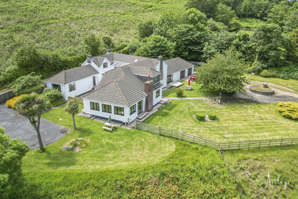
- Price
- £1,100,000
- Size
- 2.79 acres
Llanmadoc, Swansea, Llangennith, Llanmadoc and Cheriton, Swansea SA3 Wales
Added on 03/07/2026Residential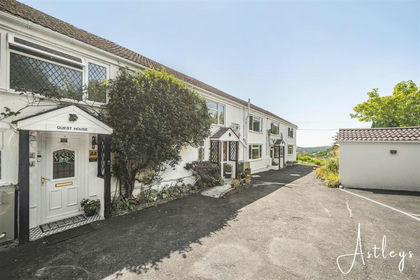
- Price
- Offers in Region of£825,000
- Size
- 4 acres
Added on 10/09/2026House with Land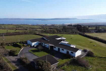
- Price
- Offers in Region of£950,000
- Size
- 2 acres
Pembrey, Burry Port, SA16, Pembrey and Burry Port Town, Carmarthenshire SA16 Wales
Added on 28/01/2026House with Land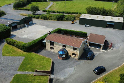
- Price
- £945,000
- Size
- 22 acres
Coopers Road, Ammanford, Carmarthenshire., Llanedi, Carmarthenshire SA18 Wales
Added on 12/08/2026House with Land
- Price
- Guide Price£950,000
Lot 3 - Cartref, Llanmihangel Farm, Pyle, Bridgend, CF33, Margam, Neath Port Talbot CF33 Wales
Added on 20/07/2026Barn Conversion
- Price
- £1,350,000
- Size
- 1 acres
West Road, Nottage, Porthcawl, CF36, Porthcawl, Bridgend CF36 Wales
Added on 02/08/2026House with Land