Carreglefn, Amlwch, LL68
- Land size
- 156.18 acres
- Bedrooms
- 5
- Bathrooms
- 2
Key Features
- ISLE OF ANGLESEY
- Well equipped stock farm with period farmhouse
- In all 156.18 acres (63.21 ha)
- Excellent range of steel framed and general purpose buildings, suiting a host of alternative enterprises
Description
*** A well situated Isle of Anglesey stock farm particularly well equipped with period farmhouse, *** Excellent general buildings and healthy land *** Ideal as an add-on or stand alone agricultural enterprise noted as an area for all around grass production
*** Period farmhouse, traditionally constructed of some 227 sq m which offers 4 bedroomed accommodation, oil central heating and double glazing ***
**Excellent range of steel framed and general purpose buildings, suiting a host of alternative enterprises *** A separate arrangement of traditional stone farm buildings having alternative use potential ***
Well located on the north of the Island of Anglesey, 5 miles south of Amlwch and within easy reach of Holyhead
In all 156.18 acres (63.21 ha)
We are informed by the current Vendors that the property benefits from mains water, mains electricity, private drainage to septic tank. Oil fired central heating to the farmhouse (currently disconnected).
Construction Type
Stone and slate
LOCATION
Well located on the north of the Island of Anglesey, 5 miles south of Amlwch and within easy reach of Holyhead and Llangefni. 7 miles from A55 expressway at Bryngwran.
GENERAL
A very well situated healthy stock farm on the Isle of Anglesey. Ideal as an add-on or stand alone agricultural enterprise noted as an area for all around grass production, the holding particularly well equipped with a comfortable family sized farmhouse and excellent range of steel framed and general purpose buildings, suiting a host of alternative enterprises and a separate arrangement of traditional stone farm buildings having alternative use potential.
The farm is further enhanced by having an attractive period farmhouse, traditionally constructed of some 227 sq m which offers 4 bedroomed accommodation, oil central heating and double glazing. An additional appealing factor to the farm is a range of traditional period buildings that have potential for conversion to such uses as holiday cottages, workshops and ancillary agricultural purposes (subject to the appropriate consents being obtained).
This is a well equipped farmstead with surrounding pastures givi...
THE FARMHOUSE
The farmhouse is well equipped and is family proportioned and provides more particularly the following character accommodation, which is generally well maintained.
The house has 2 chimneys, offers 227 sq m of accommodation, is of period traditional construction, rendered with modern slated roof, UPVC windows and oil fired central heating.
The accommodation provides more particularly as follows:-
FRONT ENTRY PORCH
With UPVC front entry door.
RECEPTION HALL
With laminate flooring and understairs cupboard.
HALLWAY
4' 6" x 4' 6" (1.37m x 1.37m) Via side entry door.
KITCHEN/DINER
17' -1" x 11' 6" (5.16m x 3.51m) with tiled floor. Rayburn Royal oil fired range. 1.5 bowl sink unit. Breakfast bar. Fan oven and grill over.
INNER HALL
FRONT RECEPTION ROOM
12' 2" x 12' 2" (3.71m x 3.71m) with laminate flooring. Fireplace with electric fire (not tested).
REAR RECEPTION ROOM
17' 7" x 15' 0" (5.36m x 4.57m) with Victorian style fireplace. Laminated floor.
GROUND FLOOR SHOWER ROOM/WC/UTILITY
15' 2" x 7' 8" (4.62m x 2.34m) with oil fired central heating boiler running domestic systems. Pedestal wash hand basin, low level flush w.c. corner shower cubicle. Heated towel rail.
LANDING
Approached via internal timber staircase.
BEDROOM 1
16' 0" x 15' 0" (4.88m x 4.57m) laminate flooring. 2 radiators. Loft access
FAMILY BATHROOM
12' 6" x 11' 8" (3.81m x 3.56m) with corner bath and mixer tap. Heated towel rail. Pedestal wash hand basin. Separate shower cubicle. Low level flush w.c. Radiator.
BEDROOM 2
12' 3" x 8' 5" (3.73m x 2.57m) with radiator.
BEDROOM 3 - BOX ROOM
6' 3" x 5' 6" (1.91m x 1.68m)
BEDROOM 4
12' 0" x 13' 4" (3.66m x 4.06m) with radiator.
BEDROOM 5 (REAR)
12' 0" x 7' 5" (3.66m x 2.26m)
THE FARM SETTING
THE FARMYARD
A traditional farm yard comprises a range of period buildings, some of which are dilapidated and require renovation and are set away from the modern range so as not to detract from the modern capabilities of the farm.
These comprise more particularly:-
FARMHOUSE REAR
RANGE 1
60' 0" x 18' 0" (18.29m x 5.49m) Of stone and slate.
ATCOST BARN - 3 BAYS
57' 0" x 45' 0" (17.37m x 13.72m) part concrete portal frame construction and clad sides and roof.
BARN RANGE 2
30' 0" x 18' 0" (9.14m x 5.49m) of stone and slate with adjacent former dilapidated cow shed of stone construction with corrugated asbestos roof, part of which requires re roofing immediately. (47' x 18')
BARN RANGE 3
36' 0" x 16' 0" (10.97m x 4.88m) stone range with slated roof.
MODERN FARM BUILDINGS
The modern farm buildings provide more particularly as follows:-
LARGE STEEL FRAMED BUILDING
100' 0" x 90' 0" (30.48m x 27.43m) with high eaves, concrete floor, steel upright roof and part sides.
2 X SIMILAR ADJACENT STEEL FRAMED BUILDINGS
100' 0" x 38' 6" (30.48m x 11.73m) EACH with concrete floors through. Concrete panelled walls.
FURTHER MODERN RANGE OF COVERED YARDS
156' 0" x 86' 0" (47.55m x 26.21m) all interconnecting and can be integrated as various feed areas, cubicle housing with central feeding passages. Steel framed with Yorkshire clad sides and part steel.
FURTHER CUBICLE SHED ADJACENT
156' 0" x 200' 0" (47.55m x 60.96m) with numerous cubicles and cleaning and feeding channels.
SIGNIFICANT SLURRY PIT
50M X 15M - well fenced for safety reasons.
THE LAND
The land is a particular feature of the farm which extends to 156.18 acres (63.21 ha) including the yard areas.
The farm is reasonably fenced and is contained with a stockproof ring fence with internal divisions fenced for cattle and some for sheep. 98 acres or thereabouts is good quality stock grazing undulating with rock and more difficult rocky outcrops in part, but ideal for wintering of sheep, grazing of store cattle, and has carried a substantial herd of sucklers in recent times.
Some 12 acres (4.85ha) of Site of Special Scientific Interest (SSSI) registered marshland lies alongside part of the southern driveway and is registered with Natural Resources Wales.
The land is all reasonably well maintained and capable of sustaining good stocking levels. The capabilities of farmland on the Isle of Anglesey are well documented and noted within agricultural circles.
In total 156.18 acres (63.21 ha)
THE FARMSTEAD ARRANGEMENT
OLD YARD BUILDINGS
TOP YARD
LAND TO THE SOUTH-WEST SIDE
LAND TO EAST SIDE
LAND TO EAST OF FARM
LAND TO CENTRAL SECTION
LAND TO CENTRAL FARM
LAND LOOKING WEST
TENURE AND POSSESSION
We are informed the property is of Freehold Tenure and will be vacant on completion.
The property is listed under the Isle of Anglesey and has the following charges. Council Tax Band: D
AGENTS COMMENTS/GENERAL REMARKS
This is a well equipped holding particularly attractively situated on the Isle of Anglesey noted as an area of significant grass production throughout the year and having good quality.
Clegyrog Uchaf is a well equipped livestock rearing farm that has carried a substantial herd of suckler cows and beef cattle and has been a livestock rearing enterprise until now.
The farm also has been the base for an agricultural contracting business with particularly spacious high rise agricultural buildings in the main, which provide extensive livestock housing, general workshops, and storage facilities with considerable diversification potential.
ANTI MONEY LAUNDERING
To comply with Government anti-money laundering legislation, we are legally required to carry out identity and verification checks on all buyers and sellers.
We work with our trusted and industry-recognised partner, Coadjute, who will send you a secure link to complete these biometric checks electronically once your offer has been accepted (subject to contract).
A non-refundable fee of £45 + VAT per person is payable directly to Coadjute for this service. These checks must be completed before we can issue the memorandum of sale to the solicitors and progress the transaction.
If you have any questions or need any assistance, please don’t hesitate to contact the office – we’re always happy to help.
LAND TRANSACTION TAX
The purchase of this property may be subject to Land Transaction Tax (LTT). The amount payable will depend upon the purchase price and the purchaser’s individual circumstances. Buyers are advised to use the Welsh Revenue Authority Land Transaction Tax calculator and/or seek advice from their solicitor or financial adviser.
Map Location
Property details
- Tenure
- Freehold
- Council Tax Band
- D
- Date Posted
- 2026-09-09
Market Value Analysis
Compared with 41 Farms & Smallholdings listings in Wales (100+ acres).
Energy Performance Certificate
Energy Efficiency Rating
Based on UK Energy Performance Certificate standards (EU Directive 2002/91/EC)
Running costs are one side. Planning activity, flood history and ground risks for this location are in the full report.
Utilities & Restrictions
Utilities
- Electricity
- Mains
- Water
- Mains
- Heating
- Double Glazing, Oil Heating
- Broadband
- Full Fibre (FTTP)
- Sewerage
- Septic Tank / Private
Rights & Restrictions
- Public Rights of Way
- Ask Agent
- Private Rights of Way
- Ask Agent
- Listed Property
- Ask Agent
- Restrictions
- Ask Agent
Listed status, conservation areas and planning constraints for this location are in the full report.
Property Features
- Accessibility
- Ask Agent
- Parking
- Driveway, Private Parking
- Garden
- Garden
Beyond the particulars: planning activity, flood history, heritage and ground risks, checked for this exact spot.
Connectivity
Broadband
Fastest speed available at this postcode
1.8 Gbps
Gigabit full fibre
Suitable for
- 4K streaming on every screen
- Full-time home working
- Online gaming & big downloads
Mobile signal
Outdoor predictions; indoor signal depends on building materials.
Ofcom Connected Nations postcode-level predictions. Speeds and signal are modelled, not measured, and vary between addresses and providers.
Signal is the easy part. Planning activity, flood history and protected designations here are in the full report.
Nearest Schools
Primary
- Ysgol Gymuned Llanfechell1.6 miles
- Pupils
- 81
- Type
- Nursery, Infants & Juniors
- Language
- Welsh medium school / provision (including transitional)
- Ysgol Cemaes2.3 miles
- Pupils
- 63
- Type
- Nursery, Infants & Juniors
- Language
- Welsh medium school / provision (including transitional)
- Ysgol Gynradd Rhosybol2.5 miles
- Pupils
- 75
- Type
- Infants & Juniors
- Language
- Welsh medium school / provision (including transitional)
- Ysgol Gynradd Amlwch3.9 miles
- Pupils
- 258
- Type
- Nursery, Infants & Juniors
- Language
- Welsh medium school / provision (including transitional)
- Ysgol Gymuned Llannerch-y-medd3.9 miles
- Pupils
- 123
- Type
- Nursery, Infants & Juniors
- Language
- Welsh medium school / provision (including transitional)
Secondary
- Ysgol Syr Thomas Jones3.4 miles
- Pupils
- 537
- Type
- Secondary (ages 11-19)
- Language
- Welsh medium school / provision (including transitional)
- Ysgol Uwchradd Bodedern7 miles
- Pupils
- 810
- Type
- Secondary (ages 11-19)
- Language
- Welsh medium school / provision (including transitional)
- Ysgol Gyfun Llangefni9.6 miles
- Pupils
- 761
- Type
- Secondary (ages 11-19)
- Language
- Welsh medium school / provision (including transitional)
- Ysgol Uwchradd Caergybi10 miles
- Pupils
- 818
- Type
- Secondary (ages 11-19)
- Language
- Welsh medium school / provision (including transitional)
- Ysgol David Hughes15 miles
- Pupils
- 1,123
- Type
- Secondary (ages 11-19)
- Language
- Welsh medium school / provision (including transitional)
Distances are straight-line from the advertised location. Source: the national school registers (DfE, Welsh Government, Scottish Government) and Ofsted.
Schools are just the start: sold prices nearby, planning activity and any flood history are in the full report.
Amenities
Supermarket
GP surgery
Pharmacy
Straight-line distances from the advertised location. Sources: NHS records, Geolytix supermarket locations, OS Open Greenspace and the national trails registers.
The area stacks up? Now check the location itself: planning nearby, protected designations and past flooding.
Getting Around
Nearest station
Nearest bus stop
Typical drive times
Straight-line distances from the advertised location; drive times are typical free-flow times over OpenStreetMap road data, so allow more at peak. Public transport locations from DfT NaPTAN.
Easy to reach matters. So do planning activity, flood history and ground risks: all in the full report.
Flood Risk
From Natural Resources Wales flood map open data, checked around the advertised map pin and allowing for the listed acreage where known. This summary comes from LandSale, the advertising platform, not from the listing agent, and is not part of the agent's particulars. Risk can vary across a single holding, so verify anything critical through your own searches before committing.
Rivers and the sea
Surface water
Mapped within the area searched, not at the advertised map pin itself.
These bandings are the summary. Where this location sits on the flood maps, plus planning activity, heritage and ground risks, is in the full report.
Important notice: Information, maps and tags on this page are drawn from the advertising agent's marketing materials or generated automatically. LandSale has not verified them. Relying on these details is at your own risk, always carry out independent checks before committing to a purchase.
LandSale full disclaimer
Marketing information only - not formal particulars. The details on this website are provided for general guidance and do not constitute an offer or contract. Neither LandSale nor the advertising estate/land agent accepts responsibility for any inaccuracy.
1. Source of information
- Listing content: Core description, asking price, tenure, measurements, photographs and planning history originate from the marketing materials of the advertising estate or land agent. LandSale does not author this content and cannot guarantee its accuracy.
- Automated tags & categorisation: Property type, land-use class, acreage bands and similar labels may be applied by machine-learning models. They are intended as a helpful guide only and may not reflect the property's legal status or permitted use.
- Third-party & enriched data layers: Maps, boundary outlines, planning designations, soil reports, broadband coverage and other environmental or location-based insights are licensed from external suppliers. Such data are supplied “as is", may be incomplete or out of date and are subject to change without notice.
2. Verification required
Prospective purchasers must verify critical matters, including but not limited to planning permission, title boundaries, public rights of way, environmental constraints, acreage, services, access and VAT status, through their own inspections, specialist surveys, legal advisers and the selling agent before relying on the information or entering into any contract.
3. No warranty or liability
LandSale gives no warranty, express or implied, as to the accuracy, completeness or fitness for any particular purpose of the information displayed. LandSale shall not be liable for any loss, damage, cost or expense arising directly or indirectly from any use of or reliance on such information, save where liability may not be excluded by law.
4. Updates & feedback
If you believe any detail on this listing is inaccurate, please let us know. We will investigate and, where appropriate, update the listing or notify the agent.
© LandSale | Version 1.3 - August 2026
Listing agent
Morgan & Davies, Lampeter
12 Harford Square, Lampeter, SA48 7DT
Similar properties for sale
- Price
- £1,250,000
- Size
- 4.4 acres
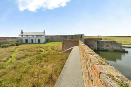
Cemlyn, Cemaes Bay, Isle of Anglesey, LL67, Cylch-y-Garn, Isle of Anglesey LL67 Wales
Added on 25/07/2026House with Land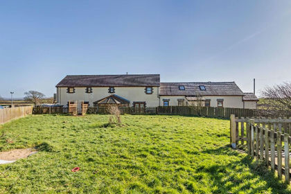
- Price
- Offers in Region of£1,250,000
- Size
- 4.28 acres
Bodwina Bellaf, Gwalchmai, Anglesey, LL65, Bodffordd, Isle of Anglesey LL65 Wales
Added on 29/01/2026House with Land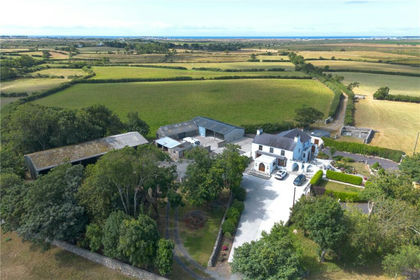
- Price
- £1,295,000
- Size
- 75.3 acres
Bryngwran, Holyhead, Isle of Anglesey, LL65, Bryngwran, Isle of Anglesey LL65 Wales
Added on 15/09/2026Farm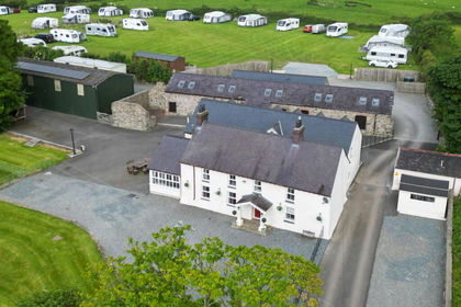
- Price
- Offers in Region of£1,895,000
- Size
- 18 acres
Cerrigceinwen, Bodorgan, LL62, Llangristiolus, Isle of Anglesey LL62 Wales
Added on 12/06/2026Camping Land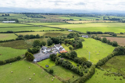
- Price
- £1,500,000
- Size
- 10.8 acres
Pentraeth, Isle of Anglesey, LL75, Pentraeth, Isle of Anglesey LL75 Wales
Added on 29/01/2026Holiday Let Property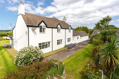
- Price
- £1,500,000
- Size
- 10.8 acres
Pentraeth, Isle of Anglesey, LL75, Pentraeth, Isle of Anglesey LL75 Wales
Added on 29/01/2026Holiday Let Property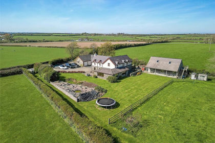
- Price
- Offers Over£1,100,000
- Size
- 3.12 acres
Llanddaniel, Isle of Anglesey, Rhosyr, Isle of Anglesey LL60 Wales
Added on 20/02/2026Residential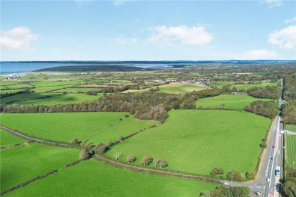
- Price
- Guide Price£2,240,000
- Size
- 180 acres
Llandwrog, Caernarfon, Gwynedd, LL54, Llandwrog, Gwynedd LL54 Wales
Added on 05/03/2026Farmland
- Price
- £1,300,000
- Size
- 7 acres
Added on 29/01/2026Camping Land
- Price
- Offers in Region of£1,100,000
- Size
- 2.3 acres
Nant Y Gamar Road, Llandudno, Conwy, LL30, Llandudno, Conwy LL30 Wales
Added on 05/06/2026House with Land