Cudham Lane North, Sevenoaks, Kent
- Land size
- 8.5 acres
- Bedrooms
- 5
- Bathrooms
- 3
Description
Hostye Farm – A Distinguished Country Estate Near London
Situated just 16 miles from Central London, Hostye Farm is an exceptional Grade II listed period farmhouse with stables and a collection of versatile outbuildings. Set within approximately 8.5 acres of picturesque grounds, the property offers both a sense of seclusion and significant potential for further development, subject to the necessary permissions.
Steeped in history, the house presents a rich blend of Tudor, Georgian, and Victorian architecture. Constructed primarily of brick and flint, it retains an abundance of original character, including striking oak beamed rooms that form the oldest part of the home, dating back to the 16th century.
The property is ideally positioned for commuters, with excellent transport links and fast trains to London Bridge taking as little as 15 minutes. Internally, the farmhouse extends to approximately 386 sq. metres and provides well-balanced, spacious accommodation, including five bedrooms and three bathrooms. The impressive principal suite spans around 60 sq. metres and incorporates a dressing room and en suite bathroom, creating a luxurious private retreat.
At the heart of the home lies a bespoke Mark Wilkinson/Smallbone kitchen, beautifully appointed with granite worktops, hardwood cabinetry, and a range of Aga and Miele appliances. The living spaces are equally inviting, with a large open-plan lounge featuring an original inglenook fireplace and adjoining study area, while the dining room offers a more formal setting complete with a log burner and natural oak flooring. Throughout the house, generous ceiling heights and an abundance of natural light enhance the sense of space, while the bathrooms are finished to a high standard with natural stone tiling.
A particularly appealing feature is the detached games room and bar, which provides flexible additional accommodation and could easily serve as a gym, home office, or entertainment space.
The grounds are a defining aspect of Hostye Farm, extending to approximately 8.5 acres and encompassing beautifully maintained gardens, orchards, paddocks, and areas of woodland. An outdoor swimming pool measuring 8 metres by 4 metres further enhances the lifestyle offering, creating an ideal environment for relaxation and entertaining.
For those with equestrian or lifestyle interests, the property is exceptionally well equipped. The barns and stables extend to around 260 sq. metres and offer clear potential for conversion, subject to planning. The stable block is constructed of brick and flint and includes four loose boxes, complemented by a hay barn and additional storage buildings. The surrounding land includes paddocks and a field shelter, with convenient access to nearby bridleways.
Access to the property is via electric oak entrance gates, leading to extensive parking areas. There are three separate access points from Cudham Lane North, adding both convenience and flexibility. Positioned in an elevated setting, the property enjoys far-reaching countryside views and is ideally located close to the North Downs Way and Pilgrims’ Way, offering immediate access to some of the area’s most scenic walking routes.
The accommodation is arranged over two floors. The ground floor comprises a welcoming dining room with adjoining lounge area, a drawing room, study or TV room, kitchen, utility room, sun room, a spacious entrance hall, and a cloakroom. The first floor provides a generous principal suite with dressing room and en suite, along with four further double bedrooms, two additional bathrooms, and a large landing area.
Hostye Farm represents a rare opportunity to acquire a characterful country estate that seamlessly combines historic charm, modern comfort, and exceptional potential, all within easy reach of London.
Fast direct trains take just 15-18 minutes to London Bridge from Chelsfield or Orpington
railway stations, both in Zone 6 and just a 5-10 minute drive away.
Additional direct rail services to Cannon Street, Waterloo East, Charing Cross, Victoria, Blackfriars and into Kent.
Annual season train ticket prices to London from approx. £2500, free parking nearby Chelsfield rail station.
R5/ R10 Hail & ride bus service direct to Orpington rail station from Cudham Lane North.
Local taxi companies and Uber service the area.
LOCAL AMENITIES
Three local country pubs within walking distance via public footpaths and bridleways
Blacksmiths Arms 0.6 Mile. George & Dragon & Queens Head in Downe 1 mile.
More local shops & restaurants at -
Green Street Green 2 miles. Keston, Locksbottom, Orpington & Westerham 4 miles. Sevenoaks & Oxted 6.5 miles
Or for more variety, London by train in as little as 30 minutes door to door.
SCHOOLS
There are numerous highly regarded schools in the area, a small selection below.
The excellent train links to Tonbridge and Royal Tunbridge Wells makes schools located here very accessible too.
Private Schools - Sevenoaks School, Radnor House, New Beacon, Solefields, The Granville, Walthamstow Hall,
Sevenoaks Prep, Lingfield College, Russell House, Bromley High, Trinity, Bickley Park, Eltham College.
Grammar Schools - Newstead Woods, St Olave's, Weald Of Kent, Tonbridge, Judd, Dartford, Tunbridge Wells, Skinner's
State Schools - Cudham Primary, Downe Primary, St Katharine's Knockholt, Darrick Wood, Ravenswood.
Local Authority: Sevenoaks
Council Tax Band: H
Please note than an AML fee is chargeable once an offer is accepted to cover the cost of carrying out the required identity and anti-money laundering checks.
Map Location
Property details
- Tenure
- Freehold
- Council Tax Band
- H
- Date Posted
- 2026-09-07
Market Value Analysis
Compared with 11 Homes with Land listings in London (5+ acres).
Energy Performance Certificate
Energy Efficiency Rating
Based on UK Energy Performance Certificate standards (EU Directive 2002/91/EC)
Running costs are one side. Planning activity, flood history and ground risks for this location are in the full report.
Utilities & Restrictions
Utilities
- Electricity
- Ask Agent
- Water
- Ask Agent
- Heating
- Ask Agent
- Broadband
- Ask Agent
- Sewerage
- Ask Agent
Rights & Restrictions
- Public Rights of Way
- Ask Agent
- Private Rights of Way
- Ask Agent
- Listed Property
- Ask Agent
- Restrictions
- Ask Agent
Listed status, conservation areas and planning constraints for this location are in the full report.
Property Features
- Accessibility
- Ask Agent
- Parking
- Parking Available
- Garden
- Garden
Beyond the particulars: planning activity, flood history, heritage and ground risks, checked for this exact spot.
Connectivity
Broadband
Fastest speed available at this postcode
1.8 Gbps
Gigabit full fibre · available to 75% of premises
Suitable for
- 4K streaming on every screen
- Full-time home working
- Online gaming & big downloads
Mobile signal
Outdoor predictions; indoor signal depends on building materials.
Ofcom Connected Nations postcode-level predictions. Speeds and signal are modelled, not measured, and vary between addresses and providers.
Signal is the easy part. Planning activity, flood history and protected designations here are in the full report.
Nearest Schools
Primary
- Downe Primary School1 mileNo Ofsted rating
- Ages
- 4 to 11
- Pupils
- 85
- Type
- Academy converter
- Cudham Church of England Primary School1.1 milesOfsted: Good
- Ages
- 4 to 11
- Pupils
- 48
- Type
- Academy converter
- Faith
- Church of England
- Biggin Hill Primary School1.6 milesNo Ofsted rating
- Ages
- 2 to 11
- Pupils
- 444
- Type
- Academy converter
- St Katharine's Knockholt Church of England Voluntary Aided Primary School1.8 milesNo Ofsted rating
- Ages
- 4 to 11
- Pupils
- 182
- Type
- Voluntary aided school
- Faith
- Church of England
- Pratts Bottom Primary School1.9 milesOfsted: Good *
- Ages
- 5 to 11
- Pupils
- 67
- Type
- Academy converter
Secondary
- Charles Darwin School1.4 milesOfsted: Good
- Ages
- 11 to 18
- Pupils
- 1,305
- Type
- Academy converter
- Darrick Wood School2.7 milesOfsted: Good
- Ages
- 11 to 18
- Pupils
- 1,698
- Type
- Academy converter
- Newstead Wood School2.8 milesOfsted: Outstanding
- Ages
- 11 to 18
- Pupils
- 1,347
- Type
- Academy converter
- Gender
- Girls
- St Olave's and St Saviour's Grammar School3.1 milesOfsted: Outstanding *
- Ages
- 11 to 18
- Pupils
- 1,084
- Type
- Voluntary aided school
- Faith
- Church of England
- Gender
- Boys
- Meridian High School3.2 milesOfsted: Good
- Ages
- 11 to 18
- Pupils
- 535
- Type
- Academy sponsor led
* Latest graded judgement covers quality of education only; no overall grade was issued under the 2024-25 inspection framework.
Distances are straight-line from the advertised location. Source: the national school registers (DfE, Welsh Government, Scottish Government) and Ofsted.
Schools are just the start: sold prices nearby, planning activity and any flood history are in the full report.
Amenities
Supermarket
GP surgery
Pharmacy
Hospital
Green space
Straight-line distances from the advertised location. Sources: NHS records, Geolytix supermarket locations, OS Open Greenspace and the national trails registers.
The area stacks up? Now check the location itself: planning nearby, protected designations and past flooding.
Getting Around
Nearest station
Nearest bus stop
Typical drive times
Straight-line distances from the advertised location; drive times are typical free-flow times over OpenStreetMap road data, so allow more at peak. Public transport locations from DfT NaPTAN.
Easy to reach matters. So do planning activity, flood history and ground risks: all in the full report.
Flood Risk
From Environment Agency flood map open data, checked around the advertised map pin and allowing for the listed acreage where known. This summary comes from LandSale, the advertising platform, not from the listing agent, and is not part of the agent's particulars. Risk can vary across a single holding, so verify anything critical through your own searches before committing.
Rivers and the sea
Surface water
Mapped within the area searched, not at the advertised map pin itself.
The detail behind these bandings
The full report pinpoints where this location sits on the flood maps, and runs the deeper checks that usually only surface after an offer.
- Exact flood zones & annual chances (included in the full report)
- Any recorded past flooding (included in the full report)
- Planning activity nearby (included in the full report)
- Heritage & conservation (included in the full report)
- Protected nature designations (included in the full report)
- Ground risks (included in the full report)
- Sold prices nearby (included in the full report)
£14.99 · one-off purchase
By LandSale, the platform. Not provided by the listing agent. Ready in about a minute.
Important notice: Information, maps and tags on this page are drawn from the advertising agent's marketing materials or generated automatically. LandSale has not verified them. Relying on these details is at your own risk, always carry out independent checks before committing to a purchase.
LandSale full disclaimer
Marketing information only - not formal particulars. The details on this website are provided for general guidance and do not constitute an offer or contract. Neither LandSale nor the advertising estate/land agent accepts responsibility for any inaccuracy.
1. Source of information
- Listing content: Core description, asking price, tenure, measurements, photographs and planning history originate from the marketing materials of the advertising estate or land agent. LandSale does not author this content and cannot guarantee its accuracy.
- Automated tags & categorisation: Property type, land-use class, acreage bands and similar labels may be applied by machine-learning models. They are intended as a helpful guide only and may not reflect the property's legal status or permitted use.
- Third-party & enriched data layers: Maps, boundary outlines, planning designations, soil reports, broadband coverage and other environmental or location-based insights are licensed from external suppliers. Such data are supplied “as is", may be incomplete or out of date and are subject to change without notice.
2. Verification required
Prospective purchasers must verify critical matters, including but not limited to planning permission, title boundaries, public rights of way, environmental constraints, acreage, services, access and VAT status, through their own inspections, specialist surveys, legal advisers and the selling agent before relying on the information or entering into any contract.
3. No warranty or liability
LandSale gives no warranty, express or implied, as to the accuracy, completeness or fitness for any particular purpose of the information displayed. LandSale shall not be liable for any loss, damage, cost or expense arising directly or indirectly from any use of or reliance on such information, save where liability may not be excluded by law.
4. Updates & feedback
If you believe any detail on this listing is inaccurate, please let us know. We will investigate and, where appropriate, update the listing or notify the agent.
© LandSale | Version 1.3 - August 2026
Listing agent
Alan de Maid, Locksbottom
9 Princess Parade Crofton Road Orpington BR6 8NP
Contact Alan de Maid, Locksbottom
9 Princess Parade Crofton Road Orpington BR6 8NP
View agent profileSimilar properties for sale
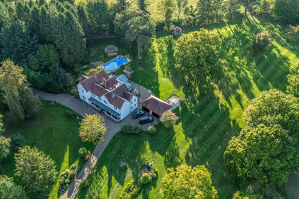
- Price
- £2,800,000
- Size
- 9 acres
Main Road, Knockholt, Sevenoaks, Knockholt, Kent TN14 England
Added on 29/01/2026Country Home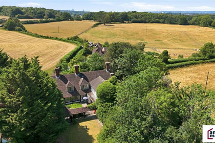
- Price
- £3,300,000
- Size
- 5 acres
Nash Lane, Keston, BR2, Bromley and Biggin Hill, Bromley BR2 England
Added on 14/07/2026Estate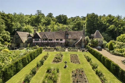
- Price
- £3,995,000
- Size
- 20 acres
Added on 11/05/2026House with Land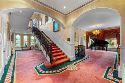
- Price
- Guide Price£3,500,000
- Size
- 14 acres
Tupwood Lane, Caterham, CR3, Caterham Valley, Surrey CR3 England
Added on 14/02/2026Country Home
- Price
- £4,500,000
- Size
- 40 acres
Gorse Hill, Farningham, Dartford, DA4, Farningham, Kent DA4 England
Added on 13/06/2026Country Home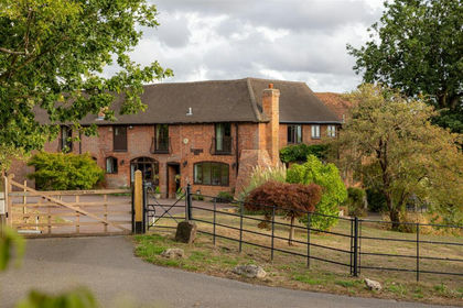
- Price
- £2,750,000
- Size
- 17 acres
Coldharbour Lane, Bletchingley, Bletchingley, Surrey RH1 England
Added on 10/09/2026House with Land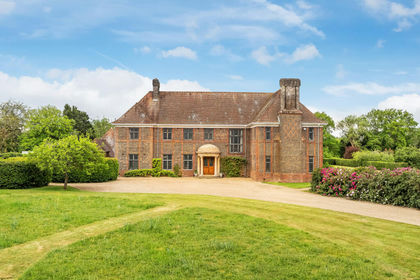
- Price
- Guide Price£3,250,000
- Size
- 15 acres
Faygate Lane, South Godstone, Godstone, Surrey, RH9, Godstone, Surrey RH9 England
Added on 06/06/2026House with Land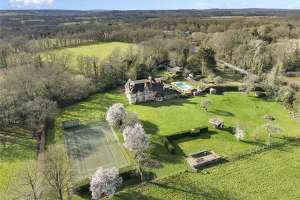
- Price
- £3,250,000
- Size
- 7.5 acres
Noble Tree Road, Hildenborough, Tonbridge, Kent, TN11, Hildenborough, Kent TN11 England
Added on 09/04/2026Country Estate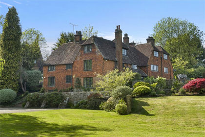
- Price
- £3,500,000
- Size
- 22.9 acres
Hartfield Road, Edenbridge, Kent, TN8, Edenbridge, Kent TN8 England
Added on 16/05/2026Farmhouse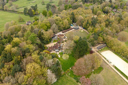
- Price
- Guide Price£3,700,000
- Size
- 44 acres
Added on 29/01/2026Equestrian property