The Granary, Wilton, Pickering
- Bedrooms
- 3
- Bathrooms
- 2
Key Features
- Stone-and-pantile barn conversion circa 1869, attached on 1 side
- One of only 5 freehold homes in an attractive courtyard setting
- 1326 sq ft of accommodation over 2 floors
- Renewable heating system with low running costs
- Recently renovated and upgraded throughout
- Exposed beams, deep window sills, barn-style windows and a fireplace
- Secure, easy to maintain garden
- Integral garage and parking for up to 4 vehicles
- Views towards the Yorkshire Wolds
Description
Charming stone barn conversion in a courtyard setting, close to Thornton le Dale.
Converted around twenty years ago from a mid-nineteenth century stone barn belonging to Manor Farm and very recently updated, The Granary forms one of five freehold homes arranged around an attractive shared courtyard. The house combines the proportions and character of the original agricultural building with a thoughtfully updated interior, creating light and practical living space finished to a high standard. With manageable gardens and generous parking, it is easily maintained and an ideal lock-up-and-leave.
Entrance porch/cloakroom, sitting/dining room, kitchen/breakfast room, utility room, separate wc.
Principal bedroom suite, 2 further bedrooms, house bathroom, fully boarded loft
Integral garage, up to 4 parking spaces, log store
Gardens to front and rear
Find Out A Little More .... - The Granary has been thoughtfully updated over the past year. A welcoming, light-filled entrance porch provides both a practical boot room and cloakroom, and, in recent years, the kitchen and bathrooms have been replaced. In addition, plumbing and wiring has been renewed, and underfloor heating has been installed in the kitchen, utility room and bathrooms.
The impressive open-plan living space retains the unmistakable character of its agricultural origins, with substantial exposed timber beams and a trio of striking stone-arched barn windows that dominate one wall. These distinctive openings fill the room with natural light and are beautifully balanced by a dramatic double-height picture window opposite. The sitting area is centred around a substantial fireplace faced in stone and housing a wood-burning stove, while the dining area adjoins the kitchen, with a glazed door opening directly onto the rear terrace.
The kitchen/breakfast room is connected to the garden through a stone-arched doorway opening onto the terrace. Contemporary cabinetry is arranged around a peninsula with breakfast bar and integrated Bosch appliances, including an induction hob. Beyond, the fitted utility room provides additional storage and laundry space, with access to the cloakroom/wc and the integral garage.
A broad turning staircase with a glazed balustrade rises to a bright first-floor landing. All three bedrooms are doubles, one currently arranged as a study. The principal bedroom spans the full depth of the house on a north-south aspect and includes fitted wardrobes, a dressing or seating area, and an en suite bathroom with a bath, shower over and heated towel rail. The family bathroom enjoys south-facing light and is equipped with a corner shower and a bath.
A fully boarded loft, accessed via a drop-down ladder, provides extensive storage with electric lighting and standing room beneath the roof apex.
Outside - The shared paved courtyard provides generous space for access, turning and parking. Two allocated parking spaces are positioned opposite the house, while the integral garage has an electric up-and-over door, power and lighting. Additional parking can be accommodated immediately in front of the property.
To the front, a south-facing paved garden is enclosed by gravel and raised planting, creating a sheltered seating area within the courtyard. A path bordered by a low stone wall leads around the western side of the house to a secure gate into the rear garden.
The rear garden has been landscaped to create a private outdoor space with a lawn surrounded by herbaceous planting including colourful climbers. A paved and gravelled terrace, accessed directly from both the sitting room and kitchen, provides a natural place for outdoor dining and enjoys a sheltered position. The garden is fully enclosed, part-walled and part-fenced with a tall beech hedge lining the front boundary.
The property also benefits from external lighting, two outside taps, two external power sockets and an EV charging point.
Environs - Thornton le Dale 1½ miles, Pickering 4 miles, Kirkbymoorside 11 miles, Scarborough 13 miles, Helmsley 16 miles, York 29 miles, Thirsk/A19 30 miles
Wilton is a small rural village lying immediately east of Thornton le Dale on the A170 between Thirsk and Scarborough. Open countryside surrounds the village, with views towards the Yorkshire Wolds and with the North York Moors National Park close by. Dalby Forest is only a short drive away, while the shops, cafés and everyday amenities of Thornton le Dale and Pickering are within an easy drive. York can be reached in around 45 minutes.
Important Information - Tenure: Freehold
EPC Rating: C
Council Tax Band: E
Services & Systems: Mains electricity, water and drainage. Air source heat pump.
Fixtures & Fittings: All items in the written text of these particulars are included in the sale. All others are expressly excluded regardless of inclusion in any photographs. Purchasers must satisfy themselves that any equipment included in the sale of the property is in satisfactory order.
Local Authority: North Yorkshire Council
Money Laundering Regulations: Prior to a sale being agreed, prospective purchasers are required to produce identification documents in order to comply with Money Laundering regulations. Your co-operation with this is appreciated and will assist with the smooth progression of the sale.
Directions: From Pickering on the A170 turn first right on reaching Wilton and turn first left into Mistle Corner where no. 4 is on the left.
What3words: ///workbench.fashion.painters
Viewing: Strictly by appointment
Photographs, images, brochure and property highlights video: July 2026. Some images may have been enhanced using artificial intelligence (AI); any such images will be clearly identified individually. Google map images may neither be current nor a true representation.
Map Location
Property details
- Tenure
- Freehold
- Council Tax Band
- E
- Date Posted
- 2026-09-02
Energy Performance Certificate
Energy Efficiency Rating
Based on UK Energy Performance Certificate standards (EU Directive 2002/91/EC)
Running costs are one side. Planning activity, flood history and ground risks for this location are in the full report.
Utilities & Restrictions
Utilities
- Electricity
- Ask Agent
- Water
- Ask Agent
- Heating
- Ask Agent
- Broadband
- Ask Agent
- Sewerage
- Ask Agent
Rights & Restrictions
- Public Rights of Way
- Ask Agent
- Private Rights of Way
- Ask Agent
- Listed Property
- Ask Agent
- Restrictions
- Ask Agent
Listed status, conservation areas and planning constraints for this location are in the full report.
Property Features
- Accessibility
- Ask Agent
- Parking
- Parking Available
- Garden
- Garden
Beyond the particulars: planning activity, flood history, heritage and ground risks, checked for this exact spot.
Connectivity
Broadband
Fastest speed available at this postcode
1.8 Gbps
Gigabit full fibre
Suitable for
- 4K streaming on every screen
- Full-time home working
- Online gaming & big downloads
Fixed wireless access may also be an option here.
Mobile signal
Predicted 4G and 5G signal; indoor signal depends on building materials.
Ofcom Connected Nations postcode-level predictions. Speeds and signal are modelled, not measured, and vary between addresses and providers.
Signal is the easy part. Planning activity, flood history and protected designations here are in the full report.
Nearest Schools
Primary
- Thornton Dale CofE Primary School1.9 milesOfsted: Good *
- Ages
- 4 to 11
- Pupils
- 146
- Type
- Academy sponsor led
- Faith
- Church of England
- Pickering Community Infant School3.8 milesOfsted: Good
- Ages
- 3 to 7
- Pupils
- 197
- Type
- Community school
- Snainton Church of England Voluntary Controlled Primary School4 milesOfsted: Good
- Ages
- 4 to 11
- Pupils
- 34
- Type
- Voluntary controlled school
- Faith
- Church of England
- Pickering Community Junior School4.3 milesNo Ofsted rating
- Ages
- 7 to 11
- Pupils
- 184
- Type
- Community school
- St Joseph's Catholic Primary School - a Catholic voluntary academy4.4 milesNo Ofsted rating
- Ages
- 3 to 11
- Pupils
- 84
- Type
- Academy converter
- Faith
- Roman Catholic
Secondary
- Lady Lumley's Academy4.4 milesOfsted: Good
- Ages
- 11 to 18
- Pupils
- 676
- Type
- Academy sponsor led
- Malton School8.5 milesOfsted: Good
- Ages
- 11 to 18
- Pupils
- 999
- Type
- Academy converter
- Norton School8.6 milesOfsted: Good
- Ages
- 11 to 18
- Pupils
- 651
- Type
- Academy converter
- Graham School10 milesOfsted report card · Feb 2026
- Ages
- 11 to 16
- Pupils
- 893
- Type
- Academy sponsor led
- St Augustine's Catholic School - a Catholic voluntary academy11 milesNo Ofsted rating
- Ages
- 11 to 16
- Pupils
- 610
- Type
- Academy converter
- Faith
- Roman Catholic
* Latest graded judgement covers quality of education only; no overall grade was issued under the 2024-25 inspection framework.
Distances are straight-line from the advertised location. Source: the national school registers (DfE, Welsh Government, Scottish Government) and Ofsted.
Schools are just the start: sold prices nearby, planning activity and any flood history are in the full report.
Amenities
Supermarket
GP surgery
Pharmacy
Hospital
Straight-line distances from the advertised location. Sources: NHS records, Geolytix supermarket locations, OS Open Greenspace and the national trails registers.
The area stacks up? Now check the location itself: planning nearby, protected designations and past flooding.
Getting Around
Nearest station
Nearest bus stop
Typical drive times
Straight-line distances from the advertised location; drive times are typical free-flow times over OpenStreetMap road data, so allow more at peak. Public transport locations from DfT NaPTAN.
Easy to reach matters. So do planning activity, flood history and ground risks: all in the full report.
Flood Risk
Environment Agency open data, checked around the advertised map pin for the listed acreage. Long-term risk counts flood defences; the planning map's flood zones do not. Provided by LandSale, not the listing agent, and not part of the agent's particulars. Risk varies across a holding, so verify before committing.
Rivers and the sea
Planning map: Flood Zone 1.
Surface water
Not at the pin: mapped about 10 metres away.
These bandings are the summary. Where this location sits on the flood maps, plus planning activity, heritage and ground risks, is in the full report.
Important notice: Information, maps and tags on this page are drawn from the advertising agent's marketing materials or generated automatically. LandSale has not verified them. Relying on these details is at your own risk, always carry out independent checks before committing to a purchase.
LandSale full disclaimer
Marketing information only - not formal particulars. The details on this website are provided for general guidance and do not constitute an offer or contract. Neither LandSale nor the advertising estate/land agent accepts responsibility for any inaccuracy.
1. Source of information
- Listing content: Core description, asking price, tenure, measurements, photographs and planning history originate from the marketing materials of the advertising estate or land agent. LandSale does not author this content and cannot guarantee its accuracy.
- Automated tags & categorisation: Property type, land-use class, acreage bands and similar labels may be applied by machine-learning models. They are intended as a helpful guide only and may not reflect the property's legal status or permitted use.
- Third-party & enriched data layers: Maps, boundary outlines, planning designations, soil reports, broadband coverage and other environmental or location-based insights are licensed from external suppliers. Such data are supplied “as is", may be incomplete or out of date and are subject to change without notice.
2. Verification required
Prospective purchasers must verify critical matters, including but not limited to planning permission, title boundaries, public rights of way, environmental constraints, acreage, services, access and VAT status, through their own inspections, specialist surveys, legal advisers and the selling agent before relying on the information or entering into any contract.
3. No warranty or liability
LandSale gives no warranty, express or implied, as to the accuracy, completeness or fitness for any particular purpose of the information displayed. LandSale shall not be liable for any loss, damage, cost or expense arising directly or indirectly from any use of or reliance on such information, save where liability may not be excluded by law.
4. Updates & feedback
If you believe any detail on this listing is inaccurate, please let us know. We will investigate and, where appropriate, update the listing or notify the agent.
© LandSale | Version 1.3 - August 2026
Listing agent
Blenkin & Co, York
Priestley House Bootham York YO30 7BL
Similar properties for sale
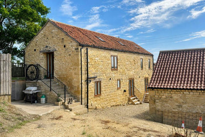
- Price
- Guide Price£375,000
- Size
- 0.11 acres
Added on 23/09/2026Barn Conversion
- Price
- Guide Price£375,000
- Size
- 0.33 acres
55 High Street, Snainton, Snainton, North Yorkshire YO13 England
Added on 29/01/2026Redevelopment Land
- Price
- £625,000
- Size
- 1.5 acres
High Street, Snainton, Scarborough, North Yorkshire, YO13, Snainton, North Yorkshire YO13 England
Added on 16/04/2026House with Land
- Price
- Offers Over£600,000
- Size
- 1 acres
Added on 29/01/2026House with Land
- Price
- £425,000
- Size
- 1 acres
Carr Lane, Scalby, Newby and Scalby, North Yorkshire YO13 England
Added on 16/09/2026House with Land
- Price
- Offers Over£450,000
Main Street, Barton-Le-Street, Malton, Barton-le-Street, North Yorkshire YO17 England
Added on 25/03/2026Barn Conversion
- Price
- Guide Price£500,000
Iris Close, Burniston, YO13, Burniston, North Yorkshire YO13 England
Added on 23/04/2026Building Plot
- Price
- £495,000
- Size
- 0.34 acres
135-137 Victoria Road, Scarborough, Scarborough, North Yorkshire YO11 England
Added on 16/04/2026Commercial Land
- Price
- Guide Price£375,000
- Size
- 0.4 acres
Land adjacent, 25 Holbeck Hill, Scarborough, North Yorkshire YO11 England
Added on 29/01/2026Development Land
- Price
- Offers in Excess of£465,000
- Size
- 1 acres
Added on 03/07/2026Smallholding