South Newton, Lochranza, KA27
Key Features
- Measuring roughly 35m wide x 45m deep
- Situated in the picturesque village of Lochranza
- Panoramic views over the Firth of Clyde
- Approved outline planning permission for plots
- Zoned in a General Urban Area for planning
- No conservation designations cover the site
- Freedom to create your own house design
- Mains access to electricity, water and BT
Description
Three exceptional building plots for sale in the idyllic village of Lochranza, measuring approximately 35m wide x 45m deep and situated in the North Arran National Scenic Area, one of the most breath-taking and picturesque sites on the entire Isle of Arran.
Features
• Three fully serviced building plots for sale
• Measuring roughly 35m wide x 45m deep
• Situated in the picturesque village of Lochranza
• Panoramic views over the Firth of Clyde
• Approved outline planning permission for plots
• Zoned in a General Urban Area for planning
• No conservation designations cover the site
• Freedom to create your own house design
• Mains access to electricity, water and BT
Body
A rarely available opportunity to purchase a significant and sought-after plot of land along Lochranzas stunning Newton Shore, situated beside the coast amongst beautiful scenery, including panoramic views over the Firth of Clyde. There are four plots in total, with three for sale (the northern plot having already sold). Each plot measures roughly 35m wide x 45m deep to allow ample space for a substantial house with surrounding gardens and off-street parking. The outline planning permission for plots and access has been approved.
Site Description
Situated in Lochranza, towards the northern end of Newton Road, the site of the plots is visually stunning, occupying a highly desirable position in the village against a backdrop of green rolling hills and an eye-catching cliff that rolls down to the rugged coast with its sapphire-blue waters. The site lies within the breath-taking North Arran National Scenic Area and is relatively flat and open, providing panoramic coastal views that are truly inspiring. It also has a charming coastal pathway to the Whins, which will be realigned and upgraded.
It is an amazing location for a forever family home or even a second holiday home, providing an idyllic coastal lifestyle in a relaxed and friendly village. Buyers also enjoy the freedom to develop their own property designs and plans, to create the house of their dreams. And when it comes to design proposals, there should be additional freedom in the style, size, and architecture as the site is zoned in a General Urban Area and there are no tree preservation orders (TPO) or other conservation designations covering the site.
Proposed Development
The three large plots each measure approximately 35m wide x 45m deep to provide generous living accommodation for families, as well as ample gardens and off-street parking. The plots follow a linear development line consistent with the properties on either side of the bay, which ensures a high degree of amenity and privacy.
The house shapes and positions currently shown on the plots and site maps are purely for illustration purposes. As mentioned, buyers of each plot will be given the freedom to create their own detailed house designs, allowing you to develop an ideal residence bespoke to your own personal needs. Whilst the house designs are subject to planning permission (STPP), it should be possible to incorporate modern components and architectural styles, but at the same time remain in harmony with the neighbouring properties. It is an excellent and rarely available opportunity in this area to create a very special residence directly beside the coast.
For added convenience, each plot will have mains access to electricity, water, and BT. However, similar to other properties along Newton Road, a private drainage system (eg. septic tank) will be required as there is no mains sewer. It is worth noting it may be possible for buyers to share a system for those who wish to do so, we can assist relevant parties in making contact.
Location
Lochranza is thought to be the most scenically attractive of Arran's villages and is sheltered by the surrounding hills. The village focal point is Lochranza Castle, which sits on a shingle spit. On the southern side of the loch, other attractions include the Isle of Arran Distillery, which began production in 1995, the large population of red deer, golden eagles, seals and otters and a 11-hole golf course. There is a ferry terminus that allows quick access to the stunning West of Scotland via Claonaig. Kintyre here we come ! The village has an active local community, post office, surgery and the 'Stags' restaurant, which is renowned for excellent food. The Lochranza Hotel has been purchased by the local community (December 2022) and plans to re-open during 2023. Primary schooling is available at the nearby village of Pirnmill, with secondary schooling in Lamlash.
Map Location
Property details
- Tenure
- Freehold
- Council Tax Band
- Ask Agent
- Date Posted
- 2026-08-29
Utilities & Restrictions
Utilities
- Electricity
- Ask Agent
- Water
- Ask Agent
- Heating
- Ask Agent
- Broadband
- Ask Agent
- Sewerage
- Ask Agent
Rights & Restrictions
- Public Rights of Way
- Ask Agent
- Private Rights of Way
- Ask Agent
- Listed Property
- Ask Agent
- Restrictions
- Ask Agent
Listed status, conservation areas and planning constraints for this location are in the full report.
Property Features
- Accessibility
- Ask Agent
- Parking
- Parking Available
- Garden
- Garden
Beyond the particulars: planning activity, flood history, heritage and ground risks, checked for this exact spot.
Connectivity
Broadband
Fastest speed available at this postcode
80 Mbps
Superfast · available to 61% of premises
Suitable for
- HD streaming
- Video calls
- Web & social
Mobile signal
Predicted 4G and 5G signal; indoor signal depends on building materials.
Ofcom Connected Nations postcode-level predictions. Speeds and signal are modelled, not measured, and vary between addresses and providers.
Signal is the easy part. Planning activity, flood history and protected designations here are in the full report.
Nearest Schools
Primary
- Pirnmill Primary School5.7 miles
- Pupils
- 8
- Type
- Non-denominational
- Corrie Primary School6.9 miles
- Pupils
- 14
- Type
- Non-denominational
- Brodick Primary School9.9 miles
- Pupils
- 68
- Type
- Non-denominational
- Carradale Primary School11 miles
- Pupils
- 16
- Type
- Non-denominational
- Clachan Primary School11 miles
- Pupils
- 11
- Type
- Non-denominational
Secondary
- Tarbert Academy12 miles
- Pupils
- 120
- Type
- Non-denominational
- Rothesay Academy12 miles
- Pupils
- 277
- Type
- Non-denominational
- Arran High School14 miles
- Pupils
- 242
- Type
- Non-denominational
- Largs Academy18 miles
- Pupils
- 994
- Type
- Non-denominational
- Ardrossan Academy19 miles
- Pupils
- 795
- Type
- Non-denominational
Distances are straight-line from the advertised location. Source: the national school registers (DfE, Welsh Government, Scottish Government) and Ofsted.
Schools are just the start: planning activity, heritage and any flood history here are in the full report.
Amenities
Supermarket
GP surgery
Pharmacy
Green space
Walking trail
Straight-line distances from the advertised location. Sources: NHS records, Geolytix supermarket locations, OS Open Greenspace and the national trails registers.
The area stacks up? Now check the location itself: planning nearby, protected designations and past flooding.
Getting Around
Nearest station
Nearest bus stop
Typical drive times
Straight-line distances from the advertised location; drive times are typical free-flow times over OpenStreetMap road data, so allow more at peak. Public transport locations from DfT NaPTAN.
Easy to reach matters. So do planning activity, flood history and ground risks: all in the full report.
Flood Risk
SEPA open data, checked around the advertised map pin for the listed acreage. Provided by LandSale, not the listing agent, and not part of the agent's particulars. Risk varies across a holding, so verify before committing.
Rivers and the sea
Surface water
These bandings are the summary. Where this location sits on the flood maps, plus planning activity, heritage and ground risks, is in the full report.
Important notice: Information, maps and tags on this page are drawn from the advertising agent's marketing materials or generated automatically. LandSale has not verified them. Relying on these details is at your own risk, always carry out independent checks before committing to a purchase.
LandSale full disclaimer
Marketing information only - not formal particulars. The details on this website are provided for general guidance and do not constitute an offer or contract. Neither LandSale nor the advertising estate/land agent accepts responsibility for any inaccuracy.
1. Source of information
- Listing content: Core description, asking price, tenure, measurements, photographs and planning history originate from the marketing materials of the advertising estate or land agent. LandSale does not author this content and cannot guarantee its accuracy.
- Automated tags & categorisation: Property type, land-use class, acreage bands and similar labels may be applied by machine-learning models. They are intended as a helpful guide only and may not reflect the property's legal status or permitted use.
- Third-party & enriched data layers: Maps, boundary outlines, planning designations, soil reports, broadband coverage and other environmental or location-based insights are licensed from external suppliers. Such data are supplied “as is", may be incomplete or out of date and are subject to change without notice.
2. Verification required
Prospective purchasers must verify critical matters, including but not limited to planning permission, title boundaries, public rights of way, environmental constraints, acreage, services, access and VAT status, through their own inspections, specialist surveys, legal advisers and the selling agent before relying on the information or entering into any contract.
3. No warranty or liability
LandSale gives no warranty, express or implied, as to the accuracy, completeness or fitness for any particular purpose of the information displayed. LandSale shall not be liable for any loss, damage, cost or expense arising directly or indirectly from any use of or reliance on such information, save where liability may not be excluded by law.
4. Updates & feedback
If you believe any detail on this listing is inaccurate, please let us know. We will investigate and, where appropriate, update the listing or notify the agent.
© LandSale | Version 1.3 - August 2026
Listing agent
Watermans, Glasgow
193 Bath Street Glasgow G2 4HU
Similar properties for sale
- Price
- Offers Over£200,000
South Newton, Lochranza, KA27, North Ayrshire and Arran, Arran and Cumbrae KA27 Scotland
Added on 29/08/2026Building Plot- Price
- Offers Over£200,000
South Newton, Lochranza, KA27, North Ayrshire and Arran, Arran and Cumbrae KA27 Scotland
Added on 29/08/2026Building Plot
- Price
- Offers Over£150,000
Added on 17/07/2026Building Plot
- Price
- Offers Over£175,000
Added on 29/08/2026Building Plot
- Price
- Offers in Region of£200,000
- Size
- 0.25 acres
Added on 28/03/2026Building Plot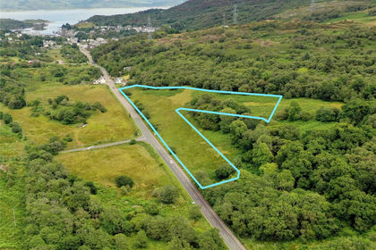
- Price
- Offers Over£250,000
- Size
- 12.4 acres
Development Opportunity, Campbeltown Road, Tarbert, PA29, Tarbert, Argyll and Bute PA29 Scotland
Added on 29/01/2026Development Land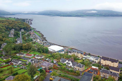
- Price
- Offers Over£195,000
- Size
- 0.88 acres
Added on 28/01/2026Development Land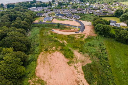
- Price
- Offers Over£170,000
Margnaheglish, Lamlash, KA27, North Ayrshire and Arran, Arran and Cumbrae KA27 Scotland
Added on 29/08/2026Building Plot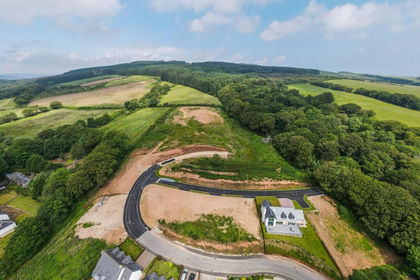
- Price
- Offers Over£185,000
Added on 27/08/2026Building Plot- Price
- Offers Over£200,000
Margnaheglish, Lamlash, KA27, North Ayrshire and Arran, Arran and Cumbrae KA27 Scotland
Added on 27/08/2026Building Plot