Knowe Road, Brodick, Isle of Arran, KA27
Description
A rare and exciting opportunity to purchase a substantial plot of land, allowing you to build a dream property in the picturesque village of Brodick on the Isle of Arran.
Two plots available.
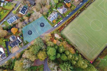
Measuring 703m2 (plot 1) and 692m2 (plot 2), the plots both enjoy a highly desirable position. The site sits on the Glencloy Burn and is well located in Brodick, close to the Ormidale Hotel, Auchrannie, Brodick Golf Course and sports fields. It is also just a short walk from beautiful open countryside and an expansive sandy beach, the perfect setting for families and holidaymakers alike. Planning permission was previously granted in 2004 for two large detached houses, but was allowed to lapse in July 2009 (N/04/00443/PP). A new application for planning permission would be required, however, the previous approval would go in its favour and the property also lies within the General Urban Area in the North Ayrshire Council Local Development Plan (NAC LDP2), meaning residential development of the site is accepted in principle.
Buyers can re-apply for detailed planning based on the previously approved designs or take the opportunity to craft their own plans. Per the NAC LDP2. Within the General Urban Area, proposals for residential development will accord with the development plan in principle, and applications will be assessed against policies of the LDP�.
For Plot 1, the previous plans feature a detached house that is generously set to cover 221.3m2, offering substantial accommodation that is designed to maximise natural light, the majority of rooms enjoying dual or triple-aspect windows. It would be comprised of a porch, a reception hall, an expansive living room, a dining room, a versatile home office/family room, a breakfasting kitchen, and a utility room with a store. Upstairs would feature four double bedrooms, an openly accessed study area (with storage), two large en-suite shower rooms, and a three-piece family bathroom.
The plans for Plot 2 are similar. This detached house, spanning 105.2m2, also focuses on spacious accommodation with multi-aspect glazing. It would open with a reception hall, leading to a large living room, and includes a home office/family room, a kitchen, a utility room, a WC, and a flexible dining room that could alternatively be used as a second double bedroom. The principal bedroom would occupy the lower ground floor, set beside built-in storage and incorporating a walk-in wardrobe and an en-suite shower room.
In addition, the plans allow each plot to have an integral single garage and a paved driveway, with both properties enveloped by wraparound gardens. For added tranquillity, the rear gardens back onto Glencloy Burn, enhancing the relaxed and peaceful ambience.
Please note: a copy of the lapsed planning permission is available.
Area
Knowe Road is located in a popular position in Brodick on the beautiful Isle of Arran. The Isle of Arran (aka 'Scotland in Miniature') has everything to offer a welcoming community, forest trails and mountain peaks, sheltered beaches, and a vast range of local heritage, crafts and produce.
Brodick, Arran's capital, has two Co-op supermarkets, a great selection of individual shops, restaurants, cafes and a full range of services including a primary school, nursery, library and medical centre.
Brodick hosts the island's main ferry terminal from which there are regular sailings throughout the day, serviced by Caledonian MacBrayne, to the mainland at Ardrossan. Commuters and travellers now benefit from Road Equivalent Tariff (RET) ferry fares. The port of Ardrossan has a mainline rail station, with direct trains to Glasgow that connect with the ferry times, and is approximately 30 miles from Glasgow City Centre. Prestwick International Airport is 16 miles to the south of Ardrossan, with Glasgow International Airport 24 miles east of Ardrossan.
The village of Lamlash, only a short drive from Brodick, is home to the Island's High School and hospital. It also offers a range of shops, restaurants and cafes. A frequent bus service runs around and across the island and, at Lochranza, there is a ferry terminal that allows quick access to the stunning West of Scotland via Claonaig. Kintyre here we come!
Map Location
Property details
- Tenure
- Freehold
- Council Tax Band
- Ask Agent
- Date Posted
- 2026-08-29
Utilities & Restrictions
Utilities
- Electricity
- Ask Agent
- Water
- Ask Agent
- Heating
- Ask Agent
- Broadband
- Ask Agent
- Sewerage
- Ask Agent
Rights & Restrictions
- Public Rights of Way
- Ask Agent
- Private Rights of Way
- Ask Agent
- Listed Property
- Ask Agent
- Restrictions
- Ask Agent
Listed status, conservation areas and planning constraints for this location are in the full report.
Property Features
- Accessibility
- Ask Agent
- Parking
- Parking Available
- Garden
- Garden
Beyond the particulars: planning activity, flood history, heritage and ground risks, checked for this exact spot.
Connectivity
Broadband
Fastest speed available at this postcode
950 Mbps
Gigabit full fibre · available to 4% of premises
Suitable for
- 4K streaming on every screen
- Full-time home working
- Online gaming & big downloads
Mobile signal
Predicted 4G and 5G signal; indoor signal depends on building materials.
Ofcom Connected Nations postcode-level predictions. Speeds and signal are modelled, not measured, and vary between addresses and providers.
Signal is the easy part. Planning activity, flood history and protected designations here are in the full report.
Nearest Schools
Primary
- Brodick Primary School0.8 miles
- Pupils
- 68
- Type
- Non-denominational
- Lamlash Primary School3 miles
- Pupils
- 61
- Type
- Non-denominational
- Corrie Primary School5.4 miles
- Pupils
- 14
- Type
- Non-denominational
- Whiting Bay Primary School5.8 miles
- Pupils
- 55
- Type
- Non-denominational
- Shiskine Primary School7 miles
- Pupils
- 20
- Type
- Non-denominational
Secondary
- Arran High School3 miles
- Pupils
- 242
- Type
- Non-denominational
- Ardrossan Academy15 miles
- Pupils
- 795
- Type
- Non-denominational
- St Matthew's Academy15 miles
- Pupils
- 1,303
- Type
- Roman Catholic
- Auchenharvie Academy16 miles
- Pupils
- 678
- Type
- Non-denominational
- Rothesay Academy18 miles
- Pupils
- 277
- Type
- Non-denominational
Distances are straight-line from the advertised location. Source: the national school registers (DfE, Welsh Government, Scottish Government) and Ofsted.
Schools are just the start: planning activity, heritage and any flood history here are in the full report.
Amenities
Supermarket
GP surgery
Pharmacy
Green space
Walking trail
Straight-line distances from the advertised location. Sources: NHS records, Geolytix supermarket locations, OS Open Greenspace and the national trails registers.
The area stacks up? Now check the location itself: planning nearby, protected designations and past flooding.
Getting Around
Nearest station
Nearest bus stop
Typical drive times
Straight-line distances from the advertised location; drive times are typical free-flow times over OpenStreetMap road data, so allow more at peak. Public transport locations from DfT NaPTAN.
Easy to reach matters. So do planning activity, flood history and ground risks: all in the full report.
Flood Risk
SEPA open data, checked around the advertised map pin for the listed acreage. The map pin for this listing is approximate, so these readings describe the surrounding area. Provided by LandSale, not the listing agent, and not part of the agent's particulars. Risk varies across a holding, so verify before committing.
Rivers and the sea
Surface water
Not at the pin: mapped about 20 metres away.
These bandings are the summary. Where this location sits on the flood maps, plus planning activity, heritage and ground risks, is in the full report.
Important notice: Information, maps and tags on this page are drawn from the advertising agent's marketing materials or generated automatically. LandSale has not verified them. Relying on these details is at your own risk, always carry out independent checks before committing to a purchase.
LandSale full disclaimer
Marketing information only - not formal particulars. The details on this website are provided for general guidance and do not constitute an offer or contract. Neither LandSale nor the advertising estate/land agent accepts responsibility for any inaccuracy.
1. Source of information
- Listing content: Core description, asking price, tenure, measurements, photographs and planning history originate from the marketing materials of the advertising estate or land agent. LandSale does not author this content and cannot guarantee its accuracy.
- Automated tags & categorisation: Property type, land-use class, acreage bands and similar labels may be applied by machine-learning models. They are intended as a helpful guide only and may not reflect the property's legal status or permitted use.
- Third-party & enriched data layers: Maps, boundary outlines, planning designations, soil reports, broadband coverage and other environmental or location-based insights are licensed from external suppliers. Such data are supplied “as is", may be incomplete or out of date and are subject to change without notice.
2. Verification required
Prospective purchasers must verify critical matters, including but not limited to planning permission, title boundaries, public rights of way, environmental constraints, acreage, services, access and VAT status, through their own inspections, specialist surveys, legal advisers and the selling agent before relying on the information or entering into any contract.
3. No warranty or liability
LandSale gives no warranty, express or implied, as to the accuracy, completeness or fitness for any particular purpose of the information displayed. LandSale shall not be liable for any loss, damage, cost or expense arising directly or indirectly from any use of or reliance on such information, save where liability may not be excluded by law.
4. Updates & feedback
If you believe any detail on this listing is inaccurate, please let us know. We will investigate and, where appropriate, update the listing or notify the agent.
© LandSale | Version 1.3 - August 2026
Listing agent
Watermans, Glasgow
193 Bath Street Glasgow G2 4HU
Similar properties for sale
- Price
- Offers Over£95,000
Knowe Road, Brodick, KA27, North Ayrshire and Arran, Arran and Cumbrae KA27 Scotland
Added on 29/08/2026Building Plot
- Price
- Offers Over£110,000
Glencloy Road, Brodick, KA27, North Ayrshire and Arran, Arran and Cumbrae KA27 Scotland
Added on 27/08/2026Building Plot
- Price
- Offers Over£100,000
Glencloy Road, Brodick, KA27, North Ayrshire and Arran, Arran and Cumbrae KA27 Scotland
Added on 27/08/2026Building Plot
- Price
- Guide Price£80,000
Plot 3, Mid Mayish, Brodick, North Ayrshire and Arran, Arran and Cumbrae KA27 Scotland
Added on 28/01/2026Building Plot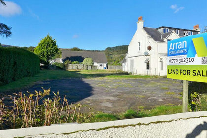
- Price
- Offers Over£120,000
- Size
- 0.17 acres
Brodick Shore Road Building Plot, Brodick, North Ayrshire and Arran, Arran and Cumbrae KA27 Scotland
Added on 29/01/2026Building Plot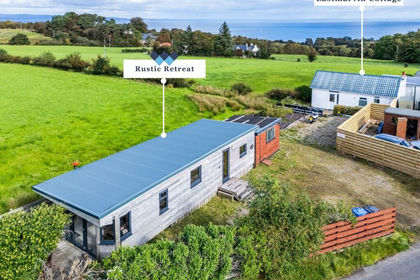
- Price
- Fixed Price£125,000
Added on 29/08/2026Redevelopment Land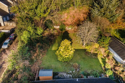
- Price
- Offers Over£80,000
Lamlash, Isle of Arran, KA27, North Ayrshire and Arran, Arran and Cumbrae KA27 Scotland
Added on 29/08/2026Building Plot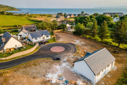
- Price
- Offers Over£125,000
McNicol Croft, Blackwaterfoot, KA27, North Ayrshire and Arran, Arran and Cumbrae KA27 Scotland
Added on 29/08/2026Building Plot
- Price
- Offers Over£99,950
Whiting Bay, Isle of Arran, KA27, North Ayrshire and Arran, Arran and Cumbrae KA27 Scotland
Added on 29/08/2026Building Plot
- Price
- Offers in Excess of£110,000
Added on 18/07/2026Pub