Lillingstone Road, Akeley, Buckingham
- Land size
- 1 acres
Key Features
- Derelict former farm site with planning approved for 5 executive private homes
- Situated on the northern edge of Akeley Village nr Buckingham
- Expansive open views across rolling countryside and fields.
- No Section 106 or CIL.
- Data Pack available.
- Offered with vacant possession upon completion.
Description
SUMMARY
Unique edge of village circa 1 acre development site with striking views over countryside in sought after Akeley Village. Planning approved for demolition of existing agricultural buildings and new build of 5 No. detached executive homes with associated parking, landscape and access improvements.
DESCRIPTION
The land at former Hillside Farm has far reaching views across rolling countryside and is in an enviable position to the northern edge of the village of Akeley. The land for sale, part of the wider original Hillside Farm, comprises approximately 1 acre and incoporates now derelict livestock buildings extending to approximately 1483 sqm, ranging from stone to steel portal frame. These are to be demolished as part of the planning approval for new homes.
As information to potential buyers, just outside the site is a telecoms mast understood to be leased to O2 and set just at the top of the fields that used to be part of Hillside Farm. There is separate access to this across the neighbouring field.
Planning approval was granted on the 5th May 2026 by Buckinghamshire Council under planning ref 25/02177/APP for the demolition of existing agricultural buildings and erection of 5 No. detached dwelling houses with associated parking, landscape and access improvements.
There is no S106, no CIL, and that the land is not registered for VAT.
BNG (Biodiversity Net Gain) is applicable, buyer to calculate costs
The 5 executive private detached homes total circa13,784 sq ft
Land Registry Title is indicated by title BM476371
A link to a Data Room with numerous reports and plans is available upon request.
With the exception of one barn, details of which to be confirmed, the demolition and clearance of the site as required will be the responsibility of the buyer.
Local Authority And Utility Co
Buckinghamshire Council Tel.
Anglian Water Tel.
Western Power/National Grid Tel.
Buyers are to confirm all the details of Data Pack reports and surveys, and confirm arrangements for Demolition, S106, CIL, VAT and suitable availability of services eg electicity and water, and be satisfied by such, prior to making an offer.
Location
The development site is situated in a rural location to the northern edge of the village of Akeley and accessed via Lillingstone Road.
The bustling University Town of Buckingham is just a few miles to the south and provides an extensive range of local and amenity services together with education and employment opportunities, including Stowe School, Buckingham Primary & Maids Moreton Church of England Primary and the Royal Latin School, Silverstone UTC and The Buckingham School.
The home of British Motorsport, Silverstone, is just 8 miles away with it's world-renowned race circult, high-tech motorsport industry park hosting over 90 companies, together with education and research facilities in advanced engineering.
Site Visits
Site visits are strictly by appointment only and to be arranged by Connells. No access onto the site is permitted at any time without permission.
Method Of Sale
Written proposals for the freehold interest, subject to contract only, are invited to be sent on email to Jeffrey. by the strict deadline date of Friday 2nd October at 12 noon.
The proposals should be based on the information provided and must include Purchaser Identity, Purchase Price, Internal Approval Process, Financing, Deposit Available upon Exchange and
Completion Structure and Timings, Legal Advisors and Due Diligence undertaken. Company experience of previous projects would be welcome.
The vendor is not obliged to accept the highest, or any, offer.
1. MONEY LAUNDERING REGULATIONS - Intending purchasers will be asked to produce identification documentation at a later stage and we would ask for your co-operation in order that there will be no delay in agreeing the sale.
2: These particulars do not constitute part or all of an offer or contract.
3: The measurements indicated are supplied for guidance only and as such must be considered incorrect.
4: Potential buyers are advised to recheck the measurements before committing to any expense.
5: Connells has not tested any apparatus, equipment, fixtures, fittings or services and it is the buyers interests to check the working condition of any appliances.
6: Connells has not sought to verify the legal title of the property and the buyers must obtain verification from their solicitor.
Map Location
Property details
- Tenure
- Freehold
- Council Tax Band
- DELETED
- Date Posted
- 2026-08-28
Market Value Analysis
Compared with 108 Development Land listings in South East England (1+ acres).
Utilities & Restrictions
Utilities
- Electricity
- Ask Agent
- Water
- Ask Agent
- Heating
- Ask Agent
- Broadband
- Ask Agent
- Sewerage
- Ask Agent
Rights & Restrictions
- Public Rights of Way
- Ask Agent
- Private Rights of Way
- Ask Agent
- Listed Property
- Ask Agent
- Restrictions
- Ask Agent
Listed status, conservation areas and planning constraints for this location are in the full report.
Property Features
- Accessibility
- Ask Agent
- Parking
- Parking Available
- Garden
- Ask Agent
Beyond the particulars: planning activity, flood history, heritage and ground risks, checked for this exact spot.
Connectivity
Broadband
Fastest speed available at this postcode
1.8 Gbps
Gigabit full fibre · available to 83% of premises
Suitable for
- 4K streaming on every screen
- Full-time home working
- Online gaming & big downloads
Mobile signal
Outdoor predictions; indoor signal depends on building materials.
Ofcom Connected Nations postcode-level predictions. Speeds and signal are modelled, not measured, and vary between addresses and providers.
Signal is the easy part. Planning activity, flood history and protected designations here are in the full report.
Nearest Schools
Primary
- Maids Moreton Church of England School1.7 milesOfsted: Outstanding
- Ages
- 4 to 11
- Pupils
- 97
- Type
- Voluntary aided school
- Faith
- Church of England
- St James and St John CofE Primary School1.9 milesOfsted: Good
- Ages
- 4 to 11
- Pupils
- 144
- Type
- Voluntary controlled school
- Faith
- Church of England
- Buckingham Primary School2.1 milesOfsted: Good *
- Ages
- 4 to 11
- Pupils
- 354
- Type
- Community school
- Bourton Meadow Academy2.7 milesOfsted: Good *
- Ages
- 3 to 11
- Pupils
- 571
- Type
- Academy converter
- George Grenville Academy2.8 milesNo Ofsted rating
- Ages
- 2 to 11
- Pupils
- 186
- Type
- Academy sponsor led
Secondary
- Buckingham School2.9 milesOfsted: Good
- Ages
- 11 to 18
- Pupils
- 1,110
- Type
- Community school
- Royal Latin School3 milesOfsted: Good
- Ages
- 11 to 18
- Pupils
- 1,326
- Type
- Academy converter
- Silverstone UTC3.6 milesOfsted: Requires improvement
- Ages
- 14 to 19
- Pupils
- 463
- Type
- University technical college
- Watling Academy6.2 milesOfsted: Outstanding
- Ages
- 11 to 18
- Pupils
- 1,767
- Type
- Free schools
- The Radcliffe School6.5 milesOfsted: Requires improvement *
- Ages
- 11 to 19
- Pupils
- 1,192
- Type
- Foundation school
* Latest graded judgement covers quality of education only; no overall grade was issued under the 2024-25 inspection framework.
Distances are straight-line from the advertised location. Source: the national school registers (DfE, Welsh Government, Scottish Government) and Ofsted.
Schools are just the start: sold prices nearby, planning activity and any flood history are in the full report.
Amenities
Supermarket
GP surgery
Pharmacy
Hospital
Green space
Straight-line distances from the advertised location. Sources: NHS records, Geolytix supermarket locations, OS Open Greenspace and the national trails registers.
The area stacks up? Now check the location itself: planning nearby, protected designations and past flooding.
Getting Around
Nearest station
Nearest bus stop
Typical drive times
Straight-line distances from the advertised location; drive times are typical free-flow times over OpenStreetMap road data, so allow more at peak. Public transport locations from DfT NaPTAN.
Easy to reach matters. So do planning activity, flood history and ground risks: all in the full report.
Flood Risk
From Environment Agency flood map open data, checked around the advertised map pin and allowing for the listed acreage where known. This summary comes from LandSale, the advertising platform, not from the listing agent, and is not part of the agent's particulars. Risk can vary across a single holding, so verify anything critical through your own searches before committing.
Rivers and the sea
Surface water
The detail behind these bandings
The full report pinpoints where this location sits on the flood maps, and runs the deeper checks that usually only surface after an offer.
- Exact flood zones & annual chances (included in the full report)
- Any recorded past flooding (included in the full report)
- Planning activity nearby (included in the full report)
- Heritage & conservation (included in the full report)
- Protected nature designations (included in the full report)
- Ground risks (included in the full report)
- Sold prices nearby (included in the full report)
£14.99 · one-off purchase
By LandSale, the platform. Not provided by the listing agent. Ready in about a minute.
Important notice: Information, maps and tags on this page are drawn from the advertising agent's marketing materials or generated automatically. LandSale has not verified them. Relying on these details is at your own risk, always carry out independent checks before committing to a purchase.
LandSale full disclaimer
Marketing information only - not formal particulars. The details on this website are provided for general guidance and do not constitute an offer or contract. Neither LandSale nor the advertising estate/land agent accepts responsibility for any inaccuracy.
1. Source of information
- Listing content: Core description, asking price, tenure, measurements, photographs and planning history originate from the marketing materials of the advertising estate or land agent. LandSale does not author this content and cannot guarantee its accuracy.
- Automated tags & categorisation: Property type, land-use class, acreage bands and similar labels may be applied by machine-learning models. They are intended as a helpful guide only and may not reflect the property's legal status or permitted use.
- Third-party & enriched data layers: Maps, boundary outlines, planning designations, soil reports, broadband coverage and other environmental or location-based insights are licensed from external suppliers. Such data are supplied “as is", may be incomplete or out of date and are subject to change without notice.
2. Verification required
Prospective purchasers must verify critical matters, including but not limited to planning permission, title boundaries, public rights of way, environmental constraints, acreage, services, access and VAT status, through their own inspections, specialist surveys, legal advisers and the selling agent before relying on the information or entering into any contract.
3. No warranty or liability
LandSale gives no warranty, express or implied, as to the accuracy, completeness or fitness for any particular purpose of the information displayed. LandSale shall not be liable for any loss, damage, cost or expense arising directly or indirectly from any use of or reliance on such information, save where liability may not be excluded by law.
4. Updates & feedback
If you believe any detail on this listing is inaccurate, please let us know. We will investigate and, where appropriate, update the listing or notify the agent.
© LandSale | Version 1.3 - August 2026
Listing agent
Connells, Buckingham
2 West Street Buckingham MK18 1HL
Similar properties for sale
- Price
- Guide Price£1,750,000
Cofferidge Close, Stony Stratford, MK11, Stony Stratford, Milton Keynes MK11 England
Added on 04/07/2026Development LandLeasehold
- Price
- From£1,500,000
- Size
- 1.05 acres
Added on 29/01/2026Development Land Added on 08/07/2026Development Land
- Added on 08/07/2026Development Land
- Price
- Guide Price£2,250,000
- Size
- 7.5 acres
Bridle Way, Toddington, LU5, Toddington, Central Bedfordshire LU5 England
Added on 03/07/2026Commercial Land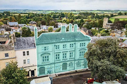
- Price
- From£1,500,000
18-19 Market Place, Chipping Norton, Oxfordshire, OX7, Chipping Norton, Oxfordshire OX7 England
Added on 06/05/2026Development Land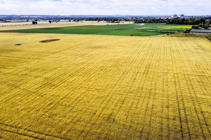
- Price
- Guide Price£2,375,000
- Size
- 220 acres
Willington, Bedford, Bedfordshire, Willington, Bedford MK44 England
Added on 15/07/2026Farm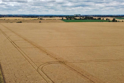
- Price
- Guide Price£1,600,000
- Size
- 152.91 acres
Willington, Bedford, Bedfordshire, Willington, Bedford MK44 England
Added on 15/07/2026Farm
- Price
- Guide Price£1,500,000
- Size
- 2.89 acres
Barns, Great Kingshill, Bucks HP15, Hughenden, Buckinghamshire HP15 England
Added on 28/03/2026Development Land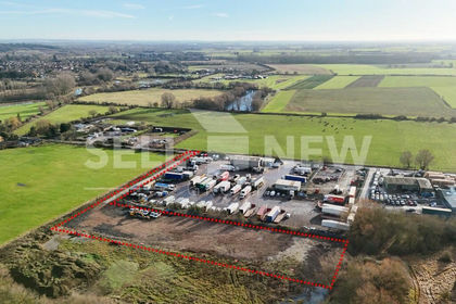
- Price
- POA
- Size
- 1.3 acres
Added on 29/01/2026Development Land