Dalreach, Rychraggan, Drumnadrochit
- Land size
- 22.35 acres
- Bedrooms
- 3
- Bathrooms
- 1
Key Features
- 22.35 Acres
- Detached cottage
- Summerhouse
- Remote location
- Wood-burning stove
Description
A perfectly positioned, three bedroomed detached cottage with garden grounds, and land extending to 22.35 acres located in an area of natural beauty.
Property - Privately nestled in a tranquil and peaceful setting amongst scattered woodland on the outskirts on Drumnadrochit, Dalreach is a quaint, three bedroomed detached cottage which affords glorious garden grounds featuring a fantastic summer house, which is accompanied by further surrounding land which extends to 22.35 acres. Inside, the accommodation requires a touch of modernisation and is spread over two floors, with the upper floors having coomed ceilings. On entering the cottage, you are met with an entrance hall that leads to the double aspect lounge which features a wood-burning stove, providing a warm and cosy atmosphere for evenings indoors, and a door which gives access to the side garden. Further to this is a front facing double bedroom, and a useful box room, which could be utilised for a number of uses. To the rear of the property lies a hallway which gives access to the rear garden, bathroom and the spacious kitchen/diner. Boasting two large windows, allowing the natural light to flood the room throughout the day, this bright and airy room is fitted with a pantry, base mounted units with worktops and splashbacks, and has a sink with drainer and taps. It provides space for a good sized table and chairs for dining, and white goods located here are included in the sale. The fully tiled bathroom comprises a wash hand basin, WC, a bath and a tiled shower cubicle. Upstairs, there is an open landing, that gives access to a further two double bedrooms which overlook the pleasant garden grounds and surrounding land. Further pleasing features include double glazed windows, electric heating, with storage being provided by a cupboard in the hallway, landing and ground floor bedroom.
Outside, a sweeping driveway leads to the substantial garden grounds, which surround the property and are laid to lawn, with decorative shrubs and hedges. Scattered woodland offers ultimate privacy, and a well placed summer house offers an outdoor area to relax, enjoy the sunshine and al-fresco dining, whilst enjoying the view. There is a neatly place log store, along side a seating and drying area which are located to the rear elevation.
The surrounding land extends to approximately 22.35 acres and stretches to the front and side elevation. It is landscaped in nature, and is enclosed by wire fencing. Early viewing is encouraged to fully appreciate this warm and inviting home, along with the substantial grounds and tranquil setting it occupies.
Drumnadrochit lies on the West shore of Loch Ness, 13 miles from Inverness. Fantastic local amenities include a selection of village shops, a bank and part time post office, doctors surgery, and primary and secondary schooling, along with super after school clubs and care. The area is renowned for tourism and houses the Loch Ness Visitors Centre, nearby Urquhart Castle and Loch Ness.
Entrance Hall -
Lounge - approx 3.48m x 4.01m (approx 11'5" x 13'1") -
Box Room - approx 2.00m x 1.80m (approx 6'6" x 5'10") -
Rear Hall -
Kitchen/Diner - approx 3.82m x 4.01m (approx 12'6" x 13'1") -
Bathroom - approx 1.75m x 3.01m (approx 5'8" x 9'10") -
Bedroom One - approx 4.00m x 3.48m (approx 13'1" x 11'5") -
Landing -
Bedroom Two - approx 3.48m x 4.12m (approx 11'5" x 13'6") -
Bedroom Three - approx 4.07m x 3.46m (approx 13'4" x 11'4") -
Services - Mains electricity, private water supply is via a spring and drainage is to a septic tank.
Extras - All carpets, fitted floor coverings, curtains, blinds and white goods. Some items of furniture are available.
Heating - Electric heating.
Glazing - Double glazed windows throughout.
Council Tax Band - D
Viewing - Strictly by appointment via Munro & Noble Property Shop - Telephone
Entry - By mutual agreement.
Home Report - Home Report Valuation - £365,000
A full Home Report is available via Munro & Noble website.
Directions - Upon leaving the village of Drumnadrochit on the A831 towards Cannich, carry on along this road, passing the Loch Ness Glamping pods/Polmaily House on your right. Continue on this road for around 400 yards until you approach a bus stop on the right hand side, and a sign marked Achtemarack. Take this road and drive to the very top of the hill until you come to a cattle grid. There is a green sign marked Dalreach pointing to the left, follow the track until you approach the gate. The cottage is at the end of the drive.
Map Location
Property details
- Tenure
- Freehold
- Council Tax Band
- D
- Date Posted
- 2026-08-19
Market Value Analysis
Compared with 71 Homes with Land listings in Scotland (10+ acres).
Energy Performance Certificate
Energy Efficiency Rating
Based on UK Energy Performance Certificate standards (EU Directive 2002/91/EC)
Running costs are one side. Planning activity, flood history and ground risks for this location are in the full report.
Utilities & Restrictions
Utilities
- Electricity
- Mains
- Water
- Private Supply
- Heating
- Electric Heating
- Broadband
- Ask Agent
- Sewerage
- Septic Tank / Private
Rights & Restrictions
- Public Rights of Way
- Ask Agent
- Private Rights of Way
- Ask Agent
- Listed Property
- Ask Agent
- Restrictions
- Ask Agent
Listed status, conservation areas and planning constraints for this location are in the full report.
Property Features
- Accessibility
- Ask Agent
- Parking
- Driveway
- Garden
- Garden
Beyond the particulars: planning activity, flood history, heritage and ground risks, checked for this exact spot.
Connectivity
Broadband
Fastest speed available at this postcode
9 Mbps
Under 10 Mbps here
Suitable for
- Basic browsing & email
Mobile signal
Predicted 4G and 5G signal; indoor signal depends on building materials.
Ofcom Connected Nations postcode-level predictions. Speeds and signal are modelled, not measured, and vary between addresses and providers.
Signal is the easy part. Planning activity, flood history and protected designations here are in the full report.
Nearest Schools
Primary
- Balnain Primary School1.3 miles
- Pupils
- 14
- Type
- Non-denominational
- Glenurquhart Primary School2.8 miles
- Pupils
- 145
- Type
- Non-denominational
- Tomnacross Primary School6.8 miles
- Pupils
- 111
- Type
- Non-denominational
- Teanassie Primary School8 miles
- Pupils
- 43
- Type
- Non-denominational
- Cannich Bridge Primary School8.1 miles
- Pupils
- 31
- Type
- Non-denominational
Secondary
- Glen Urquhart High School2.8 miles
- Pupils
- 209
- Type
- Non-denominational
- Charleston Academy14 miles
- Pupils
- 746
- Type
- Non-denominational
- Inverness Royal Academy14 miles
- Pupils
- 1,351
- Type
- Non-denominational
- Inverness High School15 miles
- Pupils
- 491
- Type
- Non-denominational
- Kilchuimen Academy15 miles
- Pupils
- 47
- Type
- Non-denominational
Distances are straight-line from the advertised location. Source: the national school registers (DfE, Welsh Government, Scottish Government) and Ofsted.
Schools are just the start: planning activity, heritage and any flood history here are in the full report.
Amenities
Supermarket
GP surgery
Pharmacy
Walking trail
Straight-line distances from the advertised location. Sources: NHS records, Geolytix supermarket locations, OS Open Greenspace and the national trails registers.
The area stacks up? Now check the location itself: planning nearby, protected designations and past flooding.
Getting Around
Nearest station
Nearest bus stop
Typical drive times
Straight-line distances from the advertised location; drive times are typical free-flow times over OpenStreetMap road data, so allow more at peak. Public transport locations from DfT NaPTAN.
Easy to reach matters. So do planning activity, flood history and ground risks: all in the full report.
Flood Risk
SEPA open data, checked around the advertised map pin for the listed acreage. The map pin for this listing is approximate, so these readings describe the surrounding area. Provided by LandSale, not the listing agent, and not part of the agent's particulars. Risk varies across a holding, so verify before committing.
Rivers and the sea
Surface water
Not at the pin: mapped about 40 metres away.
These bandings are the summary. Where this location sits on the flood maps, plus planning activity, heritage and ground risks, is in the full report.
Important notice: Information, maps and tags on this page are drawn from the advertising agent's marketing materials or generated automatically. LandSale has not verified them. Relying on these details is at your own risk, always carry out independent checks before committing to a purchase.
LandSale full disclaimer
Marketing information only - not formal particulars. The details on this website are provided for general guidance and do not constitute an offer or contract. Neither LandSale nor the advertising estate/land agent accepts responsibility for any inaccuracy.
1. Source of information
- Listing content: Core description, asking price, tenure, measurements, photographs and planning history originate from the marketing materials of the advertising estate or land agent. LandSale does not author this content and cannot guarantee its accuracy.
- Automated tags & categorisation: Property type, land-use class, acreage bands and similar labels may be applied by machine-learning models. They are intended as a helpful guide only and may not reflect the property's legal status or permitted use.
- Third-party & enriched data layers: Maps, boundary outlines, planning designations, soil reports, broadband coverage and other environmental or location-based insights are licensed from external suppliers. Such data are supplied “as is", may be incomplete or out of date and are subject to change without notice.
2. Verification required
Prospective purchasers must verify critical matters, including but not limited to planning permission, title boundaries, public rights of way, environmental constraints, acreage, services, access and VAT status, through their own inspections, specialist surveys, legal advisers and the selling agent before relying on the information or entering into any contract.
3. No warranty or liability
LandSale gives no warranty, express or implied, as to the accuracy, completeness or fitness for any particular purpose of the information displayed. LandSale shall not be liable for any loss, damage, cost or expense arising directly or indirectly from any use of or reliance on such information, save where liability may not be excluded by law.
4. Updates & feedback
If you believe any detail on this listing is inaccurate, please let us know. We will investigate and, where appropriate, update the listing or notify the agent.
© LandSale | Version 1.3 - August 2026
Similar properties for sale
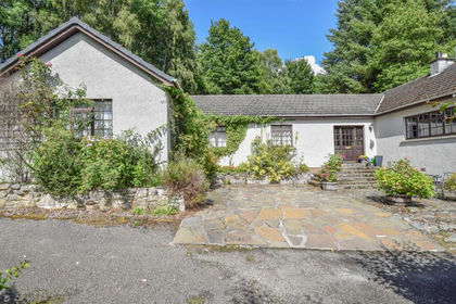
- Price
- Offers Over£395,000
- Size
- 3 acres
Cul-A-Mhuilinn, Milton, Drumnadrochit, Inverness, Skye and West Ross-shire, Highland IV63 Scotland
Added on 29/01/2026House with Land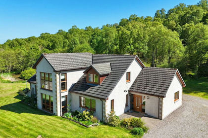
- Price
- Fixed Price£499,000
- Size
- 2 acres
Bluebell House, Breakachy, Beauly, IV4, Caithness, Sutherland and Easter Ross, Highland IV4 Scotland
Added on 21/07/2026House with Land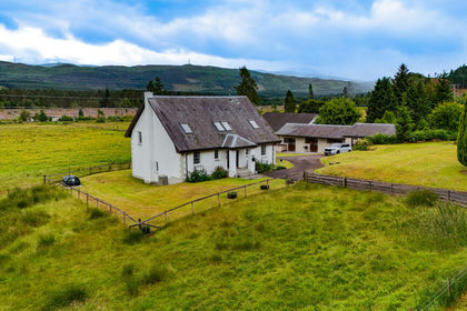
- Price
- Offers Over£450,000
- Size
- 2.5 acres
Auchterawe, Fort Augustus, PH32, Inverness, Skye and West Ross-shire, Highland PH32 Scotland
Added on 05/07/2026House with Land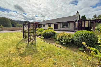
- Price
- Guide Price£420,000
- Size
- 1.3 acres
Lismore House, Invergarry, PH35, Inverness, Skye and West Ross-shire, Highland PH35 Scotland
Added on 29/01/2026House with Land
- Price
- Offers Over£325,000
- Size
- 1 acres
Duthil, Carrbridge **REDUCED PRICE**, Moray West, Nairn and Strathspey, Highland PH23 Scotland
Added on 23/05/2026House with Land
- Price
- Offers Over£300,000
- Size
- 2 acres
Added on 08/08/2026House with Land
- Price
- Offers Over£430,000
- Size
- 2.8 acres
Muckle Lyne, Nairn, IV12, Moray West, Nairn and Strathspey, Highland IV12 Scotland
Added on 11/05/2026Homestead
- Price
- Guide Price£295,000
- Size
- 0.9 acres
House Site, Mill Lane, Nethy Bridge, Moray West, Nairn and Strathspey, Highland PH25 Scotland
Added on 29/01/2026Building Plot
- Price
- Offers Over£375,000
- Size
- 2.5 acres
Kishorn, Brynaport, IV54, Inverness, Skye and West Ross-shire, Highland IV54 Scotland
Added on 22/09/2026House with Land
- Price
- Offers Over£500,000
- Size
- 2 acres
Lochyhill Farmhouse, Forres, IV36, Moray West, Nairn and Strathspey, Moray IV36 Scotland
Added on 24/05/2026House with Land