Anchor Street, Watchet
- Bedrooms
- 3
- Bathrooms
- 2
Key Features
- Beautifully Presented Accommodation
- Garage & Off Road Parking
- Close to Town Centre
- En-Suite Principal Bedroom
- Landscaped Garden
- Gas Fired Central Heating
- Historically Run as a Successful Holiday Let
Description
A stunning and unique detached three bedroom barn conversion, situated in the heart of Watchet’s Conservation area with gas central heating, a Garage and Gardens.
The accommodation in brief comprises; Wooden door with inset stain glass leaded light window into spacious Entrance Hall; with Travertine tiled floor with underfloor heating. Utility Cupboard; with space and plumbing for a washing machine, space for further white goods if desired, wood slat shelving. Separate WC; with Travertine tiled floor, low level WC, pedestal wash basin. Inner Hallway; with hatch to roof space, ladder, and storage. En-Suite Bedroom 1; with aspect to front and an excellent range of full height fitted wardrobes with sliding doors into the En-Suite Shower Room; with Travertine tiled floor, part tiled walls, corner shower cubicle with thermostatic mixer shower over, low level WC, bidet, wash basin inset into vanity unit, heated towel rail. Bedroom 2; with aspect to side, oak beam feature detailing. Bedroom 3; aspect to side, with oak beam feature detail. Glazed door into Kitchen/Dining Room; with double aspect, Travertine tiled floor, an excellent range of cream shaker style cupboards and drawers, under a granite effect, rolled edge laminate worktop, with inset one and a half bowl sink and drainer, mixer tap over, dual fuel range oven (to be included in the sale), extractor hood over, integrated dishwasher, space for American fridge/freezer, oak beam detailing, ample room for dining table. Half glazed door into; Lean To; with front and rear access, stable doors, worktop with double cupboard under, space for tumble dryer, space for tall fridge/freezer. Living Room; with aspect to rear garden, with large arrangement of glazed doors and windows, gas coal effect living flame wood burner style fire on a slate hearth, with oak beam over, oak beam ceiling detail.
OUTSIDE: This property owns the tarmaced courtyard, and has parking for a number of cars. There is also a Garage with double timber doors; with a Vaillant wall mounted boiler for central heating, stainless steel large water tank with immersion switch. The Gardens are landscaped with a large paved seating area, and the remainder is laid to lawn with terraced planted borders.
MATERIAL INFORMATION:
Council Tax Band: F
Tenure: Freehold
Utilities: Mains water, electricity, sewage, gas
Parking: There is off road parking at this property for several cars and a Garage.
Broadband: For an indication of specific speeds and supply or coverage in the area, we would advise interested buyers to use the Ofcom checker: checker.ofcom.org.uk/en-gb/broadband-coverage
Mobile: For an indication of supply or coverage in the area, we would advise interested buyers to use the Ofcom checker: checker.ofcom.org.uk/en-gb/mobile-coverage
Flood Risk: For information relating to flood risk in the area, we would advise interested buyers to use the below government checker: flood-map-for-planning.service.gov.uk/location
Agents Notes: Some of the photographs used by Wilkie, May & Tuckwood have been taken with a wide angled lens to show the property off to its best advantage. Please note the floorplan is for guidance only and is not architecturally accurate.
THE PROPERTY MISDESCRIPTIONS ACT 1991
The agent has not tested any apparatus, equipment, fixtures and fittings or services and so cannot verify that they are in working order or fit for the purpose. A buyer is advised to obtain verification from their Solicitor or Surveyor.
References to the Tenure of the Property are based on information supplied by the Seller. The agent has not had sight of the title documents. A Buyer is advised to obtain verification from their Solicitor.
Map Location
Property details
- Tenure
- Freehold
- Council Tax Band
- F
- Date Posted
- 2026-08-08
Price history
| Date | Change | Price |
|---|---|---|
| 23 Sep 2026 | Reduced 1.7% (−£10,000) | £569,950 |
| 8 Aug 2026 | Listed | £579,950 |
Energy Performance Certificate
Energy Efficiency Rating
Based on UK Energy Performance Certificate standards (EU Directive 2002/91/EC)
Running costs are one side. Planning activity, flood history and ground risks for this location are in the full report.
Utilities & Restrictions
Utilities
- Electricity
- Mains
- Water
- Mains
- Heating
- Gas Central Heating
- Broadband
- Ask Agent
- Sewerage
- Mains
Rights & Restrictions
- Public Rights of Way
- Ask Agent
- Private Rights of Way
- Ask Agent
- Listed Property
- Ask Agent
- Restrictions
- Ask Agent
Listed status, conservation areas and planning constraints for this location are in the full report.
Property Features
- Accessibility
- Ask Agent
- Parking
- Garage, Off-Street Parking
- Garden
- Garden
Beyond the particulars: planning activity, flood history, heritage and ground risks, checked for this exact spot.
Connectivity
Broadband
Fastest speed available at this postcode
80 Mbps
Superfast
Suitable for
- HD streaming
- Video calls
- Web & social
Mobile signal
Predicted 4G and 5G signal; indoor signal depends on building materials.
Ofcom Connected Nations postcode-level predictions. Speeds and signal are modelled, not measured, and vary between addresses and providers.
Signal is the easy part. Planning activity, flood history and protected designations here are in the full report.
Nearest Schools
Primary
- Knights Templar Community Church School & Nursery760 metresOfsted: Good *
- Ages
- 3 to 9
- Pupils
- 173
- Type
- Voluntary aided school
- Faith
- Church of England/Methodist
- St Peter's Church of England First School1.1 milesOfsted: Good
- Ages
- 2 to 9
- Pupils
- 123
- Type
- Academy converter
- Faith
- Church of England
- Old Cleeve Church of England First School1.9 milesOfsted: Good
- Ages
- 3 to 9
- Pupils
- 127
- Type
- Academy converter
- Faith
- Church of England
- Stogumber CofE Primary School4.2 milesNo Ofsted rating
- Ages
- 4 to 11
- Pupils
- 41
- Type
- Voluntary controlled school
- Faith
- Church of England
- Dunster First School5.1 milesNo Ofsted rating
- Ages
- 4 to 9
- Pupils
- 86
- Type
- Community school
Secondary
- West Somerset College5.8 milesOfsted report card · Jan 2026
- Ages
- 13 to 19
- Pupils
- 745
- Type
- Academy converter
- Minehead Middle School6.3 milesOfsted: Requires improvement *
- Ages
- 9 to 13
- Pupils
- 570
- Type
- Academy converter
- Kingsmead Academy9.8 milesOfsted: Requires improvement *
- Ages
- 11 to 16
- Pupils
- 892
- Type
- Academy converter
- Brymore Academy11 milesNo Ofsted rating
- Ages
- 11 to 17
- Pupils
- 327
- Type
- Academy sponsor led
- Gender
- Boys
- Haygrove School14 milesOfsted: Good
- Ages
- 11 to 16
- Pupils
- 1,051
- Type
- Academy converter
* Latest graded judgement covers quality of education only; no overall grade was issued under the 2024-25 inspection framework.
Distances are straight-line from the advertised location. Source: the national school registers (DfE, Welsh Government, Scottish Government) and Ofsted.
Schools are just the start: sold prices nearby, planning activity and any flood history are in the full report.
Amenities
Supermarket
GP surgery
Pharmacy
Hospital
Green space
Straight-line distances from the advertised location. Sources: NHS records, Geolytix supermarket locations, OS Open Greenspace and the national trails registers.
The area stacks up? Now check the location itself: planning nearby, protected designations and past flooding.
Getting Around
Nearest station
Nearest bus stop
Typical drive times
Straight-line distances from the advertised location; drive times are typical free-flow times over OpenStreetMap road data, so allow more at peak. Public transport locations from DfT NaPTAN.
Easy to reach matters. So do planning activity, flood history and ground risks: all in the full report.
Flood Risk
Environment Agency open data, checked around the advertised map pin for the listed acreage. Long-term risk counts flood defences; the planning map's flood zones do not. The map pin for this listing marks the postcode area rather than the exact location, so these readings describe the surrounding area. Provided by LandSale, not the listing agent, and not part of the agent's particulars. Risk varies across a holding, so verify before committing.
Rivers and the sea
Planning map: Flood Zone 1.
Surface water
These bandings are the summary. Where this location sits on the flood maps, plus planning activity, heritage and ground risks, is in the full report.
Important notice: Information, maps and tags on this page are drawn from the advertising agent's marketing materials or generated automatically. LandSale has not verified them. Relying on these details is at your own risk, always carry out independent checks before committing to a purchase.
LandSale full disclaimer
Marketing information only - not formal particulars. The details on this website are provided for general guidance and do not constitute an offer or contract. Neither LandSale nor the advertising estate/land agent accepts responsibility for any inaccuracy.
1. Source of information
- Listing content: Core description, asking price, tenure, measurements, photographs and planning history originate from the marketing materials of the advertising estate or land agent. LandSale does not author this content and cannot guarantee its accuracy.
- Automated tags & categorisation: Property type, land-use class, acreage bands and similar labels may be applied by machine-learning models. They are intended as a helpful guide only and may not reflect the property's legal status or permitted use.
- Third-party & enriched data layers: Maps, boundary outlines, planning designations, soil reports, broadband coverage and other environmental or location-based insights are licensed from external suppliers. Such data are supplied “as is", may be incomplete or out of date and are subject to change without notice.
2. Verification required
Prospective purchasers must verify critical matters, including but not limited to planning permission, title boundaries, public rights of way, environmental constraints, acreage, services, access and VAT status, through their own inspections, specialist surveys, legal advisers and the selling agent before relying on the information or entering into any contract.
3. No warranty or liability
LandSale gives no warranty, express or implied, as to the accuracy, completeness or fitness for any particular purpose of the information displayed. LandSale shall not be liable for any loss, damage, cost or expense arising directly or indirectly from any use of or reliance on such information, save where liability may not be excluded by law.
4. Updates & feedback
If you believe any detail on this listing is inaccurate, please let us know. We will investigate and, where appropriate, update the listing or notify the agent.
© LandSale | Version 1.3 - August 2026
Listing agent
Wilkie May & Tuckwood, Watchet
35 Swain Street, Watchet, TA23 0AE
Similar properties for sale
- Price
- £525,000
- Size
- 1 acres
Added on 29/09/2026House with Land
- Price
- Guide Price£575,000
- Size
- 1 acres
Church Lane, Carhampton, Minehead, TA24, Minehead, Somerset TA24 England
Added on 28/05/2026House with Land
- Price
- Guide Price£685,000
- Size
- 1 acres
Kingswood, Stogumber, Taunton, Crowcombe, Somerset TA4 England
Added on 02/09/2026House with Land
- Price
- Guide Price£700,000
- Size
- 1.5 acres
North Hill Road, Minehead, TA24, Minehead, Somerset TA24 England
Added on 29/01/2026House with Land
- Price
- Guide Price£595,000
- Size
- 1.5 acres
Added on 22/08/2026Smallholding
- Price
- £595,000
- Size
- 2 acres
Maundown, Wiveliscombe, 2 Acres, Wiveliscombe, Somerset TA4 England
Added on 29/01/2026House with Land
- Price
- Guide Price£675,000
- Size
- 1 acres
Added on 06/05/2026Cottage
- Price
- Guide Price£485,000
Added on 02/10/2026Barn Conversion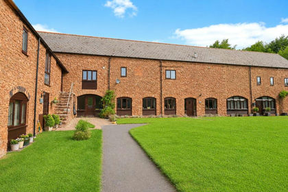
- Price
- Offers in Excess of£500,000
Fitzhead, Taunton, Somerset, TA4, Fitzhead, Somerset TA4 England
Added on 10/05/2026Barn Conversion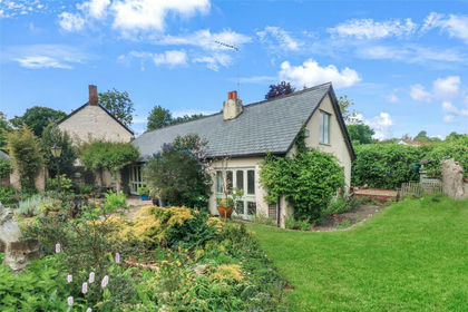
- Price
- Guide Price£595,000
Croford, Wiveliscombe, Taunton, Somerset, TA4, Wiveliscombe, Somerset TA4 England
Added on 01/08/2026Barn Conversion